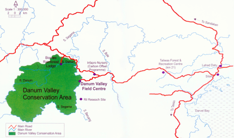
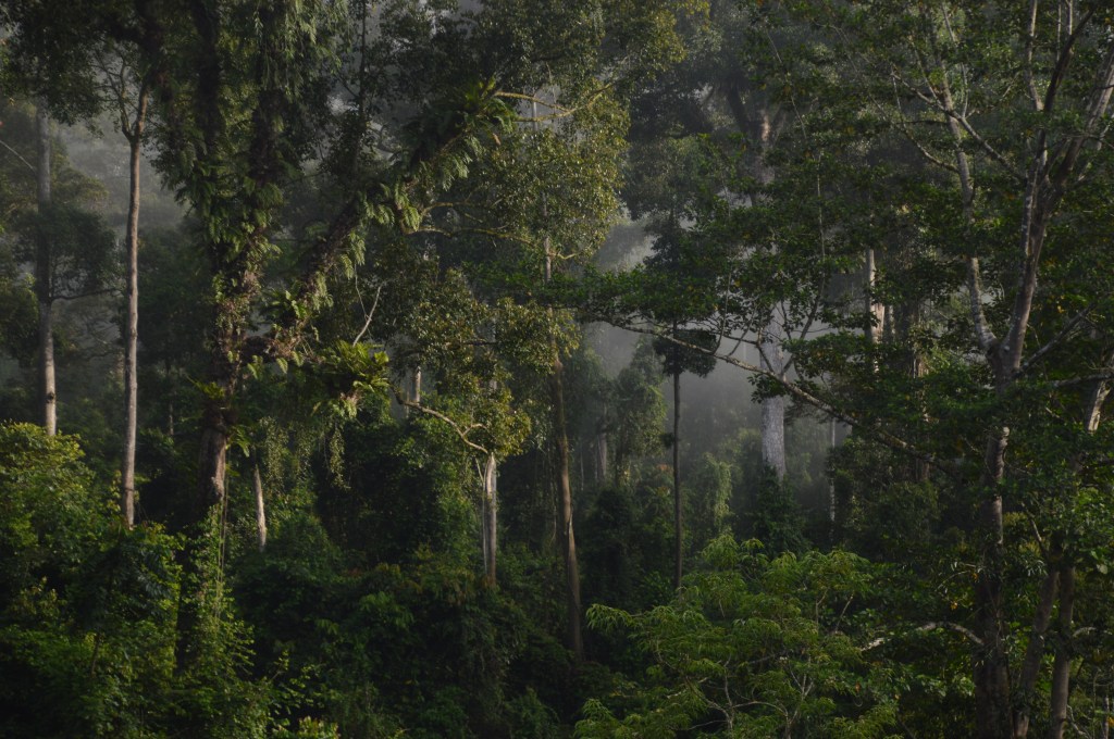
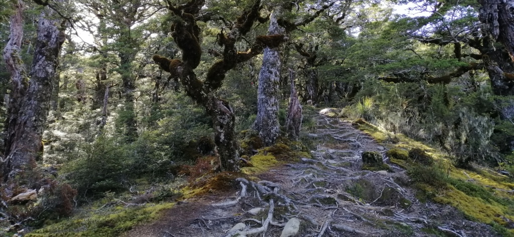
Borneo, a huge tropical island – exudes rawness, untamed and unexplored ecosystems teeming with assortment of flora and fauna. Danum Valley, about 80km from Lahad Datu, offered exciting opportunities, untouched wilderness, to experience wildlife and native tropical forest. There are over 300 species of birds, which account for 75% of Borneo’s bird species. There are also over 500 tree species. Additionally, there are over 120 species of mammals, including 10 species of primates. Danum Conservation Area is 438sq km. of which 95% is mixed lowland dipterocarpus trees (including shores, hopea and drybalocarpus).
Most areas covered is non-logged. It is a 130 million years pristine primary forest. This forest is a lush, untouched world. Wild orangutans, pygmy (Bornean) elephants, red (maroon) leaf monkeys, hornbills, and gibbons still roam free here. It also has the tallest tropical rainforest tree – yellow meranti (Shorea faguetiana). Locally called Seraya Kuning Siput at over 100m. Danum Valley is truly one of the last wild places left.
Sabah (Malaysian Boneo) – is an exciting place for exploration and adventure. There are several thrilling experiences to enjoy. You can go diving at Sipadan, Mabul and Kapalai Islands, and Tunku Abdul Rahaman Park. The Semporna coast for diving/snorkeling. You may also climb the highest peak in South East Asia, Mt Kinabalu, which stands at 4000m. Wildlife experiences await at Mersilau, Tabin, and Danum Valley. Enjoy Kinabatangan River Cruises. Nature reserves like Sipilok offer awe-inspiring visits to the Orang Utan and Sun Bear Rehabilitation Center. Visit Labuk Bay for the Proboscius Monkey Sanctuary and Buefort’s Klias Wetlands. The list goes on. There are many ethnic groups. Each has a unique culture. These people call Sabah – the Land Below the Wind – home.
Information and bookings
Staying in Danum Valley
When planning a visit to the Danum Valley Conservation Area, there are two accommodation options — and both offer very different experiences:
Borneo Rainforest Lodge – A luxurious eco-resort, ideal for those seeking comfort, gourmet meals, and guided nature walks with a touch of indulgence.
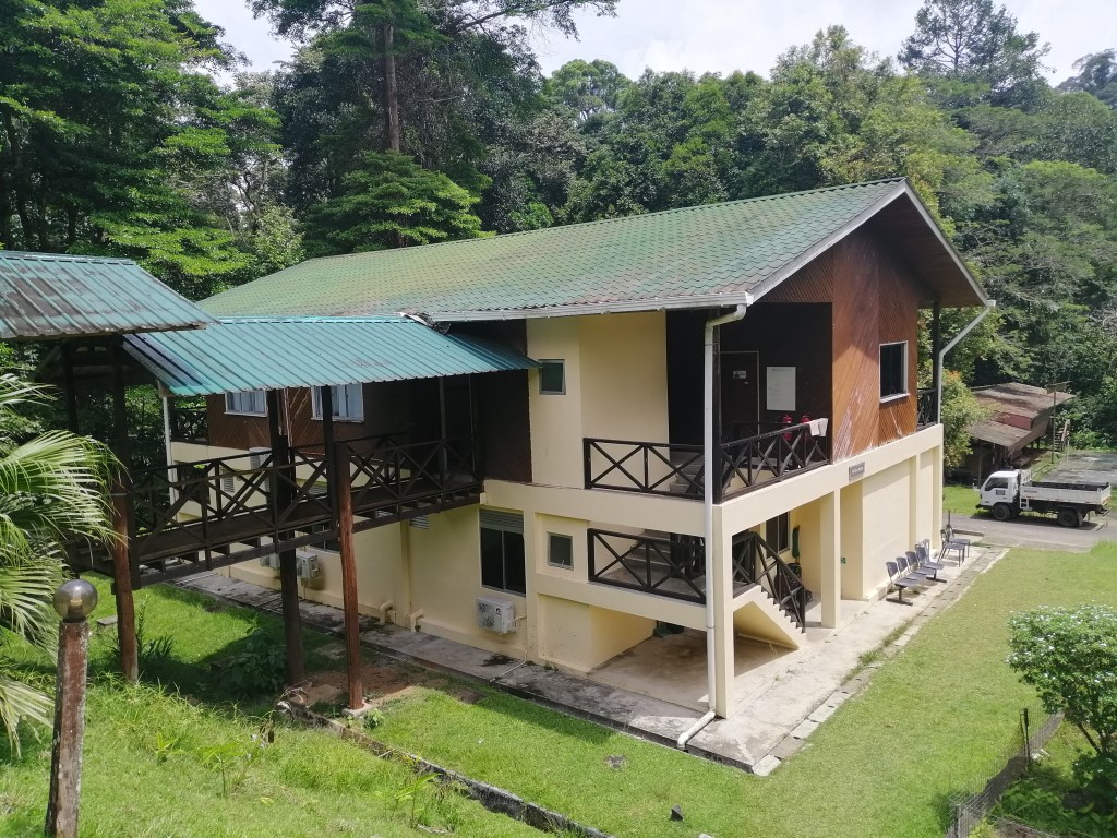
Danum Valley Field Center (DVFC) – A renowned rainforest research station that’s more rustic, but no less immersive. DVFC is ideal for nature enthusiasts, birders, researchers, and travelers looking for a more authentic, close-to-nature experience.
I chose the latter — Danum Valley Field Center — and it was an unforgettable experience.
Booking & Travel Tips
Accommodation bookings for both places can be made directly. I recommend booking directly. Alternatively, you can book via travel agents, especially if you’re bundling other adventures. These adventures include Kinabatangan River cruises, Sepilok Orangutan Rehabilitation Centre, and Proboscis Monkey at Labuk Bay (Sipilok)/Klias Wetlands (Beaufort). You can also explore Tabin Wildlife Reserve, hike Mount Kinabalu, or go diving/snorkelling from Semporna.
If you’re going through an agent, I personally suggest River Junkie. They were quick to respond, transparent with pricing, and flexible with itinerary options. Note: Travel agents provide their own guides, so experiences may differ slightly.
Contact & Guide Recommendations
To book directly with DVFC, here are the best contacts:
Reception: +60 11 1762 3016
Ms Rosti (Lahad Datu office): +60 10 931 7612
Ask for Daryl or Henry as your guides — I had both. They were fantastic. Deeply knowledgeable, patient, and genuinely passionate about the forest and its inhabitants.
Once on site, you can choose from several activity packages. Most are optional, including: Sunrise viewing, Night Drives. For specialist activity like Birding, pre-booking is essential.
Accommodation Types & Pricing
DVFC offers two-tier pricing — one for Malaysians and another for international visitors. If you’re Malaysian, ask if the local rate still applies— I managed to get it!
Here’s a breakdown based on my stay (3D2N, New AC Resthouse, single occupancy):
Malaysian: MYR 1,770
Non-Malaysian: MYR 2,820
Room Types:
Deluxe Rest House: Air-conditioning, hot showers, and a basic wired internet connection (no Wi-Fi).
Standard Rest House: Fan-cooled, hot showers, no A/C.
Getting There
The jump-off point is Lahad Datu, which can be reached in several ways:
By air: Daily MAS Wings flights from Kota Kinabalu (BKI) to Lahad Datu Airport (LDU).
By road: Public transport or taxi from Sandakan (approx. 4–5 hours) and Semporna (approx. 2.5–3 hours)
Private overland transfer: Can be arranged with your DVFC or travel agent booking.
A Note on Wildlife Viewing
Let’s be real — this is a vast, dense tropical forest, not a zoo. Wildlife sightings aren’t guaranteed, and patience is essential. With the help of experienced guides, regular excursions, and scanning the forest floor and canopy, your chances improve significantly. By listening to the sounds and occasionally detecting smells, the possibilities increase tremendously. Being in this unique natural environment is already a plus!
My Experience: Lahad Datu & the Journey to DVFC
I arrived by flight from Kota Kinabalu to Lahad Datu (mid-June). Then, walked to the DVFC office nearby and completed my registration, permits and payments.
As a solo traveller, I was expected to hire a private guide—which typically involves an extra cost. I was fortunate. A group of three travellers were departing for Danum Valley on the same day. I could join them. That said, this arrangement depends on both availability of guides and group consent, so it may not always be possible.
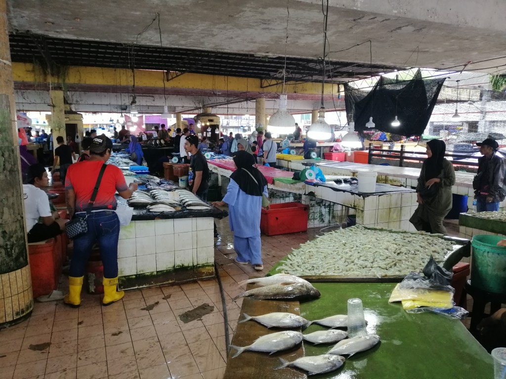
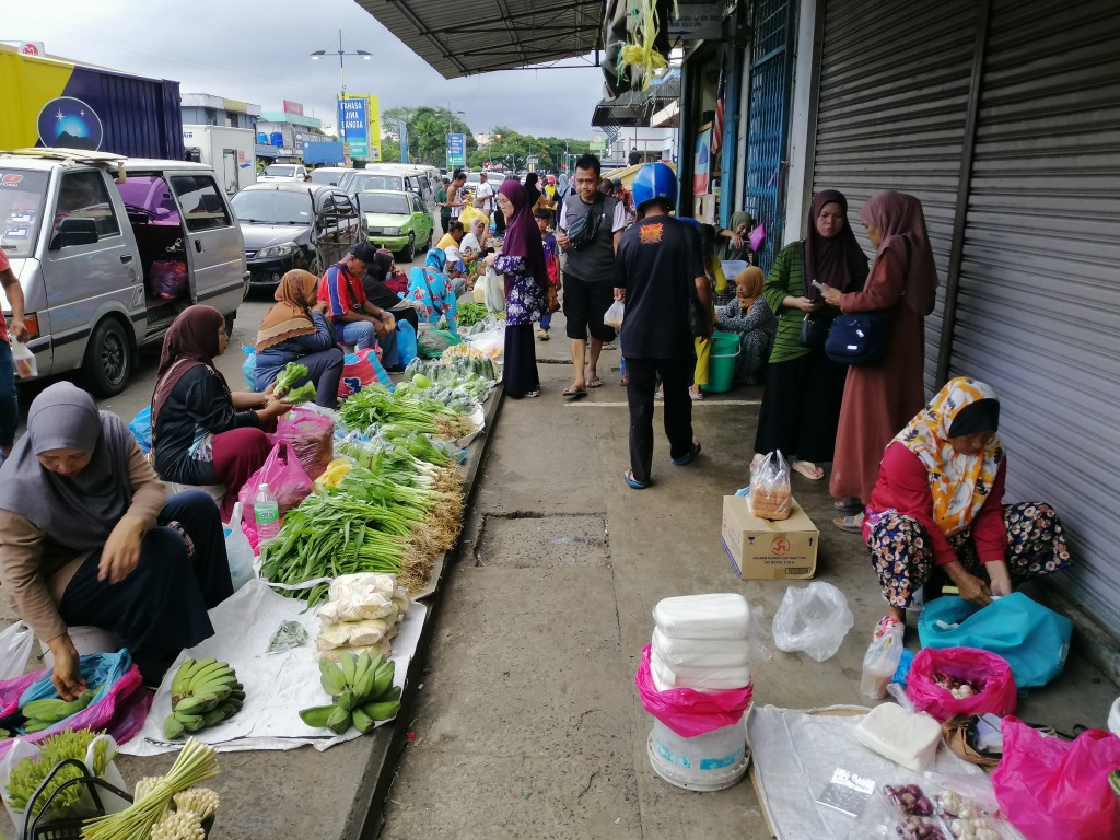
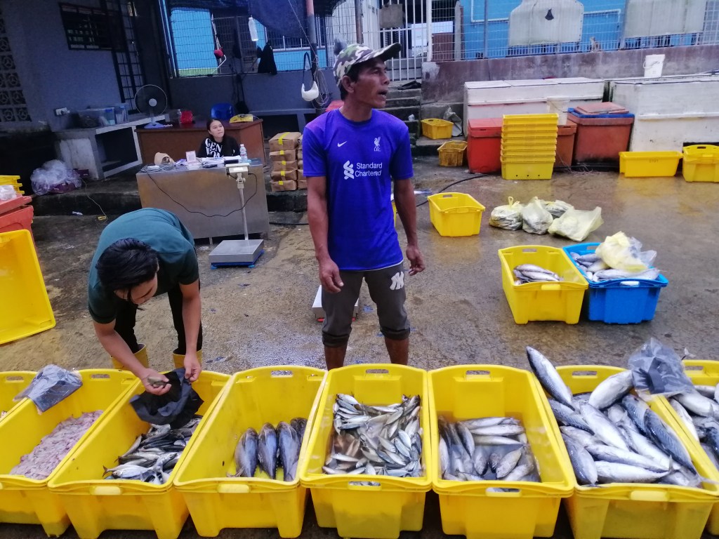
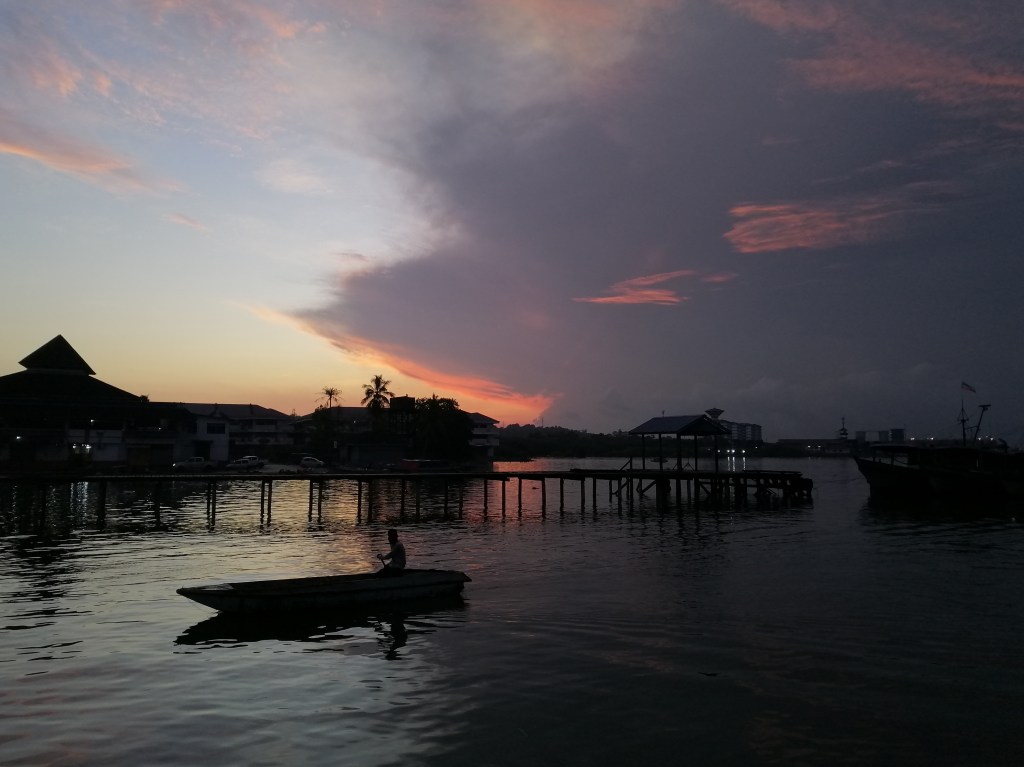
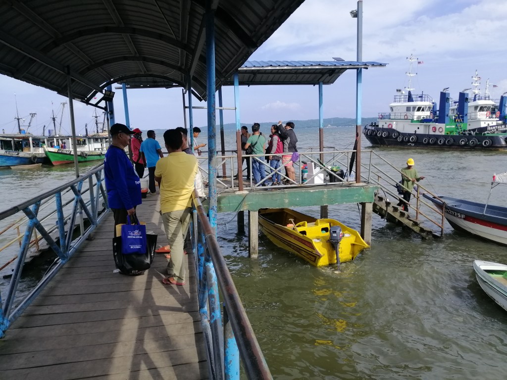
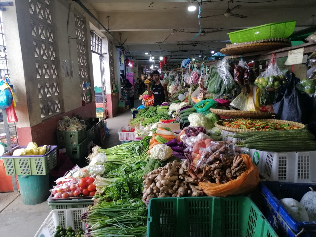
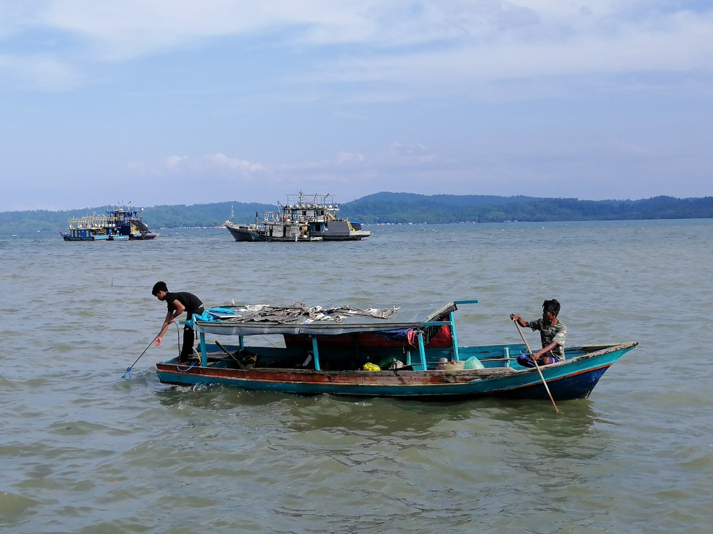
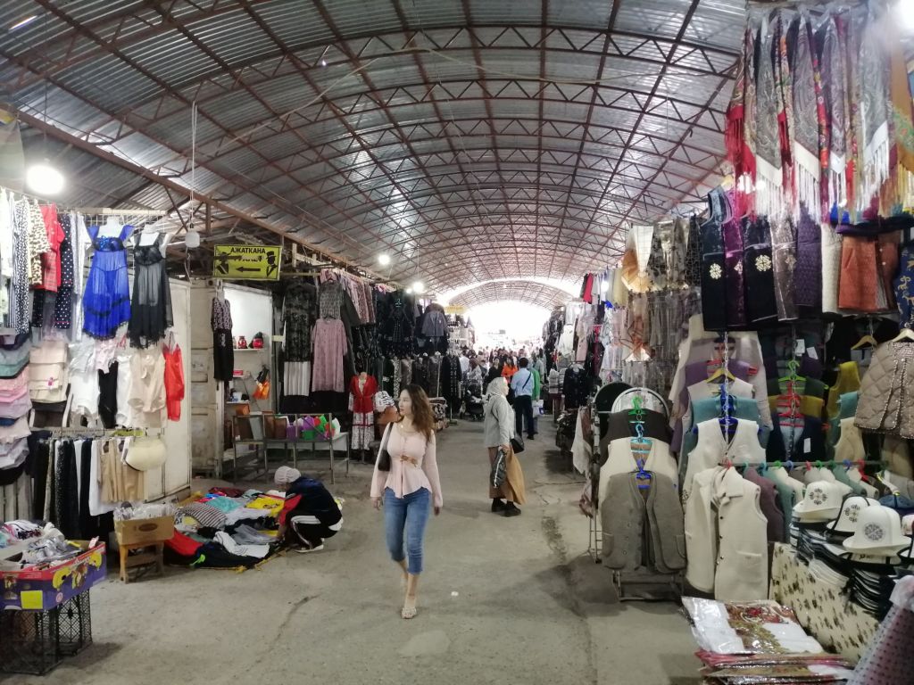
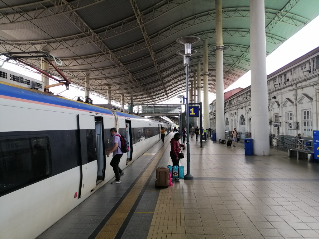
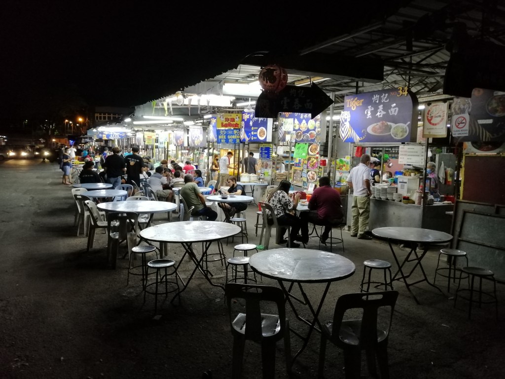
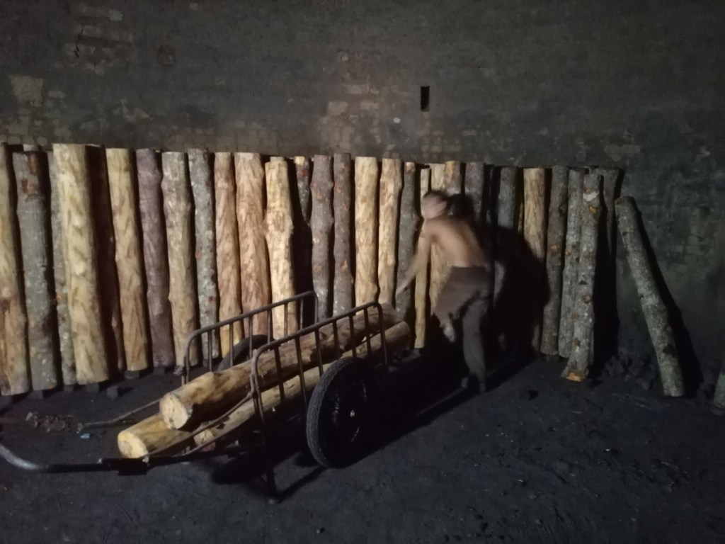
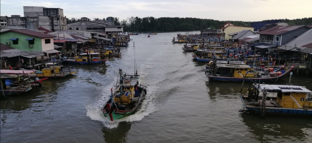
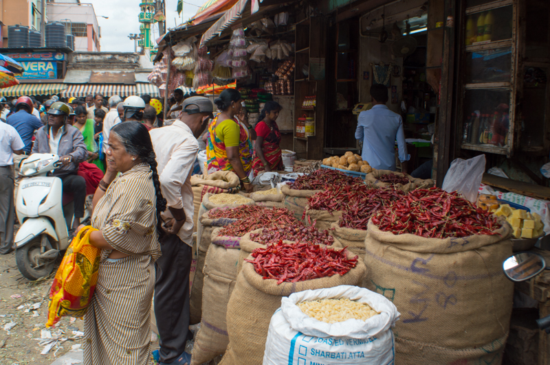
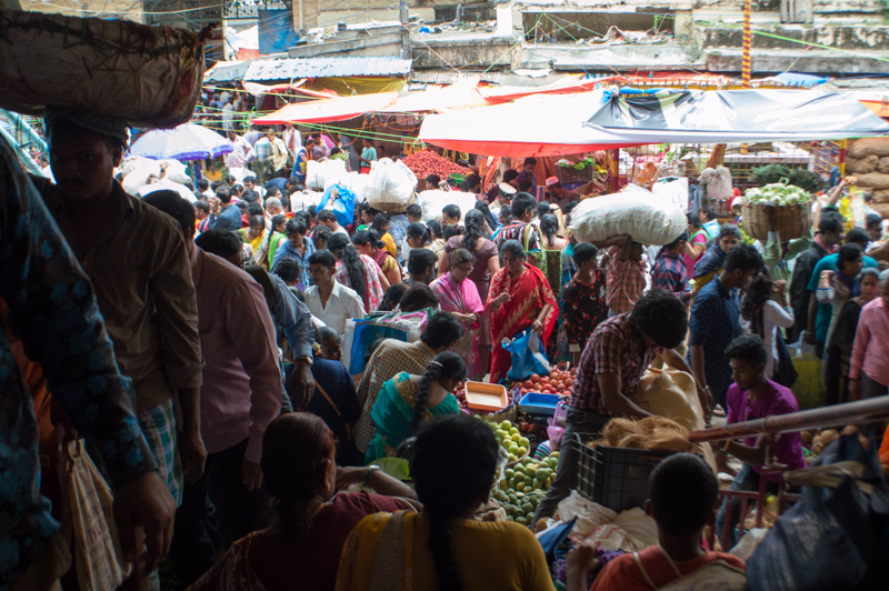
Wanting to explore more of the area, I had arrived a day earlier. Lahad Datu is a small coastal town with a distinct local charm. I spent the afternoon wandering its fish harbour, boat jetty, and the lively wet market along the waterfront.
My accommodation in the heart of the town – The Executive, with plenty of local eateries and night markets nearby.
Day 1 – Into the Heart of the Jungle: My Journey to Danum Valley
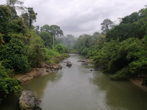
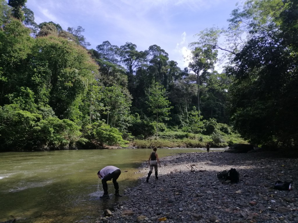
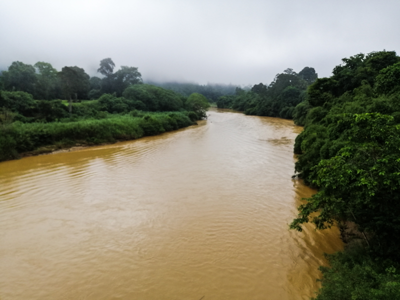
The following morning, a DVFC driver picked me up at 0930, together with three fellow nature enthusiast at my hotel. We headed off south on the highway towards Silam. From thereon, another 63km, on unsealed and winding roads through Ulu Segama Forest Reserve. The journey was quite thrilling crossing through thick tropical jungle. Our driver kept his eyes peeled for wildlife along the entire journey. A Yellow Throated Marten hastily crossed the road. It was an exhilarating drive through thickets of bamboo, mature forest trees standing like sentinels forming a dense canopy. After two hours, we arrived at Danum Valley Field Centre (DVFC), nestled along the banks of the Segama River. The river, slow and shallow, meandered gently through the forest. It separated two distinct ecosystems. There was lush primary forest on one side and the regenerated secondary forest on the other. A reminder of past logging and nature’s remarkable resilience.
First, some formalities and introduction to our guide – Henry. My AC accommodation was quite good. However, power is from 7am – 11pm only. The cafeteria is separated from the accommodation and delightful place to let the forest environment sink in. Leaves in the canopy rustled in the light wind. Insects singing and bird calls everywhere including Hornbills and ants marching in search of a meal. Lunch was optional. I brought (from Lahad Datu) ‘Nasi Lemak’ – a Malaysian favorite. The weather turned gloomy, but the vibrant forest environment lifted my spirits.
First Steps into the Jungle: A Rainy Start
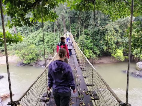
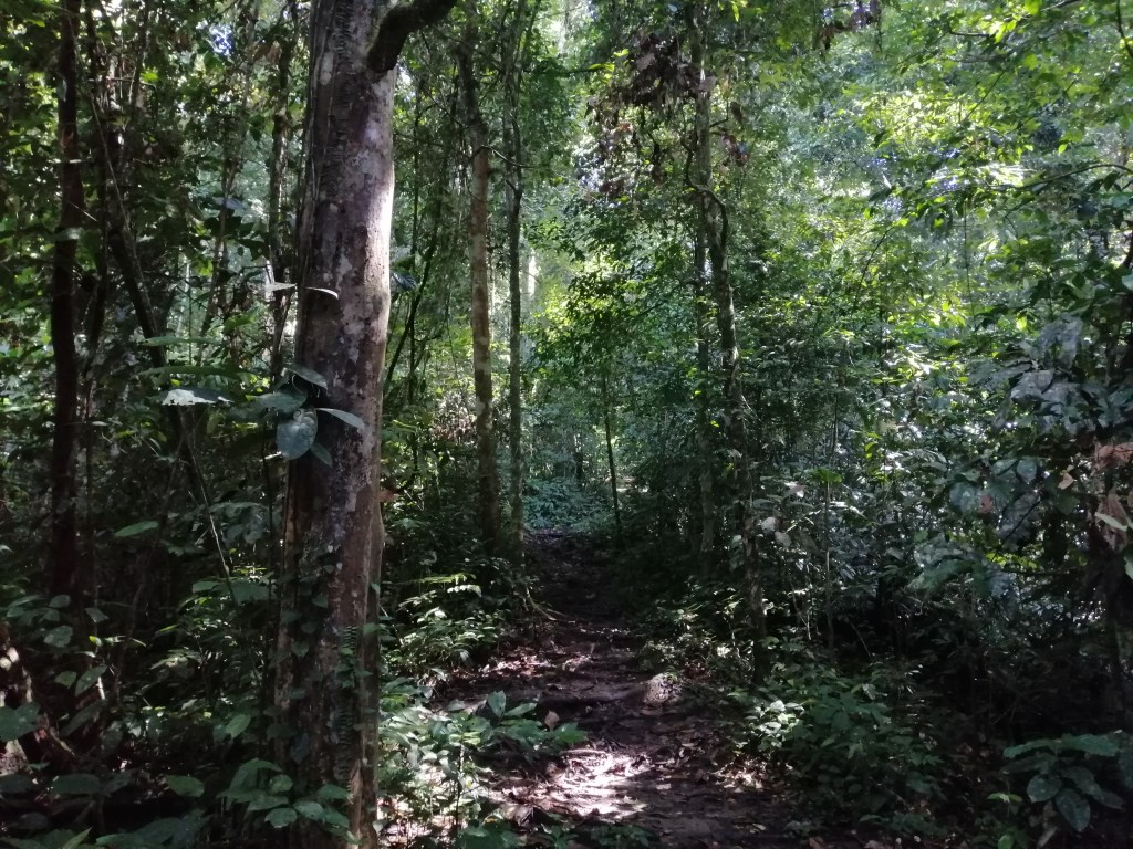
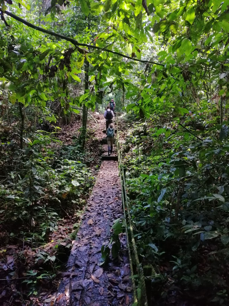
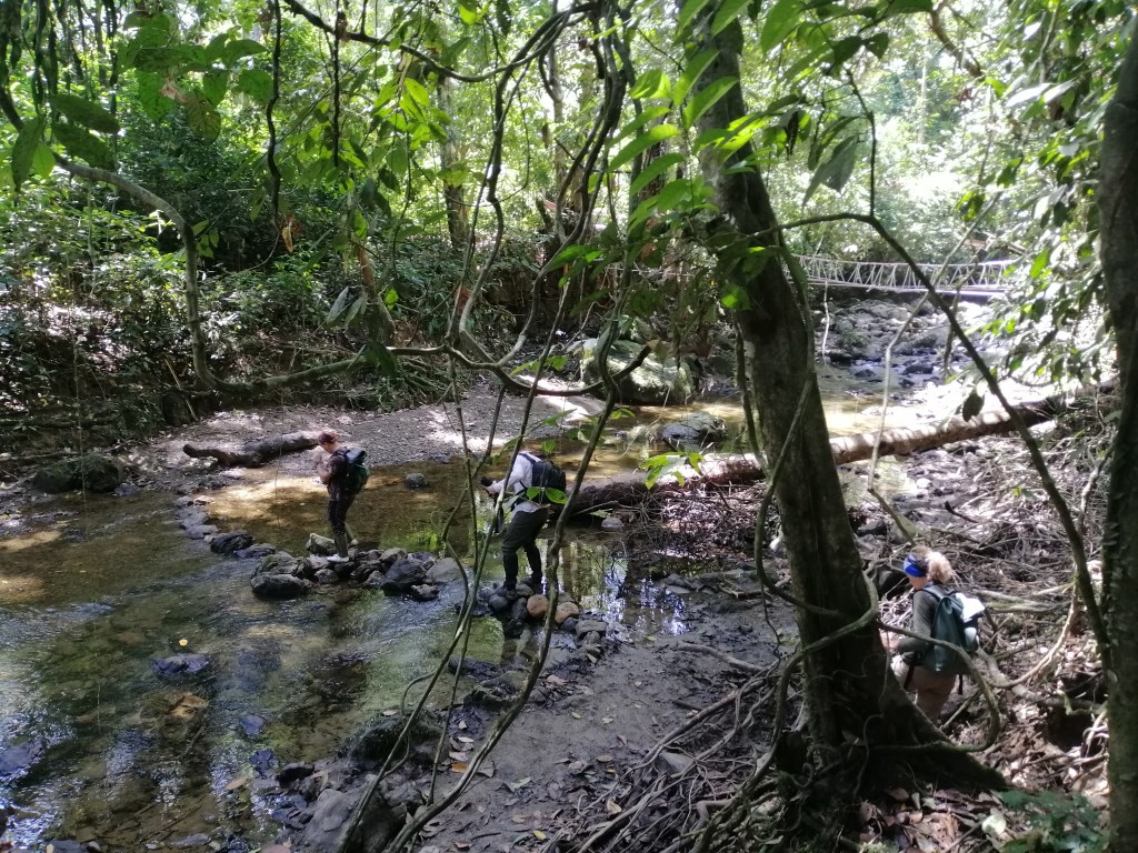
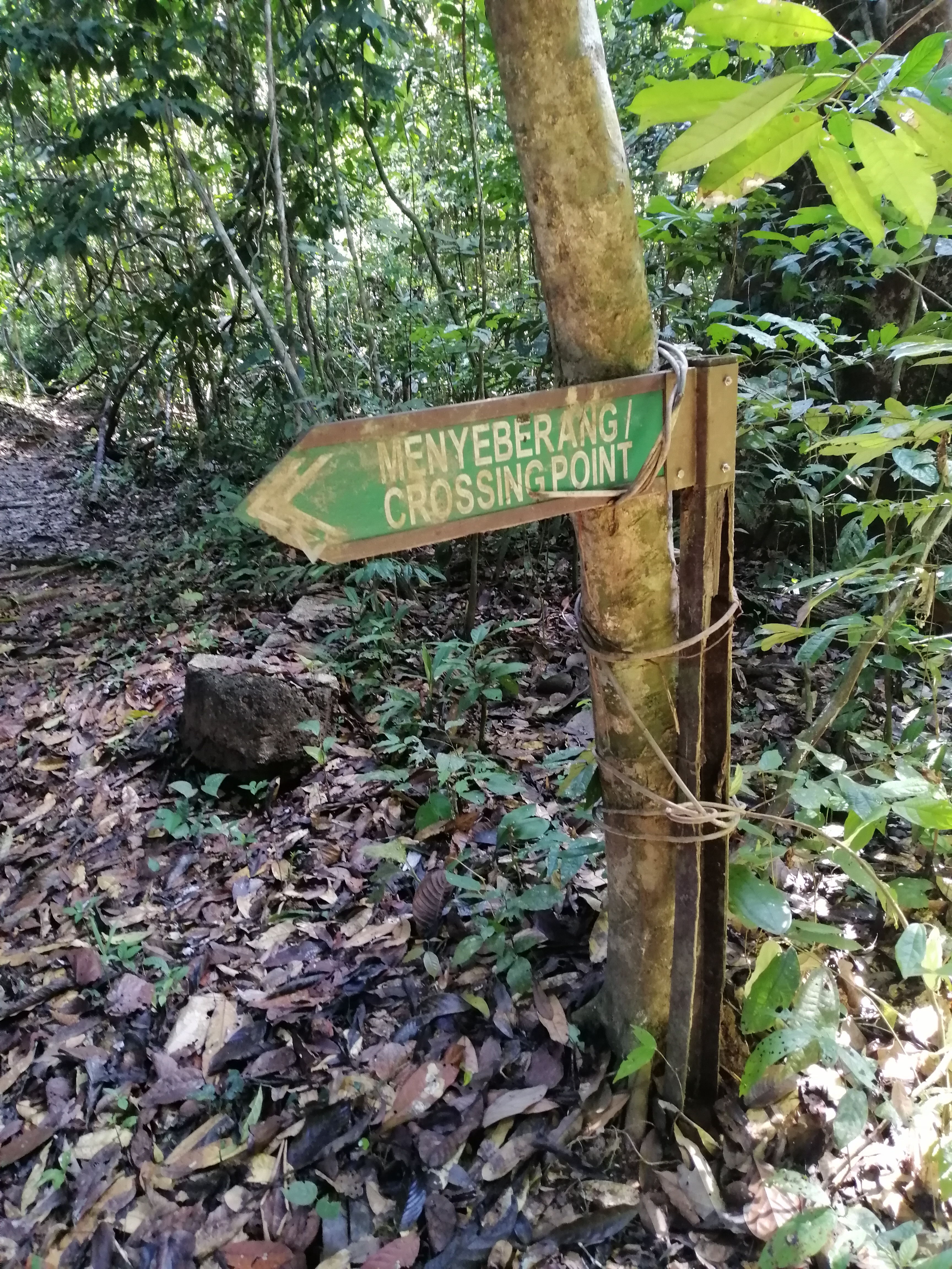
My first trek in the forest was at 1530. Unfortunately, it rained from 1500 onward making wildlife spotting challenging plus the trail slippery. With intermittent rain, Henry led us to an accessible area. We crossed a suspension bridge over the Segama River into the primary forest. DVFC sits in a region previously logged, with the road acting as a boundary between untouched and regenerating forest. The track was muddy and filled with intertwined and tangled tree roots. Leeches are present. We crossed small streams on makeshift bridges amid humid air and the strong smell of decaying leaves.
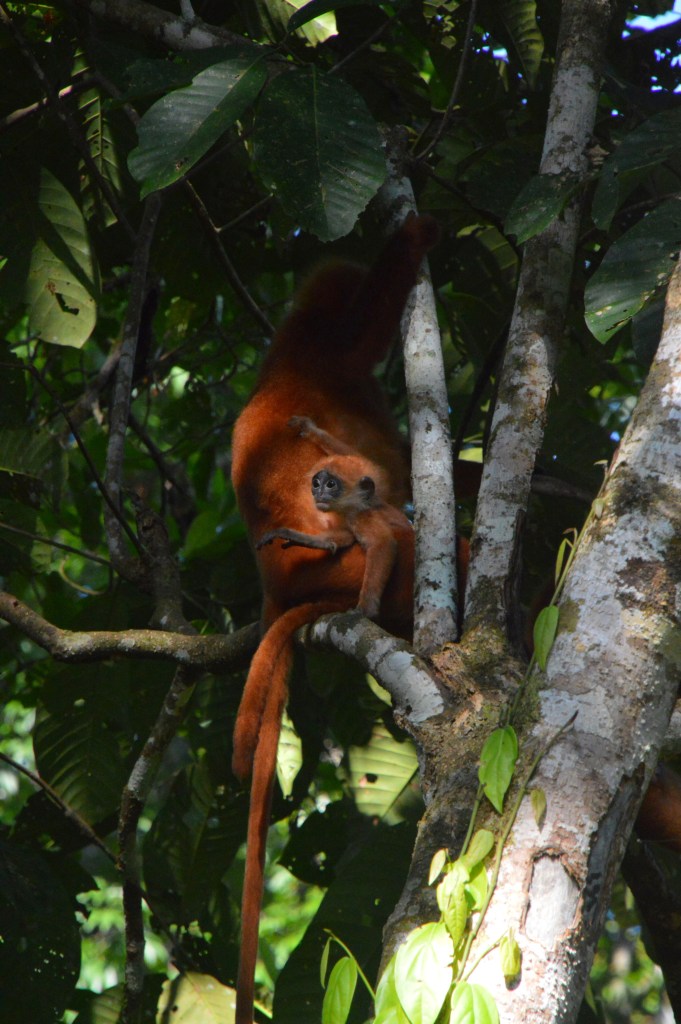
After exploring for just 30 minutes, Henry received a call from another guide. There were Red Leaf Monkeys (Maroon Languor) nearby along the road. We hurried. Sure enough, we witnessed a family of Red Leaf Monkeys feeding on tender reddish leaves. Two babies gingerly learnt the ‘ropes of life on the treetops’. As raindrops fell, with plentiful of fresh leaves, the family was in no hurry to leave. With poor visibility under the dark canopy, we return to our lodge by 1700. That was enough to get my appetite for more jungle treks. A tropical rainfall followed. Back at the rustic dining hall – with a hot cup of coffee, chocolate cake (left over from my flight), listening to rain fall onto adjacent dreamy looking forest trees and insects calls – bliss. Fortunately, the rain stopped by 1800. Dinner at 1900 was simple but hearty, filled with local flavours and accompanied by the forest’s night symphony.
Into the Dark – Night Drive Adventure
At 2000, an optional night drive (MYR80) offered a thrilling ride on the back of a truck through the dark. Spotters – wielding flashlights, sweeping the darkness in search of nocturnal life. A sense of adventure and anticipation of seeing something set in.
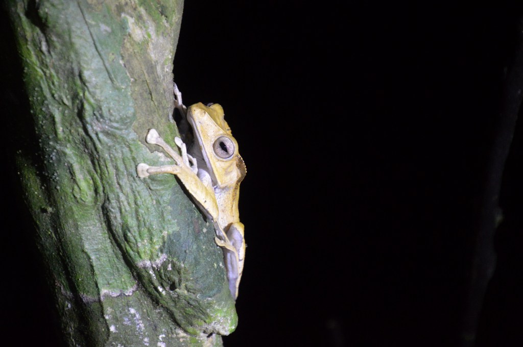
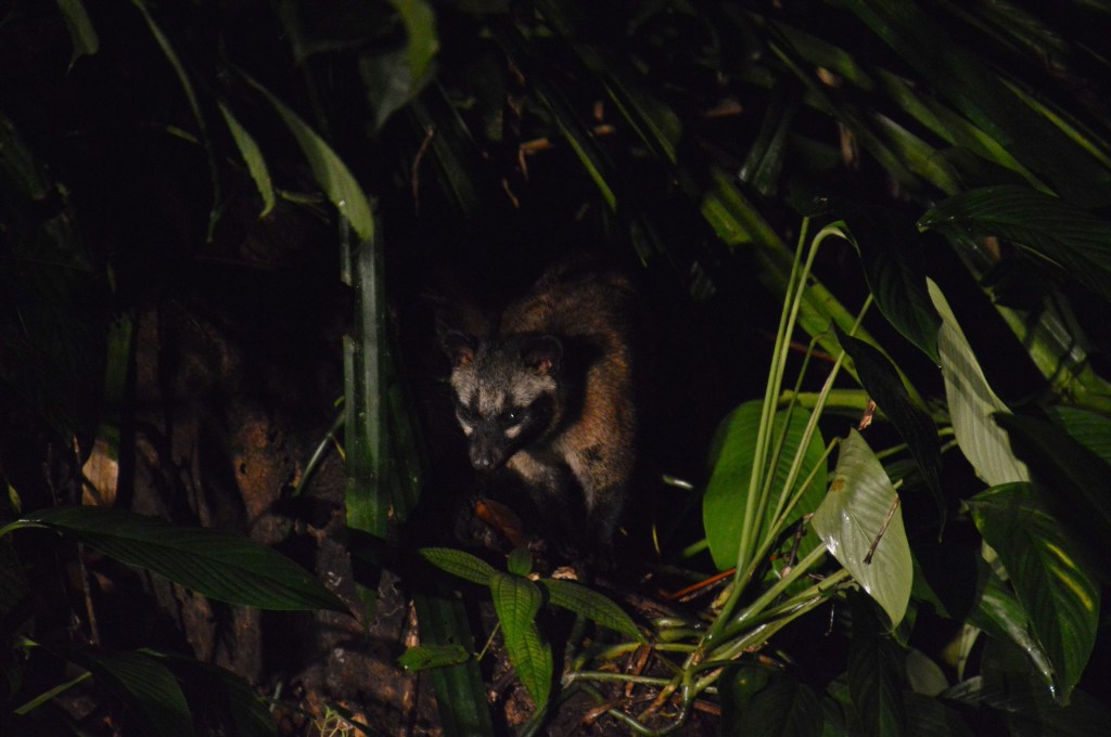
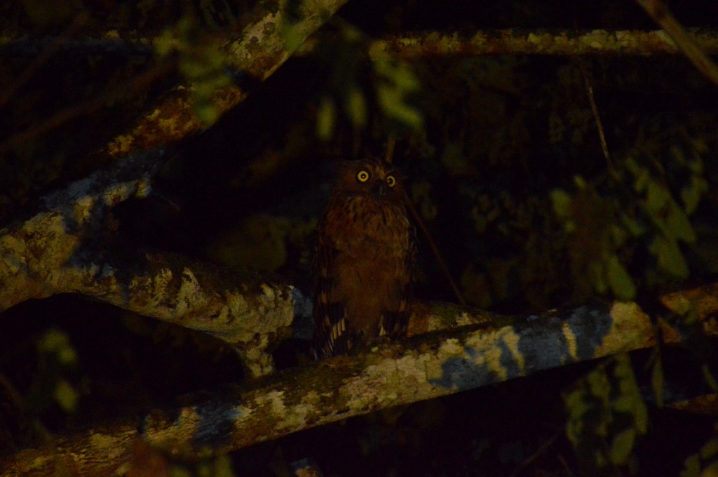
For two hours, we bumped along jungle tracks. Hearts racing with every sighting – Samba Deer, Brown Wood Owl, Red and Black Flying Squirrel, large male Frog-Mouth Owl, Malayan Civet, Crimson Pitta Bird (endemic to Sabah), flying frog, and a male Banded Civet in the shadows. The exhilarating experience more than justified the cost – window into the secret life of the forest. The forest buzzed with life well into the night. What an exciting beginning!
Day 2 – Morning Mist & Majestic Hornbills – A Daybreak in Danum Valley
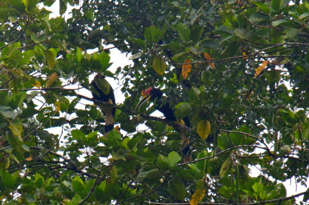
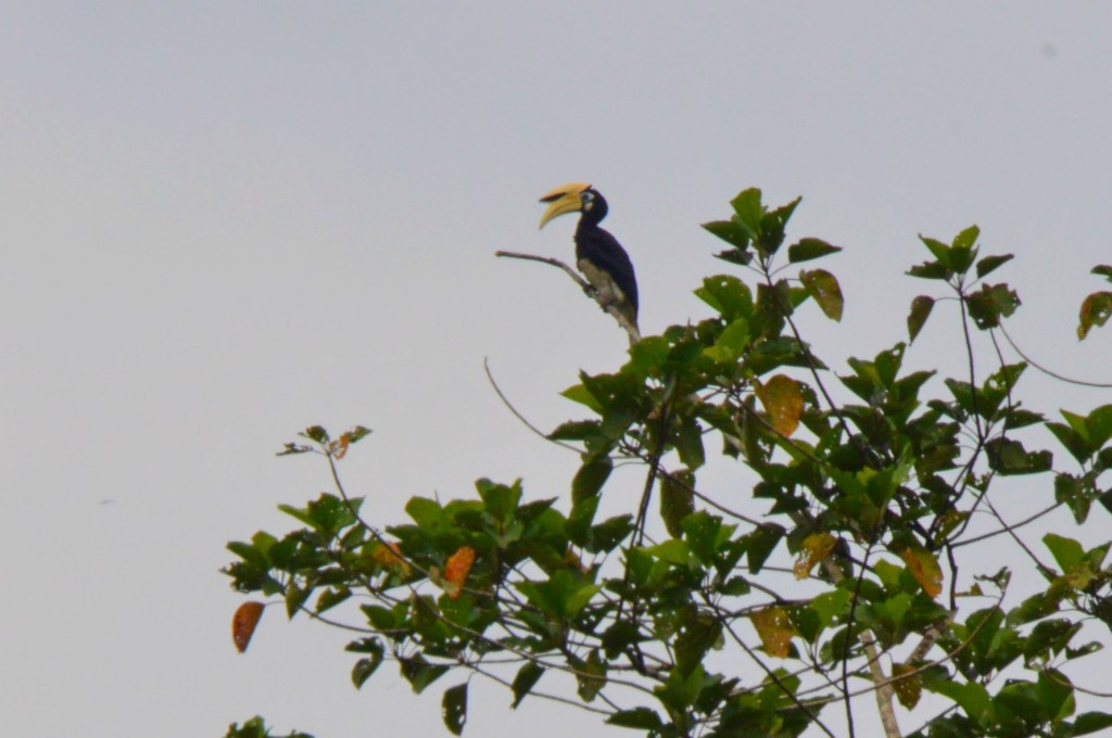
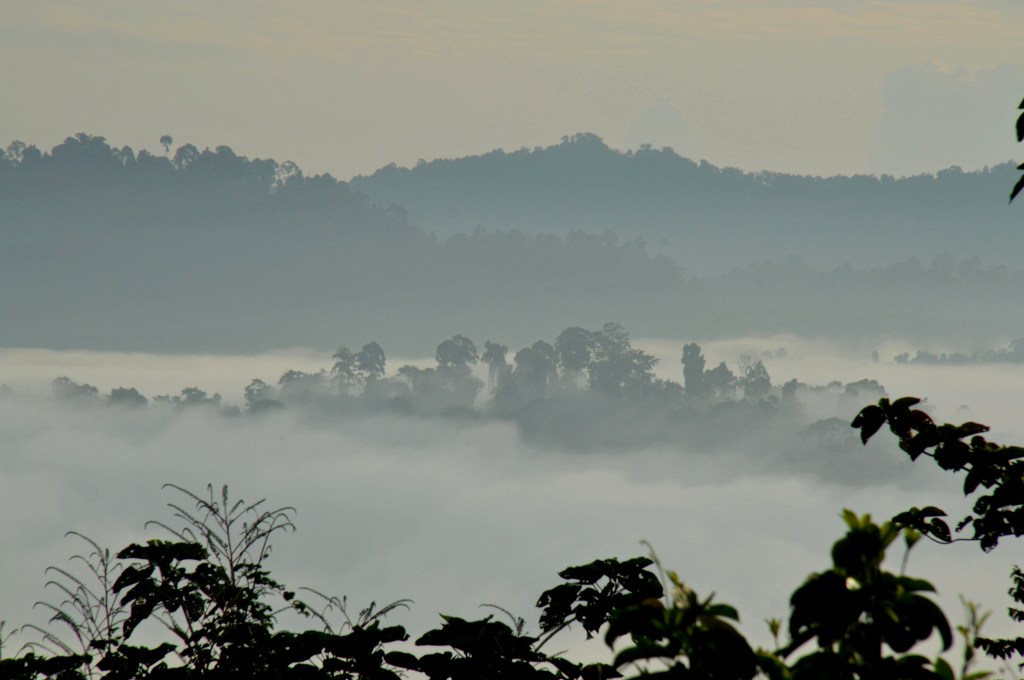
Reeling from last night’s thrilling night drive, I looked forward to a full day of discovery. After a cup of hot coffee and biscuits, we went on a morning walk at 0630. The surroundings was cloaked in dense mist and silhouettes of a hidden forest canopy. Bird calls echoed from every direction. Henry identified one – Helmeted Hornbill, largest of its species. The trails were muddy and made walking slippery. Nevertheless, we trudged on. It was only an hour’s walk before breakfast. I lingered longer waiting for the next trek at 0900. I heard squawks from a fig tree, several hundred meters from DVFC, on the banks of Segama River. Several Oriental Pied Hornbills flew into the canopy. Amongst them, I spotted a striking pair of Rhinoceros Hornbills, the second largest. It was a remarkable sight – these magnificent birds feeding and socialising. Fig trees are rich with fruits in August, attracting birds and primates. Henry noted DVFC’s high wildlife density is partly due to fig trees (Ara) planted years ago in the secondary forest. Even a short walk can lead to unforgettable encounters.
Into the Wild – An Encounter with Orangutans and Pygmy Elephants
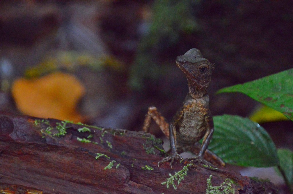
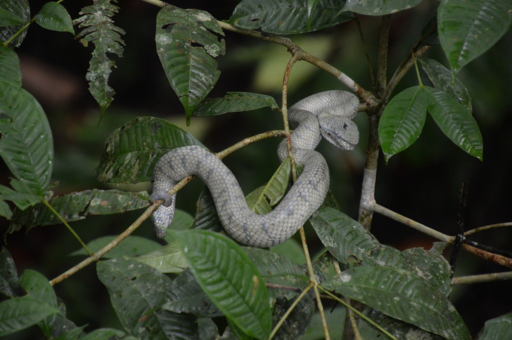
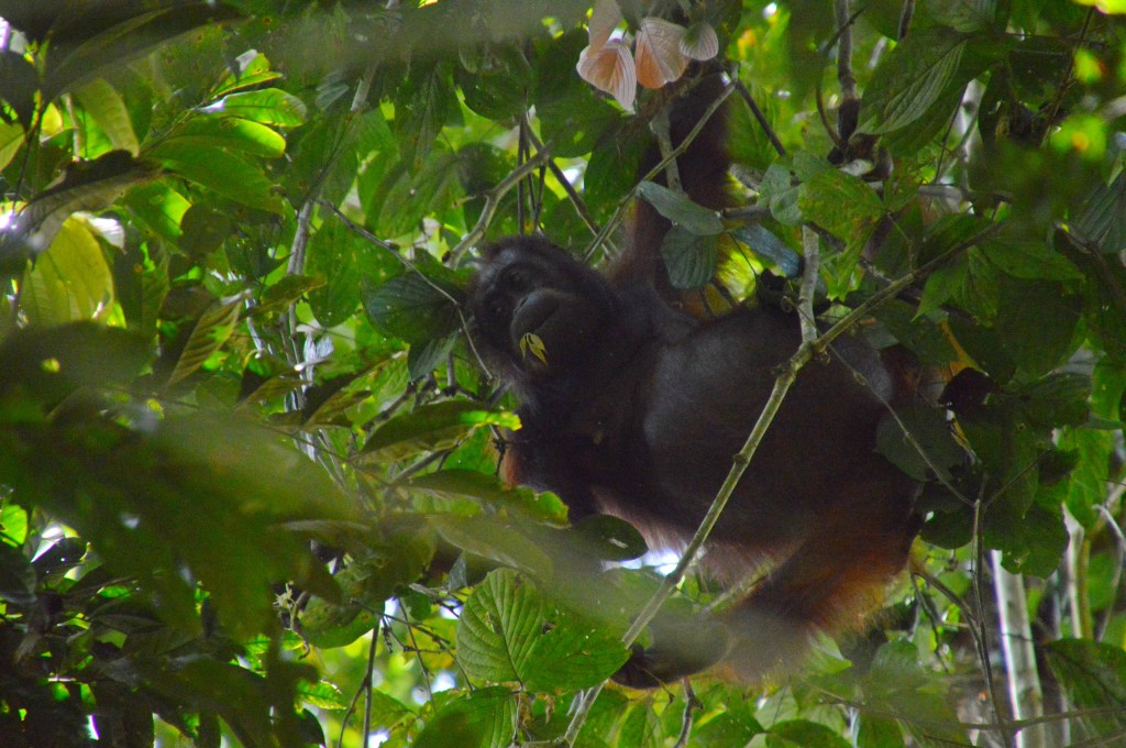
Just after we departed for out 0900 trek, we spotted a venomous Pit Viper curled up of a shrub – reportedly seen for days. Every jungle trek brings opportunities for wildlife encounters. I kept an eye out for leeches as we navigated muddy paths. On a fallen tree trunk, spotted a handsome Angle head Agamit Lizard. We criss-crossed between the secondary and primary forest, across streams and makeshift bridges. Unfamiliar insects – chirping and humming, carried through the forest. Henry got a whiff of a pungent smell – Orang Utan urine. His senses heightened. Moments later, a shaggy, reddish-orange figure appeared in the canopy—a female with her baby. With plenty of young leaves, they lingered. We watched, for over an hour. The mother glided through the treetops, while the baby playfully explored, never straying far. Thoughts of leeches forgotten. A deeply moving and fulfilling day.
Back at the cafeteria, another sumptuous lunch. Delighted to have some ‘pisang goreng’ (fried bananas). I decided to extend another day at DVFC as the feeling of being here was mesmeric. It was a little tricky as guides are designated to individuals/groups. Henry was assigned to another group the following day. I left it to the admin staff. On a trumpet-like creamy flower – a sun bird fed intensely on the nectar with its long beak. I have seen this bird from day 1. Its tenacity must be appreciated.
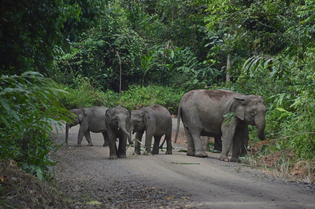
After lunch, headed to a small bench outside the rest house. The view over the small valley and Segama River offered opportunities for bird watching. On a nearby matured Ficus trees, multiple bird species – Bornean Spider Hunter; Malaysia Blue Fly Catcher; and Black and Blue Fly Catcher. The colours were vibrant. We left 1530 for an afternoon walk with Henry. He received a call. Bornean Elephants were spotted along the road, just 1 km away. There were two female adults and 3 babies. We hurried and caught my first views of the Bornean Elephants (Pygmy elephants). A lucky and unforgettable encounter.
The Forest After Dark – Night Walk Wonders
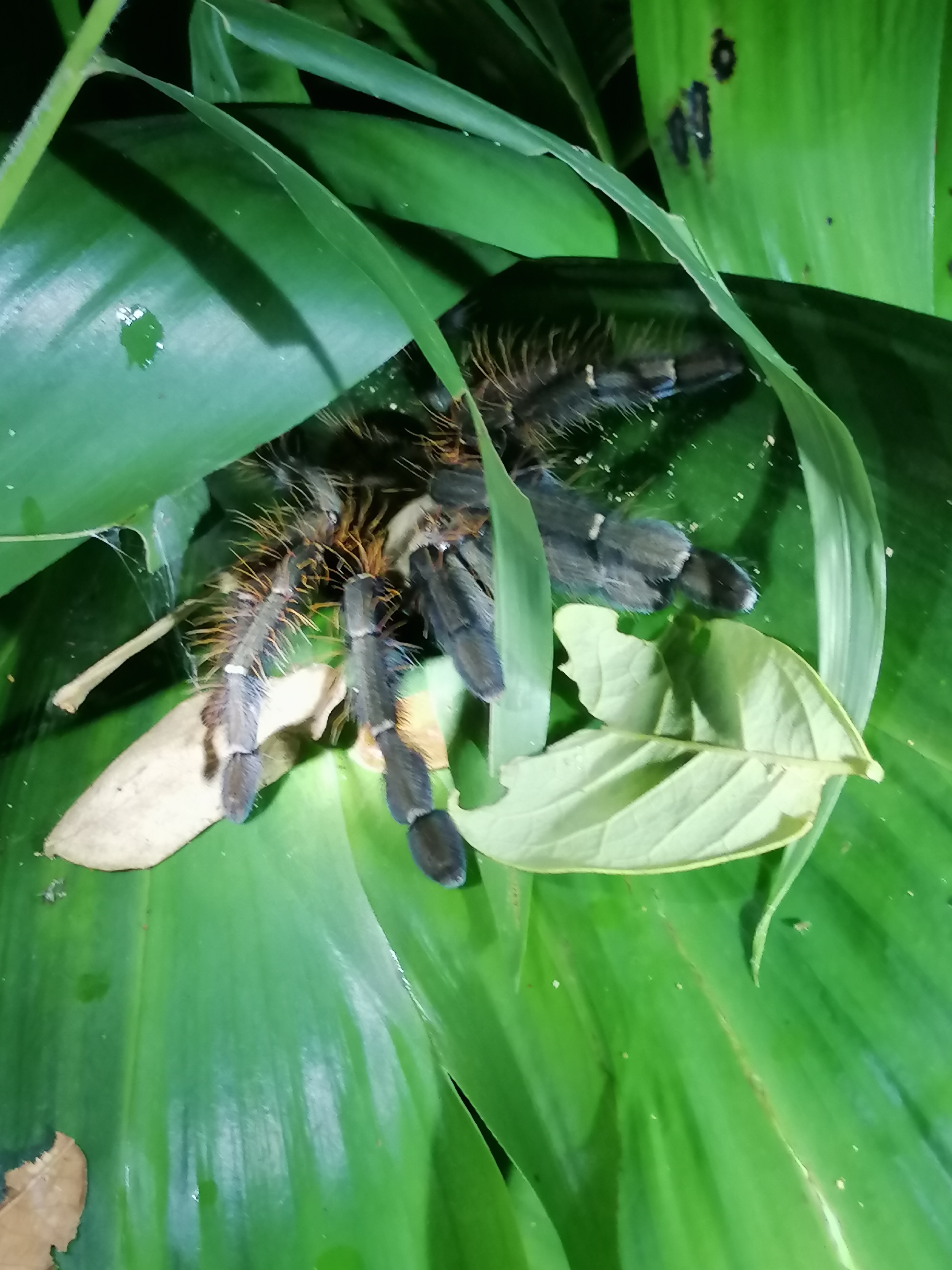
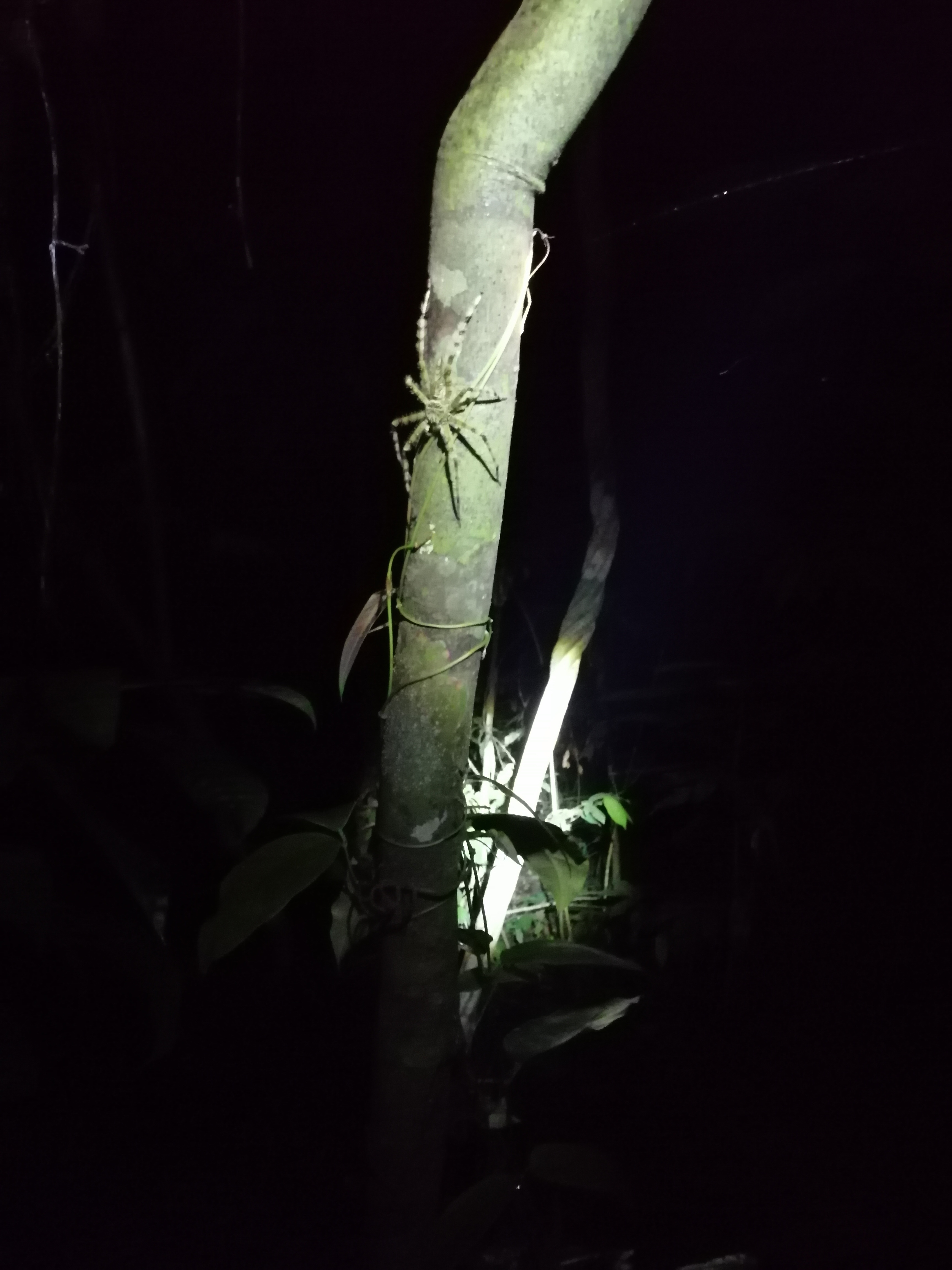
At 2100, we joined Henry for a night walk to discover the rainforest’s nocturnal side — a real highlight. Flashlights in hand, we ventured into the shadows. We spotted Crested Fireback Pheasant, File Eared Tree Frog, Earth Tiger Tarantula, Dark Eared Tree Frog, Giant Huntsman Spider, Banded Palm Civet. Near the rest house, a stunning Buffy Fish Owl. The jungle by night is a realm unto itself – activity invisible during the day. An extraordinary second day.
Day 3 –Sunrise Over Danum Valley: A Morning to Remember
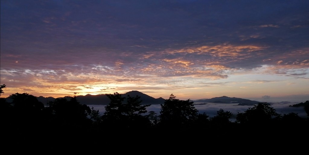
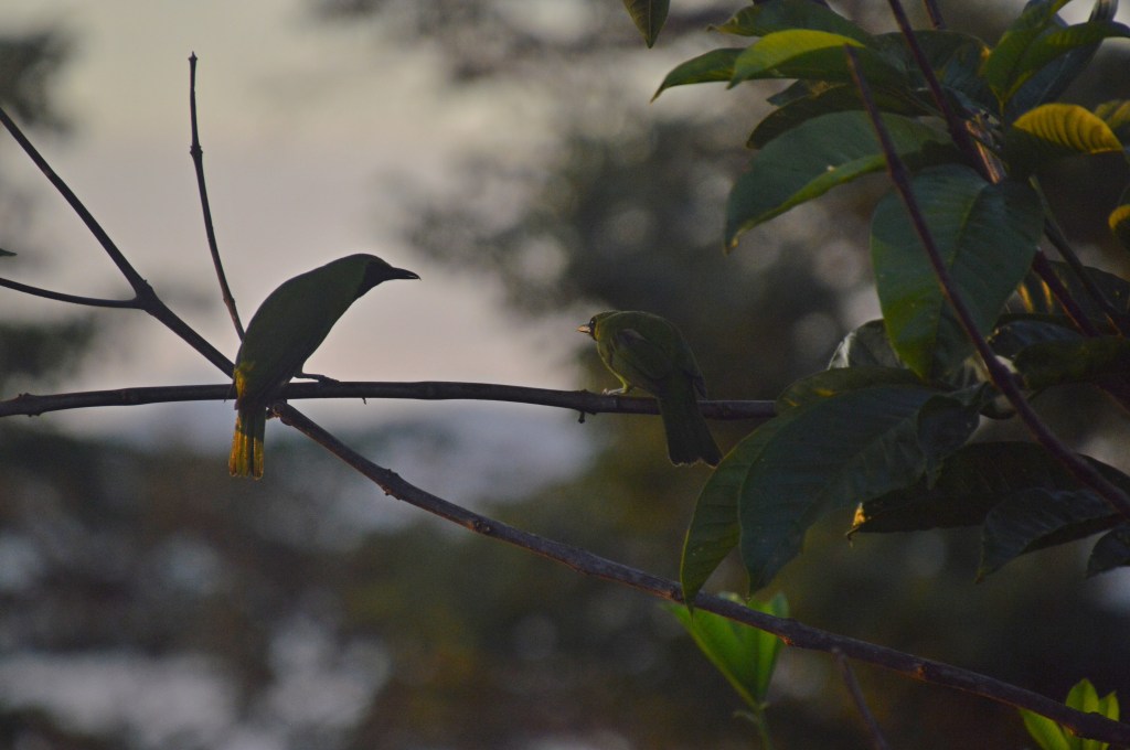
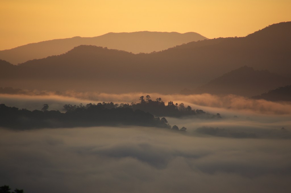
I opted (MYR80) to take the 0500 – sunrise drive to Bukit Atur. It was still dark. In the pre-dawn darkness, our headlights revealed a herd of elephants. They were slowly making their way off the road and into the forest. At the lookout tower, dawn broke. A pair Lesser Green Leaf Bird were perched on the tree top as thick mist settled over the forest.
The sky was filled with streaks of fiery red, orange and yellow. Gibbon calls woke the residents of the forest. A sea of clouds blanketed the landscape, broken only by silhouettes of treetops reaching skyward. The cacophony of the forest became louder. Sunrise was spectacular as bands of rays illuminated the forest canopy – a fortunate break in the weather.
On the drive back, we spotted a White Crowned Shama Bird, Crested Fireback, Bornean Yellow Muntjac , the same herd of Elephants, Pig Tail and Long Tail Macaques. At breakfast, a family of red leaf monkeys foraged adjacent to the dining hall. Just another reminder that in Danum Valley, wildlife is never far.
Into the Wild: Gibbons, Orangutans & Elephants in Danum Valley
For the morning walk, Daryl took the Tongkat Ali trail, guided by the haunting calls of the North Bornean Gibbons. In the canopy, only shadows – hand and the back. Their movements unpredictable. We moved on after half an hour. Then, signs (fresh dung) of a single elephant – a bull. If nearby, this can be dangerous. Daryl was alert. Tracking through the dense and humid forest, a clearing – a bend on the Ulu Segama River. A great place to take a dip. In the early days, they used to pan for gold here. Under a tree shade, Daryl spotted a Greater Angus Pheasant. Overhead, a variety of Hornbills soared, as their deep coarse calls echoed across the tree canopy.
Back on the trail, we managed to see a family of orangutans – mother, baby and a older sibling (perhaps the same one we saw yesterday). It’s a joy to see the baby trying out its antics in climbing. However, always within mum’s long reach. To witness these intimate family moments in the wild is humbling and privileged.
Afternoon walk, with another group of visitors, headed east on the main road. We doubled back. after news of elephant sighting near DVFC. The elephants were restless – trumpeting call and erratic. Soon they disappeared into the forest. After all, these are wild elephants. Several trails were closed from storm damage. The night walk focused on nocturnal insects and crawlies. In places, the sounds were deafening.
Day 4 – Waking Wild – Final Morning in the Rainforest
Sleep in my non-AC room was intermittent. Around 3am, sounds of Sambar Deer grazing outside my room. As dawn crept in, the forest slowly came alive. The haunting, whooping calls of gibbons echoed through the forest. Near the centre, I watched Red Leaf Monkeys leap unhurriedly along a narrow stream. In the bush – a Crested Fireback Pheasant ducked between the dense forest floor. Above the canopy, chorus of deep calls of Rhinoceros Hornbills. Time to pack up. At 0930, a FWD picked us up and returned to Lahad Datu.
Closing Thoughts
My journey to Danum Valley was a thrilling immersion into Borneo’s untouched rainforest. From misty treks and hornbill sightings to intimate encounters with orangutans and pygmy elephants. Night walks revealed the forest’s hidden world, alive with elusive creatures. Danum Valley’s rich biodiversity and serene beauty offered more than just a wildlife experience. It was humbling and raw. It provided a deep connection with the natural world. This ancient ecosystem thrives quietly, revealing its wonders only to those willing to slow down and listen. Sometimes, it’s simply about being present—as the forest continues its mysterious rhythm, untouched and magnificent.
Here’s a list of things to consider bringing :
Leech socks (I found it useful to detect and dispose them)
Trekking shoes
Comfortable t-shirts (long sleeves and quick-dry)
Outdoor pants (long, quick-dry)
Insect repellent
Sunscreen
Hat
Flashlight/Torch (headlights are not recommended as hornets are attracted to them)
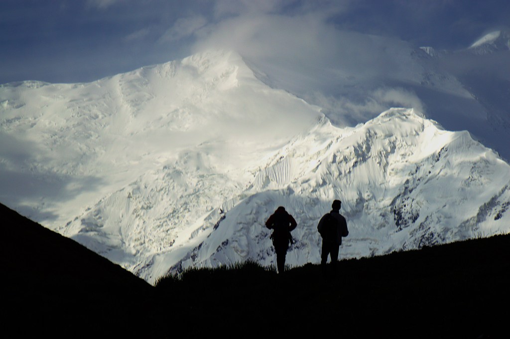
My journey started from Khyber Pass through the Hindu Kush in the Kalash and Swat Valleys. Continued on the magical ancient Silk Route – Karakoram Highway (“8th Wonder of the World”) to Kashgar via Khunjerab Pass. Continued west into Central Asia’s legendary Silk Road cities – Samarkand, Khiva and Bukhara, through Irkestam Pass in Tien Shan mountains. Finally through the Fann mountains to begin my Pamir journey.
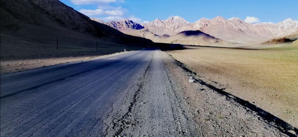
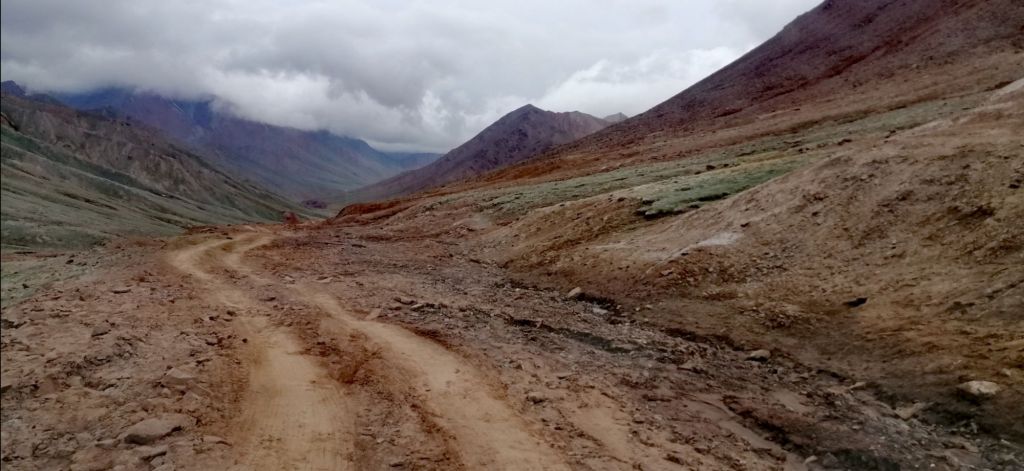
The legendary Pamir Highway, also known as “Bam-i-Dunya” or Roof of the World. It is the second highest highway. Once an ancient Silk Road, it transverses the high desert-like Pamir Mountains. The route passes through Afghanistan, Uzbekistan, Tajikistan, and Kyrgyzstan. Known as M41 (Dushanbe to Osh), a Soviet-built road, covers over 1200 km. Damage from erosion, glaciers, and landslides is common. I liked it because it slowed down the pace of travel. This allowed one to look and immerse oneself in this harsh yet unique environment. This is rough travel and perhaps the world’s last true adventure.
My journey began on 10th June 2024 from Dushanbe. It included an exploration of the Wakhan Valley. I rejoined M41 at Bulunkul to finish in Osh – 1530km. With three other travelers, 10 copies of passport and GBAO, on an organised 9 days tour which included a 4WD and Norbuk – local Krygis driver.
“A 1500km epic journey through desolate winding and perilous roads with over 2000 years of civilisation over awe-inspiring landscapes and sparsely populated areas promised adventure – high passes bound by soaring rugged icy peaks, lush fertile valleys and meadows fed by life giving glacial rivers and witness the resilience of the Pamiri people whom call this harsh environment, home”
Day 1 – Dushanbe to Qala i Khumb (8.5hr, 350km)
After fuelling and stocking up with water, fresh fruits and snacks, I was excited to leave Dushanbe (700m) at 11am. Dushanbe lies in the valleys of Gissar Range in the western part of the Pamir-Alay mountains. Just on the outskirts of Dushanbe, instead of going Northeast onto M41- ‘aka Pamir Highway’, we turned Southeast onto Highway E008 towards Kulob.
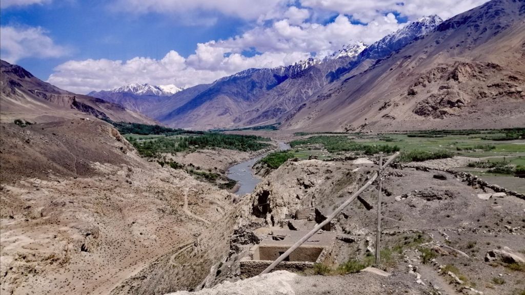
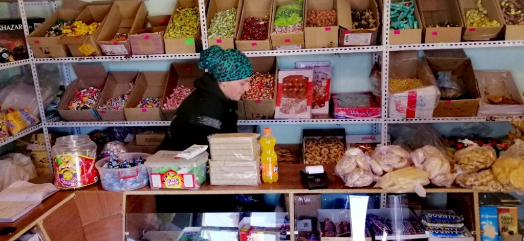
The sealed road steadily climbed as we crossed Vakhsh River. We entered Karotosh village, which is popular for fried fish from the surrounding waters. Further up, the picturesque bluish water of Nuruk Reservoir. Good place to stock up on dried fruits and nuts. Drove passed through two tunnels, into wide valleys cultivated with various crops. Around midday, road was busy with traffic. We passed historic Hulbuk Fortress. It is the Palace of the Governor of Kulbhuk in Pingan. It is near the confluence of two rivers. The fortress is said to guard the Western entrance of Pamir Hwy. The current structure is not the original. We arrived at Kulob at 2pm. Good place to grab some lunch.
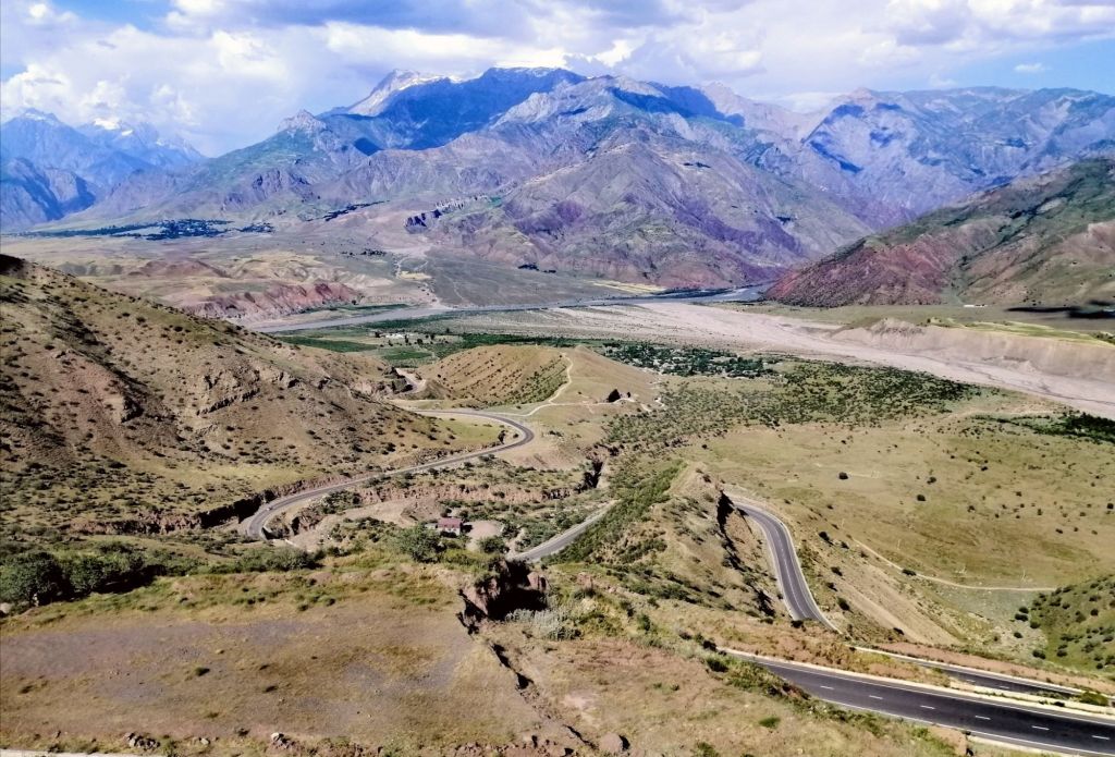
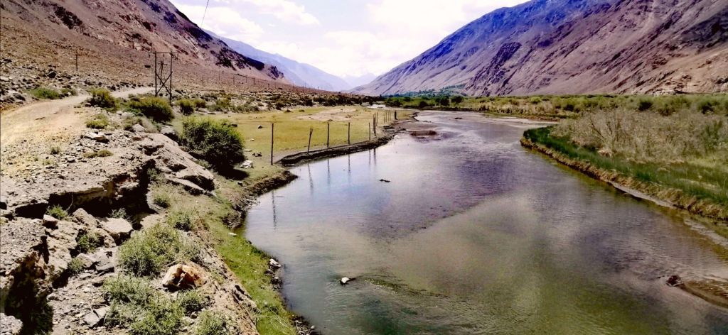
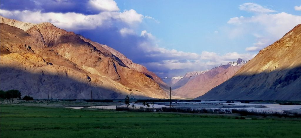
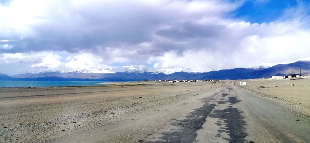
After Kulob, at Shurabad Pass, we reached a viewpoint at 1250m. I had my first views of the Panj River. It separated Tajikistan and Afghanistan. Formidable brown and grey mountains rose beyond the banks of the Panj with scattered icy peaks and settlements. In the foreground, a mottled landscape with scrub dominated Tajik side and a winding road descended towards Panj Valley. The earlier heavy traffic weaned off. This is the beginning of Gorno-Badakhshān region.
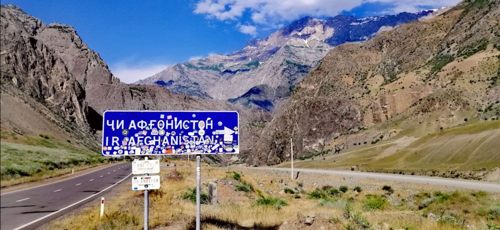
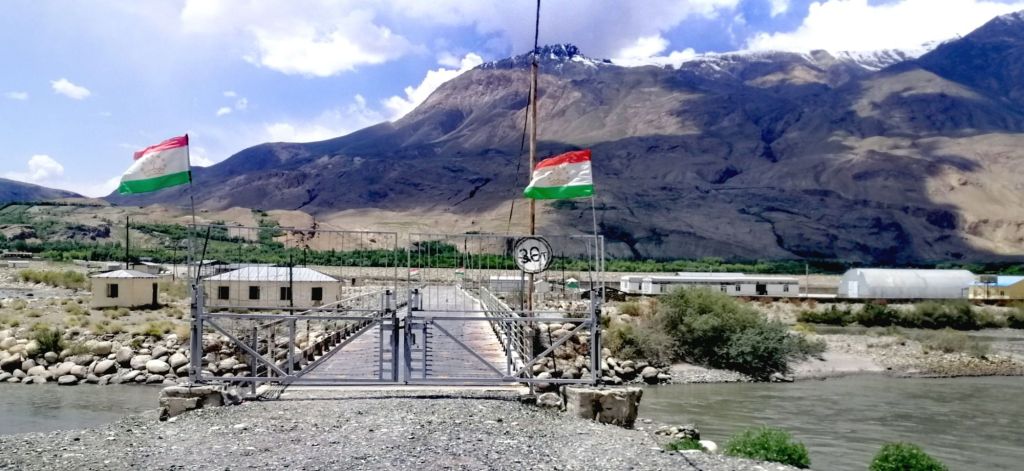
After a series of switchbacks, we descended along Panj river with Afghanistan sometimes just meters across. We stopped to watch. Women washed cloths in the river. I can hear their voices. Nearby, village homes made with stones blended with the environment. A gravel road, like the Pamir Highway, was cut onto the mountain slopes along the Panj. It ran parallel on the Afghan side. There was hardly any traffic. We stopped near Tajik and Afghan border post where a red bridge connected the two. The huge road sign pointed to the direction of Afghanistan. This border crossing is closed. On Saturdays, people can cross into Afghanistan to visit the bazaar. The paved road continued to cut through a gorge that narrowed and widened along the Panj River.
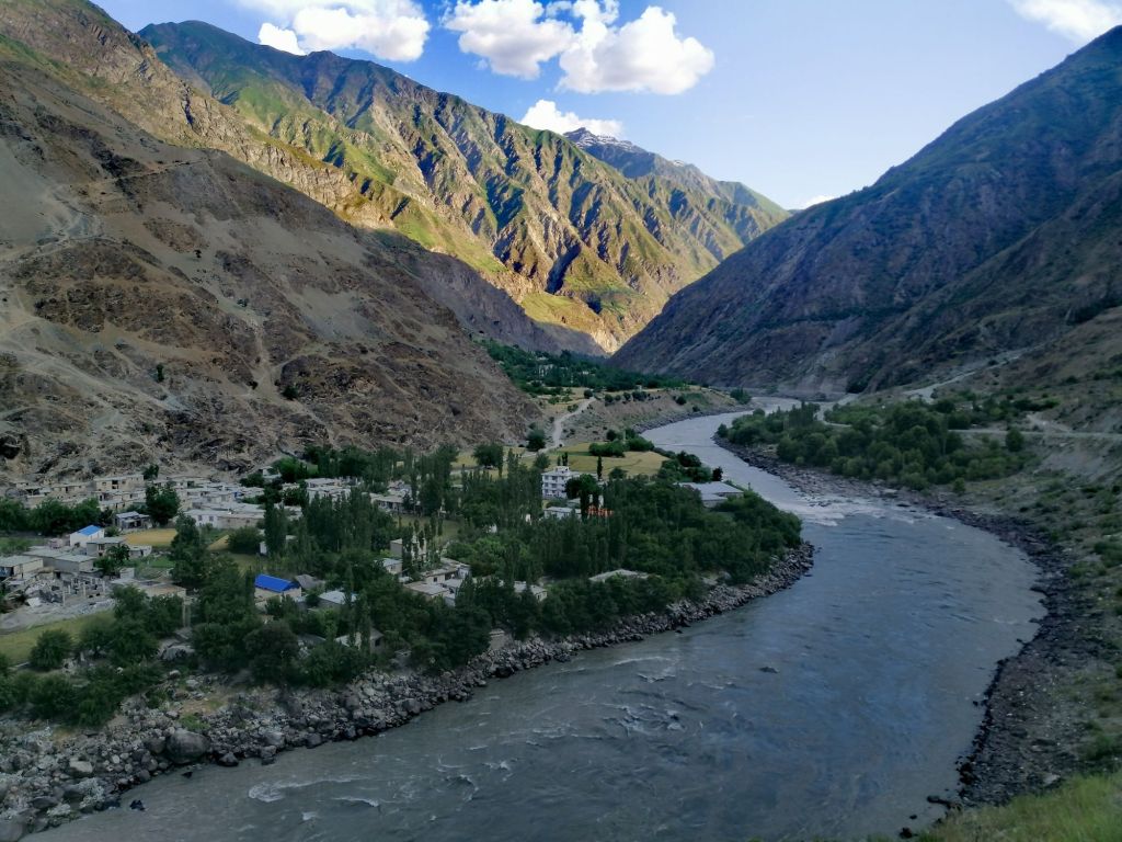
The landscape with the setting sun was quite dramatic. It was past 5pm. The Panj is fast flowing and raging in places. 2nd check police post near Zigar. Passed a substantial Afghan village. Homes had satellite with corrugated roofs and brick walls. Blue coloured roofs of a school seemed out of place against the brown hue of the landscape. Transportation on the gravel roads were by walking, backs of donkeys and occasional motorbikes. Women laid a large cloth under walnut trees to harvest the nuts. Some dried these nuts. Idyllic village life perhaps. On Tajik side, paved roads with cars and public transport.
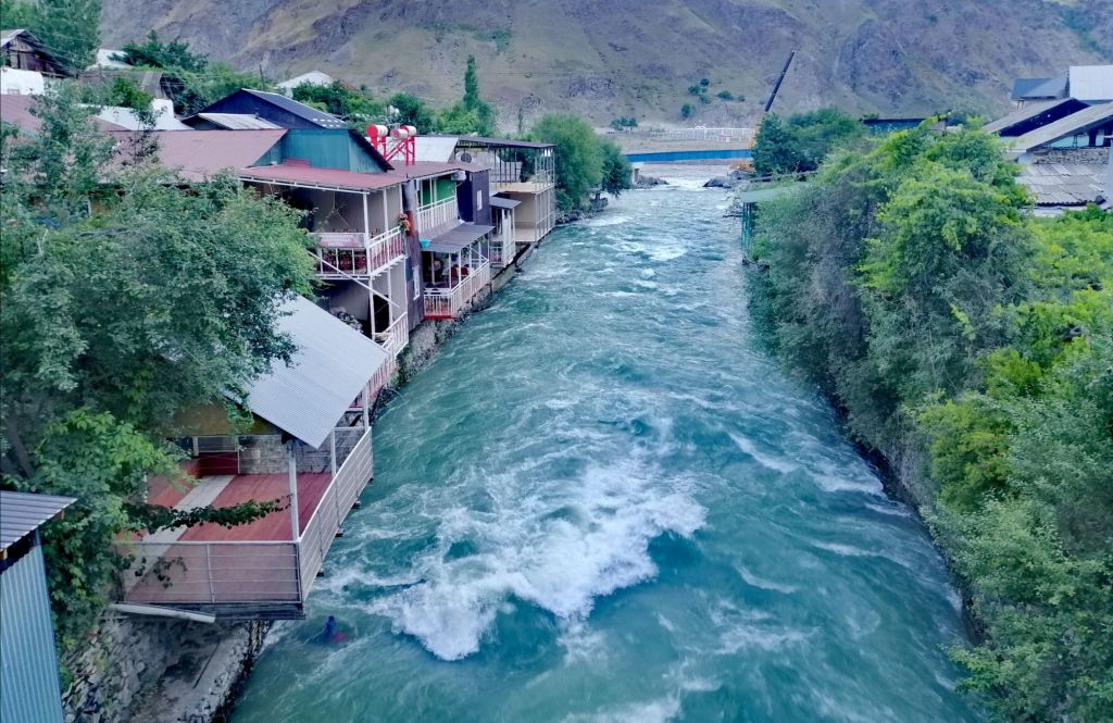
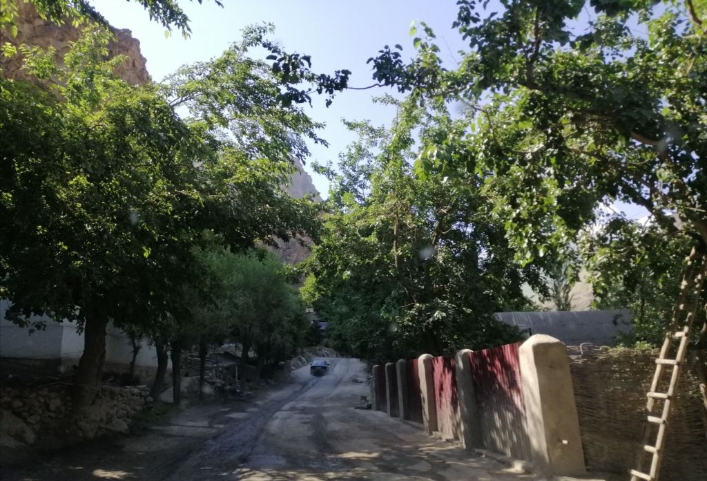
The villages, on both sides, set deep in the gorge, with the Panj dividing the two, is quite dramatic. We arrived at Qala i Khumb (1200m) at 1830. The setting sun casted shadows on the mountains. Roads were good. In front of a monument, a Markhor statue. On the main road, share taxi drivers gathered. Kids played football on the road and side streets. While walking along the river at 1900, I heard Taliban boys training with live firing across the Panj. The locals said its normal and they don’t trouble anyone. Qala i Khumb is surrounded by rugged mountains with the Panj River dividing Tajikistan with Afghanistan. We stayed at picturesque Jurev Roma Guesthouse (200TjS), perched over the fast flowing Khumb River, a tributary of the Panj. Meals are challenging if you don’t consume (less) meat, like me.
Day 2 – Qala i Khumb to Jizeu (9.5hr, hike 1.5hr, 201km)
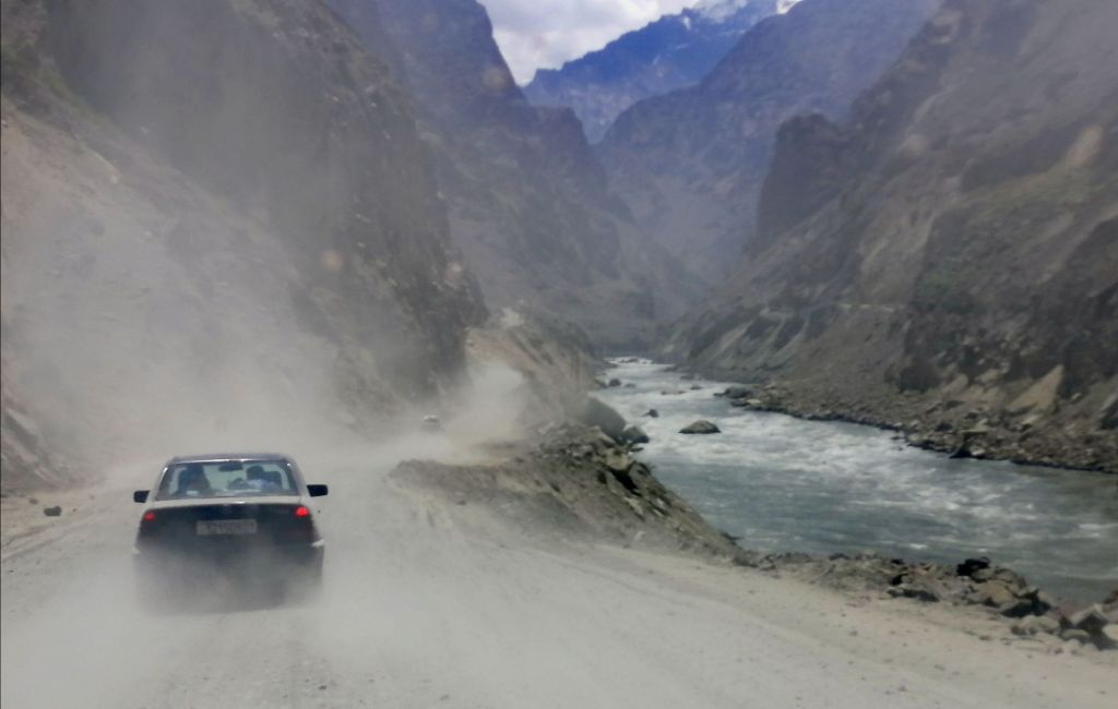
Early breakfast with condensed milk on bread and black tea! My kind of breakfast. Left at 0700 on a bright and sunny day. Immediately after leaving town, sealed road turned into a dusty gravel road under construction. Snowy peaks appeared after 30 mins. More construction – a tunnel under construction that lead away from the Panj. Across Panj, more stone houses along the rugged mountain slopes in Afghanistan. Women in bright dresses hauled up barrels filled with water. Just before Toghmay village, our journey was delayed for an hour as diggers continued to reshape this ancient road. Across the Panj, an Afghan village mostly made with stones. Donkeys brayed as few villagers walked along the slope cut road. Mountain slopes on Afghan side were covered in trees.
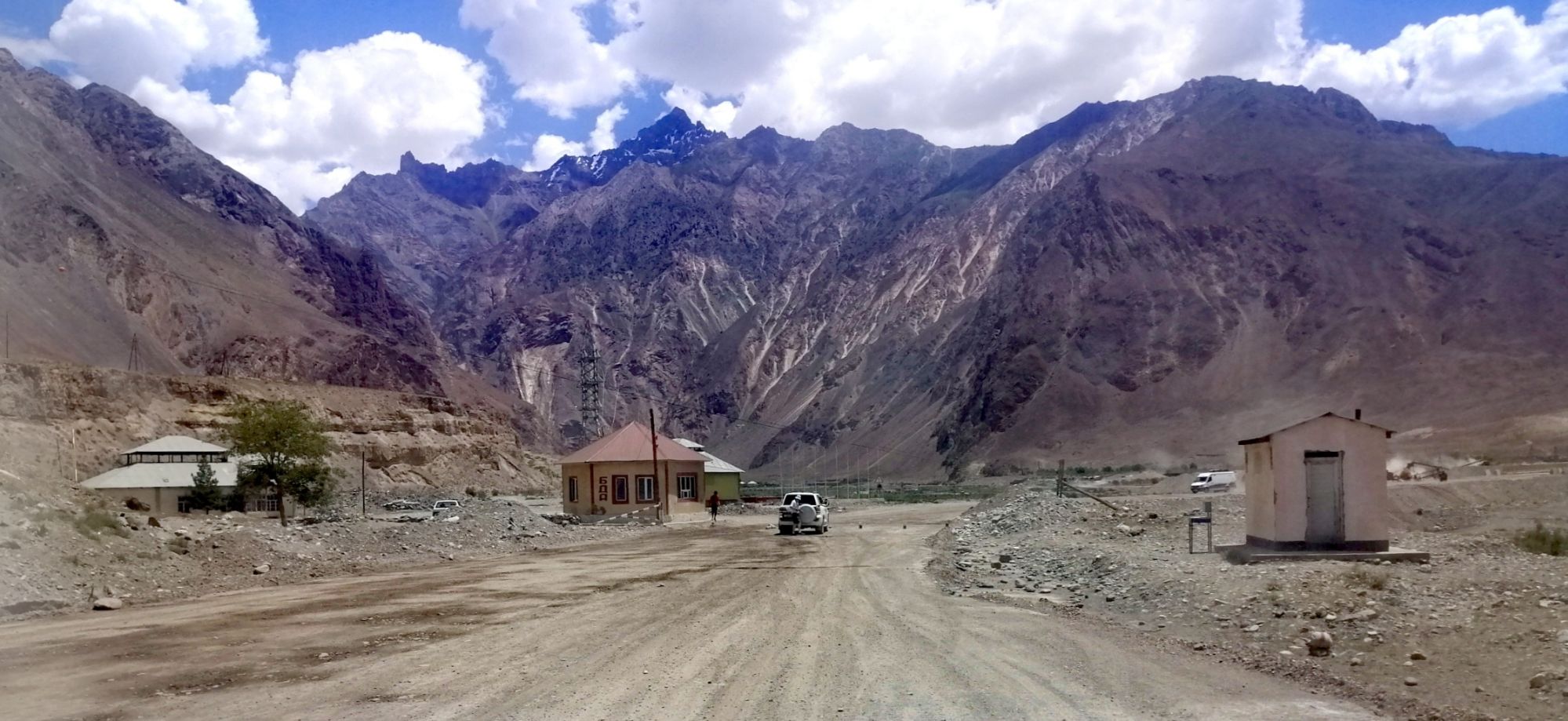
Unfortunately, at 0930, another road closure. With nothing to do, we sought shelter in our 4WD as the bright sun shinned down. Fortunately, Norbuk cut up a watermelon. We only managed to get away after two hours. Norbuk pointed out a patch of marble hills with cut block waiting for collection. At Bahvani Tag, valleys widened and the Panj became segmented and slow moving. A lone cyclist ploughed through the dust. A challenging journey indeed. At midday, passport and GBAO was checked at a police post at Vanj Valley road junction. Lunch stop at Kalot. I settled for fried eggs , potato chips and cucumber salad. Taking a south route, gravel road turns north east and Panj River resembled a lake. At Baroshon, road conditions improved. Unfortunately, it was only a tease. I’ve noticed a few decorated shelters that look like bus stops of a bygone Soviet days. Paused by the Panj near a shared van taxi and cheery passengers. People here smile easily.
Getting into Rushon, on paved roads lined by lush trees, we entered a modern town. Soon, we detoured into Bartang Valley. The rocky road sometimes hugged onto vertical cliffs as it weaved along a stream with views of snow peaked mountains. Eventually we passed the wider Bartang River through a spectacular gorge and idyllic villages. A couple of locals packed into 4WD headed towards upper Bartang Valley. That gravel road led all the way to Karakul Lake to rejoin M41. That would be an adventure in itself.
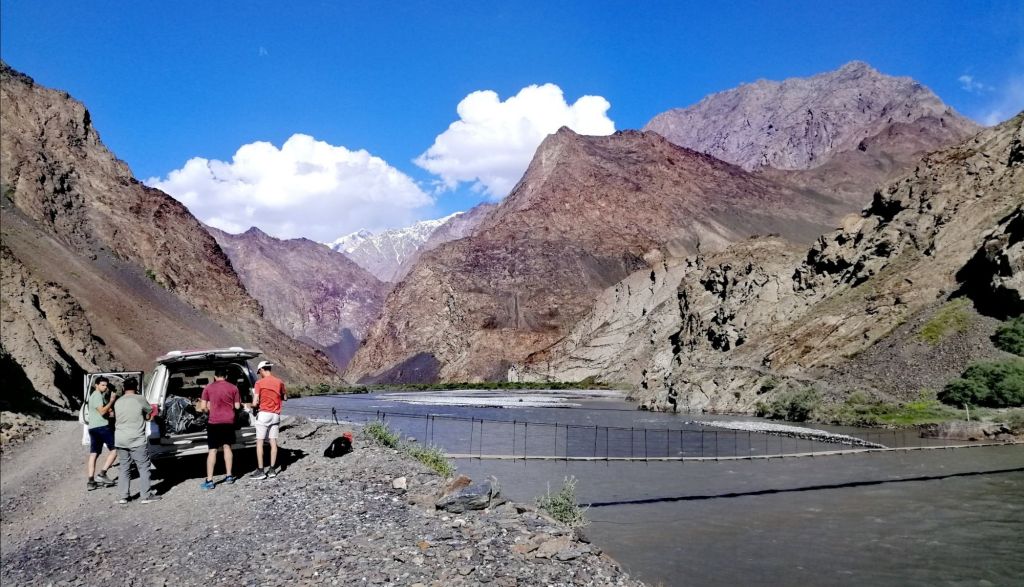
A short distance later, we reached a suspension bridge across a slow moving Bartang River at 1630. The sun was just above the mountains. The bridge, fastened onto the cliff face, was rickety but steady. I was excited just to walk. It was just an overnight hike. With just a day pack, we crossed the suspension bridge with views of barren vertical mountains and setting sun. The track immediately ascended over a narrow rocky path. Mostly over shale, followed a stream, which disappeared, amongst green shrubs and short trees, underground only to emerge later. We continued to hike upstream sandwiched between mountains. The setting sun was intense. It was refreshing as we crossed the now fast flowing stream.
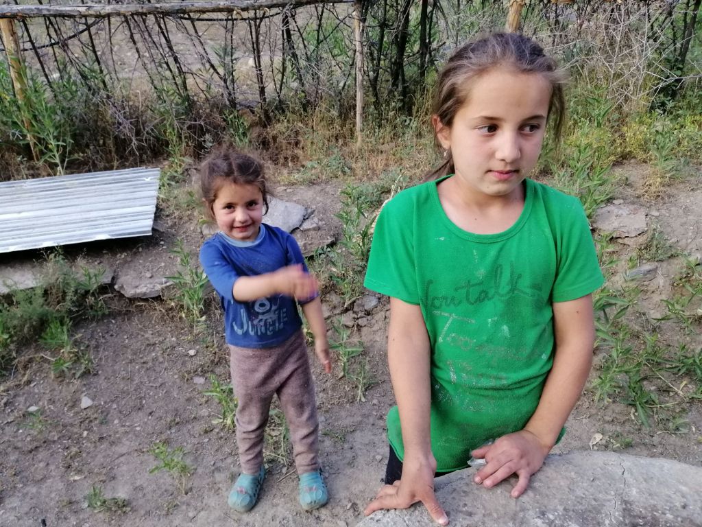
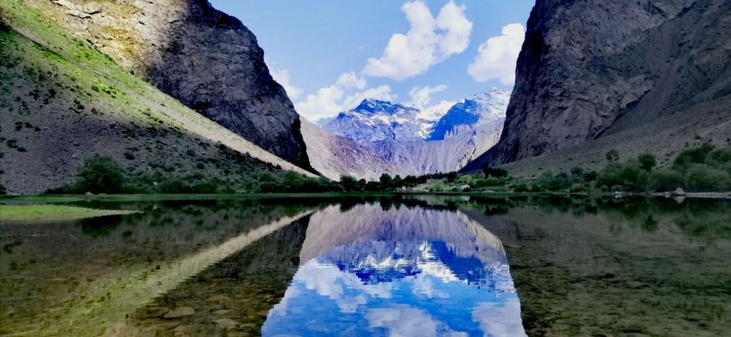
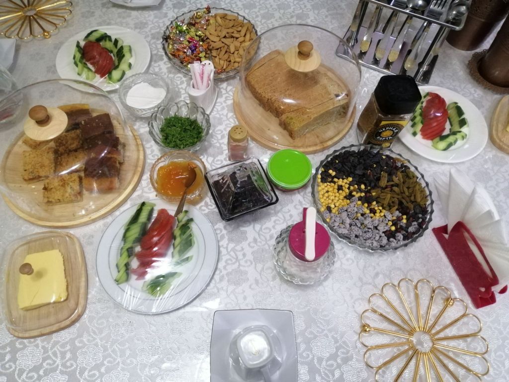
We approached a meadow and spotted a stone shed with thatched roof and cluster of mud brick structures. After 1.5 hrs of easy 5.5km trek, at 1800, we reached Gorhan Homestay (250TjS), the first homestead in Jizeu Village. We were greeted by Gorhan and his wife. Then, their two adorable daughters. Its a typical village – crop fields and animal husbandry but against a backdrop of icy peaks. We sat under almond trees and sipped hot green tea. On the table, an assortment of tasty treats. I explored upstream while the sun was still up. Reached a placid shimmering lake, the source of the stream we had tracked along. The peaks reflected on its surface. It was a tranquil place. A trail led beyond the lake to more homesteads and villages. Due to delays getting here, time was limited. Perhaps another day is required to visit these villages. For dinner, a special mixture of rice and vegetables.
Day 3 – Jizeu to Khorog (hike 1.5hr, 2hr, 66km)
After an early breakfast, walked around Jiveu Lake taking in the stunning reflection of snow peaked mountains. A couple of local ladies from the upper villages walked briskly towards Gorhan’s place. A pair of ducks foraged near the banks.
Left after 0900 to meet up with Norbuk at 1100. The return walk was much easier. A couple of women shepherded a few goats and cattle towards Jizeu. Always smiling and pleasant. We noticed Norbuk waiting across the bridge. With a last steep climb over smoothed rocks, we crossed Bartang River. Time was 1100. Made our way out of Bartang Gorge and valley. Day turned from sunny to cloudy. However, it was a pleasant drive. Back on the main road, we headed south. At the junction, another old Soviet bus stop. I noticed that each had a unique design decorated with stones and tiles. Once again, our journey continued along Panj River with Afghanistan on the opposite bank. We stopped at a police check post after Pashor village. This is quite regular along the Pamir Highway. The roads we’ve travelled so far were sealed.
As we approached Khorog (2200m), the landscape became urban. Green trees lined the roads as we passed an airport. We arrived at our homestay Tat Mizro Homestay (250TjS) at 1300, just before the city. We were greeted by our host and invited for some tea. On the table, a array of tasty snacks, homemade apricot and chocolate cakes. They were delicious. Rooms were tidy and had an outdoor platform under almond tree to lounge. Best accommodation so far.
Lunch in Khorog on Lenin Street near World Cuisine restaurant. Typical Tajik fare. Khorog is the capital of Gorno-Badakshan, a substantial town with supermarkets, banks, atm and café. From hereon, there is limited opportunity to get cash. Norbuk suggested to visit the Botanical Garden. The heat was intense, I gave it a miss. On Saturdays, there is a colourful Afghan market. The Gunt River runs through Khorog to meet the Panj.
“The Panj River formed by five tributaries – Vanj, Bartang, Pamir, Wakhjil and Gunt Rivers. It flows west joining Vakash River to become Amu Darya (the ancient Oxus)”
Further west, a border crossing into Afghanistan (currently closed). We re-stocked at a supermarket and returned to Tat Mizro for some tea and delicious cakes. I headed straight for the outdoor platform. A pair of tourist police interviewed me and the homeowner as to promote Khorog. Dinner was chicken soup with vegetable and salads. Plus, more apricot cakes!
Day 4 – Khorog to Langar (10hr, 240km)
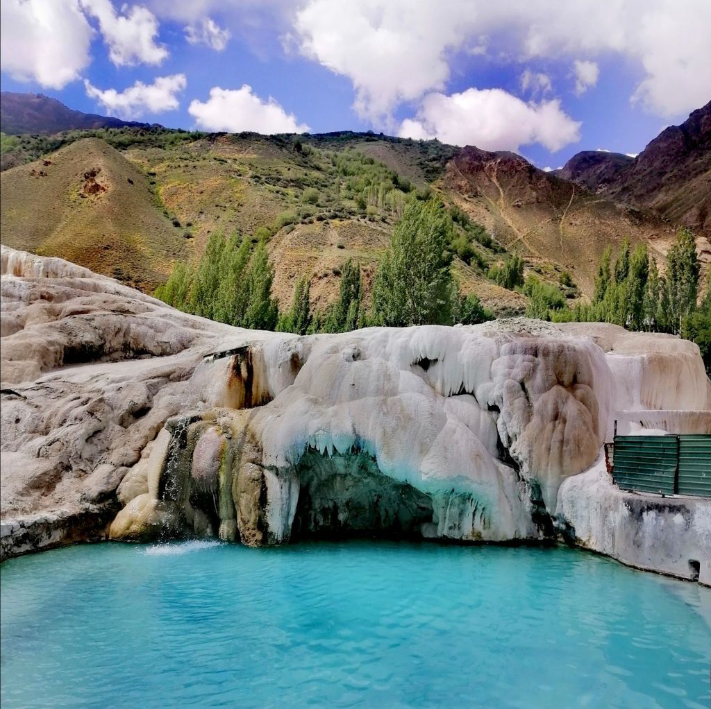
Breakfast was sumptuous. Left after 0800. Khorog is a substantial town surrounded by snow peaked mountains at the confluence of Gunt and Panj Rivers. The Pamir Highway M41 goes east towards Bulunkul and onward to Alichur/Murghab. We continued on the southern route along the Panj and Wahkan Valleys. Half hour later, a police check post. The road ascended and descended into a canyon. Across the Panj, in Afghanistan, a single gravel track on a treeless slope. After passing through another border checkpoint, we arrived at Andarob. We detoured east. Followed a narrow stream through a leafy road to a thermal spring (Ghram Chasma) in Bakor village. It looked set for tourist – several hotels across the stream catered for visitors. Both private and open pools are available. Looking at the large travertine mound, its old. We rejoined the southern route. I noticed for the last three days, a new power towers along the road. Apparently, Tajikistan supply power to Afghanistan and Pakistan.
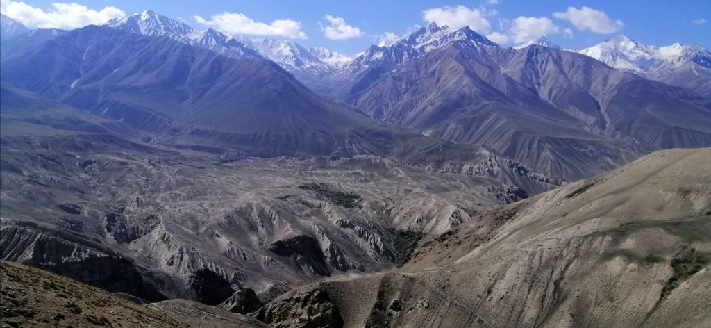
Just before Ishkoshim, my first views majestic Hindu Kush and Wakhan Valley. Between Yakshswol and Sumchin, the river valley widened with islands and wild shrubs. Green meadows with cows grazing. We passed the Ishkoshim border crossing into Afghanistan. It was closed. On Saturdays, there is a market within the borders in purpose built buildings on both sides. (Due to political indifference, this market/border may be closed). Arrived at by Ishkoshim around 12pm. Lunch stop. Left 1300 and headed east.
Just past Tokgakhona, the Hwy turns north, along the Wakhan Valleys. Across the Panj, a lone Afghan man walked with a donkey along a single gravel road. Another four men traversed the stony barren landscape. It seems quiet and hardly any people or vehicle movements. Pik Engels glistened in the late afternoon sun. Occasionally, Hindu Kush snowy peaks peeked behind this barren and monotonous brown hued mountains dotted with villages with stone houses. The fertile wide valleys enabled large scale crop cultivation – cereals and fruit trees. Interestingly, the road between villages are devoid of trees. These villages are like an oasis.
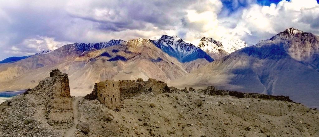
In Namangut village, we stopped at the 3rd-4th century Khaakha fortress. This fortress, from the Kushan era, is perched over a small hill. It overlooks the vast expanse of Wahkan Valley. This is an army outpost. An important outpost along the Silk Route.
“Kakhkaha led a fire-worshiping tribe called the Siah-Posh (black-robed). They ruled in the Wakhan. The tribe was defeated around the time of the region’s conversion to Islam. The descendants of the Siah-Posh now live in present-day Nuristan in Afghanistan.”
Did the Red Kafirs in Shahkenendeh village in Kalash Valley (Rhumbur, Pakistan), from here – fleeing Nuristan from forced conversion to Islam? Or from Soviet occupation? They practiced Hinduism with animism (later Islam with animism) but Islam today. Are Kalash people descendants of the “black-robed” Siah-Posh?
The Panj became a braided river. Sand dunes along the road near Zumudg village. We headed NE and then E. We continued higher through nerve-wracking winding gravel road. Finally, we reached the 2200 years old Yamchun Fortress (3100m). It is perched on a hill with expansive views over the Panj, Afghanistan’s Hindu Kush, and Wakhan Valley. It is on the crossroads of the northern Silk Route between east and west. Nearby is Bibi Fatima Hot Spring(40s). Said to increase fertility in women. Naked and few steps down, entered a turquoise thermal water in a grotto like cave. Soaking in hot mineral water to sound of gushing fall was quite blissful.
In Ymang, we stopped by a small field. A dozen kids played football. A white walled building stood behind – Wakhan Museum. There was a assortment of books, artifacts and musical instruments. Ahmad, a caretaker, eventually emerged. He’s a lively guy. Ahmad explained that this museum is dedicated to Sufi Muboraki Vakhani. He pulled out a book to authenticate his legacy. In the adjoining room, he explained the traditional Pamiri home. He pointed out the skylight with four (elements) beams. These beams descend down on five pillars (of Islam). He went on to play the Rubab (Pamiri lute). Before Islam there was Zoroastrian and Buddhism in these parts. This museum still has the old religions incorporated. Near the road, is an interesting stone solar calendar used by Vakhani.
We made another stop along the tree lined main road in Vrang. Local kids quickly shouted “Buddhist stupa”, pointing up towards a rocky mountain. I could make out the image. A short walk through a potato field brought us to the edge a mountain. A steep and sometimes slippery climb brought us to the tiered stupa. The kids tagged along. Nearby were several rock-cut structures, probably served as meditating cells for monks. A stone inscription described this place as the ancient capital of Wakhan – Kundul. The views of fertile lush green Wakhan Valley on Tajik side in contrast against a desolate arid Afghan was stunning.
We finally arrived at our homestay for two nights in Hisor. Mischa Homestay (450s) is about 2km from Langar (2800m). We got there at 1800. The sun set over the Wakhan Valley, confluence of Pamir and Wakhan Rivers and the formidable Hindu Kush was stunning. Life in the Pamirs is basic. People engage in livestock farming for milk and meat. They grow fruit trees. Wheat is cultivated in the fertile valleys of the Wakhan. So far, this stretch had the most check points and army presence. Perhaps keep an eye on the cross-border opium trade by the Taliban!
Today, the plan was to do a 17km day hike to Pik Engles from Langar (alternately, start from Zong). Norbuk dropped us off at the start of the trail head, about 2km, in Langar village(2850m) around 0730. A couple of local girls came over for a short chat. They are always curious and smiling. A few villages tended to the animals and fields. The air was chilly.
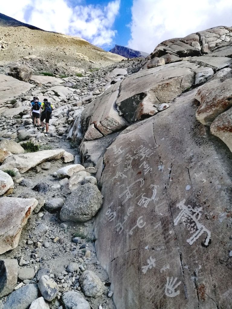
The hike to Pik Engles from Zong is gradual and helps acclimatise but adds 2km more. It meets the trail from Langar, which is steep from the beginning. I pulled out Maps.me to locate the route. The trail at 2850m immediately climbed over a rocky and sandy terrain. A small stream flowed down beside the trail. We gained elevation quickly. After an hours’ arduous uphill hike past numerous petroglyphs etched onto boulders, we reached 3380m. It was a gradual 35-degree incline. It was quite exhaustive. The expansive views of lush green Langar contrasted with a desolate and arid Afghanistan. The Wahkan and Pamir Rivers flowing west to become the Panj. Just after 0900, we had climbed to 3550m. This is the meeting point of the trail from Zong. A concrete water channel with fast flowing water descended downhill.
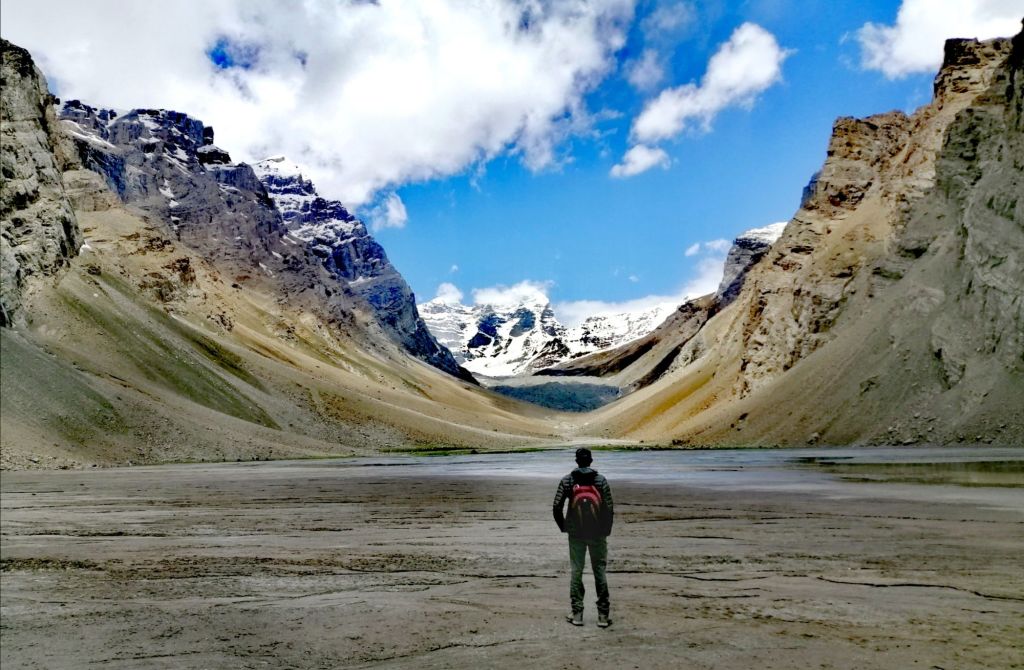
Glimpses of Pik Engles appeared on the horizon. On the right, a steep drop towards Kishtijarob River which carved the valley that led towards Pik Engels. A farmer moved with a few goats along the river. After 3.5 hrs, we reached the grassy Peak Meadows. The views of the winding stream, green meadow with cows and yaks grazing, and snowy Pik Engles was quite a sight. A few shepherds moved a large herd of sheep, few horses and cows along the lakes edge. The weather turned cloudy and temperature dropped. Carefully negotiated the swampy field, we reached the water edge, at 3930m, around 1130. I felt Pik Engles (6510m) was almost within arm’s reach. Karl Marx Peak (6726m) is somewhere on the left.
This is a great sight for camping. There are several tracks that start from here including Moscokvskoy Pravda (6075m), Churlenisa (5794m) and Danilaytisa (5837m). We had an hours’ lunch. The weather changed dramatically as more dark clouds descend on the surrounding mountains in the south. Pik Engles was clearly visible and sunny. At 1230, we quickly retraced our track. Local kids, adapted to the cold weather, stripped and swam in the frigid water. Icy wind picked up. Suddenly, it snowed heavily for half an hour. It faded as quickly as it arrived. The sun returned. Soon we turned left along the canal and descended over a loose rocky terrain towards Langar. This time, there was time to appreciate the numerous ancient petroglyphs etched onto rocks and boulders. They depicted mountain goats, archers, Bacterian camels and rubob (musical instrument). Some are unwanted newer additions.
Langar was on the crossroads for caravans plying the Silk Road. A meeting point for civilisation and cultures. The petroglyphs are ‘maps’ left by early settlers. Citing the numerous animal images, Langar was perhaps a rich hunting ground in the Pamirs. Towards the end of the track, at 1530, we passed a cemetery, just above the village. Women were busy in the fields as children played on the dusty roads. Yellow flowers on crops brightened the landscape. Langar seems like the most productive place so far. Local men gathered at the village center. Walked 2km on the dusty gravel highway with reprieve under shady trees to Hisor. Back as Misha, with a hot cup of coffee, I looked far into Wahkan Valley as dusk descended on Hindu Kush.
Day 6 – Langar to Murghab (8hr, hike 3 hr, 230km)
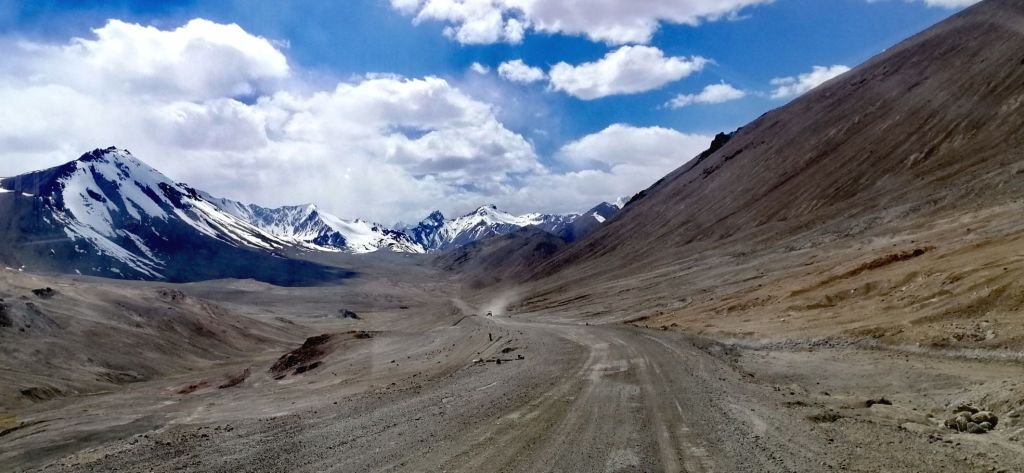
Back on the gravel road, we left Langar at 0730. Just outside the village, a bridge connected to Afghanistan was closed. Trade does occur on Saturdays. Further up, a huge army camp. The gravel road immediately climbed up, zig-zagged and headed North. The formidable Hindu Kush mountains in Afghanistan – barren and snow capped, increased in density. The road is just sand and gravel followed the contour of the mountain slope. At the bottom is Khargush Gorge, carved out by Pamir River flowing south. Suddenly, on the right, a delightful meadows of wild yellow flowers sprouted out of the rocky terrain. It was very localised. On the left of the road, not even a single flower! Within minutes, there was none. That was extraordinary.
Even with the strong sun, it was cold. Khargush Gorge is more than 50km long. We left the formidable Hindu Kush as we headed North. The craggy peaks of the Afghanistan mountains are in close proximity.
Bacterian camels rested along the Panj on the Afghan side. Golden marmots ran around and disappeared into holes. The drive for the last 2 hrs was quite spectacular. The land transformed into an arid desert-like landscape with wide valleys as the road steadily gained altitude. Patches of agricultural oases common along the Panj was sparse here. A shepherd’s dog gave us a chase. Soon, view of Pik Engels was visible in the south. Even in this seemingly desolate place, a shepherd with cattle, goats and donkeys walked along Pamir River in this cold and windy day. We gained elevation as we headed towards Khargush and went further away from the Pamir (headed east) and Afghanistan.
Arrived at Khargush check point (3880m) at around 1000. The small settlement (mainly army) was further lower in the valley. It is certainly high, cold and far away. Icy wind kept the border guard wrapped in warm jackets. Like all other check post, there were no issues. Norbuk gave him some cucumbers and melons to maintain rapport. Afghan and Tajik snowy peaks appeared across stony plains towards the horizon. More marmots appeared. We continued through Khargush Pass at 4344m and passed patches of ice and alpine lake below icy mountain.
At 1030 we stopped by the gravel road, between Khargush and Karadara Lakes, to hike up to Hausibek’s Viewpoint. In my mind, our next stop was Bulunkul Lake. I was unprepared. The first part of the track was a gradual climb on Panorama View trail. Maps.me came in very handy to navigate on this unmarked trail. It was an exhausting climb due to altitude and cold wind. A hare sprinted downhill upon seeing us. There was a couple of false summits. After 1.5 hrs of arduous hike, through icy wind, we reached the viewpoint (4750m).
The views were stunning – in the east, Wahkan Valley heading towards China. The westerly icy wind battered down. I did not have a windproof jacket. It was bitterly cold. The only refuge was a pile of stacked rocks. This is the highest point achieved on Pamir Highway. After some snacks and rest, we returned via a steep slope with loose rocks. It took only 3/4 hour to reach our transport. There was no wind here and the sun was intense, still cold. Norbuk prepared a sumptuous picnic lunch. Khargush means valley of hare. We saw more marmots than hares.
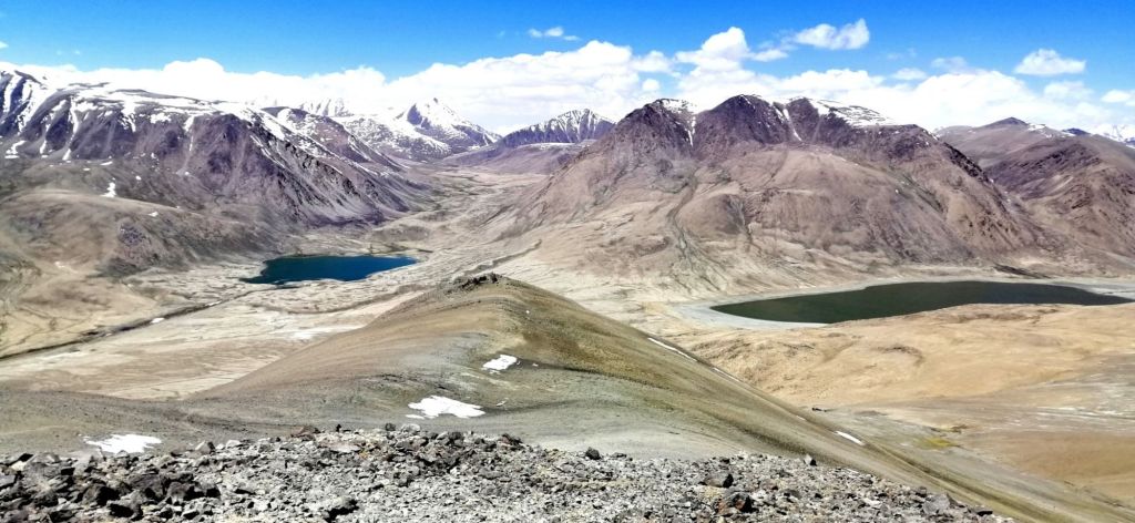
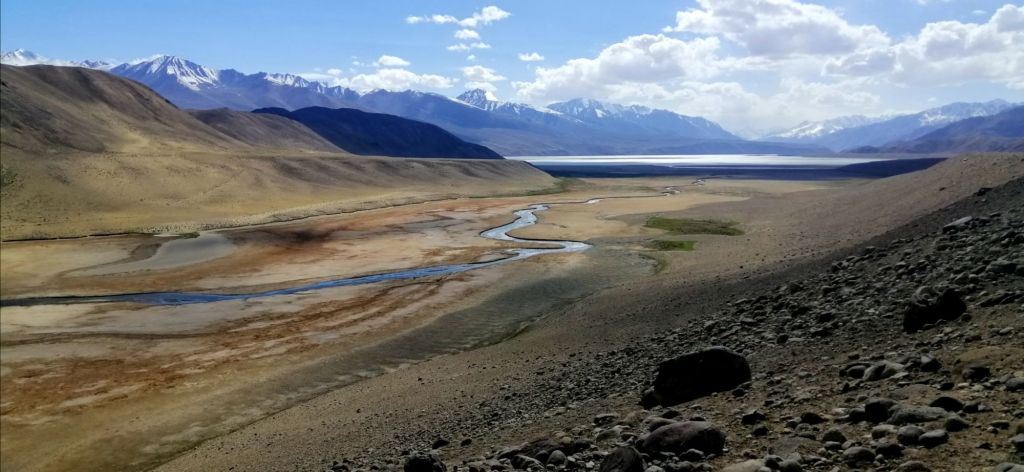
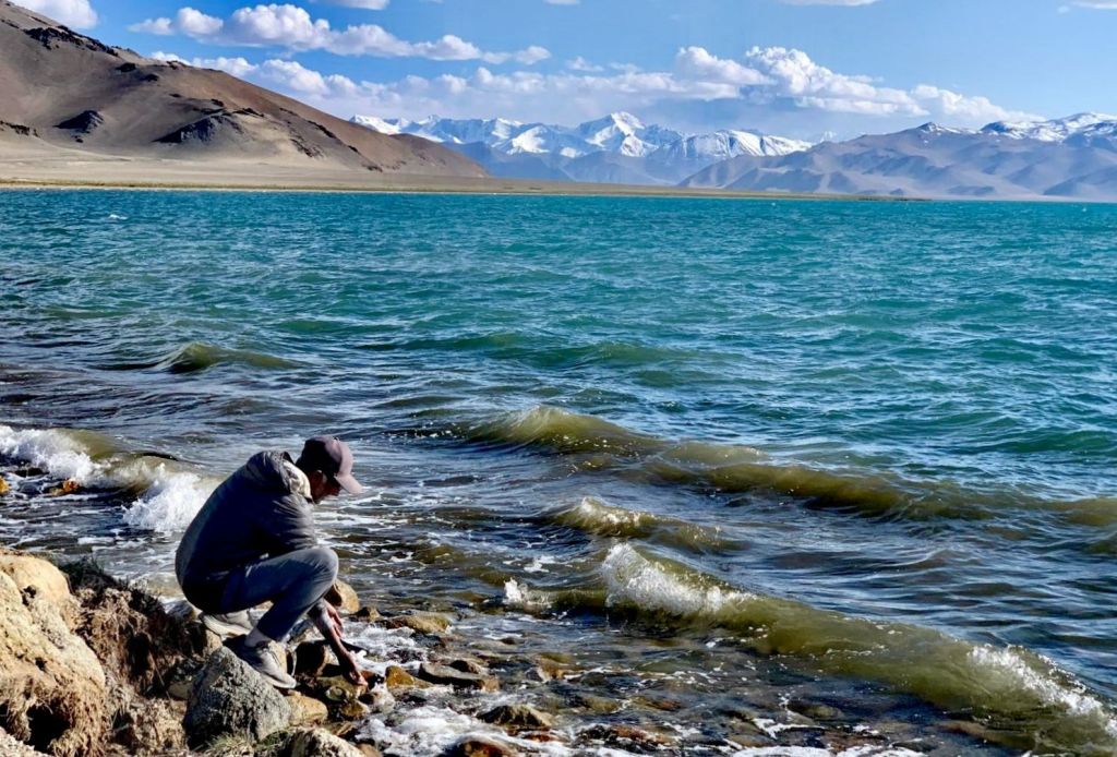
We paused at another saline lake – Chukurkul (3945m). This is a great camping site. We rejoined M41 – Pamir Highway and turned left towards Khorog. Only for short distances before driving onto a flat sandy path towards a cobalt blue Bulunkul (3775m). The sky was blue and the sun intense. A small winding stream connected Bulunkul to the larger Yashikul (3700m) further up. Norbuk informed us that lake area is now a national park with an entry fee of 180 TjS. However, he drove us to the park’s border (may have gone further) to view Yashikul. Both lakes were surrounded by snow capped mountains. We returned to M41 and continued our journey east passing three salt water lakes- Chururkul, Tuzkul and the larger greenish tinged Sasykul. It was almost 1630.
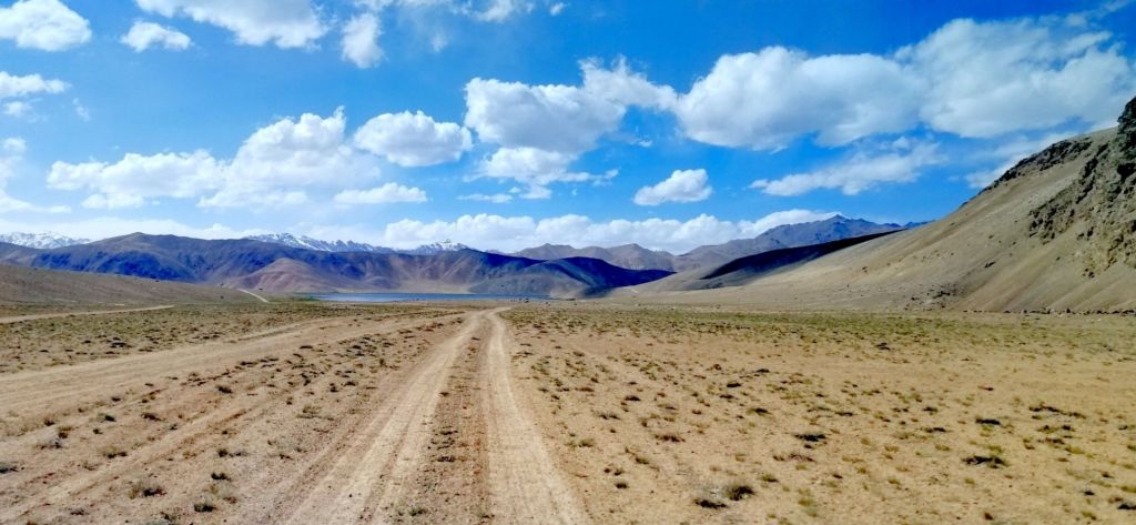
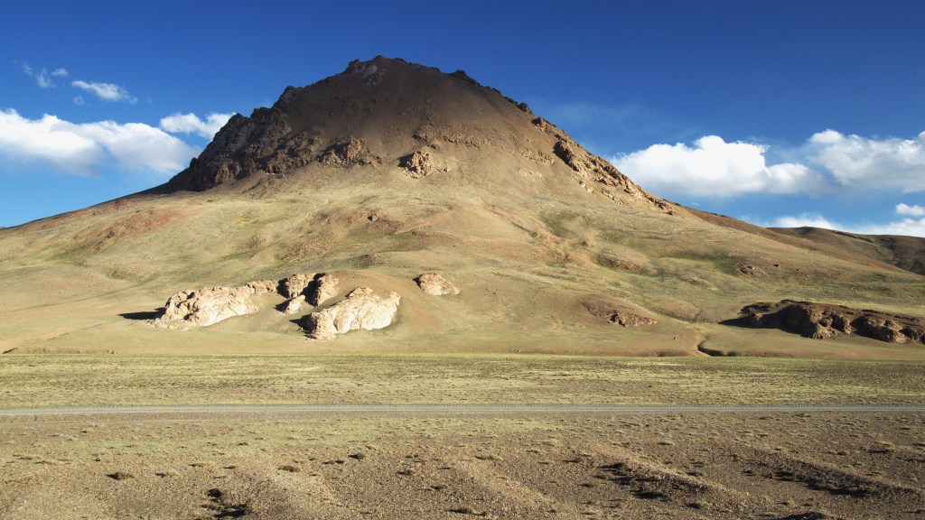
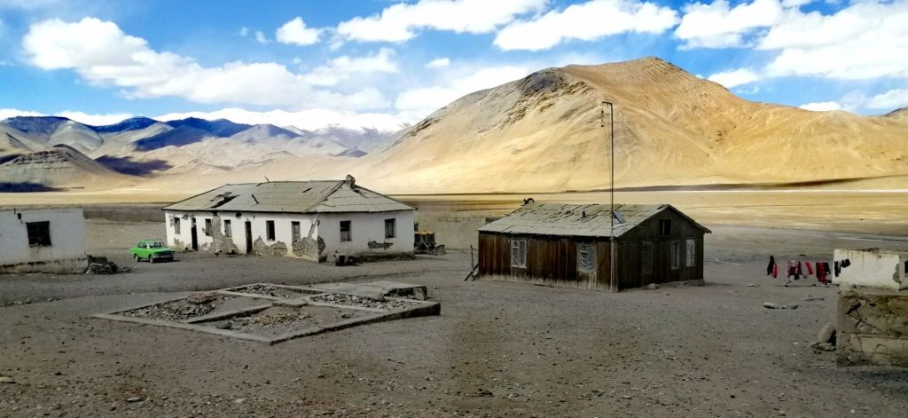
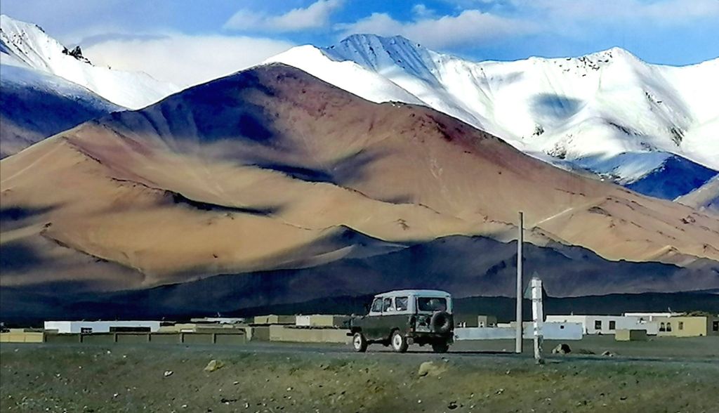
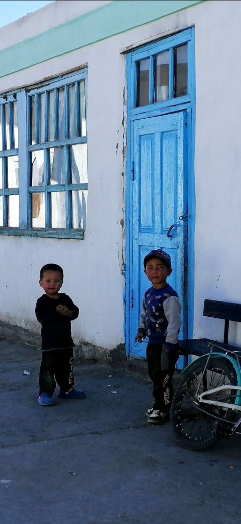
Although the highway is a sealed, there were many pot holes. We passed two lorries with breakdown. Self reliance is critical in these sparsely populated and low traffic Eastern Pamirs. We entered a desolate and wide Alichur Valley. A short drive past Alichur River that meandered through the village, at 1630, we arrived at Alichur (3990m). It is a neatly organised white washed village, sits on a wide flat valley. It has a school. Temperature -60°C in winter is common. Farming, hunting and a little tourism are the main source of income.
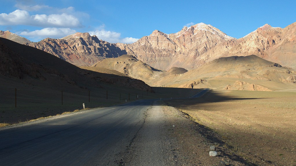
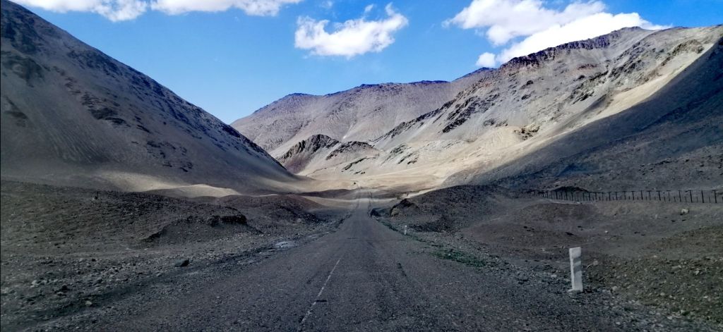
Our original plan was to stay a night here. However, we continued towards Murgab. Soviet built vans and trucks are still in use here. Just out of the village is a small lake with trout in Jun /July. A shepherd ushered goats and sheep on this parched almost grass-less land. Once out of the long wide valley, the road quality improved. The scenery became a lunar landscape. The craggy and rounded mountains took on shades of brown, green and red. Shadows and changing hues on the mountains cast by the setting sun were spectacular.
Marmots basked in the sun while a fox foraged at the edge of a bush. While driving, Norbuk, spotted 6 rare Marco Polo (sheep) grazing on the mountains slopes. Later, I spotted another family of Marco Polos, around 8. I was excited and quite happy with our sighting. Norbuk quipped, not all tourists are lucky to see Marco Polo. We continued through a narrow valley with reddish mountain – Mamadiar Valley. It was past 1800. The play of light on the multi-hued rocky mountains were quite dramatic.
At Murgab (3618m), another police check post. To keep a good rapport, Norbuk gave somecucumbersto the guards. Another substantial village with satellite dishes on roof tops. We passed Lenin’s statue and a few Soviet styled buildings. It was 1930 when we arrived at our accommodation (East Pamir Eco Tour Guesthouse 220TjS). Very comfortable indeed. Many families are of Krygis origin and interestingly, they follow Osh (Krygis) time. Tomorrow is Id Adha. As we arrived, dinner was served. The meal included borsook (small fried puffy pillow), veg soup, Non (flat bread), rice with veg, and fried brinjal. A father and son also arrived today but from Karakul. Both suffered a degree of altitude sickness (started from Osh). Thus, a major disincentive to start high (Ak Baital Pass and Karakul Lake) from Osh. Relaxed after a long day.
Day 7- Murgab to Karakul (3.5hr, 165km)
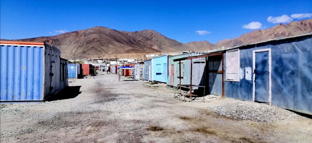
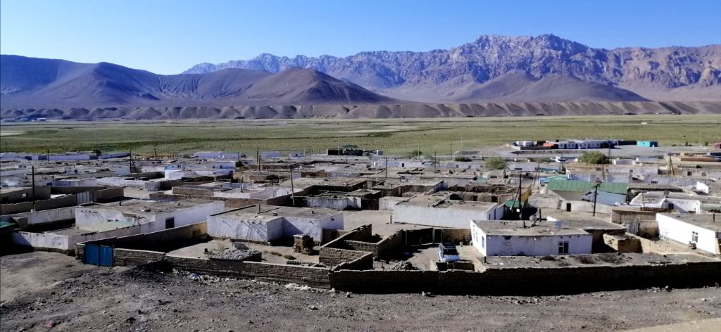
Early in the morning, the local men congregated at the mosque to celebrate Id Adha. This morning, there was no rush as we planned to leave for Karakul, just 3hrs drive, at noon. The family was busy preparing food and delicacies for today’s celebration. Food was laid on the floor in one of the rooms. At breakfast, I tried the traditional shirchoy – milk tea with salt (sometimes butter is added). It tasted like yak butter tea. After breakfast, we wandered around this white-washed village. Today, being Id Adha, the bazaar was closed. It is an interesting collection of containers. All locked. There is almost no greenery here. In fact, hardly any since Alichur.
The dry air, almost artic, picked up and was chilly. However, the morning sun was intense. Kids walked with plastic bags from house to house collecting snacks and sweets. A tradition here during Id. We found one magazine (shop) open. Bought some fruits and snacks from a lovely Krygis lady. Nearby, a health clinic and ground water pump. Across the main street, a petrol kiosk. There is also hamam. Popped in and coal burnt in the boiler room. Smoke bellowed from the sooth filed chimney. There was no one to be seen. Perhaps at the mosque. A school provided basic education. For higher education, children need to move to Dushanbe.
Murgab is a high altitude, windswept, arid and desolate place with little to do. It was called Pamirskiy Post – a Soviet outpost set up during the “Great Game” between the Russian and British Empires. With the demise on the Union, locals returned and continued their lifestyle, albeit a harsh environment. It’s the Pamiri way!
The locals tended to livestock and provided food and accommodation to passing tourists and truckers. Its proximity to China and Kyrgyzstan is idle as a truck stop. South-East of Murgab is Qolma Pass that connected Pamir Highway to Karakoram Highway at Tashkurgan. However today, there were no trucks passing at all. Murgab is also a good place to explore the surrounding valleys – Pshart Valley and Madiyan Valley. Perhaps Rangkul and excursions to view (hopefully) the rare Marco Polo sheep. At midday, we headed to Pamir Hotel for lunch. Like all meals on the Pamir, it was challenging but manageable.
At 1300, we left Murghab on the M41. We entered Ak Baital Valley. The Pamir is a harsh place to live particularly in places like Alichur and Murghab. Drivers have to be skilled and resourceful. Breakdowns are common particularly lorries hauling heavy loads on depleted roads. An off road lead towards to Rangkul (3784m). The road is straight and sealed with fewer potholes.
As we traveled, a fence appeared along the mountains. This is the border, a no man’s land of 10km, between Tajikistan and China. Both Tajik and Chinese patrol this endless and deteriorated fence. There were no guards spotted at all. In places, the Chinese fence runs just meters from Pamir Hwy. At times, they disappeared and then reappeared. Abandoned stone structures built by Tsar Nikolai 2 along the border is vivid reminder of the past Soviet presence. We finally reached Ak Baital Pass (4655m) just past 1400. In this cold, windy and desolate place, it is the highest point on the Pamir Highway. Its a long gravel road with vast expanse. We passed a couple of tourist sorting out their 4WD and another two on motorbikes, heading towards Karakul.
Another of Nicolai’s abandoned buildings with a picturesque view by the river and China border. Occasionally, patches of frozen ice laid in flat areas. In the middle of nowhere, a small settlement, rather a collection of delipidated buildings with a luminous green Lada. Were they herders? The almost straight sealed road headed towards the horizon. With thick clouds above, a thin blue line – the high altitude Karakol Lake. We detoured left to view the western edges of the turquoise lake before approaching the township.
The valley is surrounded by by soaring snow capped peaks including Peak Lenin on the Trans- Alay mountains. There were no roads. Instead over a sandy flat grassland. Yaks roamed freely foraging on the meager grass. We checked into Alichur Guest House (220TjS) at 1630. This is the last settlement before reaching Kyrgyzstan. Like Murghab, all the residents here are Krygis. The languages of Krygis, Uzbek, Azerbaijan, Kazakhs are Turkish origin and Tajik is Farsi origin. No one at the check post and modern buildings occupied the right side of the road – army camp. The China border fence is just meters from the road which goes round the camp.
Karakol Lake, a salt water lake at 3895m, is one of the highest lakes in the world. The village has about 700 people. Living conditions are hard – the icy wind, the intense heat and the remoteness. All fruits and vegetables are brought in as the weather is unsuitable for cropping. Cattle, yak and sheep are reared for milk and meat.
Karakul is the second coldest place in the Pamirs (- 40°C) after Alichur (- 60°C in winter). Like Alichur and Murghab, white-washed houses are built low to retain heat. Roof tops are flat. We had heaters in the room (effectively heat from the kitchen used for cooking). The Chinese fence is visible along the mountain, away from the lake. A few residents milled about the village. Some traveling away in Soviet made trucks. All well dressed for Id celebrations. At the windy water’s edge, a band of salt, yak grazing and abandoned water tanks. Its freezing cold and its not winter yet.
Back in our cozy and heated guesthouse, a teacher (from Murghab) and doctor hooked a laptop powered by a generator. For dinner- hot vegetable soup, manti (local dumpling), fresh salads and bread. Norbuk enjoyed the heat in the kitchen.
Day 8 – Karakul to Tulparkul (6.5hr, 185km)
Unlike yesterday, it wasn’t cold or windy this morning at Karakul Village. It was quiet. We left after a lovely breakfast at 0745. The sealed road, often straight, goes through the wide valley towards the horizon. The Chinese fence ran parallel to road. Apparently, it stretched for 200 km. The weather was gloomy. Reached Tajik border at Kyzyl Art Pass (4280m) at 1000. It was quite spectacular. A statue of a Marco Polo at the gates. Border army guys kept shuffling their hands in pockets to keep warm. One replied, its not too bad today. It felt like below zero. Norbuk passed a cigarette to the soldiers and walked into ramshackle of buildings including re-purposed containers. Inside, we handed our passports and the GBAO permits. Stamped. Within 30 minutes, back to our vehicle and escorted by a soldier not far into no man’s land. We are required to exchange vehicles and drivers. Three other vehicles were also waiting for their customers.
We bid Norbuk farewell as he passed a bag to the Krygis driver. Norbuk’s home in Osh is so close, yet he can’t cross. Tajik and Krygis are prohibited from crossing this border due to a political dispute. Foreigners are permitted, since July 2023, with pre-approval. We hoped ours were sorted by Visit Alay. Krygis times is 1030. Road conditions deteriorated to a muddy clay track but the views were spectacular with low clouds and filtered light. Our new driver Gerkin skillfully negotiated the descending steep and slippery track. The surrounding mountains were clothed in mist. Next to the road, a wide river. It was still gloomy. By 1110, we reached Bor Dobo (3400m), Kyrgyzstan border. One by one, the border guard manually went through a register to check our names. I was last. Yeah, approved and finally cleared immigration at 1130. Both Tajikistan exit and entry into Kyrgyzstan was straight forward and cordial.
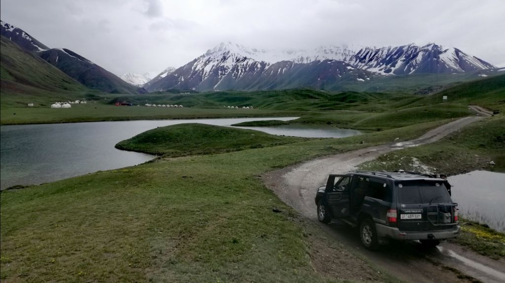
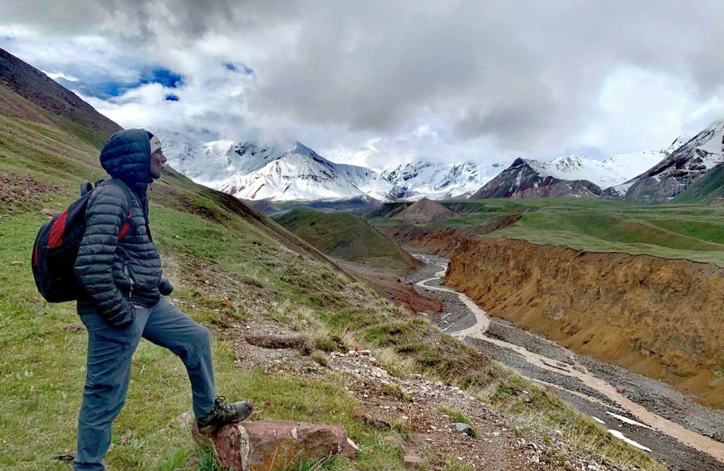
We left the Pamirs and now descended into Alai Valley (Alaika) – an extension of the Tien Shan Mountains. Wide grassy plain dotted with yurts, horses, cattle and herds of sheep. The Pamir Mountains headed westward. Lenin Peak (7134m) amongst them. On the northern horizon – Alay Mountains. On the north East – to Irkestam border – China. My initial entry into Kyrgyzstan from Kashgar, China. The sun peaked through dark clouds onto the grassland. There was even two observatory. Plenty of horses roamed the grassland.
After lunch 1300 at Sary Tash (3170m) , headed SW towards Sary Mogul (3700m). The Pamirs were almost invisible. Finally, the heavens opened up and rained heavily. More storm clouds accumulated in the west. At Sary Mogul, we went off the main road towards Tulparkul. Deeper into the Alay Mountains and crossed a vast grassland. After rain, patches of ice on the grass as we neared conical mountains. Shepherds have set up yurt camps. The wettish road wound uphill over muddy paths.
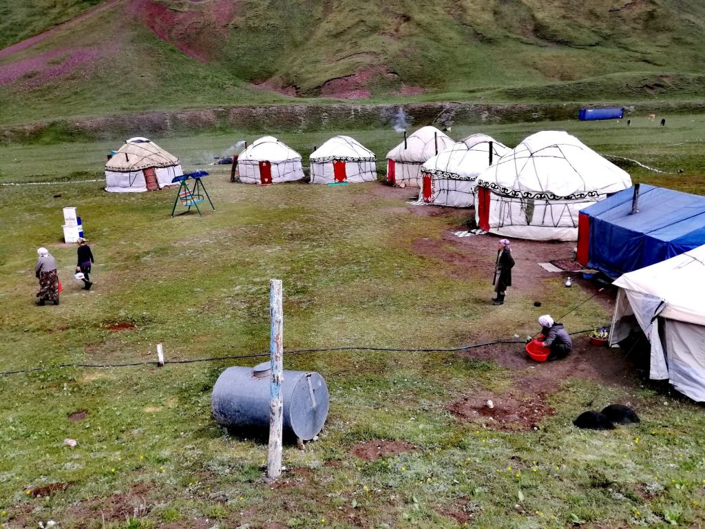
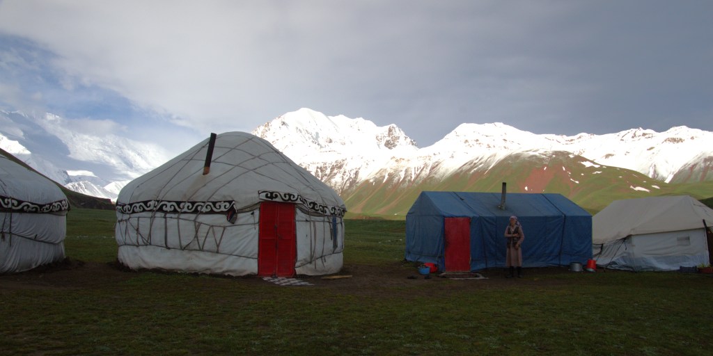
Several lakes – Tulparkul(3500m) with yurt camps scattered around. These catered for locals and tourist. Lenin Peak (7134m), partially obscured by clouds, rose in the background. Gherkin continued past and finally we reached our campsite, the last one, at 1430. My first experience staying in a traditional Krygis yurt. This is a wild place. We were welcomed by a Aiesha. Her face was weathered, from the harsh environment but always had a smile. Rain was eminent but held for now. We had 4 beds. It was cozy. The fire was already going as more coal was added. I visited the loo, pleasantly surprised that it had sitting toilet. A luxury considering its location. Having experienced squat toilets in Pakistan for a month was enough for my ‘inflexible knees’.
I got out my thermal top and layers before venturing out. The day was gloomy and dark at 1500. It was cold with slight wind. A kid on horseback and another on a bicycle herded some cattle back to its stall, somewhere. It started to drizzle. We headed back to our yurt. Sure enough, it rained. The is no power and let alone Wi-Fi. The is no phone reception either. Just chill and listen to the rain. Aiesha diligently checked the fireplace. The were no views of the mountains. Kids played football in the rain. A hardy lot indeed. A need to survive in high places like this. Outside, vapor emerged with every breath. With nowhere to go, we rested on the bed and waited for dinner at 1900. Only 3 hrs to go!
Occasionally, the Aiesha would come to top up coal pieces. Just before dinner time, we played football with the local kids for a while. As I entered the dinner yurt, I was taken aback by the glittering gold plated table ware. It was as if, a banquet for royalty. We sat in soft cushions on the ground. Another three tourists joined us. These yurt camps only operate in summer (roughly from June to September) about 4 mts when snow has melted. The yurts also served as high camps for herders. A good supplementary income for these hard working people here.
Day 9 – Tulparkul to Osh (5hr,hike 3.5hr, 240km)
My bed was slightly titled and felt like falling off. Sleep was light but not cold. Surprised that the yurt kept warm. It rained twice early morning. We decided to have an early breakfast 0630. The summit of Lenin Peak shined like a beacon. There are two hiking options – Trek to Travelers Pass (4130m) or Lenin Peak viewpoint (3800m). The morning sun was hopeful with blue skies in the east. Dark clouds hung low over the peaks in the west and rain was eminent. Secondly, the was heavy snow on the path towards Travelers Pass. The return is about 6 hours. Due to expected poor weather, poor views and accessibility, Travelers Pass was not probable. Lenin Peak viewpoint it was.
The track is on the left of the stream. It is well worn but in places, due to recent rain, it is slippery and muddy. Also, steep in some places. Across the gorge, at the Lenin Peak Base camp, there was little activity. The low clouds began to decent onto the mountains. We were not sure if Lenin Peak would be visible. As we came round the mountain, the majestic snow capped Lenin Peak. After an hour, we reached the view point. By then, clouds had descended. The weather was more menacing than earlier. Travelers Pass looked completely snowed in. We retraced our track back to our yurt camp. Although slippery in places, otherwise a moderate hike of 3.5hrs. Gherkin and Aiesha relaxed on a swing, awaiting our return.
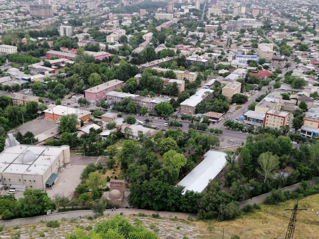
It started to drizzle heavily as we packed our stuff. As we drove off Tulparkul, it rained. It was the right decision to hike the viewpoint track. It rained all the way to Sary Tash with no views of the Pamirs or Tien Shan mountains. We stopped for lunch at the same place on the way to Tulparkul. This is my second time on winding Taldyk Pass (3615m). On both occasions, it rained with obscured views. At several points on the road to Osh, traffic was halted by herds of sheep, goats and horses driven by shepherds. It was quite a sight. We reached Osh in the late afternoon.
What a journey this has been. Perhaps, one of the last wild adventures on earth. To think that my journey began “just” on the other side of the Hindu Kush at Khyber Pass. Then, through the Karakoram Highway following the Ancient Silk Route through Khunjerab Pass into China. Then crossing over the Tien Shan Mountains into Kyrgyzstan, Uzbekistan and Tajikistan into the Pamirs. It has been a privilege indeed.
I arrived a day earlier in Dushanbe to sort out my GBAO Permit (Gorno-Badakhshān Autonomous Oblast). I had already lodged my application in March to the Tajik embassy in Kuala Lumpur (Visa on Arrival). I just had to present my passport at the OVIR office. Well, that was the plan! It was Saturday at 0830. Within 25 minutes, received the GBAO Permit (a paper) for 100 Somoni (US$10). As planned!
Visa and GBAO
Visa is required for those countries without visa free regimes. For Tajikistan – evisa.tj and for Kyrgyzstan – evisa.e-gov.kg
Three ways to obtain GBAO (for Tajikistan only) –
Department of Visas and Registration of the Ministry of Internal Affairs (OVIR) in Dushanbe. Office is open from 0800 – 1700 (Mon-Fri) and Saturdays from 0830 – 1200. Cost of GBAO paid was 100 Tajik Somoni (US10).
GBAO can be applied together with your visa application ( from countries that don’t have visa free regime).
Through your local Tajikistan Embassy or local agents in either countries.
When to travel
Pamir Highway is open all year round. However, between September and May, many places are covered in snow (especially high passes) and very cold. Alichur and Karakul, the coldest regions, had recorded -40°C and -60°C. The best time to travel is from June to September especially for those interested in hiking.
Which direction?
The Pamir Highway, used for millennia by many civilizations, essentially for trade (Silk Route) and later for political control begins and ends from Mazar i Sharif, Afghanistan and Osh, Kyrgyzstan. In Tajikistan, the Soviet named M41.
The M41 aka Pamir Highway (1200km) begins or ends between Osh and Dushanbe. The extended southern “tourist” route between Khorog and Bulunkul (300km), skirt along Afghanistan border is an exciting alternative route.
My preferred direction is from Dushanbe to Osh – easy to organise your GBAO personally in Dushanbe, elevation gain is gradual (if you have not been in high altitudes before beginning your journey – I met two people in Murghab whom had just landed in Osh, Kyrgyzstan and travelled immediately to Kyzyl- Art Pass into Tajikistan and Karakul with altitude sickness!
This should give you an idea of altitudes and acclimatation –
It depends on your time and interests. The direct route journey can be completed in 3 – 5 days. Taking the extended route, between 5 – 7 days. If you’re intending to add some side trips like hiking and exploring valleys outside the main roads, between 9 -12 days and more. I spent 9 days with several hikes. Furthermore, it depends on mode of travel. If you’re hitchhiking, be flexible with your days as transport in some areas are sparse.
Altitude Sickness
In these high mountains, anything beyond 2500m, altitude sickness is real. Travelling from Osh, you immediately reach 4300m at Kyzyl Art Pass. You then reach 4600m at Ak Baital Pass. This pass is the highest point on the Pamir Highway. Finally, you arrive at Murghab (3500m). Best precautions are drinking plenty of water couple of days before and during travel. Also, carry Diamox tablets (know how to use them).
Border crossing and police check post
Border crossing between Tajikistan (Kyzyl Art) and Kyrgyzstan (Bor Dobo) require a border permit. There is a dispute between the two countries. As a result, only foreigners are allowed to cross at Kyzyl Art Pass border. Few locals are also permitted. Permissions can be obtained through agents or e-mail to Info@tourism.gov.kg
There a several police post along the highway. Take 10 copies of passport and GBAO before departure. I noticed Norbuk gave ‘gifts’ to border guards to keep a good rapport. Thus included watermelons, cucumber and cash. None of us were asked!
Accommodation and food
Generally, accommodations are guest houses and meals (dinner and breakfast) are included. Average cost $25-$30. Usually, lunch is along the way in village eateries and typically cost $3 – $5. Meat dishes are readily available with rice or noodles . Vegetarians – little options but manageable. Fortunately, no one in my group fell seriously ill. In smaller villages, look for ‘magazine’ – village store.
Traditional food include Plov(rice dish), Laghman (noodles), Damlama (boiled vegetables – dry/soup), Shirchoi (milk tea – most times salt is added and eaten with bread), Sambusa (samosa), Shurbo (vegetable soup) and Manti (dumpling). They are sometimes vegetarian versions. Then, the ever present Non (bread) – at almost all meals. The popular Kebab/Shaslik was not common in guesthouses.
If you’re planning for hikes, it’s best to stock up in Dushanbe, Osh, or Khorog. Bring dried fruits, nuts, cereal bars, etc. Water is available everywhere. Accommodations can provide boiled eggs, bread and basic staples (best to be self reliant).
These are the accommodation I was in :-
Dushanbe – Green House Hostel (noisy and crowded. Staff are great)
Qala i Khumb – Jurev Roma Guesthouse (200TjS)
Jizeu village – Gorhan Guesthouse (250TjS)
Khorog – Tat Mizro Homestay (250TjS)
Hisor/Langar – Mischa Homestay ( 225TjS)
Murghab – East Pamir Eco Tour Guesthouse (220TjS)
Karakul – Alichur Guest House (220TjS)
Tulparkul – Aysha Yurt Camp (1800KyS)
Osh – Park Hostel, would suggest TES Hotel
Transportation
Public transport – mainly by share taxis. They can be sparse and only travel when full. Reliability is an issue unless you have more time. Cost is cheap but you’re just traveling from A to B. There are no opportunity to stop unless the driver stops. Only the M41 standard route is possible. The southern “tourist” route is possible but scarce. Every local traveling is a potential transport. On my journey, I had seen shared vans/taxis only a few times.
Hitchhiking – this may be the cheapest way to travel. However, availability of transport is limited. Cheapest, although some kind of token payment is offered to the driver. Negative is, you need plenty of time and hope. On my journey, no hitch hikers seen. Having paid for a hired car and driver, would I give a ride to someone for free? For local’s, transport I had seen are beaten up cars/vans (but a happy bunch) are usually full.
Organised tours – this may be the practical option for many independent travelers with limited time. Transport and driver is included from start to finish. Furthermore, options are available on the activities included as well as sharing the cost with others (arranged by the company). I chose this option. We formed a group through Caravanistan ride sharing forum and organised transport (tour – 9 days) through Visit Alay. Cost $55 per day (accommodations and food are excluded). Overall total cost was $80 – $100 per day. We had plenty of stops, exploring several sites and hikes.
Own vehicle – Self-drive with your own or a hired vehicle. This option provides flexibility. It enables you to take unconventional routes. However, the challenges are to be self-reliant (mechanically inclined), organised with refueling and supplies. Motorbikes and bicycles – I have seen several motorbikes and bicycles on the highway. Bicycles must be the toughest mode to handle. They have to negotiate poor road conditions, dusty trails, and uphill climbs. Bicyclists also face the harsh weather head-on. Furthermore, supplies carried on bikes are limited and distances between villages are far. For the committed, my hats off to you guys.
Currency/Budget
Carry cash – I carried local currency and few US dollars (for emergencies). Credit cards were not accepted in all the accommodations and eateries I visited. Outside Dushanbe and Osh, there are Atm’s in Khorog. A supermarket did accept visa.
My actual cost (one person) –
Organised transport – 4WD with driver(divided by four persons) = $490 for 9 days.
Accommodation (including dinner and breakfast) = $160.
Lunch = $35.
Supplies including snacks, water and miscellaneous = $35.
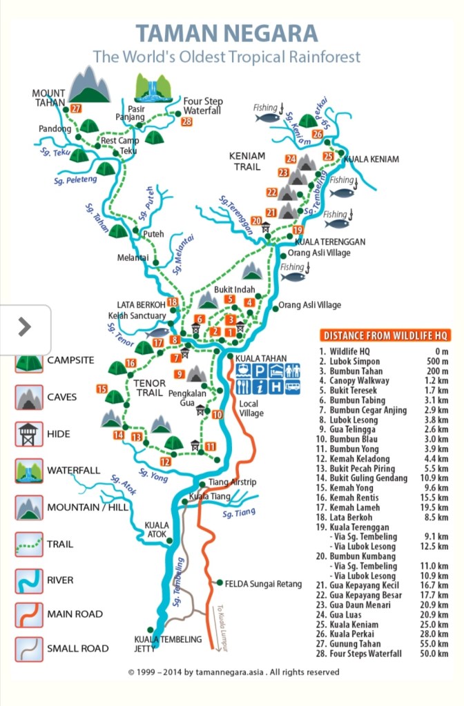
Taman Negara, in Gunung Tahan Range between the great Titiwangsa and Eastern Ranges, established around 1939 covered over 4300sq km encompasses three states – Kelantan, Pahang and Terengganu. Its tropical rain forest jungle is estimated to be over 130 million years old. Everything about this park spells nature – flora, fauna and culture. One of the most biodiverse on the planet. Plus a variety of adventure and exploration. The highest mountain is Gunung Tahan. Native tribes (orang asli) live within the park. Kuala Tahan is the entry point into Taman Negara. The park boast a spectrum of native animals, both rare and endemic, including Elephants, Tigers, Gaur, Tapir, Seladang, Serow, Barking Deer and many more. Besides elephants and deer, nearly all are rarely seen. There are over 360 species of birds. The most noticeable are the stately hornbills. Then, there are a diverse flora evolving over 130 millions with no disturbances.
Getting there
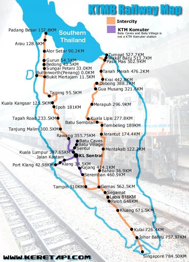
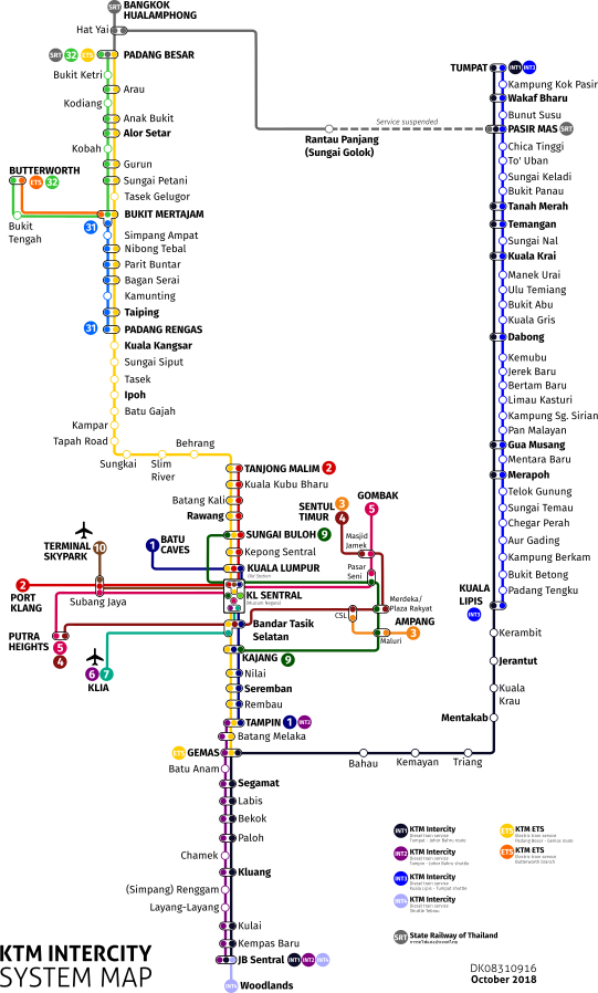
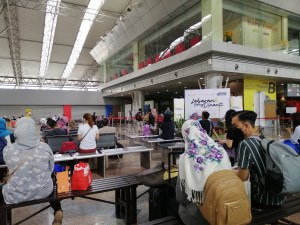
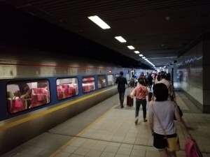
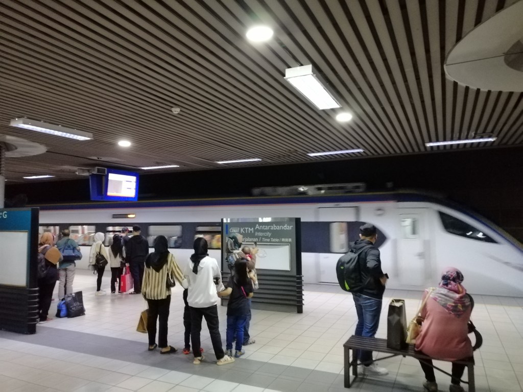
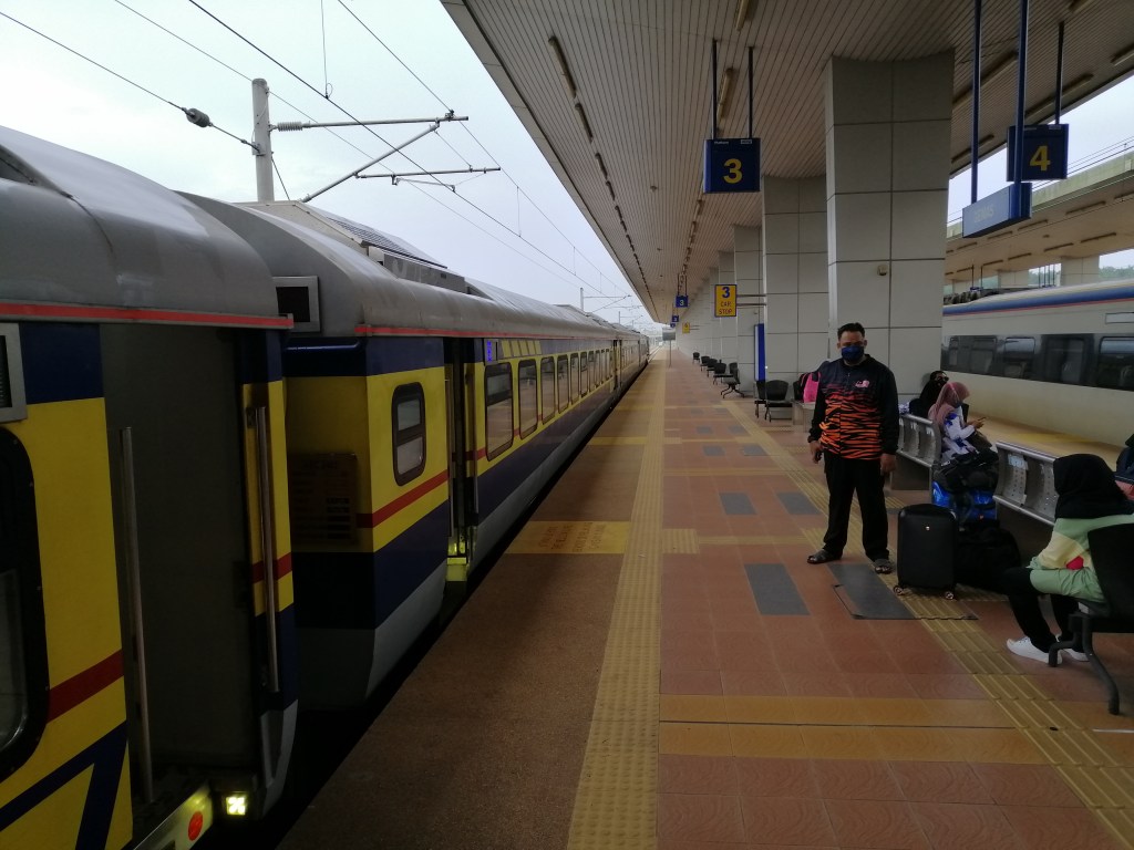
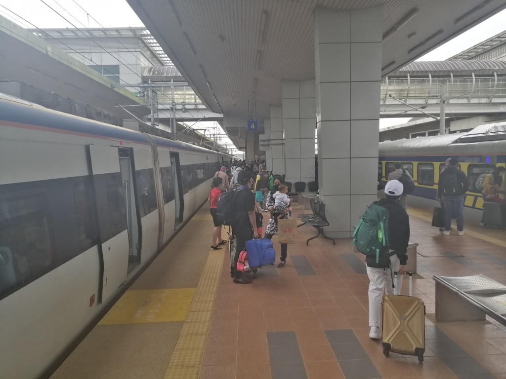
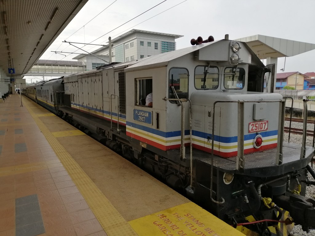
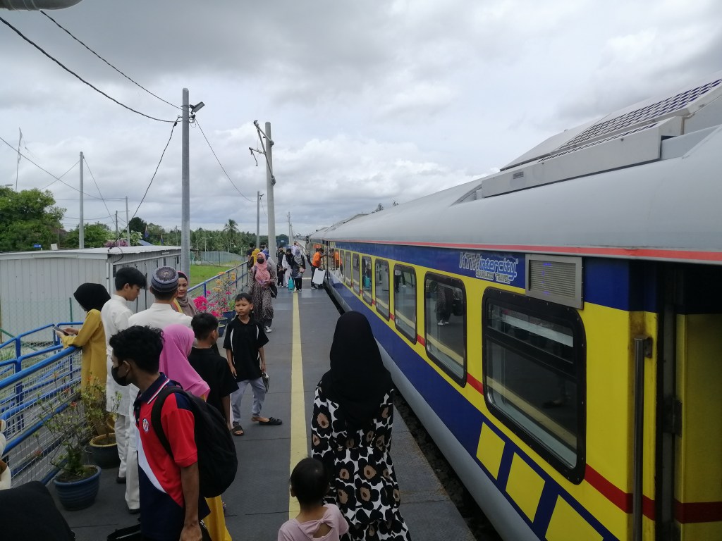
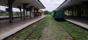
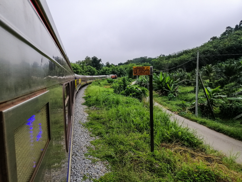
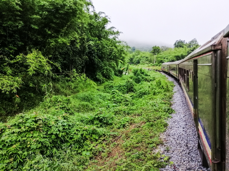
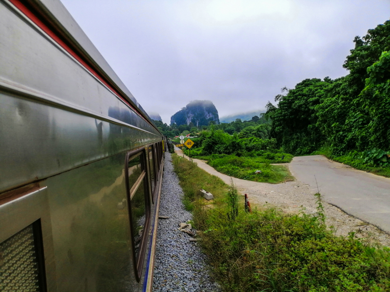
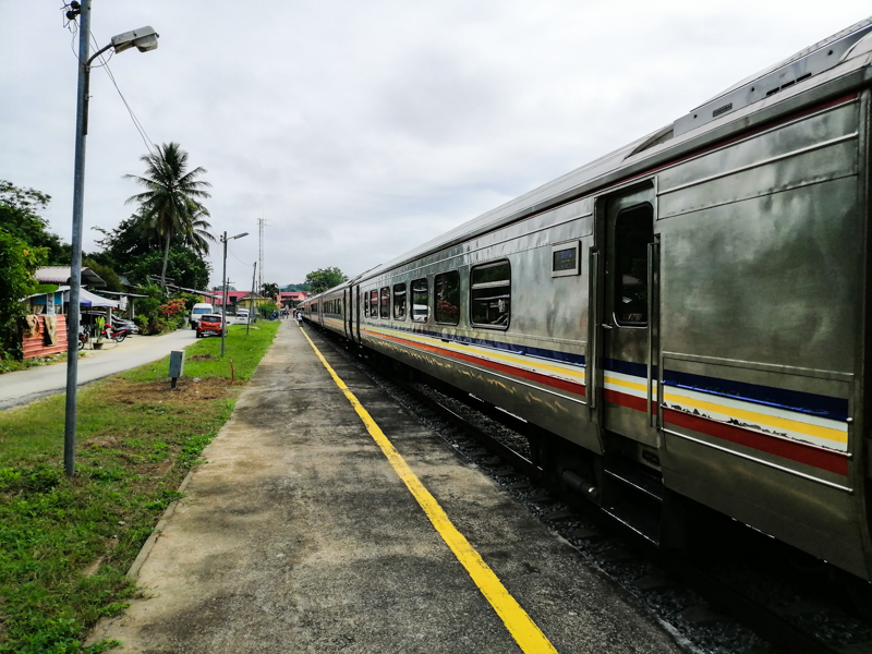
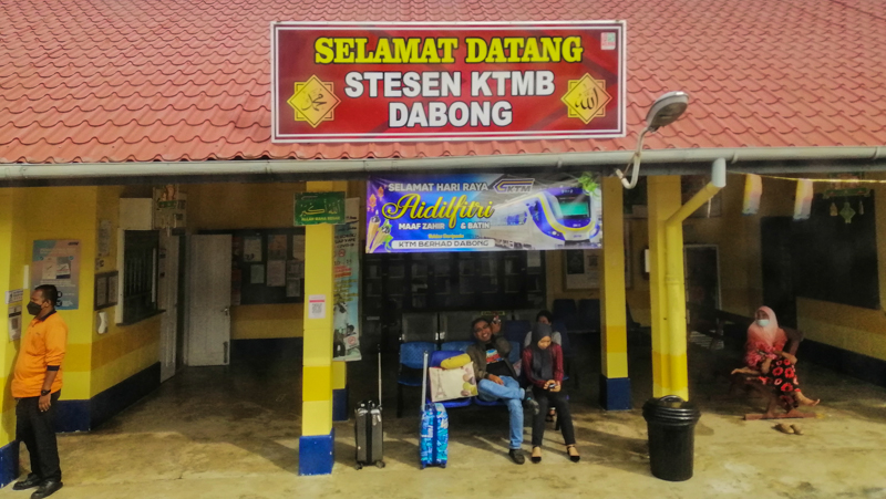
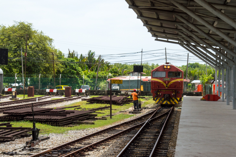
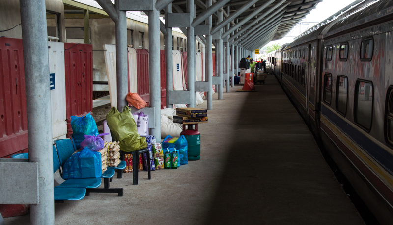
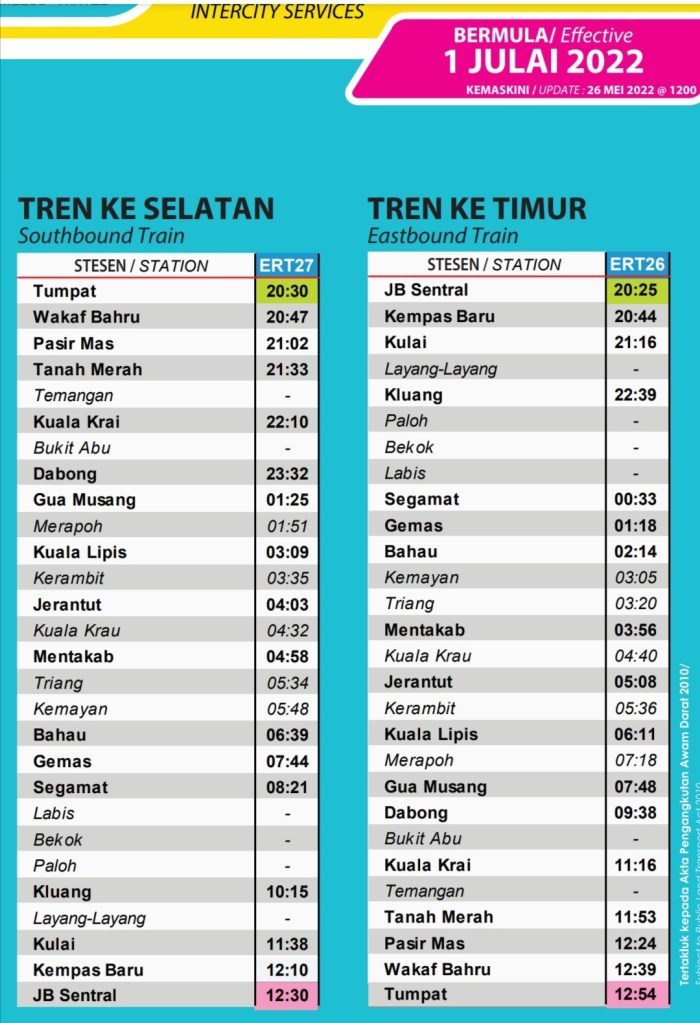
Taman Negara/Kuala Tahan is easily accessed from Jerantut (arrive by train from Gemas or Tumpat on the “Jungle Train”). From Kuala Lumpur to Jerantut, buses (4hrs) are available. I prefer the train. Two journeys are required, KL to Gemas (2.5hrs) and another from Gemas to Jerantut (3.5 hrs). I would highly recommend taking the 2 hr boat ride from Kuala Tembiling (30 minutes from Jerantut) to Taman Negara/Kuala Tahan, if they are operating. Otherwise, buses or private shuttles.
Accomodation
Mutiara Resort (luxury) is the only accommodation (with restaurant) within the park. However, several budget to mid-range places can be found in Kuala Tahan. Visitor numbers can be high, so early booking is recommend.
How many days do you need
At least 2 nights to do several activities listed here. Anyone keen to spend more time jungle trekking or birding, 3 nights would be ideal.
My journey
Due to covid (about 2 years), many establishments had ceased. My original plan was to arrive in Jerantut by train (as part of my ‘jungle train’ experience) and make my way to Kuala Tembeling. Then catch a 3 hour boat ride to Kuala Tahan. The boats were not operating. This would have been an adventurers way to get into the park. Even public transport by local bus was non-existent. I managed to contact NKS(a local private road transport and tour operator). As expected, the cost was high with no other travellers. I took it with no options left.
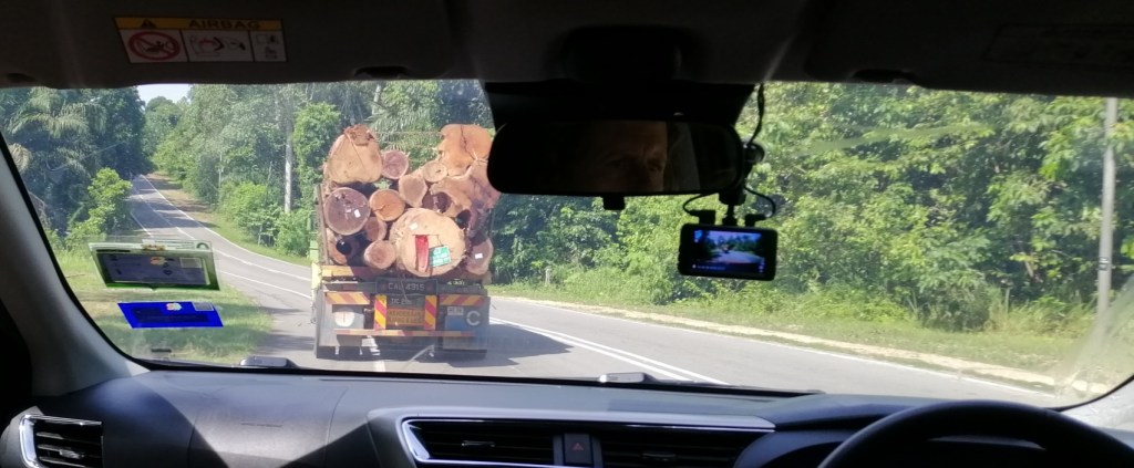
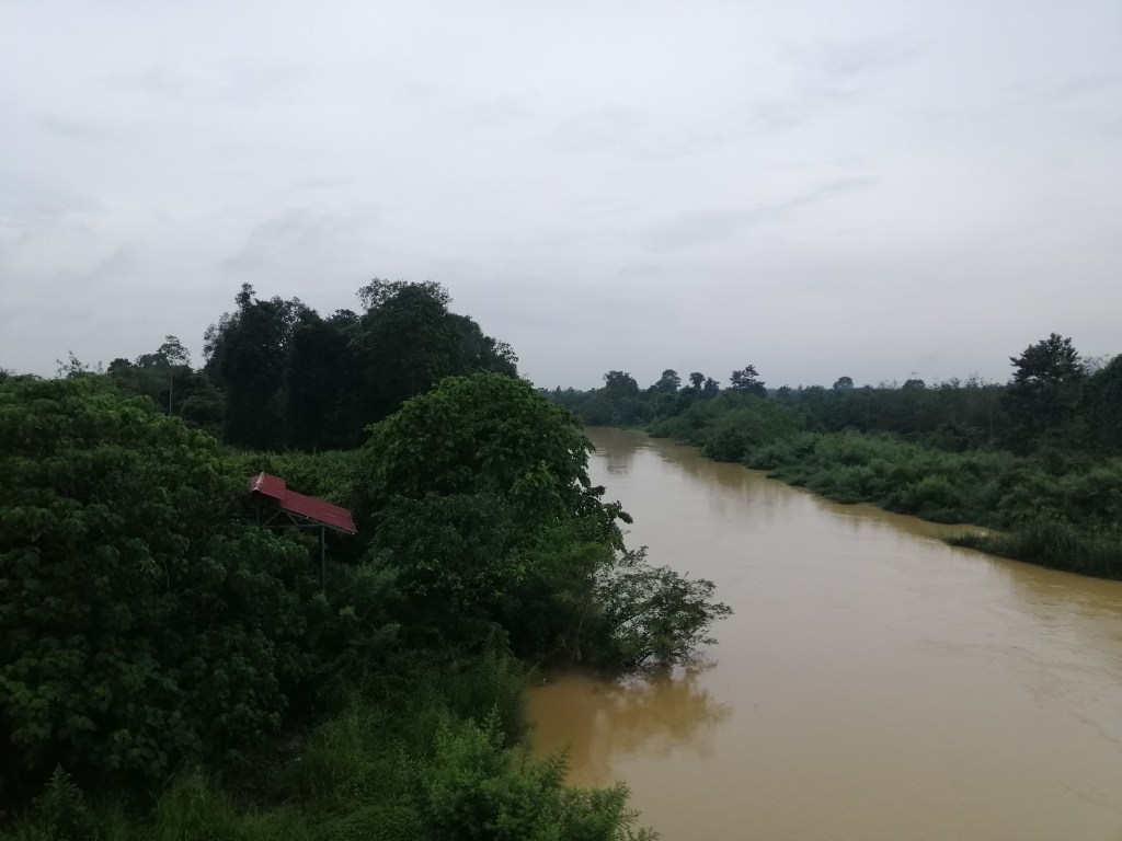
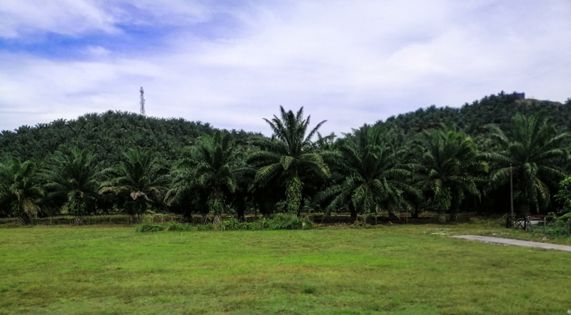
Jerantut was cool and quiet at dawn. I was the only passenger today when the NKS shuttle arrived at 7am (cost RM$80). We initially took the 58km journey to Kuala Tahan on the Jerantut-Maran Road. After a while we crossed a bridge over a very muddy Pahang River and veered off into route 2308 towards Padang Piol Felda Settlement. I was excited to be here. However, on the road, we passed several timber lorries loaded with logs and huge acreages of palm oil cultivation. I was completely perplexed (or rather utterly deflated) with venturing into a National Park! It was quite ironic. Forest appeared sporadically. It was quite stunning when the sun filtered through the mist around the tree canopies.
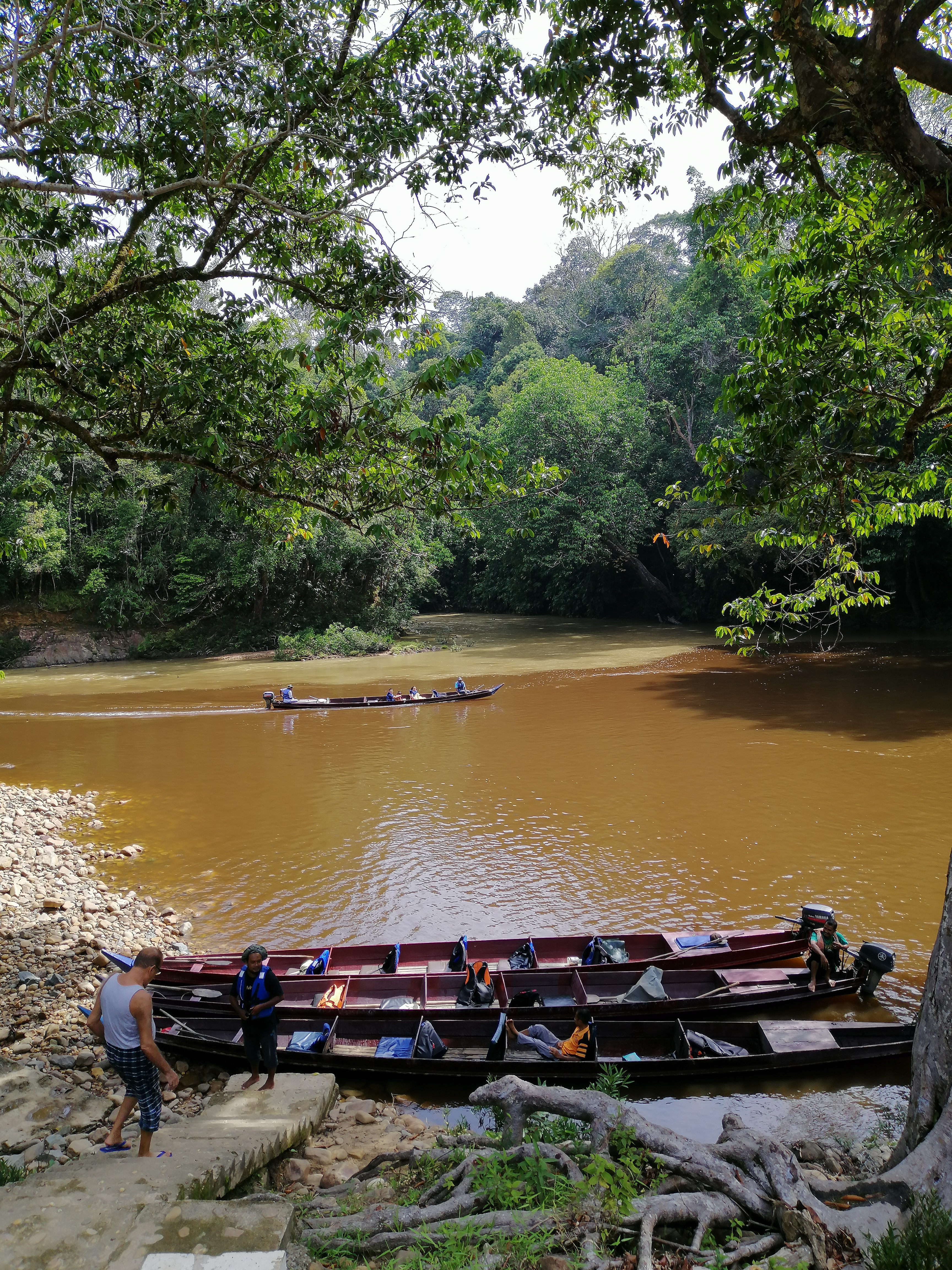
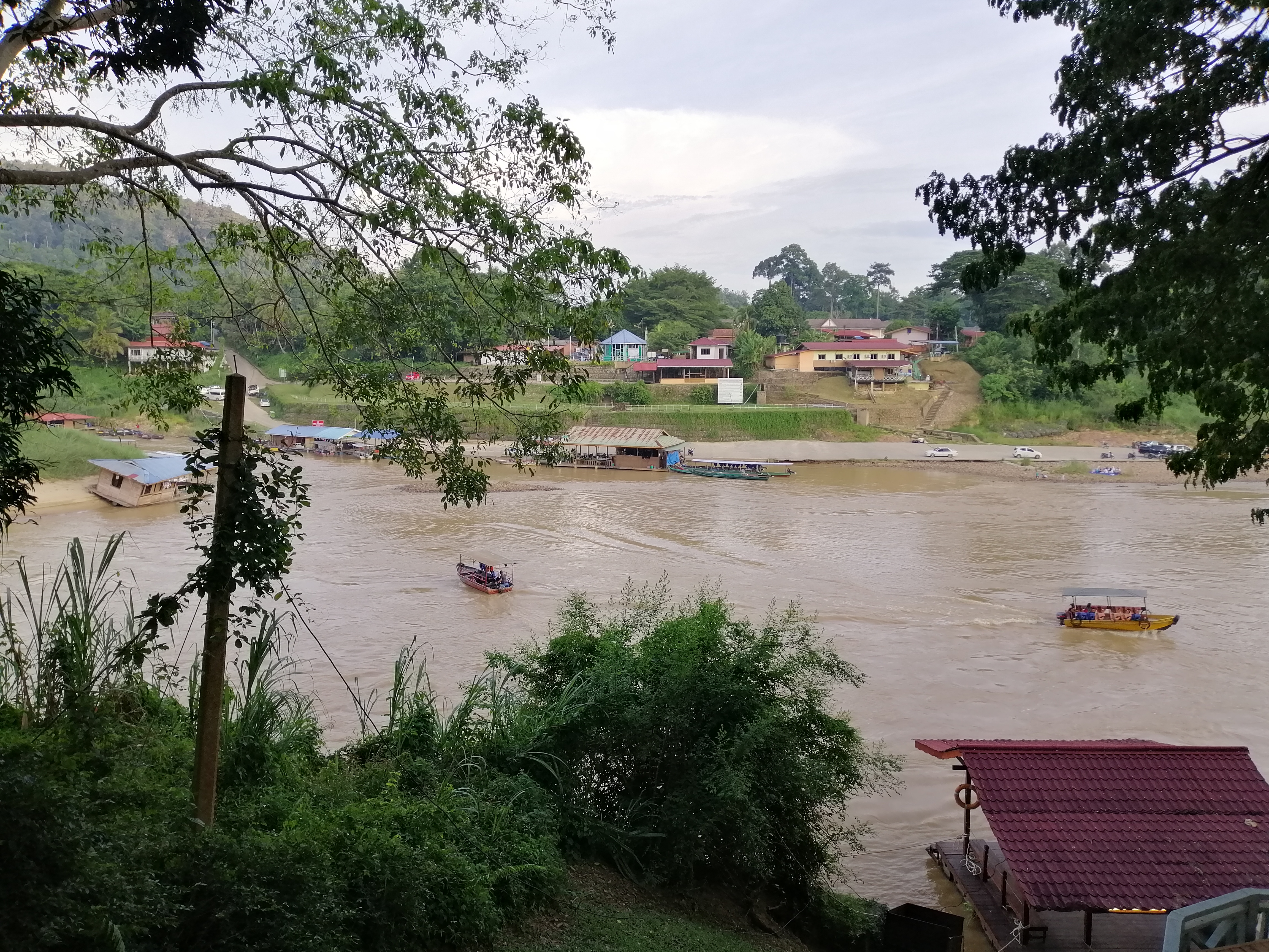
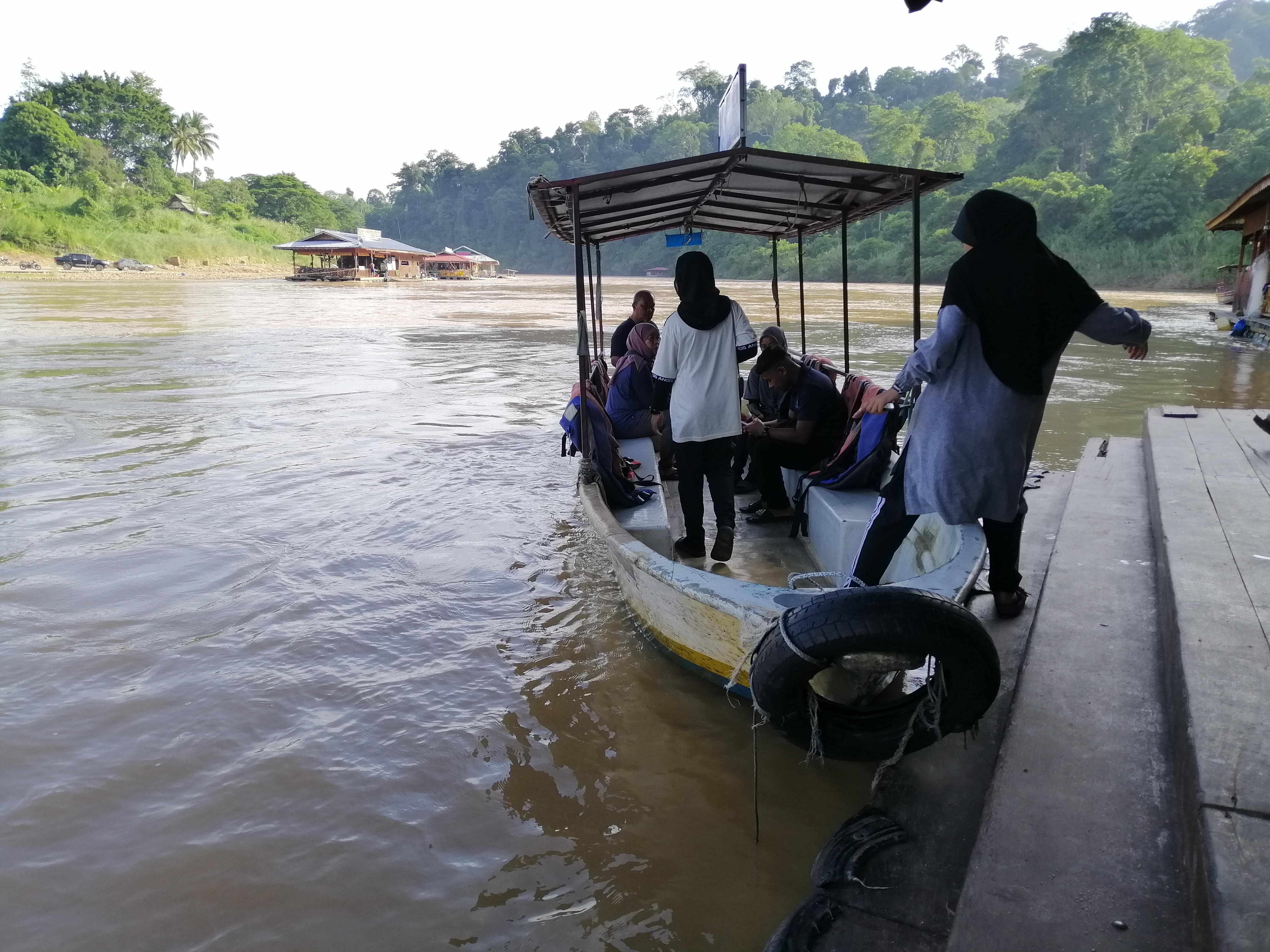
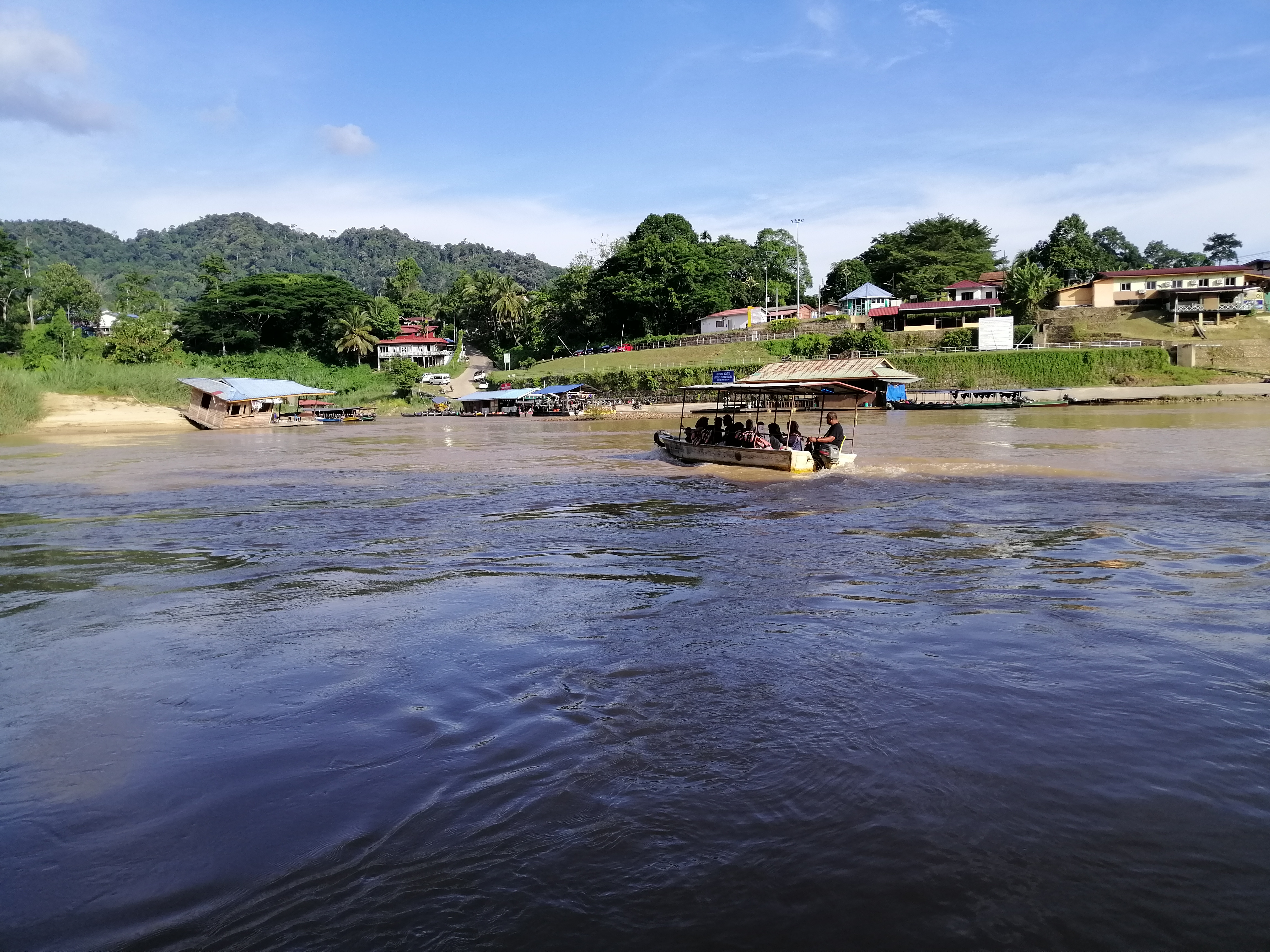
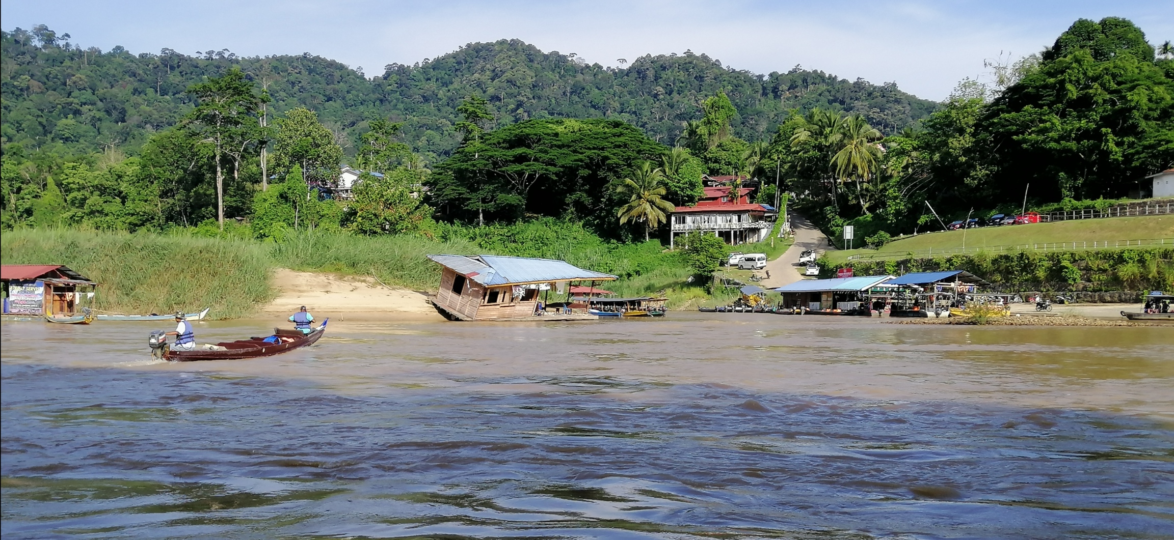
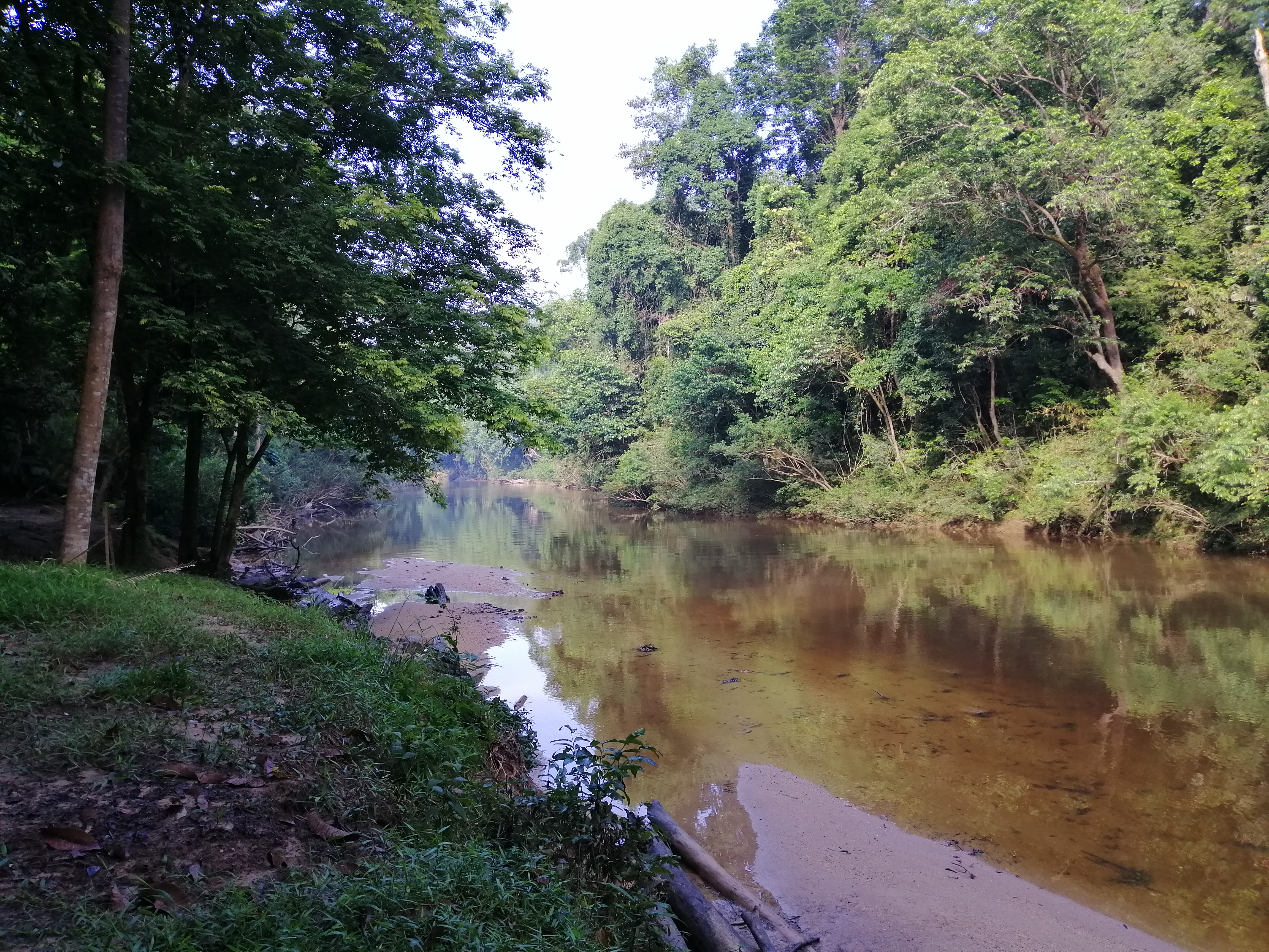
I could see tall trees in the horizon as we crossed a bridge over Tekai River. My spirits lifted with the sight of the dense tropical forest. We passed an assemblage of street stalls, mostly operated by Malays. I finally reached the roads end – Kuala Tahan, the gateway to Taman Negara. The tea coloured Tembeling River was high, with the banks nearly overflowing, and fast flowing resulting from recent rains. A collection of rustic floating boat houses were anchored to the shore. Only 3 were operating with a small canteen. I was overwhelmed to be here. Circumstances had prevented me from venturing here when I was younger and living in Malaysia. Long boats with outboard motors and brightly coloured life vest lined the shore. The terracotta roofs of Mutiara Resort, the only accommodation within the park, laid amongst lush green trees.
Kuala Tahan, at the confluence of Tahan and Tembiling Rivers, is a ramshackle of accommodation and street stalls. Malays and mix of aborigines lived on the outskirts of town dotted along the river. Tembiling River is the pulsating heart of this village. Taman Negara is its economic provider.
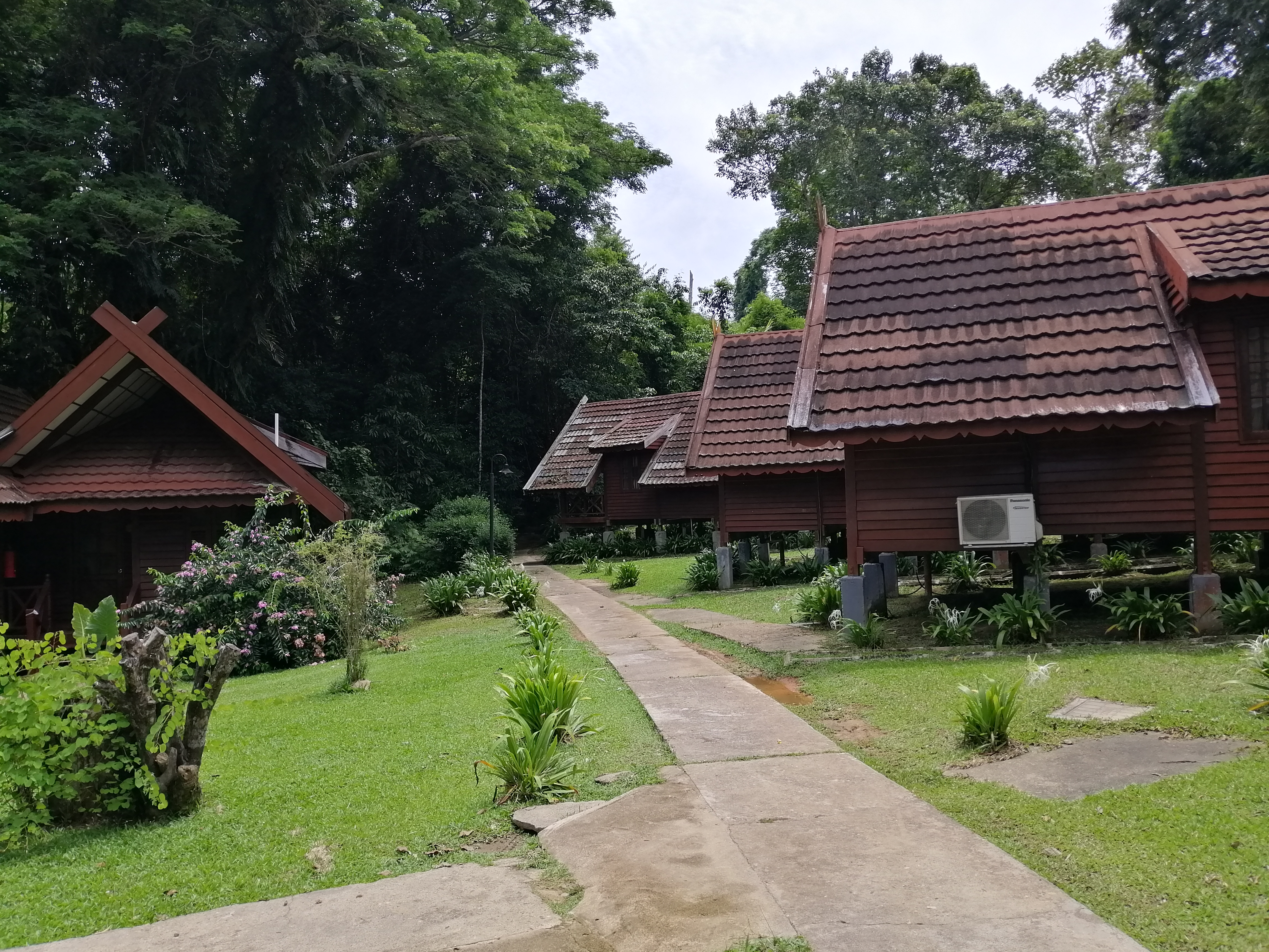
After breakfast – roti canai and kopi tarik at a floating restaurant, I jumped into a small boat (RM$1) and crossed the swollen dark tea-coloured Tembiling River. I booked my accommodation at Mutiara Resort. I taught I’d enjoy some luxury this time. Several packages were offered but I choose room only and organised selected activities at the resort. It worked out to be cheaper. The resort itself had only just opened for business. Perhaps 2-3 weeks, due to covid restriction. There are several accommodations in Kuala Tahan and they also organised activities and boat rentals.
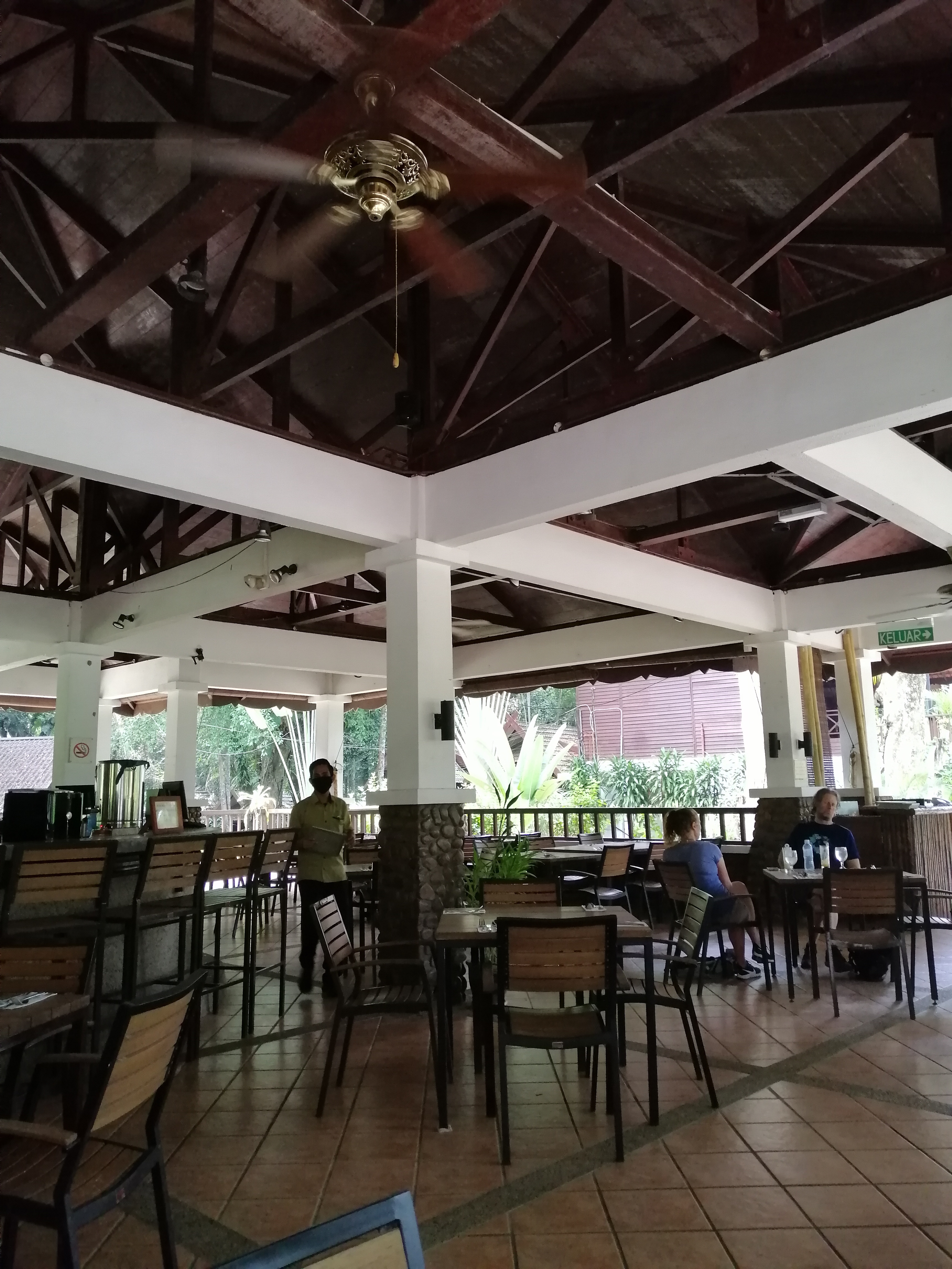
From the jetty, up a flight of steps, I entered Taman Negara at 9am. Permit cost RM$1 purchased at the Park HQ (RM$5 for camera). Mutiara is a collection of chalets set within the jungle. The staff here also organised several activities. My stay is 3D2N. At the top of the steps, I watched boats ply across the fast flowing muddy river. Boat operators busily prepared for afternoon tours. It was such a tranquil environment – sweet smell of damp earth; deafening cacophony of creatures of the jungle; breath of fresh oxygenated air; calming sights of flowing water and absence of traffic noise. Positive effects of being in nature.
Things to do in Taman Negara
A variety of activities is on offer by Mutiara Resort, Tour agents and local residents (local accommodations in Kuala Tahan and boatman). Most activities can be organised on the day of arrival. However, some activities require a minimum number of participants or paid in full.
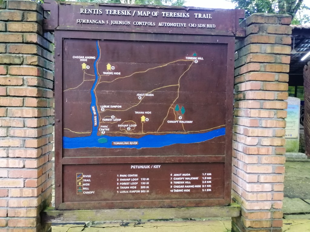
Hike to Teresek Hill
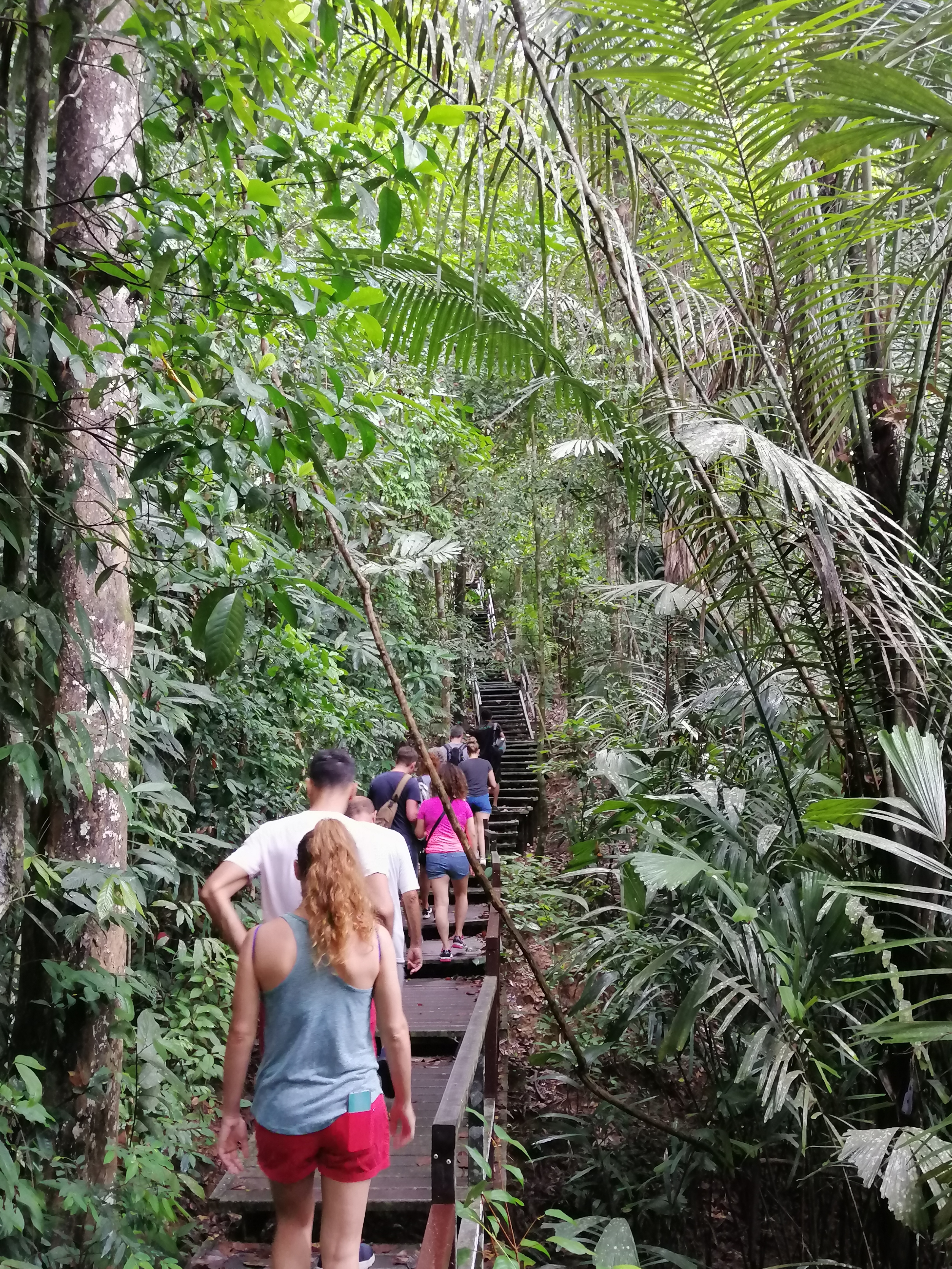
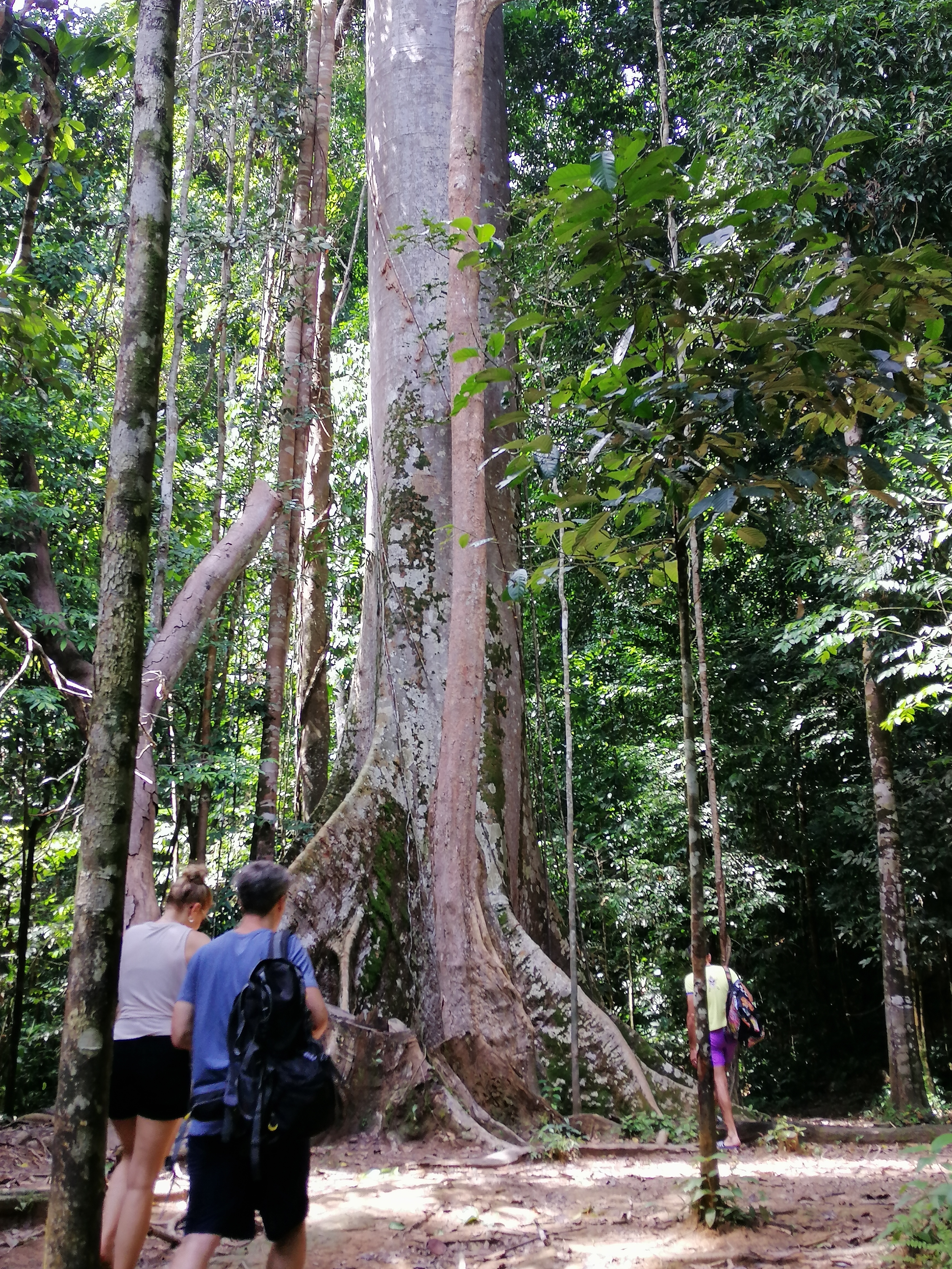
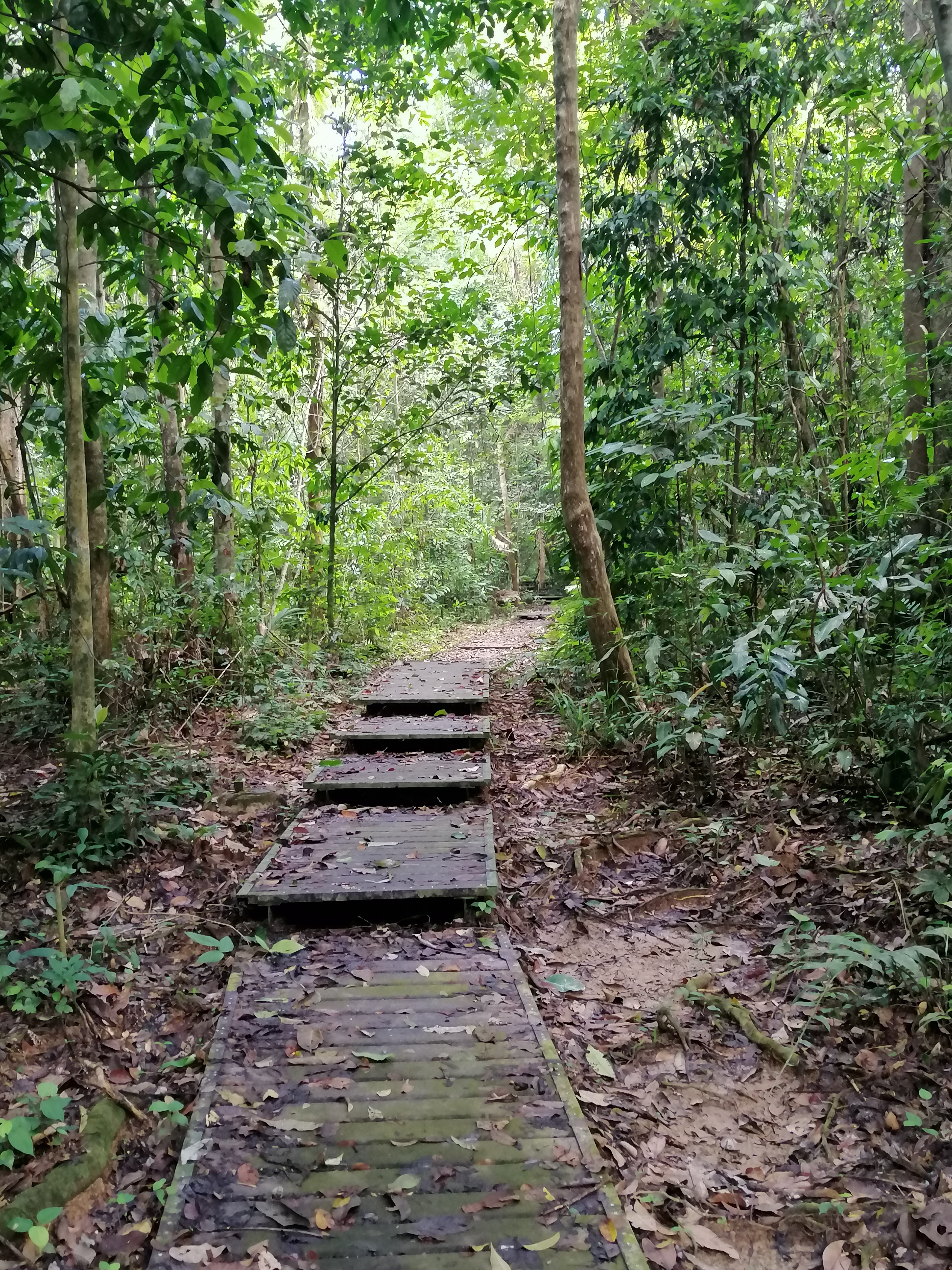
Having arrived too early, I decided to jump into an activity – guided (included with my room) hike to Teresek Hill followed by Canopy Walk. Hiking in NZ is quite different to tropical Malaysia – not only to contend with slippery and muddy tracks, high humidity but worst – leeches! The wetter the season, the higher the numbers. I was prepared. A bar of 555 soap and detol. I applied both-onto my shoes and socks. The jungle sound in the morning is loud. The initial part of the track is walking on wooden pathways surrounded by dense forest. Elephant path and dung laid strewn only half hour outside Mutiara. The ground is littered with leaves in various stages of decomposition. Amongst them, torch ginger with their unique flowers.
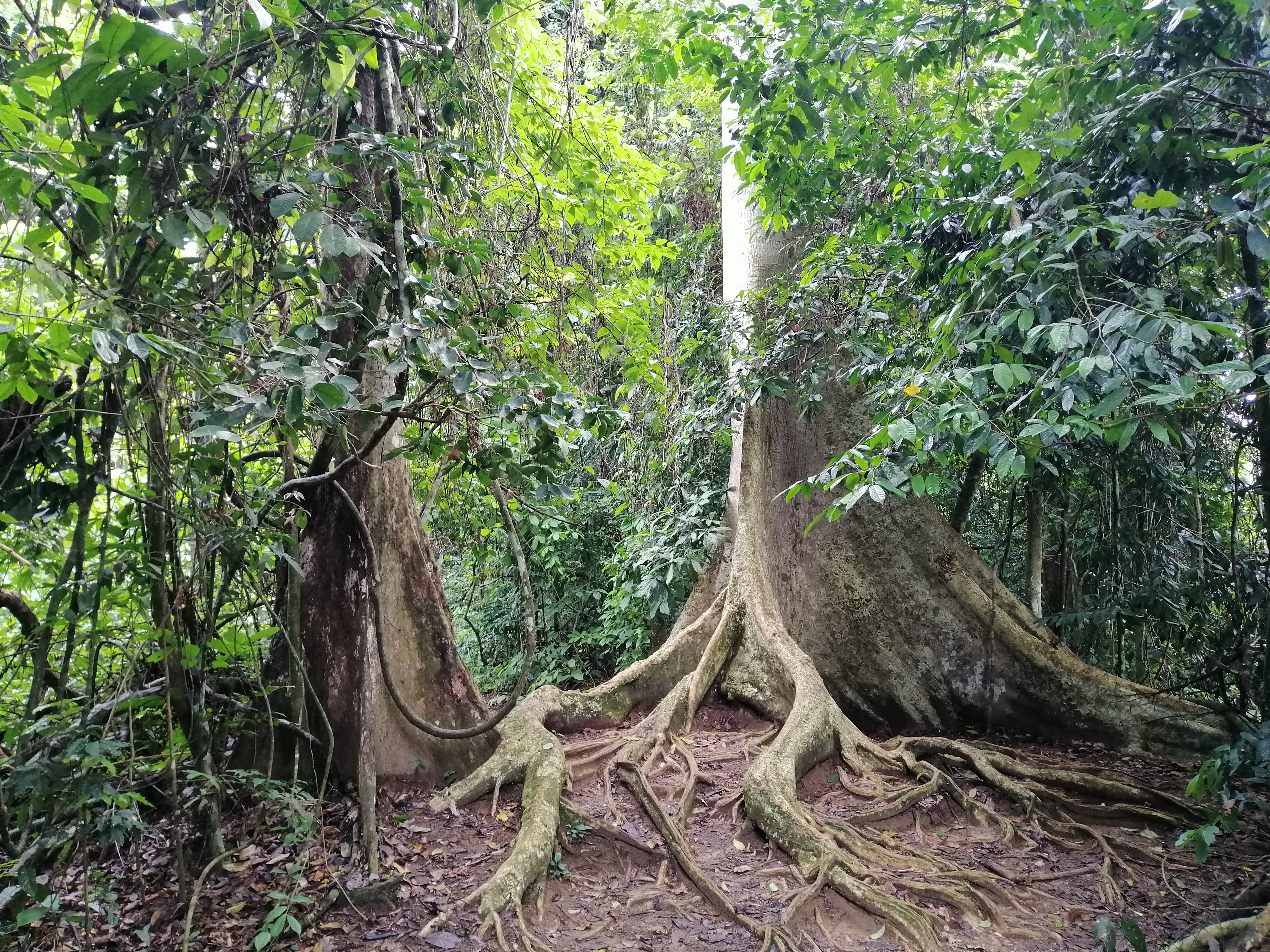
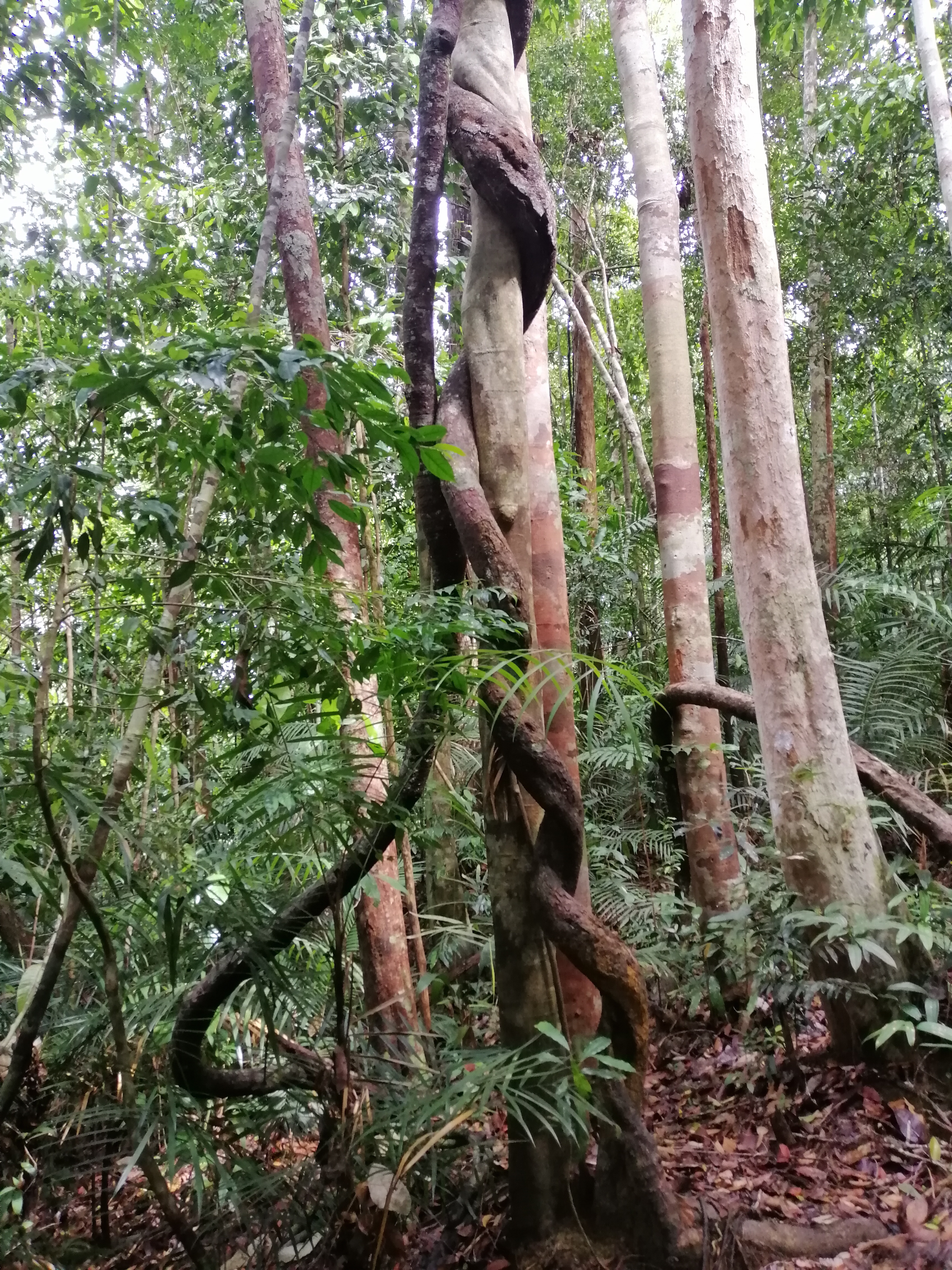
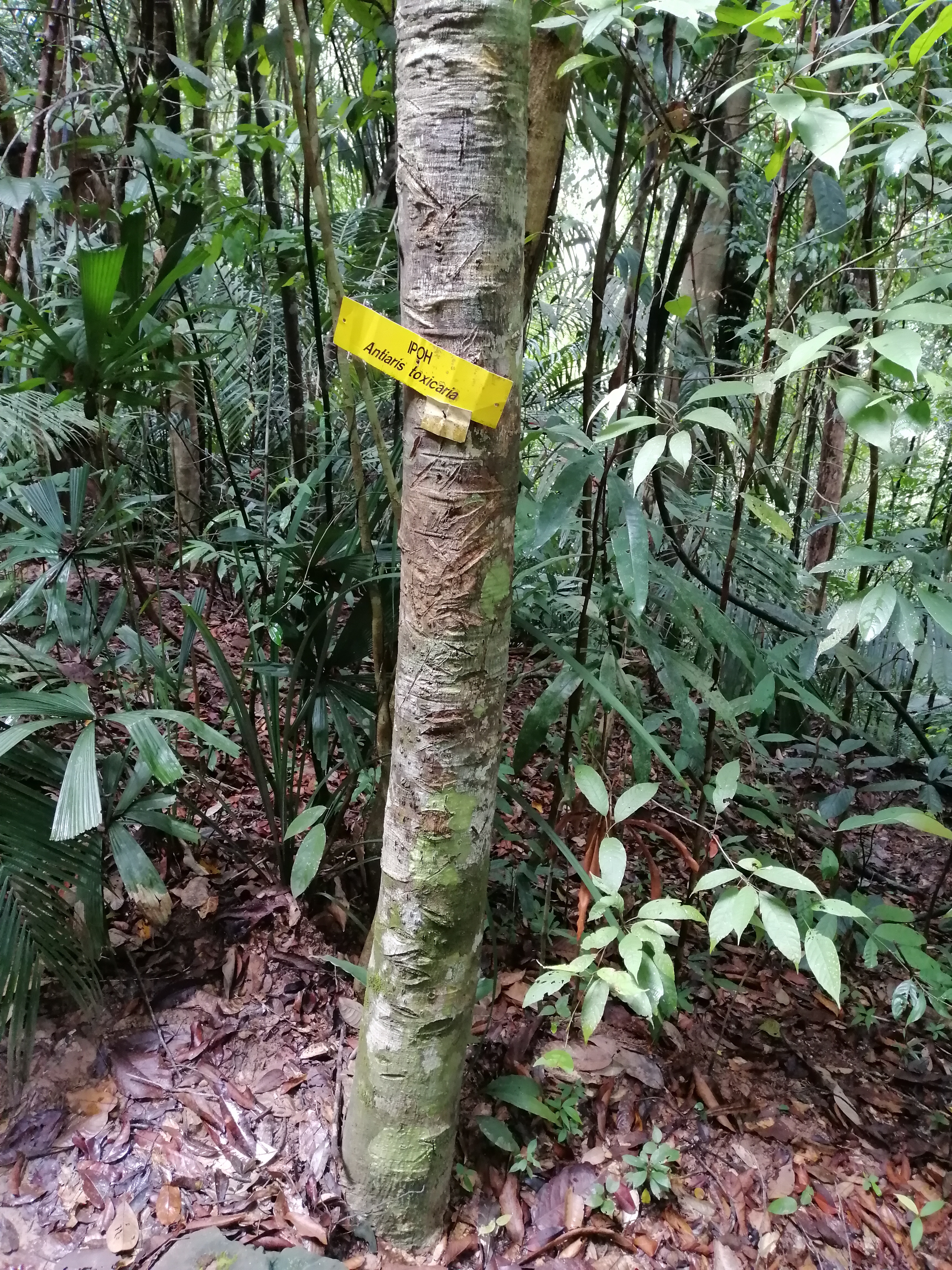
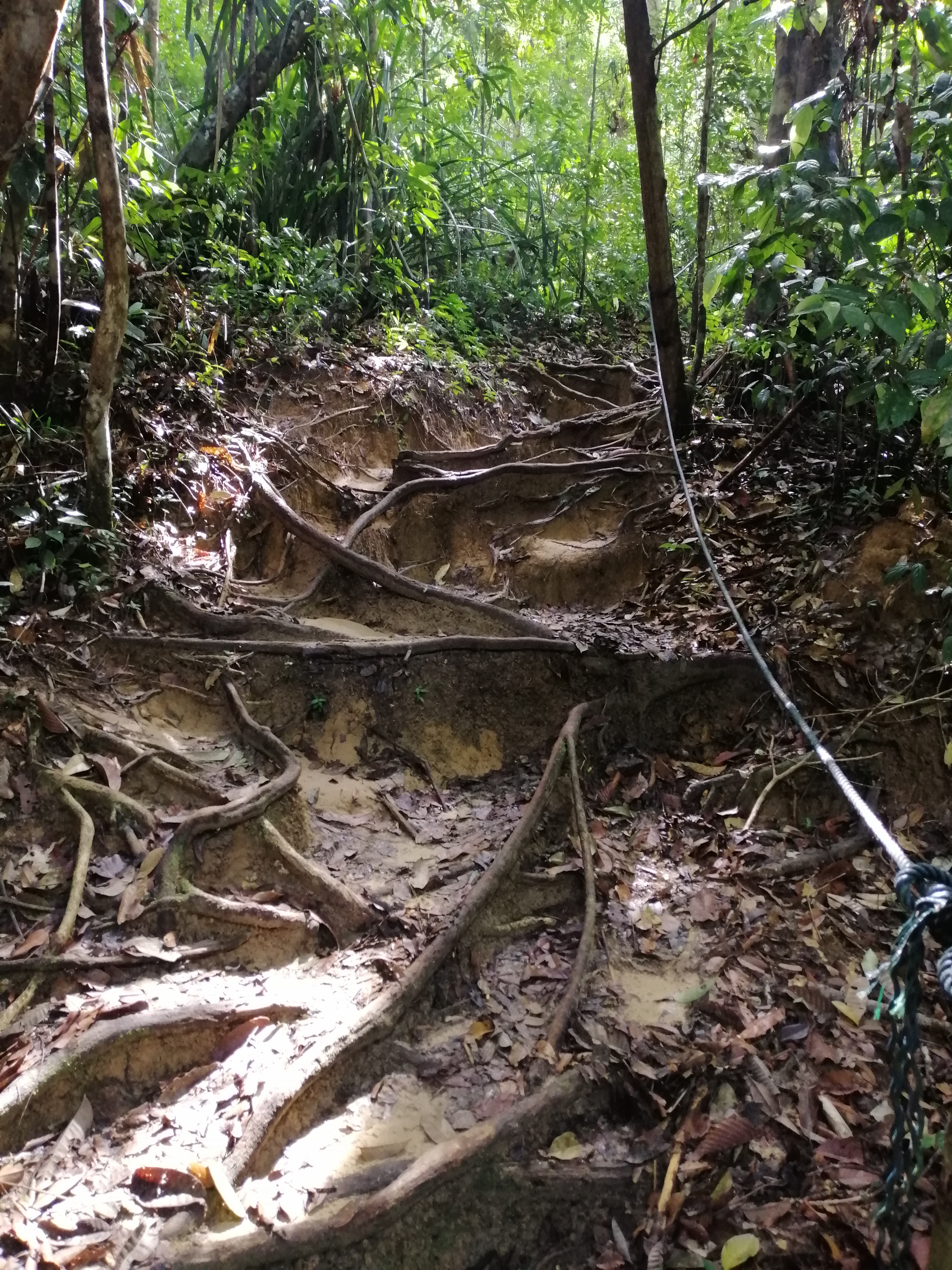
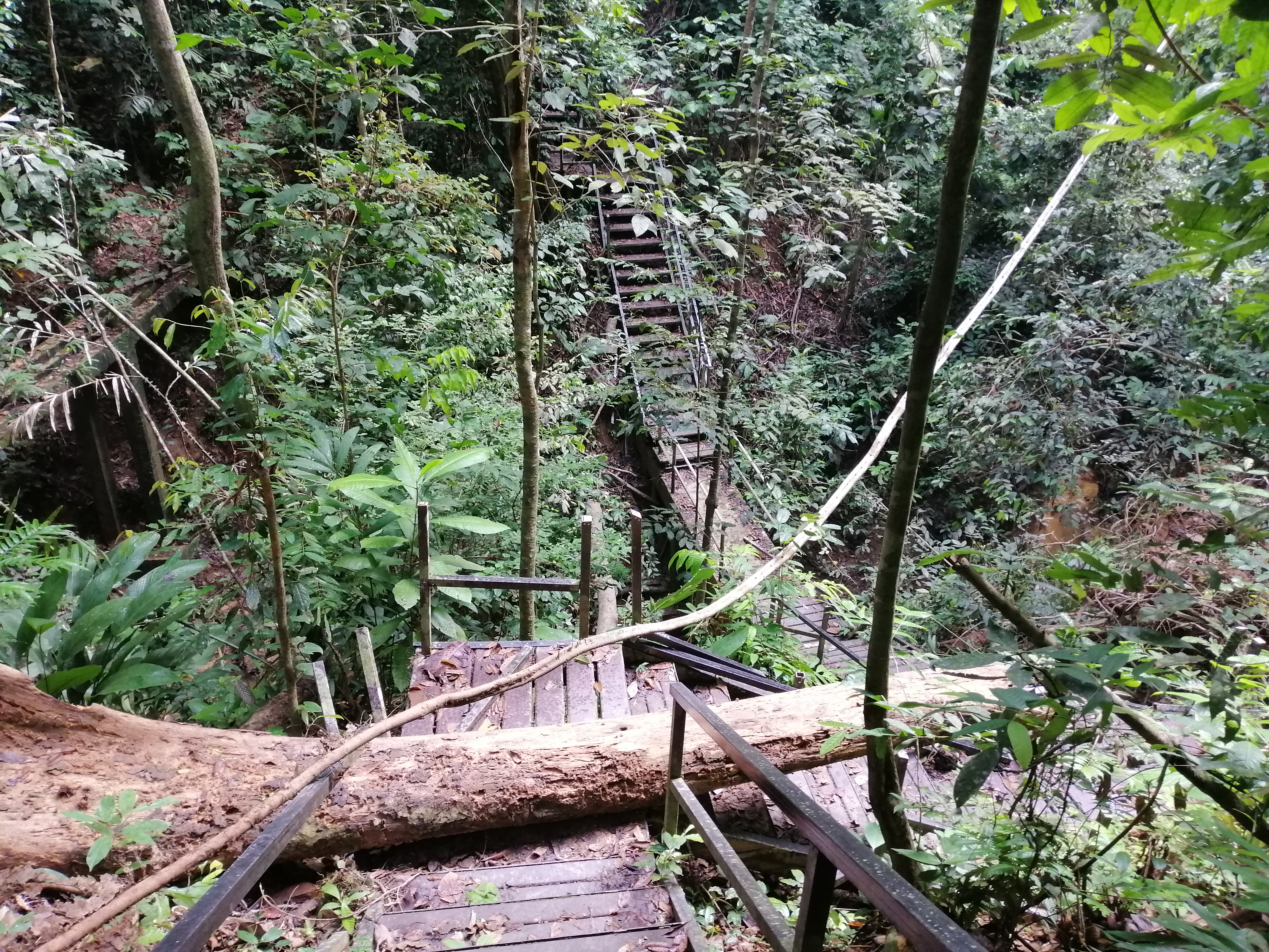
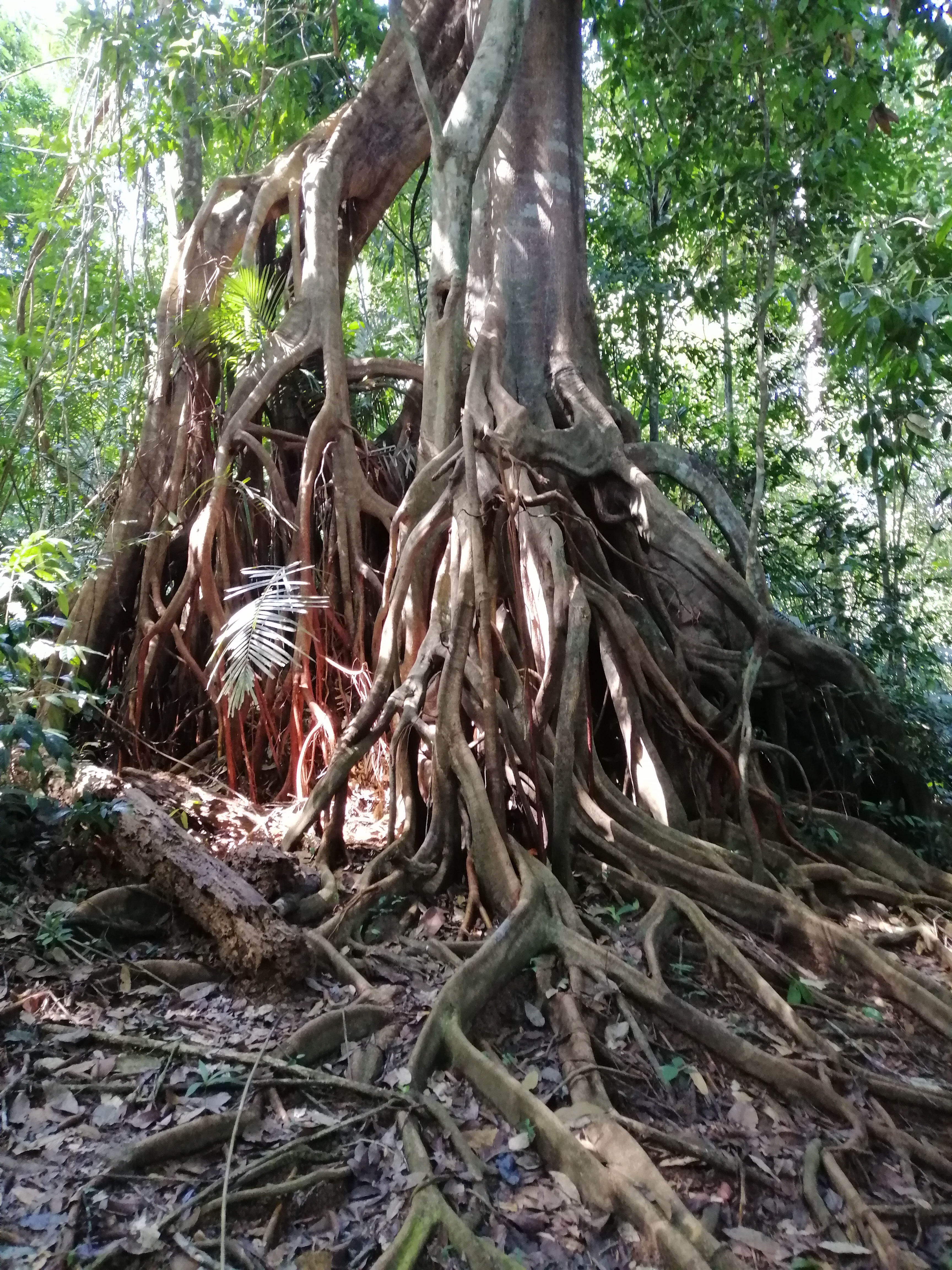
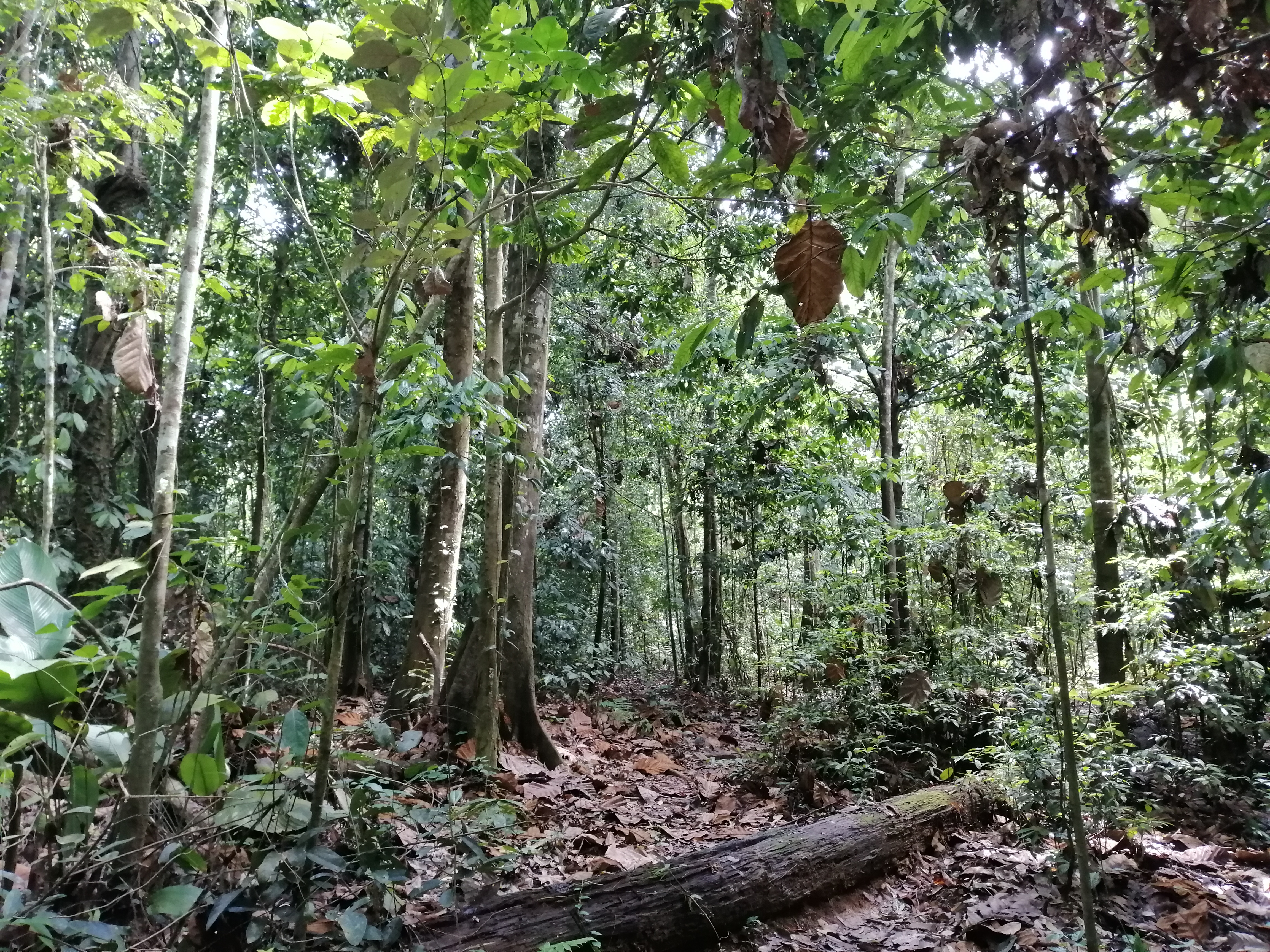
The sounds of the jungle is constant. The creatures, well camouflaged. Trees in the jungle grow straight for the light. The undergrowth is generally bare. Fungi played an important role in breaking down decaying materials and feed the jungle. Palms are plentiful. Prickly thorn of the rattan crept up trees. We came upon a magnificent specimen of Mengkudor tree. By looking at its impressive buttress roots, this tree is old. Ficus trees, clang up a tree trunk. An Ipoh tree with several cut marks indicate the poisonous sap had been ‘harvested’ by the Orang Asli (indigenous) for hunting. Walking on boardwalks under a filtered sun and surrounded by lush greenery was enjoyable. Gradually, with about 900 meters to go, steps appeared as elevation increased. The sharp thorns of the creeping rattan should be given a wide berth. Boardwalk ended with another 500 metres.
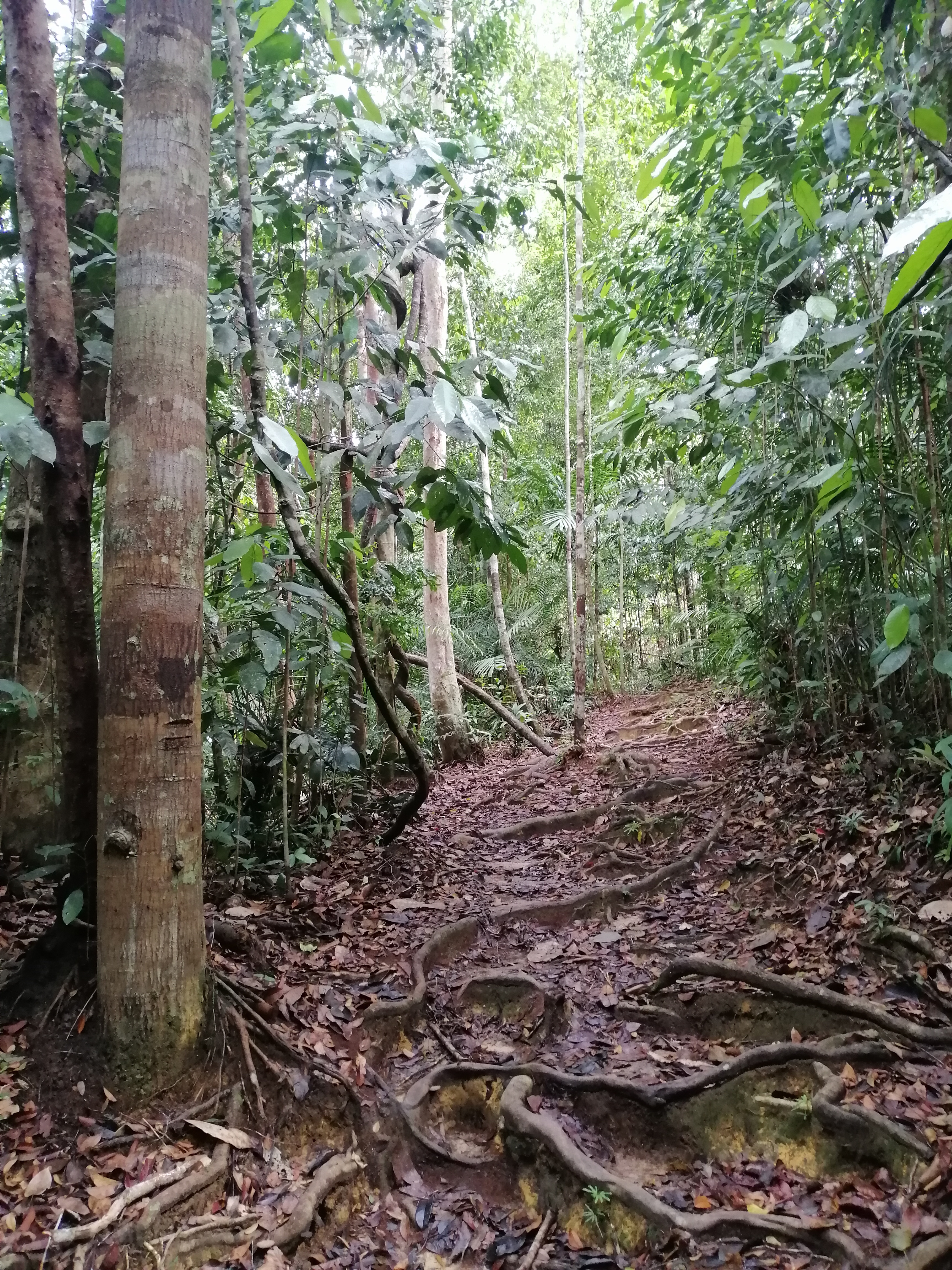
The track is now earth with exposed tree roots and rotting leaves. Industrious ants formed a line across the path. Some do bite inducing terrible pain. Best left undisturbed. At the first view point, fast flowing muddy Tembiling River and hazy tree canopies and outcrops were visible. Fortunately the heavy rains that flooded Tembeling River had retreated. The track was dry and encountered very few leeches. Towards the top of the hill, juvenile trees stood like sentinels in numbers. We reached a clearing – Teresak Hill, at 344 meters, after 1.5 hours hike. Drenched from the humidity.
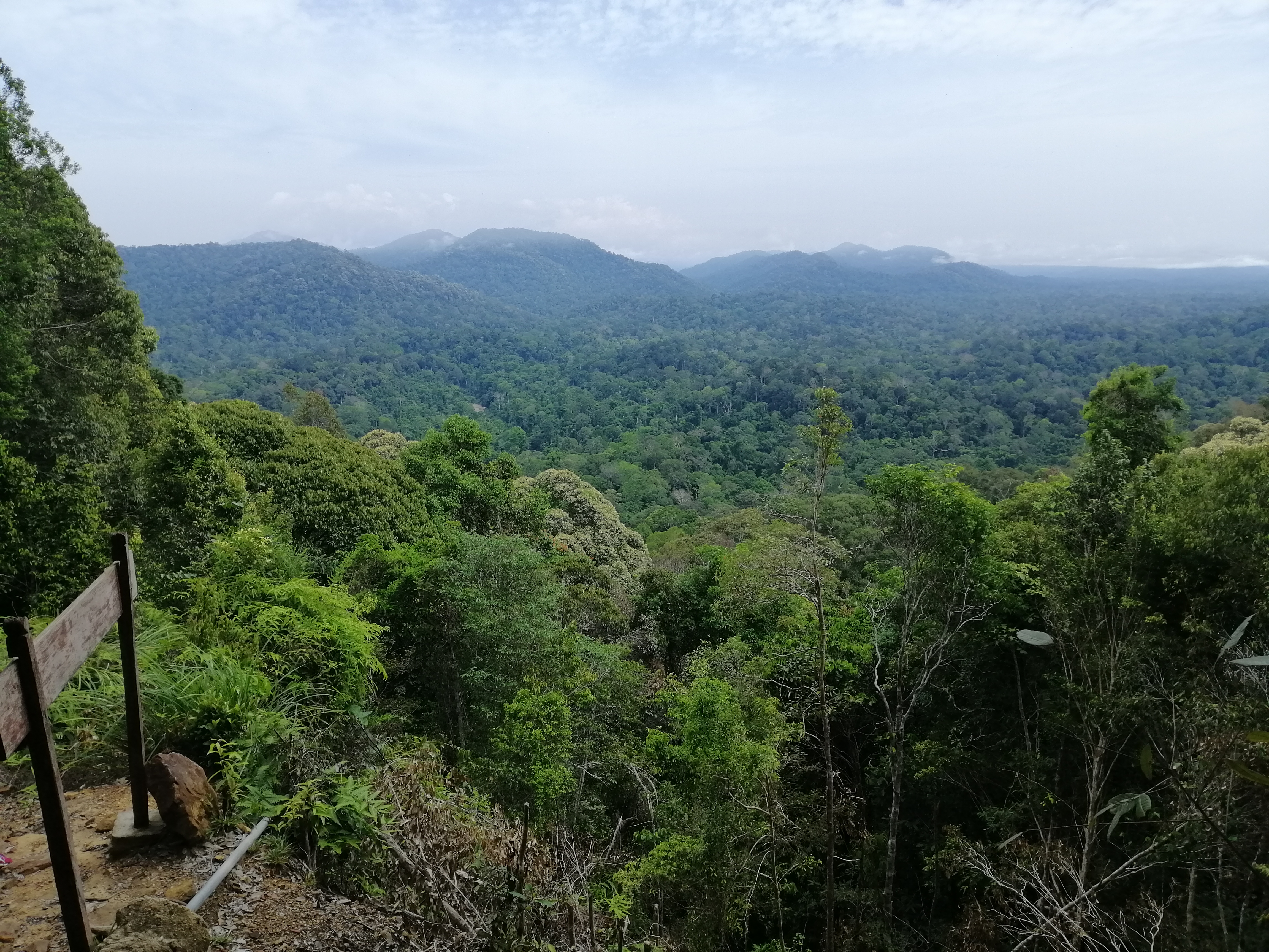
The grandeur of Taman Negara is on display – lush dense virgin jungle as far as the eyes can see. The textures, colours and structures created a mosaic of green. Several peaks appeared in the distance including Gunung Tahan, highest in peninsular Malaysia. Tahan River slithered under the tree canopies. A variety of bird calls including hornbills are heard but not seen. The walk here is easy with, surprisingly, very few leeches. Another track led downhill towards Tahan River completing a loop back to Mutiara. However, we returned the same way and proceed towards the Canopy Walk.
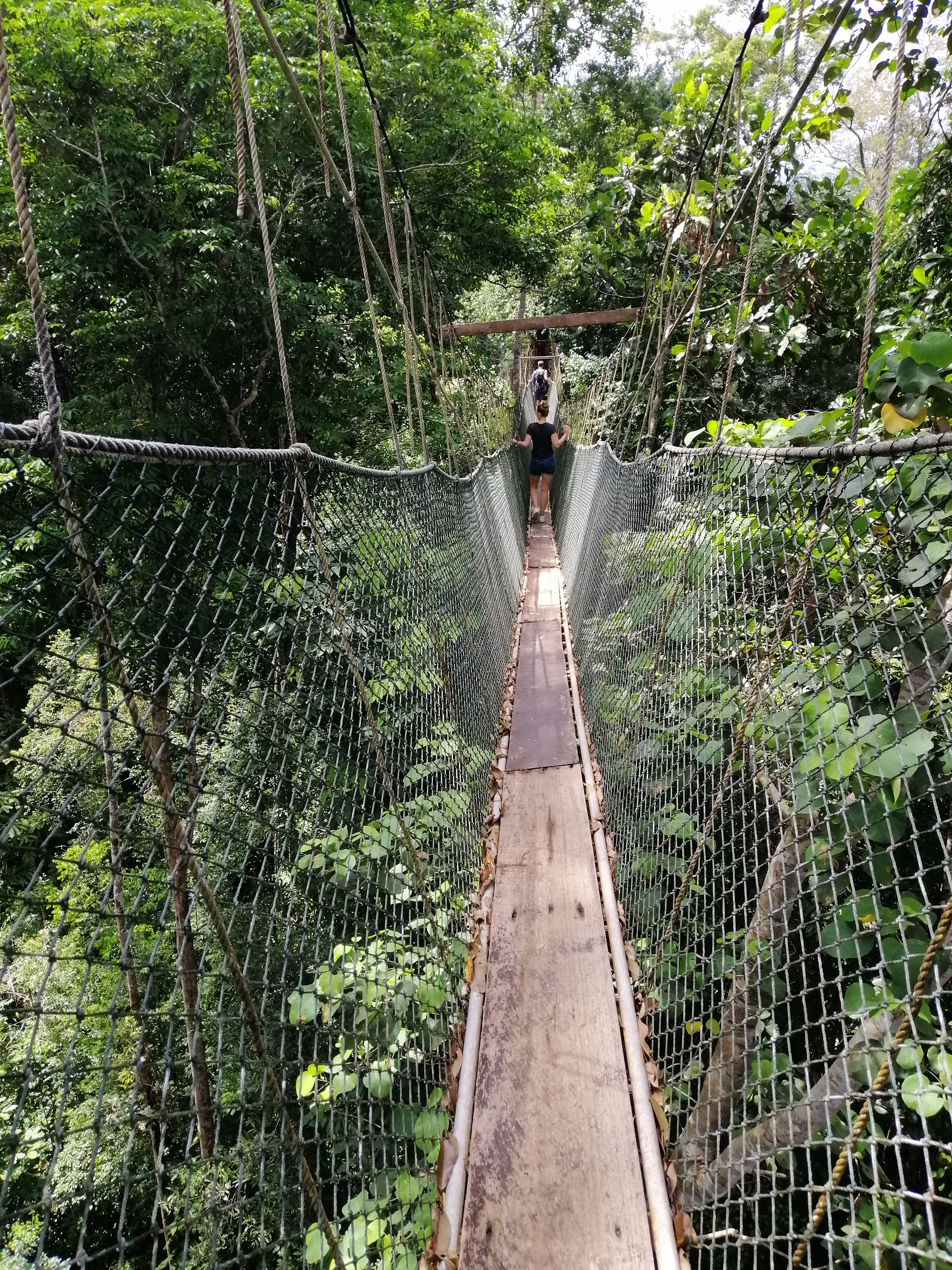
Canopy Walk
Descending from Teresek Hill, we made our way on mostly boardwalks towards the Canopy Walk. A series of suspension rope bridges and platforms, 40m above ground and stretching about 530m. The bridges are tied around tree trunks. The issue with the canopy walk is crowds. The rope bridges can only be accessed by a few at any given time. Therefore, waiting time is long if big crowds. Not the best for viewing, if any, wildlife. It opens at 10am with RM$5 charge. Get here early, 0930, to avoid crowds especially tour groups.
My group of 15 were the only ones here today. I walked last and managed to get plenty of time observing, always optimistic, of seeing something. The feeling of being amongst tree canopies gave a bird’s eye view of the forest floor. Bird songs are within earshot but mostly hidden. The moisture laden air is fresh. The perspective changes from one platform to another. Then is a short 1.7 km walk back to Mutiara/Park HQ.
Lata Berkoh and Kelah Santuary
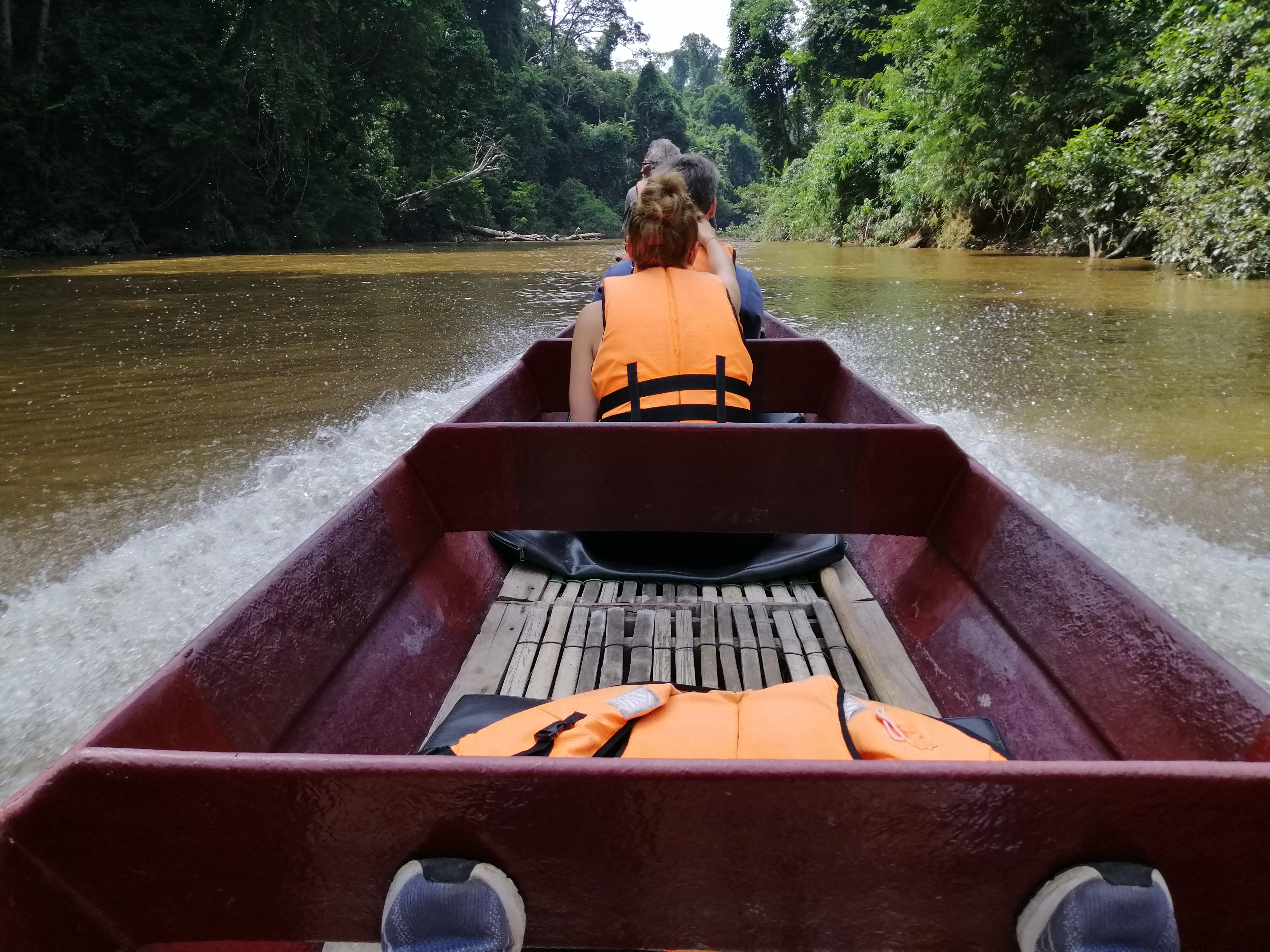
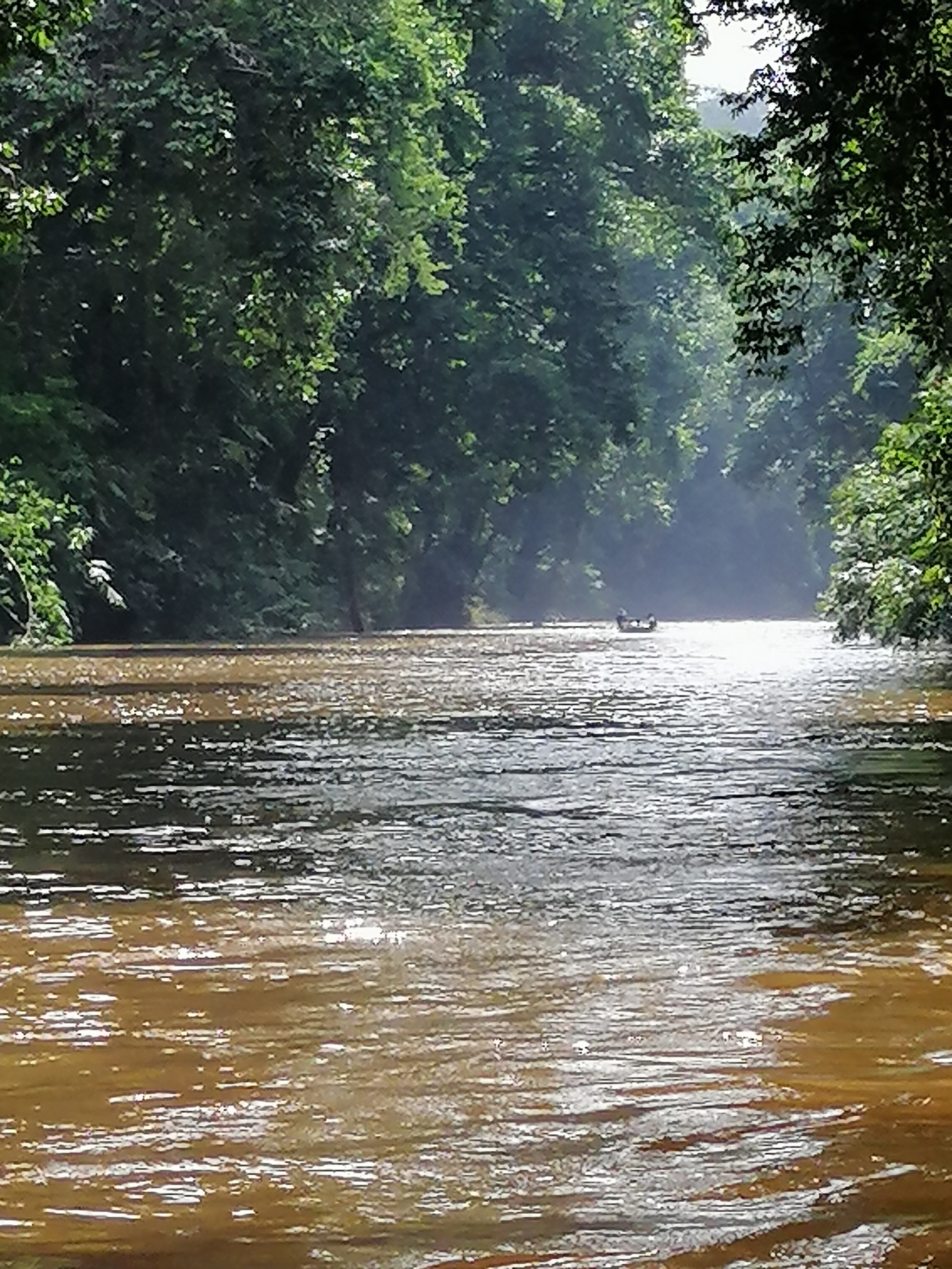
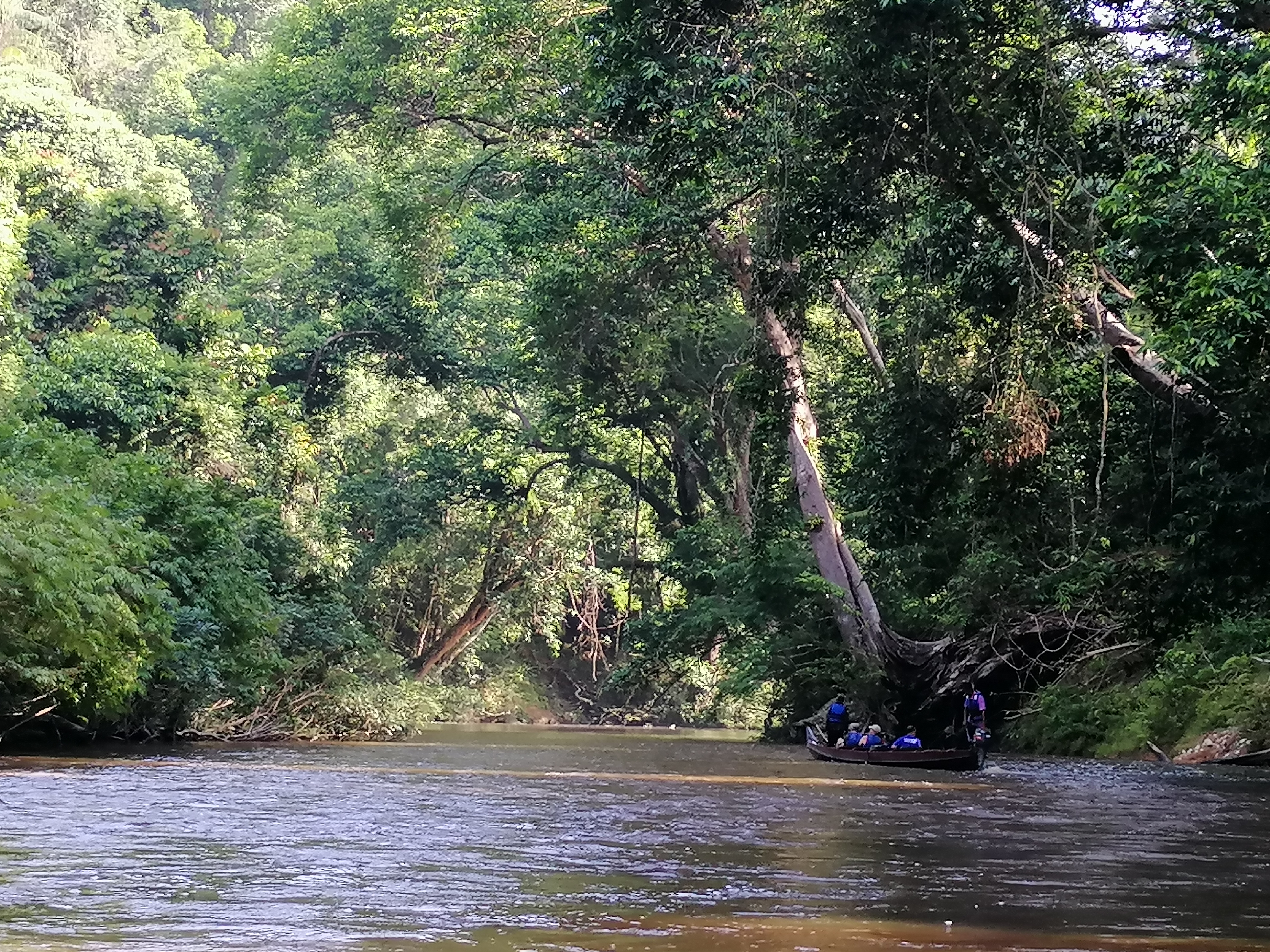
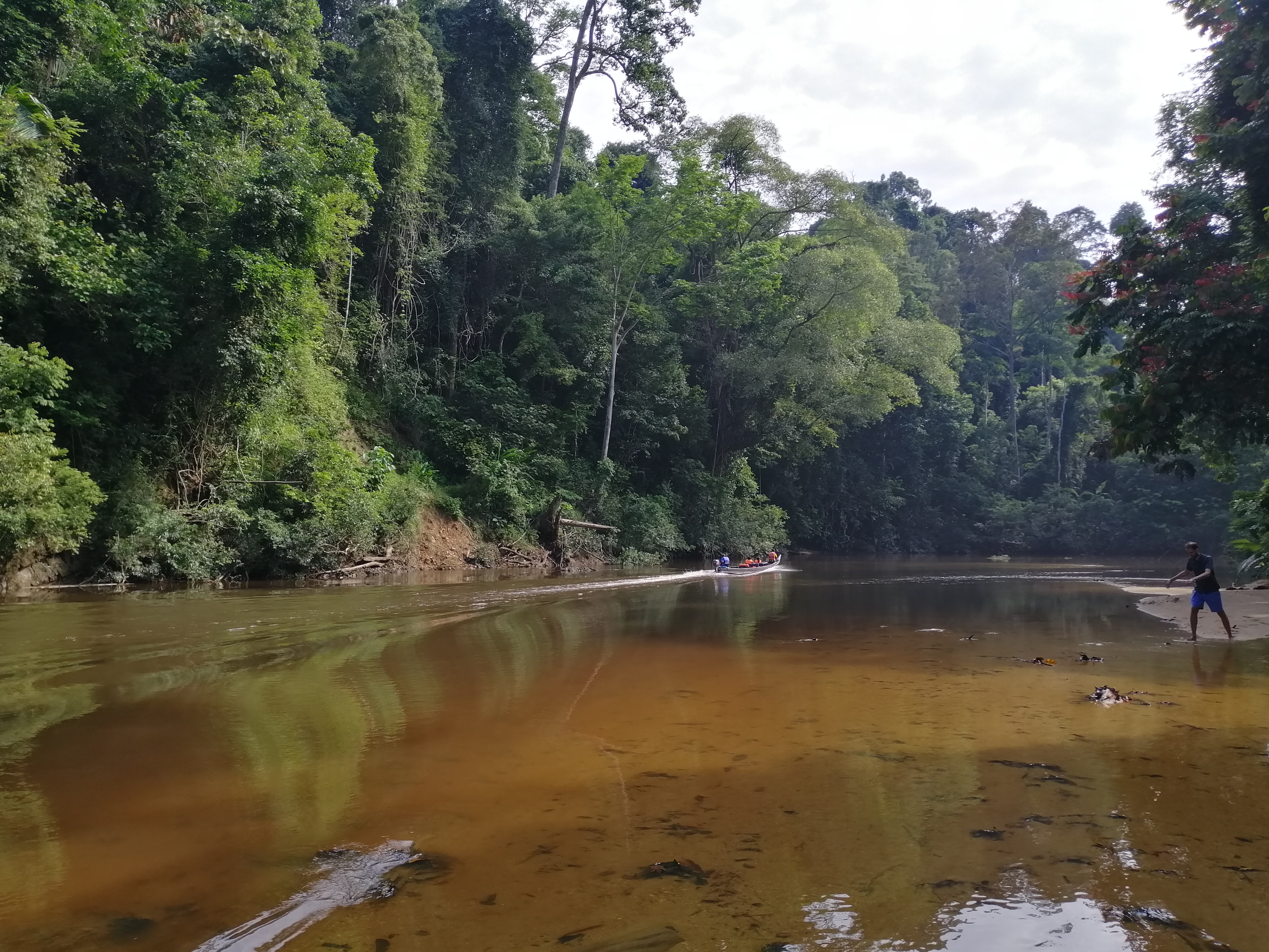
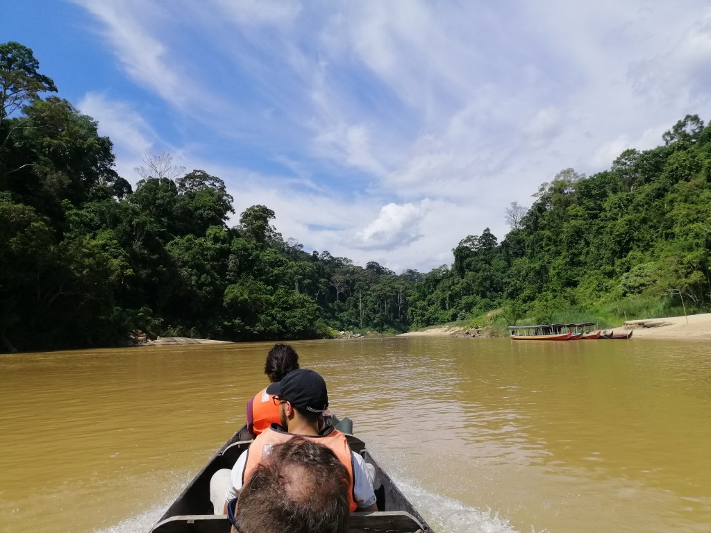
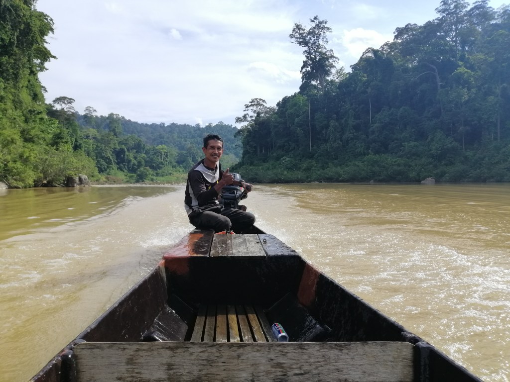
After a typical nasi lemak lunch at Mutiara’s restaurant, I organised a boat trip to Lata Berkoh. It cost RM$240 (4 pax)/boat. I signed up with just me hoping to get a few more. This trip can also be organised through the boatmen at the jetty. Eventually, there were three of us. We departed at 2.30pm. Just a short distance on the swollen and muddy Tembiling River, we travelled upstream into Tahan River.
It was shallow, clearer and much calmer. We immediately entered the dense tropical rain forest. Trees were so dense beyond the shores. Trees hung over the meandering river. In several area, the water flow over rapids were fast. However, our experienced boatmen expertly managed to get through with little incident other than water splashing onto the passengers. The fast ride over a swift river was exhilarating. Sharp manoeuvres were employed to negotiate the rapids on this winding river. Some places were so shallow, the pebbles were churned up.
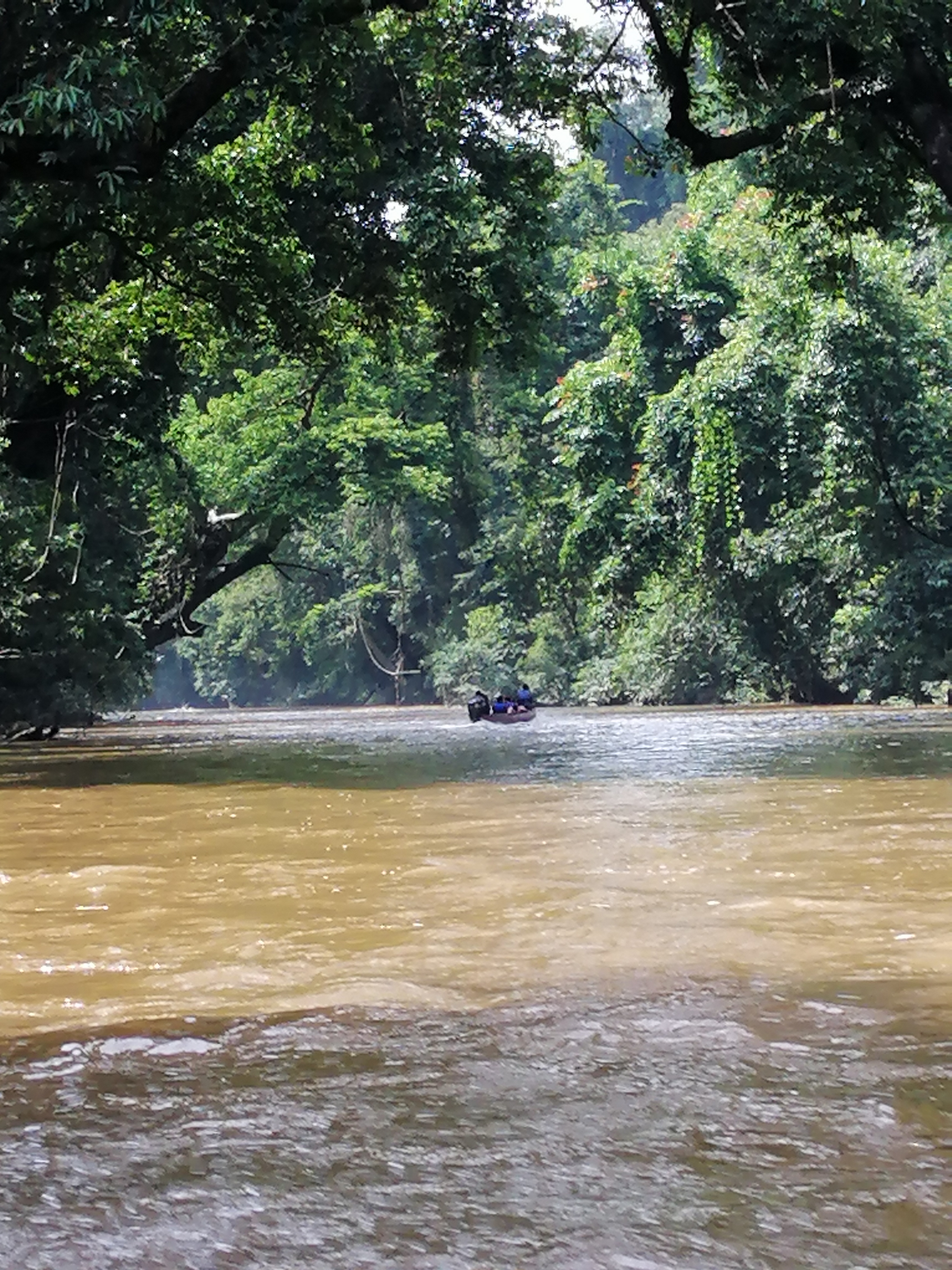
Stopped at a grand old, est 700 yrs, Tualang tree. It is a stunning specimen. There are several around but this one is closest to the river. Its straight trunk is perfectly round supported by a wide buttress root. Next stop, Kelah (type of fish) feeding and watching. With opaque and high water level, only the dives were observed. Back on the river, several manoeuvres over fast flowing rapids gave me an adrenaline rush. Away from the fast flowing waters, tannin – leeching of organic forest materials, gave rust coloured surfaces. The filtered sun gleamed against this tanin rich waters.
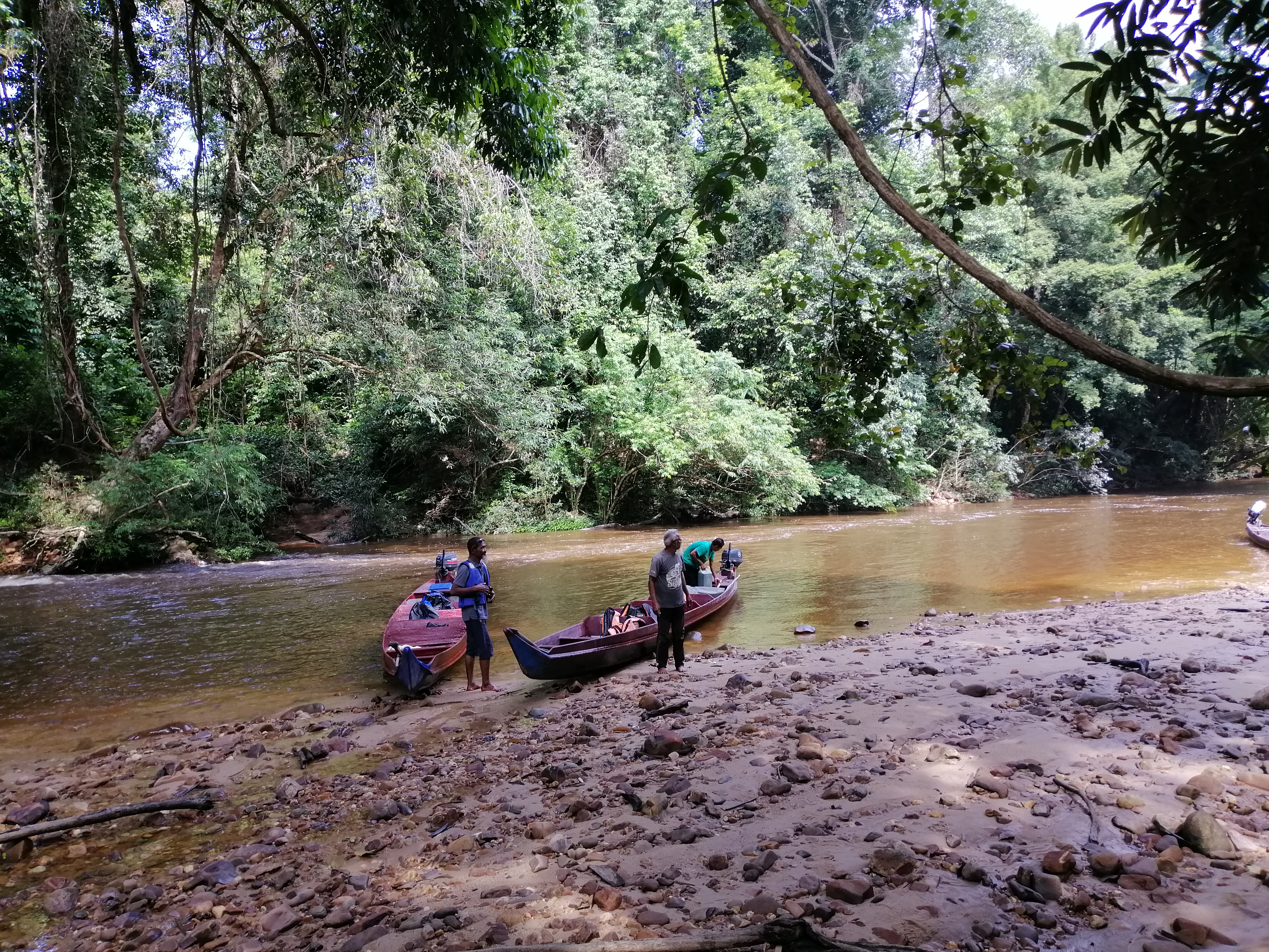
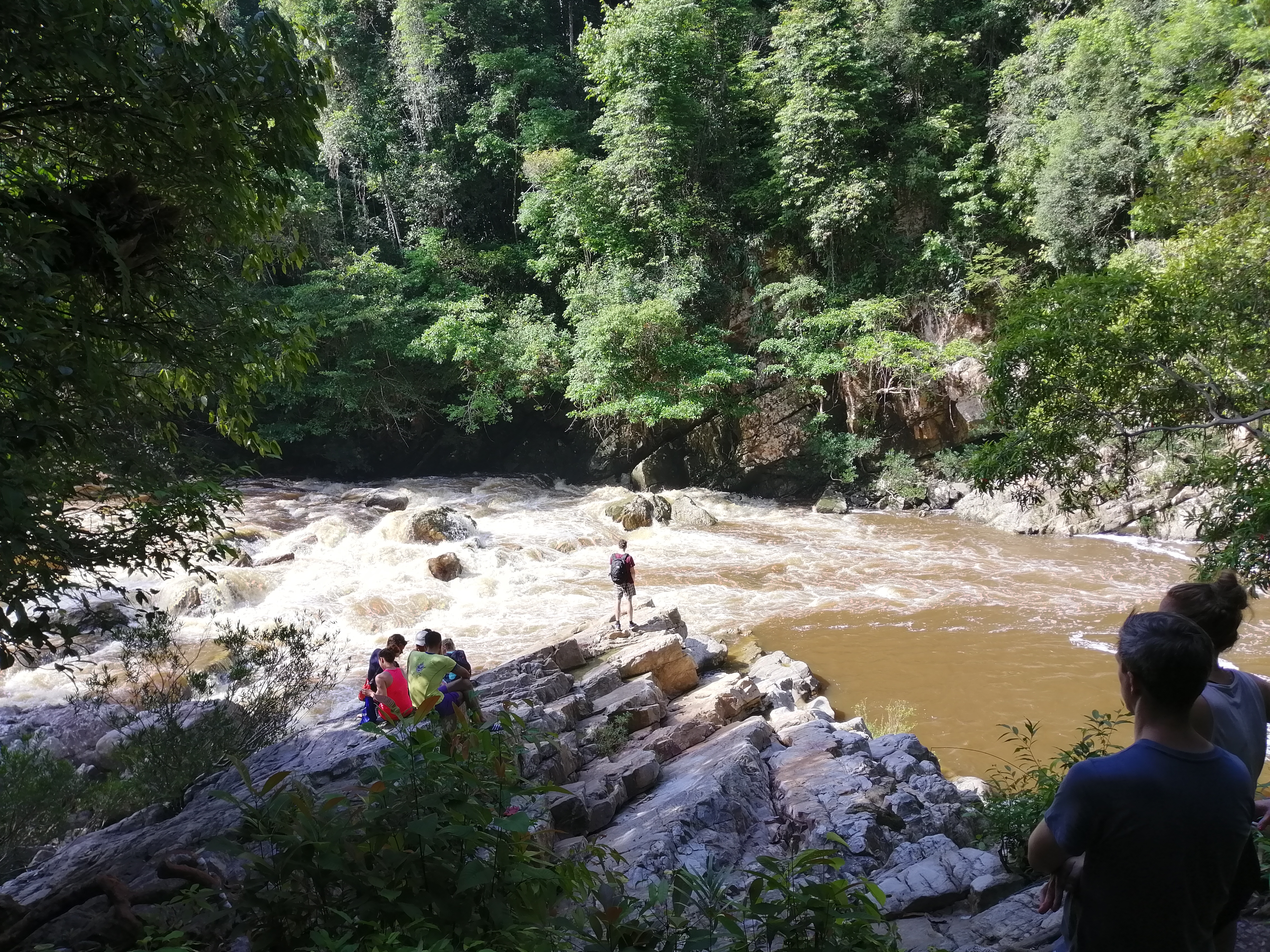
After an hours’ ride, we stopped on a sandy shore. Trees branches hung low over the river with creepers dangling down. As the boatmen anchored the boats, we walked for 30 minutes upriver towards Lata Berkoh.
The roar of the falls was loud as we approached. It was not exactly a waterfall but a violently cascading water over a series of boulders in the river. Nevertheless, it was impressive today with the high water level. Swimming is not recommended. We returned the same way but this time a little easier as we headed downstream. The ride was just as exciting. For me, the highlight was the wild fast boat ride over the rapids surrounded by lush ancient rain-forest. Be prepared to get wet. We returned to the resort around 5pm, just in time for tea.
Watching daily river life
This evening, after coffee and snacks, I headed down to the boat jetty. The sun shined brightly. Locals plied across the river. Mutiara staff giggled as they jumped into a boat to head home. Forest Rangers headed into the jungle to start their shift. It was quite meditative to watch the water churn and flow downstream. Bird songs everywhere.
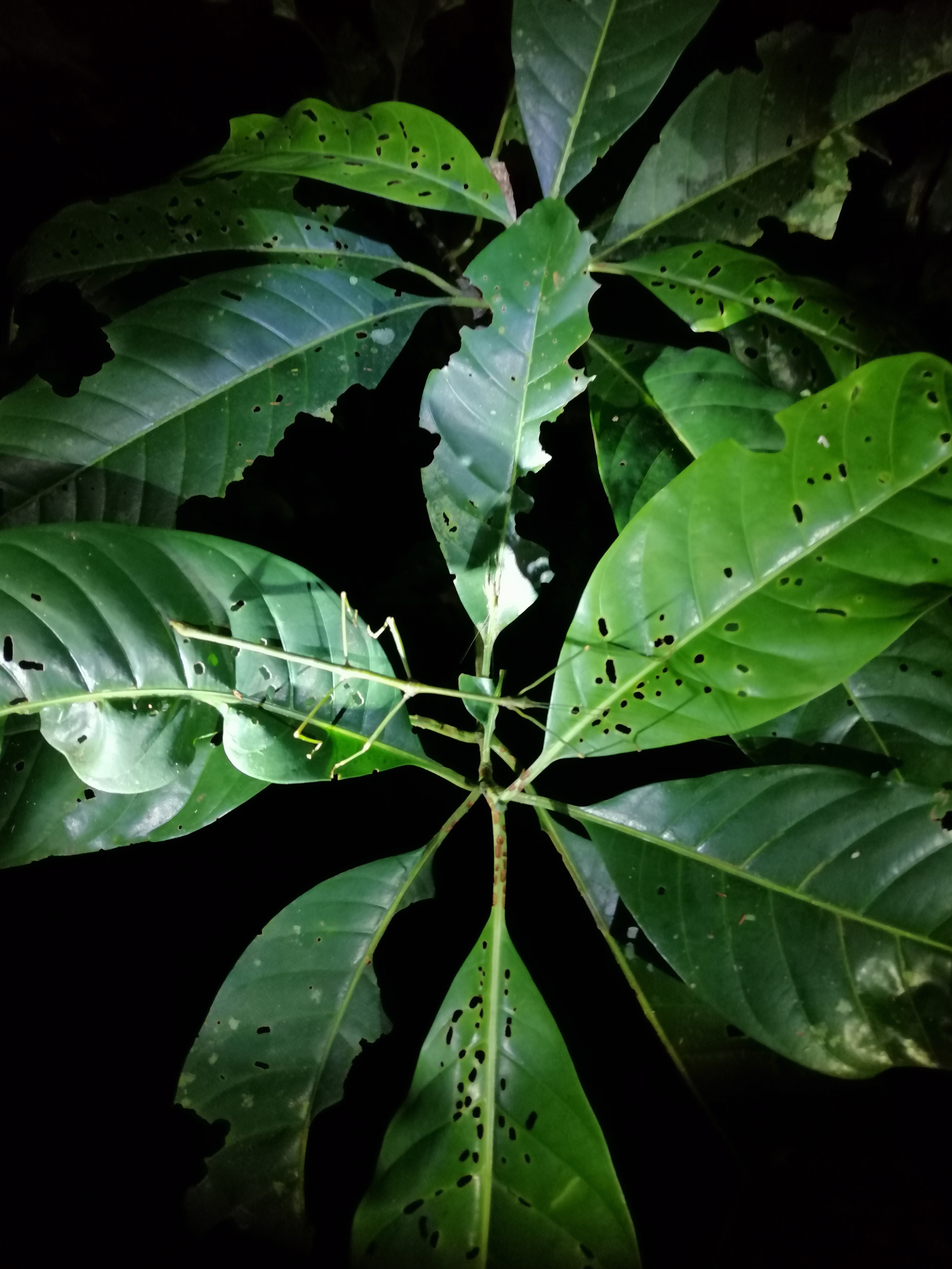
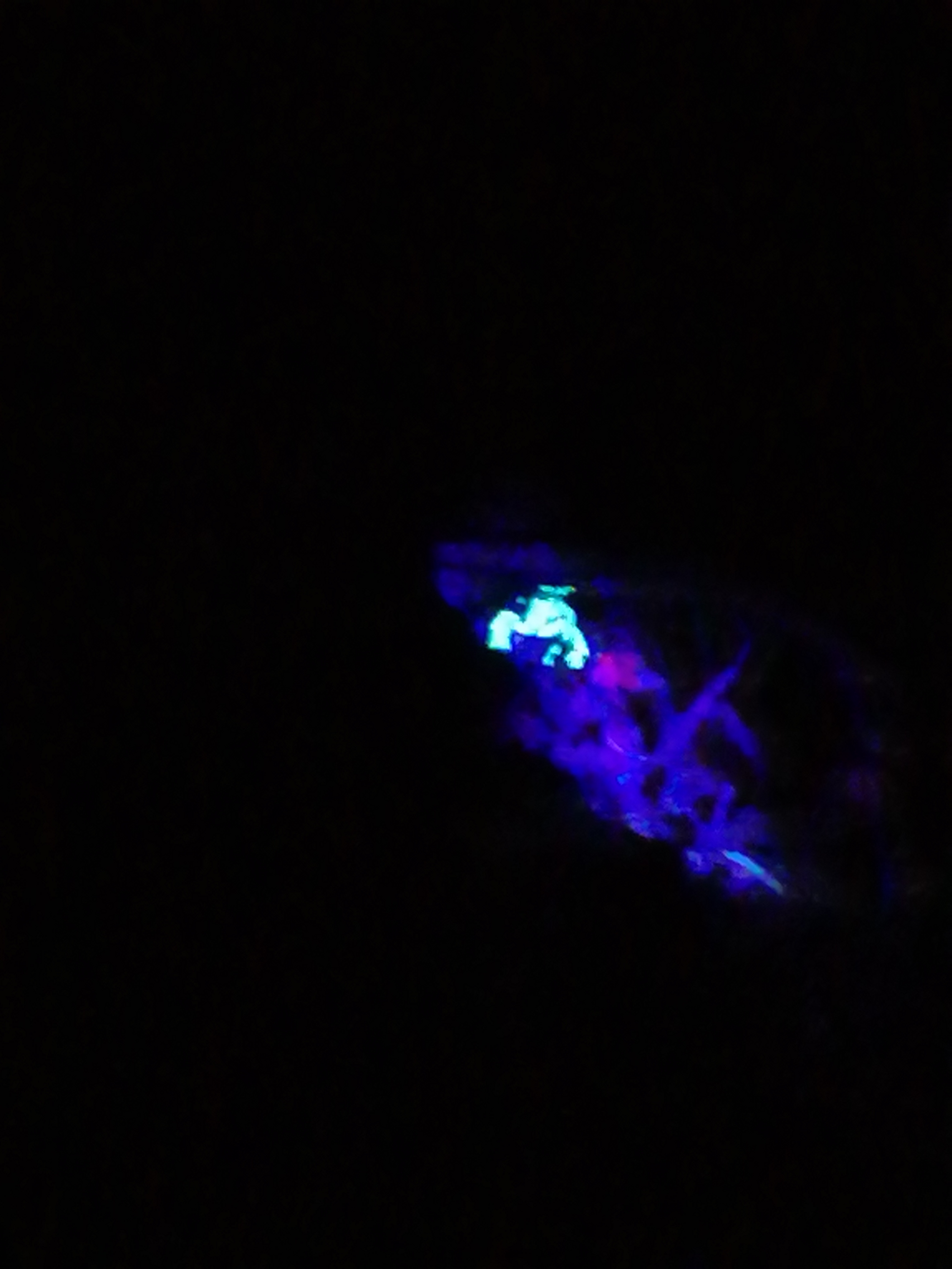
Night Walk
After dinner, I sign up for a Night Walk (RM$45) with Mutiara which started at 9pm. Armed with a binoculars and torchlight, we headed towards Tahan Hide with a local guide. Immediately, we came upon a poisonous spitting cobra wriggling on the boardwalk near our accommodations. We gave it a wide path and moved along. Always be aware when walking at night. As with all wildlife observation, nothing is for certain. Tahan Hide is an observation post looking towards a salt lick and grassy area usually frequented by grazers. Armed with a powerful torch, we managed to spot two deer foraging. The best part of walking in the dark illuminated only by torch light is the anticipation of seeing something. The jungle is noisy. The creatures of the night can be heard but unseen. We managed to see stick insects, spiders, tree dwelling lizards, tarantula and scorpions – under infra red light, was quite interesting to observe its movements. The night walk lasted an hour. Back at my room, I sipped coffee to the concert of jungle, unheard at daytime.
Hike to Tabing Hide
The 3.1km track start from the Park HQ. I did not get any guides as the tracked is well marked. Officially, guides are required? Initially, it is a series of boardwalks through mature jungle. Incidentally, this is also the start of the arduous 53km trail to Peninsula Malaysia’s tallest mountain, Gunung Tahan. In comparison, climbing Mt Kinabalu, the highest in South East Asia is easier! The sounds of the jungle is facinating. In 800m, I reached Lubuk Simpon, a swimming spot on the Tahan River. Hornbill calls, amongst others, can be heard above in the tree canopies. This is a great spot to observe birds. Boats heading to Lata Berkoh zoomed pass on the dark but clear Tahan River.
Back on the track, another trail headed uphill towards Bukit Teresek (a loop). The boardwalk ended and earth track began. This means, lookout for leeches. The diversity of the jungle is amazing. Rattan vines with sharp spikes spiralled up trees. Matured trees with massive buttress roots added texture to the landscape. The sun hardly penetrated through the dense tree canopies. Insects went about the ways recycling dead entities. Decaying elephant dung are visible along the trail. A variety of fungus transformed decaying materials into ‘soil’. The jungle is a fragile.
Fortunately, the ground was drier and thus, less presence of the pesky leeches. In places, the trail was obscured by fallen trees. I continued further up to a small concrete bridge. I finally reached a signage pointed towards the river crossing to access Chegar Anjing Hide. I was running out of time as I had organised going to visit a native village this afternoon. Perhaps, another 10 minutes walk would have brought me to Tabing Hide. Here, overnight stay to observe wildlife is permitted. Reluctantly, I retraced my track back to Mutiara. A solitude walk in a native ancient tropical jungle!
Shooting Rapids and Orang Asli Village
This afternoon, I joined a tour (RM$80) to visit an Orang Asli (native) village and riding over rapids on the Tembeling River. There were a number of people. Two boats appeared at the wharf. I picked the 4 seater ( the other about 8). I loved the passive boat travel. It permits time to observe and absorb the surroundings. The speed is exhilarating. Shortly, we arrived on the banks of asli village. The tribe here were Batek people. Sometimes, it bothered me to visit places like this – am I intruding into their nomadic lifestyle or am I contributing to the demise of the traditional ways. With ‘outsiders visiting daily, I wondered albeit benefiting financially.
The Batek homes on stilts were made from bamboo (floor), tree bark (walls) and thatched palm leaves ( roofs). I met the village head as he was entering the jungles to do some foraging. They are still hunter gatherers. Fruit trees and vegetables were cultivated in the village compound. An exhibition on using a blow pipe and starting fire using just a bamboo and thin rope. The tourists were fascinated especially when it was hands on. I had worked amongst orang asli (Semai) near Simpang Pulai and Tanjong Rambutan in Ipoh and was familiar with their lifestyles. Nevertheless, it is a learning experience. Inside the village head’s house, several ‘gifts’ of clothing and food from Samaritans laid on the bamboo floor. Dark skin and curly hair is dominant. There are a few asli villages dotted along Tembeling River within the park. The other tribe are the Semokberi. All visits are only permitted with an organised tour.
Back on the boat, we proceeded up river on the swollen and fast flowing Tembiling River. Soon, we faced our first rapid. The boat man expertly manoeuvred through it. It was exhilarating. The 8-seater boat with roof was ahead into the next rapid. The surface was rough. Their boat rocked about rolling from one side to another, almost capsizing. Screams can be heard. Water splashed onto our faces as our boat man made his way forward and out. The best part is we do it again on the return river journey. Tip – take the 4 seater open top boat. This tour took about 2. 5 hours. Although I had reservations on the asli village visit, overall it is a wonderful experience.
Other things to do
Trekking through tropical rainforest
the various tracks (see maps). You are in a 130 millions years tropical jungle. You will observe huge buttress roots, spiky rattan vines, all kind of creepy crawlies including leeches, bird songs and if you’re very lucky bigger wildlife – elephants, deer and tapir.
Hiking 53km to Gunung Tahan
This is a tough climb and guides are recommended. Camping is required. Takes between 4 – 7 days, depending on the trail and experience.
Exploring various caves
Near Taman Negara which includes Gua Kepayang Besar, Gua Kepayang Kecil and Gua Telinga. Overnight stays are possible. Organised tours can arranged. However, when I was there, access to these caves were closed by the park for safety reasons.
Bird watching
Birding is quite phenomenon here with over 380 species of birds particularly along Tahan River at Lubok Simpon and towards Lata Berkoh as these places are quite acessable. Outside the park, Hornbill Valley, from Kuala Tahan towards Kampong Pagi (by road) along Tembiling River in the early hours can be rewarding.
Dining by the river
Dining at the various floating restaurants is a wonderful way to engage with the locals, taste local staples like nasi goreng, roti canai, nasi lemak, keow teow or mee goreng and teh tarik with condensed milk.
Camping at observation hides
Some overnight stays at designated hides are permitted. Check at park HQ. This includes Bumbung Tabing, Kumbang, Yong, Blau and Chegar Anjing. Booking are only permitted 1 day before. Some may be closed. Appropriate attire, insect repellent and gear is essential.
Fishing
Fishing along both Tembeling and Tahan Rivers is one of the leisure way to enjoy the park. Boats can be hired to go further into the park. Fishing tour operators can provide gear and transport.
Summary
An amazing and exciting experience filled with thrills of the boat rides through thick overhanging forest and rapids; sitting by the swollen Tembeling River observing the locals plying up and down river; listening to the sounds of creatures of the jungle both day and night and immersed in the thick and lush tropical forest by trekking. The diversity of the flora and fauna is priceless. The anticipation of seeing something in the wild is very tantalising. Perhaps a tiger – no chance! An elephant or tapir – perhaps. Finally, a must do while in Malaysia.
My love for riding trains developed during my childhood days, around 6 years old. My siblings and I lived in Ipoh city with mum and dad worked in the plantations near Kuala Kurau (105 km). We only see him on weekends. However, during school holidays, we travel to see him in the plantation.
Friday, I am all excited anticipating the impending journey. The majestic Ipoh Railway Station, with its stunning Moorish domes and English architecture, is walking distance from home. It is always crowded. Printed razor blade size platform tickets, are required before boarding. There are a multitude of activities amidst steam gushing out from the engine; engineers in oil stained overalls – checking and oiling the iron shafts; station workers hurrying along the platform – unloading and loading assortment of goods; occasional loud clanging of wagons being hooked up; passengers scurrying, with baggage and children in hand, sorting out their carriages and seats.
I loved the seemingly chaotic scene intoxicated with the scent of hot oil and diesel. In the final scenes, looking out from the open window, train conductors waved red and green flags indicating readiness for departure. The station master handed over the track key, an oval shaped ring with a key, to the locomotive engineer before taking his place at the platform. Whistles are blown frantically indicating departure is eminent. The final clearance is given by the station master. Engine horns are sounded several times. A big jolt rumbled through the carriages, numbering over 15, as the brakes are released. Then, the engines roared. Followed by churning of the iron wheels. Slowly but surely our journey began.
Like many other children, I hardly sat on the seat. Instead, put my head out the window with the air brushing through the hair and face. The train passed through towns – stopping regularly, rustic villages, rubber plantations, bridged rivers and dense jungles. The distinct clickty-clack sound of the wheels as they rolled over the gaps on the iron tracks; the gentle sway of the carriages; the haunting sound while passing through tunnels and iron bridges; the dizzying sight of the track while pissing in the toilet and the challenges in crossing from coach to coach over the rather exposed and continuously moving platforms. At each stop, vendors hurried onto the platform and boarded the coaches to sell food and drinks. Buying and selling is brisk and sometimes on the go, with vendors running as the train departed. I loved those moments. All these experiences had etched my love for train travel.
On my return to Ipoh this April 2022, after two years of covid restrictions and quarantine isolation in Malaysia and NZ, I decided to re-live my past experiences of train journeys. There was an urgency as old diesel engines had been replaced with modern electric trains. Plans to electrify all the lines in the country is under rapid construction. The West Coast Line from Singapore via Gemas to Thailand border at Padang Besar is complete. An offshoot track from Bukit Mertajam terminated at Butterworth . Concrete replaced rustic hardwood railway sleepers. Even, the old stations had been replaced or abandoned. Fortunately some, although not in use anymore, are still around. The majestic Ipoh and Kuala Lumpur Stations are both old school iconic heritage buildings. They are irreplaceable. Fortunately, the East Coast Line – from Gemas to Tumpat – sometimes referred as ‘The Jungle Train’, still retained some of its nostalgic past – diesel engine trains with sleeper carriages snaking alongside mountains and a rapidly diminishing jungle. Unfortunately, with modern coaches, windows are sealed for air conditioning. A price to pay for comfort.
Bookings, Types of Trains/Class and Services
All bookings can be done online or stations. Railways in Malaysia is managed by Keretapi Tanah Melayu (KTM). For a alternate train information, please go to full inter city schedule.
There are several types of trains – (1) ETS, electrified double tracked intercity passenger service on the West Coast Line (WCL) operating from Gemas to Butterworth (7 hours)/Padang Besar (about 8.5 hours). Southbound from Gemas, ETS is under construction. However, a train shuttle service is available from Gemas to Johor Bahru/Kempas Baru and onward to Singapore. ETS is the fastest train service in Malaysia. Ticket prices are based on class of trains – Platinum, Gold or Silver (the classes are classified from the number of stops). Executive/Business seats cost more compared to Standard. {Note- effective October 2025, booking now can be made from KL Sentral to Segamat (normal service). This continued to Kluang with limited service}.
(2) KTM Intercity service is hauled by diesel engines with services on the East Coast Line (ECL). The 16.5 hours service is from Johor Bahru Sentral to Tumpat (in both directions) on the Express Rakyat Timuran (ERT 26/27). Sometimes referred to as the Jungle Train. The route passed through the virgin jungles at several places along the main Titiwangsa Range. This has the only sleeper amenity. This service is on a single track. Only at strategic stations, can northbound and southbound trains pass. Therefore, this service is not for those in a hurry. To fully appreciate the ‘Jungle Train‘, find the best connections for daytime journey.
(3) Another service to complement ECL is the DMU, a diesel powered shuttle service currently operating between Gemas to Kuala Lipis and another Kuala Lipis to Tumpat. They use the same single track on the ECL.
1st journey – Ipoh to Segamat
Starting my journey in IpohRailwayStation, I did several journeys northbound and southbound during my stay. Ipoh Station has a majestic architecture – a English colonial building with Moorish domes built in 1917. The second floor housed the now defunct Majestic Hotel. The first segment was to Segamat on the ETS.
Ipoh is where I was born and educated. I highly recommend everyone to explore my hometown – old town that tin built, colonial buildings, delicious street food and old coffee shops, limestone cave temples and easy pace of life.
Not far from Ipoh is old single platform wooden Batu Gajah Station. During my childhood, Mum would bring us here by train to visit our grandfather whom worked in Malayan Tin Dredging Company. Staff were given accommodation. The housing area were surrounded with mining pools. I remembered a bakery nearby. Today, the heydays of tin mining is over. The housing quarters are now privately owned housing. I was pleasantly surprised that the bakery is still operated by the same family! Furthermore, the old station is now a eatery. The building and colours had been retained. Batu Gajah was a colonial (English) administrative town. Remnants of the old colonial buildings are still being continuously used by the local government.
The intriguing Kellie’s Castle is nearby. Today, ex-mining pools are filled with wild water hyacinth and lotus. Along the train journey, sporadic patches of rubber small-holdings had been replaced by large tracts of Oil Palm plantations. However, it was wonderful to see traditional village houses as the train whizzed past.
Next stop is KamparStation, another town that tin built. In my youth, we arrived at Kampar to continue onward west towards Teluk Intan and to Lumut/Pangkor Island. This was before the new highway was built. I remembered the famous chicken curry within a baked bread. Today, cooks gave a new mouth watering name- “golden pillow”.
We passed Tapah Road Station. This used to be the gateway to the cool highlands – Cameron Highlands. The area is intensively cultivated with tea, vegetables and horticulture (fruits and ornamental). However, with greed to cultivate more, surrounding hills and mountains have been cut and developed. Today, it is not as cool as the days I was there. It’s a shame. Still, something different from the lowlands. Some colonial buildings still remain. Another entry point into Cameron Highland is from Simpang Pulai, near Ipoh. The more exciting road journey would be from Gua Musang, across the main Titiwangsa Range, via Lojing Highlands. More about this later.
Past Tapah Road, the desolate ex-mining lands are replaced with large tracks of Palm Oil cultivation and small pockets of forests. The main North-South Titiwangsa Range (form the spine of Peninsula Malaysia) becomes visible. Once past Rawang, the scenery changed to mostly urban and small scale cultivated fields. This continued till the stunning and stylish Kuala Lumpur Station – now relegated to a ‘stop-over’. Before KL Sentral Station, this was the central station. It has lost some shine. Although dated, it still has a wonderful old world charm.
Kuala Lumpur Sentral Station (KL Sentral) is the major transit or connection hub going south. This is the heartbeat of all intercity and city commuter (LRT/MRT) trains. Every time I return to Malaysia and KL Sentral, my ritual is to dine at Le Cucur – to acclimatise my taste buds in local cuisine – Laksa, Curry Mee and an assortment of sweet treats. Not this time though as my journey continued south to Gemas.
From KL to Gemas, the journey passed through more oil palm plantations. Across Negeri Sembilan, Minangkabau houses with corrugated iron roof dot the landscape. Tanpin Station is the stop to continue a road journey to Melaka. At around 1450, past a large depot, our train arrived at the GemasStation. This was my second time here. The first was many years ago with the 1151km West Coast diesel train that plied between Padang Besar (Malaysia-Thailand border) to Woodlands, Singapore. Personally, that period was the golden years of train travel in Malaysia. These days, with sealed windows and doors, we are sanitised from the exterior environment! I missed that experience.
Gemas Station is the only meeting point between the East Coast and West Coast Lines. Hence, its significance. Therefore, purchasing tickets between Ipoh and Johor Bahru on the booking website is currently not possible. The booking should be :- Ipoh – Gemas and another from Gemas – Segamat/Johor Bahru. This will soon change when all the southbound lines are fully electrified for ETS. The electrification upgrade on the West Coast Line is under rapid construction.
The southbound diesel engine train Express 45 to Segamat was waiting on the adjacent platform. Frantic exchange of north and south bound passengers was brief. With whistles, waving of green flag and toot from the blow horn, we pulled out at 1523. The ETS that I arrived departed Gemas to Butterworth at 1520. Printed tickets gets clipped like the old days. It was sobering to see pockets of forest, villages and river crossings. However, the ever expanding palm plantations had claimed most of the land.
My final destination on this journey- Segamat Station was a simple temporary structure. I met up with my long time mates – Chen and Mee Lian. We planned an exciting adventure program (on a separate post – hiking Gunung Datuk and Kolam Puteri, and camping in nature- Endau Rompin National Park). We drove past a massive construction – the new train station. Apart from KL Sentral, this place is huge. Why such an enormous station here baffled me and local residents Chen and Mee Lian too. Time for catch up over white coffee and kaya-butter toast at a kopi-tiam.
My journey to Segamat coincided with a national holiday – Hari Raya (Muslim celebration after Ramadan month of fasting). In town, residents were busy with shopping. Temporary road side stalls sold the popular ‘lemang – glutinous rice wrapped in banana leaves and cooked in bamboo. Kerosene lamps on bamboo poles lit up streets and homes. Festivities are alive in Malaysia. All this amidst COVID. Even the train station became an ‘attraction’ for smartly dressed locals and visitors with families. I discovered this on my departure. In town, I managed to witness an abandoned old railway bridge with the old tracks on hardwood railway sleepers still intact, over a muddy Segamat River. The new and modern electric lines run parallel to it.
On my return journey to Ipoh, I wandered around Gemas town, just across the new station. It still retained its atmospheric old town vibe. I discovered the Gemas Train Museum, the town’s old station. It is in shambles. Gates were locked but I managed to get access through a side fence. Old Gemas Station remained in a dilapidated state with piles of empty alcohol bottles and rubbish. Probably occupied by drug addicts and the homeless. In the arrival lobby, dogs slept on cool cement floor. On the old rusty tracks, deteriorated goods wagons stood in silence, a reminder of a bygone era.
2nd leg – Ipoh to Sg Petani
The northbound West Coast Line terminated in Padang Besar. However, my final destination was to Alor Setar, a place I first worked (for 3.5 years) after graduation – Muda Agriculture Development Authority. Strangely since I left, I had not revisited it again. Can’t explain! Anyway, this time I decided to catch up with some of the few remaining friends/former colleagues. However, at my friend Syed’s request, stopped over at his home in Sg Petani. My journey started in my hometown – Ipoh. Going north of Ipoh by ETS is the most convenient public transport – both to Penang and Thai border. Once out of Ipoh town, limestone hills become prominent. In fact, Ipoh is surrounded by limestone hills. Small rubber holdings and palm cultivations are prevalent between Tasek and Sg Siput. Housing schemes had also extended here. A cement production plant in Tasek is unmissable. The journey is mostly through semi-rural towns and cropping areas. We reached Kuala Kangsar Station.
Kuala Kangsar, on the banks of Perak River is a significant town – in fact a Royal Town where the Sultanate of Perak has residence. You’ll know when gates and road side structures are painted in gold (colour). Some of the interesting sights are the Ubudiah mosque, Royal Museum and the historic Victoria Bridge (built in 1892 -1900). Other interesting sight is cruising on Perak River and sampling local food and culture. This is also the stop for those heading toward the East Coast to Kota Bahru via the Royal Belum Forest/Temenggor Dam/Pulau Banding. Be warned, public transportation is scares. The main mountain range is now closer as we leave Kuala Kangsar and the train begins to climb towards Padang Rengas. The air is significantly cooler and the train tracks are sandwiched between rubber, palm plantations and forest. A tunnel cuts through the mountains to significantly reduce time and cost. Small holding inter-spread with secondary forest. Then descends towards Taiping Station.
Taiping, one of my favourite places is a must stop. It has plenty to offer – a major colonial town with plenty of colonial building and architecture, old markets and food courts, museums and rest houses. There is even a hill station – Maxwell Hill (accommodations were closed at the time of visit). However, the best thing to do is walking up the steep hill early in the morning as the locals do. The lake garden surrounded by ancient rain trees, war memorial cemetery and zoo should keep anyone busy for a few days. A common sight is elderly people sipping and chatting in quaint coffee shops. Taiping is taunted as “town for retirees”.
From Taiping, you can visit Kuala Sepetang by road transport. It is on the coast popular with seafood restaurants and river excursions – watching Kites, Fireflies and fishing villages. Don’t miss the boardwalk through the mangrove forest and visit a charcoal factory.
As the journey progressed north, it passed many small villages and large tracts of palm plantations. However, the train slows down significantly as it crosses a picturesque Bukit Merah Lake and rolled into Parit Buntar Station. This town took me down memory lane (childhood days). It hasn’t changed much. This is where I used to disembark and catch a taxi into Kuala Kurau towards my dad’s workplace. Those were fond memories.
At Bukit Mertajam Station, trains heading north towards Padang Besar (Thailand border) including Sungei Petani separate from those heading towards Butterworth. No exchange of trains is required. However, coming from Padang Basar, exchange is required at Bukit Mertajam. This may change. The scenery changed from plantations to paddy fields interspersed with village houses on stilts and small townships. Irrigation canals and pump stations can be see regularly. Mountains are relegated to the horizons. The land is flat making this one of the rice basket of Malaysia. Eventually, my train drifted into Sungei Petani Station. I cannot recognise this town at all. So many developments had taken place in the last 30 years. Finally to catch up with Syed and other friends.
Sungei Petani was a sleepy town with the main road passing through it. The railway line ran parallel to it. Small scale industries and small rubber holding used to flank the main roads. Development had set in. One of the interesting sight to visit is the Bujang Valley Archeological site (early Hindu Civilization) near Tikam Batu. If you are interested to the less travelled road to Thailand, there is access from here towards Baling and onward to the border.
The following day, we used road transport all the way to Alor Setar. An interesting place to stop is Gurun, with access to Gunung Jerai, a mountain resort and recreational forest. This is probably the only mountain in this rather flat landscape.
Alor Setar Station is now a modern concrete building to accommodate the ETC trains. However, the heritage wooden train station still remained but converted into a eatery. Some of the historic rain trees remained. As expected, the town had grown with several tall buildings including Menara Alor Setar, the old museums including Balai Norbat, Royal Hall, Art Gallery, Dataran Medan Bandar and Zahir Mosque. A drive to Kuala Kedah is an interesting escape out of town. I wondered if the Teluk Chengai Laksa (my old office headquarters) was still available? My favourite during my life here back in the early 80’s. One of my happy times is during Ramadan fasting month where a myriad of food and local delicacies are on sale in front of the UMNO building, opposite Pekan Rabu. My time spent here was too short to re-visit past experiences.
3rd leg – Alor Setar to Butterworth
From Alor Setar Station, the northbound ETS (and Komuter) trains terminated at Padang Besar Station on the Thai Border. I did not travel this route. Going from my past experiences, it a frontier town. Both locals and Thais can be seen trading all sorts of goods in both directions. To continue onward into Thailand – Hat Yai and Bangkok, one must cross the border and continue in a Thai train. In the past, I had taken the wonderful express train from Butterworth to Bangkok. Sadly, it is no longer in service perhaps due to covid restrictions. The nostalgic but expensive Orient Express from Singapore to Bangkok is also currently suspended.
From Alor Setar, I took the ETS to Butterworth Station (via Bukit Mertajam) and onward to Penang (Swettenham Pier), another one of my favourite places, by ferry. I made an error in booking as there is a Komuter train from Padang Besar to Butterworth. Staying in Georgetown is ideal to explore this island. Public transport is efficient. Historic buildings, old clan houses on the jetty, revived old town oozing with charm, historic homes converted into budget and boutique accommodations, cultural overload and glorious street food. Oh yes, and the beaches. Penang has it all.
Malaysia’s Jungle Train
Please read my nostalgic journey on the conventional train journey on Malaysia’s Jungle Train – the East Coast Railway Line (ECRL) in the next post.
Student trains on the Jungle Train Line
While travelling on the ECRL, I heard about a student shuttle that departs Tumpat/Tanah Merah and arrive at Dabong to begin school. After school, another shuttle goes northwards to Tumpat. Similarly, although lesser, student south of Dabong have a similar arrangement. It may be a long day for these students but may be the best option available. Road transport takes longer and parents may not have time to drive. It is a very novel way for these dedicated students to get an education. Many student board the trains at several Railway Halts (just a shed) that lines the ECRL. Something to applaud the railway operators.
Liverpool Hut Track is located 52 km from Wanaka, of which the last 30km is on gravel road, in the West Matukituki Valley, Mt Aispiring National Park. It takes between 1 to 1.5 hours with several rocky streams to ford. A high clearance vehicle is preferred. Booking is required for the 12 bunk hut and purchased online at DoC. This track is rated as advanced and for experienced hikers. The last 1.5km is very steep. Avalanches, wet weather and mist are potential hazards.
This track is open all year round. During the winter months, this track is doable for the well equipped and experienced. The last 1.5km is challenging even in summer. Let alone is winter! Furthermore, days are also shorter. Bookings are not required in the off season (May – November) but Hut passes are required. Can be obtained at DoC office in Wanaka. As usual, report to DoC before embarking on the track. Carrying a beacon is recommended, if hiking alone.
Day 1
After leaving Mt Cook National Park, partially (discontinued as crampons and ice axe were required due to snow and ice) completing Mueller Track, we arrived at Wanaka. We had originally planned to stay a night at Aspiring Hut but was closed for renovation. With a couple of days rest, we left Wanaka at 7am and arrived road’s end at Raspberry Car Park at 0800. There were already a few cars here. Some seemed like they camped here. Travelling in a group of varying age, fitness and tramping experience is always a challenge. I find myself in that situation again. I planned to go solo. Therefore, responsible for myself.
After slapping on sunblock and sandfly repellent, we started the track at 0830 along the fast flowing bluish braided Matukituki River West through Matukituki Valley, with craggy mountains on either side. The track is basically a walking acess through high country farmland – Mt Aispiring Station. It was lambing season with sheep and lambs everywhere. Within 30 minutes, we reached a suspension bridge over Mutukituki River. This 2hr easy track lead towards wonderful hanging Rob Roy Glacier. I hiked here in March this year. Liverpool Hut is 16km (5-7hrs) away.
The views across the glacial carved valley, snow peaked mountains and hanging glaciers were stunning. Low morning mist partially obscured the mountains. Mt Aispiring loomed at the end of the valley. It seemed distant. Somewhere amongst these mountains is Liverpool Hut. This track is also the access to French Ridge Hut and Upper Matukituki Valley.
Reached Aispiring Hut at 1130. It was closed with renovation in full swing. Planned to open in mid-January 2023. Looks like a lodge than a hut. Lunch on the deck of the wardens residence. It was a relief to get out of the scorching sun. From here, there is acess track to Cascade Saddle and Dart Hut. These tracks are classed as advanced due to steep terrain and prone to avalanches.
Just after Aispiring Hut, we met the warden for Liverpool and French Ridge huts. She estimated we should reach the hut by 4pm. In my mind, probably 5pm. Starting early benefited us with a long day. The relatively flat track has a gradual acent.
Within 10 minutes of leaving Aispiring Hut, we entered a humid beech forest. Shortly, the track entered the forest and crossed Cascade Creek via a suspension bridge. Then into the open valley and yet into another forested section and into Shovel Flats around 1230. Back into the sunny shrinking valley. The forested mountains closed in. Reached Pearl Flats at 1300. The gradual elevation gain from the car park to Pearl Flats is 400m. It was a long walk (15km) along the glacial meltwaters of Matukituki River West crossing several streams that criss-crossed the track. Waterfalls of various intensity are constant along the steep mountain sides. All draining into Matukituki River. The sky was blue, no wind and the sun was scorching. The sound of the moving water was constant.
A DoC signage pointed to three directions – French Ridge Hut, Upper Matukituki Valley and Liverpool Hut. We crossed Liverpool Stream over a bridge and refilled our water bottles. For safety, we stayed close as well as hired a beacon from Doc.
Left at 1330 and after a steep climb aided by beech tree roots and rocks, we heaved up towards Liverpool Hut(1065m). The hike is transformed into a climb. Its always going up a steep incline up to 700m. Looking through the forest and into the Matukituki Valley below, we quickly realised how high we’ve climbed in a short time. There are several nervous moments to negotiate. Just focused on the climb than looking down the steep drop-offs. Eventually, we emerged out of the tree line. The views of the glacial carved Mutukituki Valley with the bluish river snaking out of the valley was stuning. Several glacial covered mountains emerged. This is an exposed area with rocks and tussock grasses. Through the native shrubs and flax plants, I spotted the precariously placed red roofed toilet. It was a great relief. Soon the red roofed hut itself came into view. In the background, Mt Liverpool (2482m) . Across the glaciated valley – Mt Aispiring (3083m) .
Another precarious steep walk across a series of flat shingle with steep drop offs. I was advised by DoC, to take it slow here as the width in only a metre wide. It can be slippery when wet. Slowly, clinging onto tussock grasses and small steps, we reached the top. You might be tempted to cut across to the hut. Don’t! Follow the markers which took us higher. At 4pm we reached the highest point 1110m before descending towards the hut at the base of Mt Braff (2252m). Blue sky, scorching day and hardly any wind. In the south, Matukituki Valley winds out of the mountains. Elsewhere, we were surrounded by formidable mountains and glistening hanging glaciers. What an awsome sight. We crossed a small stream before reaching the hut. There was only 4 of us here today. Perhaps, more might arrive later. It had taken us just over 2 hours to climb this 1.5 km steep and sometimes treacherous climb. The consolation is most of the hard climb is under the beech forest canopy.
I collasped onto the deck and was transfixed on the stuning views – glistening glaciated mountains, hardy golden tussock grasses and alpine vegetation, and thin blue lines of Mutukituki River meandering out of the valley. We have walked about 16km. Boots off, sand fly spray on and just reminisced our arduous climb for the last 2 hours. At the forefront was, how are going to do this on our return the following day. I would lying if I said I wasn’t concerned. Anyway, we’ll deal with tomorrow.
Across the valley, lay Mts Aispiring and French. The sun’s reflection from the glass window of French Ridge Hut (1480m) blinded me. Having just reached here, my thought drifted – French Ridge Hut might be next. My hiking mates dared not even to contemplate. In March, I climbed to Brewester Hut and to Lake Crusible in the Gilispie Circiut. They were tough climb but nowhere near ‘dangerous’. To date, the most nerve wrecking (not to dispair – only in three short sections) hike I’ve done in NZ. The worst life threatening must be the final verticle rock climb on the Butterfly Valley to Faralya hike in Turkey. It rained just 5 minutes after we climbed over the edge. My wife and I wouldn’t be able to acend or descend on the slippery smooth rocks. Furthermore, no one knows of our whereabouts! I still get goosebumps thinking about it today.
The hut warden did inform us that there is no water as the pipe is broken. So we headed down to the little stream we crossed earlier. After a hot cup of soup and snacks, I was ready to explore this mountain top. The blazing sun began to drop behind Mt Liverpool. A little path lead up through the bush onto a clearing. Now, this came with expensive views. There was not even a breeze. The only sound heard was falling water. Suddenly, a loud bang, an avalanche somewhere on Mt Aispiring. It was out of view. Avalanches are common here. It was worth the walk many times over. All I could do is sit and be awed by the beauty and solitude of the mountains. I knew it was time to head back to the hut as the mountain shadows crept in. There were several little used path on the hill top. Perhaps, one of these might lead towards a distant summit of Mt Aispiring. Distinct Kea (alpine parrots) calls resonated across the valley.
We now realised that there were only 4 of us today. This 10- bed Liverpool Hut is cozy – sleeping, cooking and dining are all in one space. We all quickly settled into our routine – cooking, dining and preparing for the night. Unexpectedly, it was a warm night. Having dinner on the deck with twilight creeping in and the sky lit up by numerous stars was quite etheral. The sun set sometime ago but the light lingered on until 2130. A kea came calling. I immediately surveyed any items left outside the hut. These Keas are very inquisitive and might just carry anything away. Nothing to do but bewilded by the stars, galaxies and man-made satellites. Later that night, my mates watched 29 starlink setellites pass.
Day 2
It turned out to be a very warm night. Perhaps the insulation in the hut was great. I usually don’t get good sleep in huts and this, although only four of us, was no different. A kea caused a raucous on the roof, probably around 5am. That woke me up. Another glorious sunny day was emerging. The peaks of Mt Braff and Aispiring reflected strongly in the bright morning sun. The air was still but pleasantly chilly. After breakfast and the usual tidy up, we left the hut around 9am. As the organiser of the hike, I took the lead and the ‘difficult’ sections of the stone slabs was first. It seemed easier going down. Sometimes on our bums. Eventually, we descended the same way as we arrived here – hanging on dearly to the tree roots and rocks. Our decent was slower. I was focused in every step and root to hold. In many places, it was easier turning around and climbing down.
Without realising, I could hear waterfall crashing over boulders. Through the trees, I could make out the grassy flat valley below. We decided to have some lunch under the tree canopy and away from the dreaded sandflies in the valley. We met two men planning to get to Mt Aspiring summit by day’s end. They waited patiently for us to pass as it is generally a one-way track. I admired their humbleness. The weather is expected to turn into rain the following day. Hence, their reason to attempt today. I would not be coming up here if rain was expected. Could be quite a treacherous hike. Finally, at 1230 we reached the suspension bridge over Liverpool Stream on the valley floor. It was easier than I had anticipated. Even, the two other ‘dangerous’ sections were a non-event. It was a relief nevertheless. Now, perhaps, dared to consider French Ridge Hut next!
Now, it was a long hard slog back to Raspberry Creek Carpark under a scorching sun. Fortunately it was a gradual decline. We immediately refilled our water bottles in the streams. The waterfall along the way looked inviting. However, we carried on down the familiar valley. Now, turning back, I was able to spot Liverpool Hut. The many streams we forded yesterday seem to have higher volumes of water. We arrived at Aispiring Hut at 2pm. After a short rest, we continued out of the valley. A cool breeze helped a little. It was a relief to spot the suspension bridge leading towards Rob Roy Glacier. We finally reached the car park at 4pm. I was quite dehydrated.
Summary
Liverpool Hut Track is a fantastic 2 days track but certainly not suggested for inexperienced hikers. The images don’t really show the difficulty, especially the steepness of the climb. Fitness is valuable as with familiarity with avalanche and river crossings. I would highly recommend this track to those seeking isolation, a challenging 1.5km climb in a stunning location surrounded by hanging glaciers.
I wanted to experience one of South East Asia’s classic train journeys – the last remaining conventional diesel engine trains before they are all electrified – the Ekspres Rakyat Timuran on the The East Coast Line (ECL). Sometimes referred at the ‘Jungle Railway’. Built by indentured Tamil laborer between 1910 and 1931, the 530km track was built through difficult terrain, rivers, wet tropical weather and mountains. It was originally known as “Golden Blowpipe”. The builders followed the most convenient way – followed the lowest points – the river. The single track passed through plantations, village houses on stilts surrounded by tall coconut palms and mango trees; crossed a network of muddy streams and rivers over historic bridges and tunnels; and tracts of lush jungle. There is only one service on this single track, east and south bound, between Johor Bahru (near Singapore) to Tumpat (near the Thailand border). This is also the only service with sleeper amenity (ERT26/ERT27) offered by KTM. To fully appreciate this service, I did this journey in parts. Partly, to enjoy the ride in daytime as well as seeing interesting places. More importantly, to see the jungle as it is diminishing at a alarming rate to Palm Oil cultivation. I want to re-live the nostalgic journey of its hey days.
My train journey on the East Coast Line (ECL) began in Gemas. However, I would do it in 3 legs. First from Gemas to Jerantut. Second from Kuala Lipis to Gua Musang. Finally, on the iconic long distance conventional diesel locomotive with sleeper carriages (day and night) facility from Gua Musang to Tumpat.
1st leg – Gemas to Jerantut
For my 1st leg, I returned to Gemas for an onward journey to Jerantut. The reason is to visit Taman Negara (National Park) located in Kuala Tahan. I boarded the DMU Shuttle 36 at 1535. To take the conventional diesel express Express Rakyat Timuran (ERT26), I needed to depart at 0118! This is the first time I had taken the East Coast Line (ECL). Besides that, this was my first visit to the National Park (Taman Negara). The DMU Shuttle is primarily providing transport service to interior smaller towns where road access is limited. Thus included plantations and villages. The cafeteria on this train today had no service. Gemas is also the junction where the East Coast and West Coast Railway Lines meet. As such, has a large depot for maintenance.
Departing Gemas, the coaches were almost empty. Only 3 passengers in my coach. Train speed was between 35-55kph through mix of rubber and large oil palm cultivation, and across small rustic townships. In the villages, under rambutan trees, kids chatted while lying in hammocks. Passed a couple of palm processing factories and labour quarters. Stands of rubber trees with tapping panels on the trunk and black collection cups line the part of the track. Horns were sounded occasionally as the track passed close of inhabited but rural areas. This ride truly gave an insight into rural life.
However, at next stop in BahauStation, the crowds began to fill. Many were locals visiting friends and relatives during the Raya season. Malay women in head scarfs from Mentakab returned after holidaying in Bahau. The festivity mood spread around the coach. Stops were frequent, as its a peoples train. We passed market stalls and villages mosques. Train slowed down in places as cattle crossed the tracks. Several road crossings are passed with road traffic brought to a halt. Not long after, the track passed through large oil palm plantations and processing factories.
A brief stop at Kemayan Station and within minutes at Triang Station where, mostly Chinese passengers with shorts and t-shirts boarded the shuttle. MentakabStation is a significant stop for those intending to travel to Kuantan (via the East Coast Expressway), the capital of Pahang, on the coast. It is also the exit point to Kuala Gadah Elephant Sanctuary (on the fringe of Krau Wildlife Reserve). To get there, take Highway 2 to Lanchang and then follow route 236 to the sanctuary.
The station master had a train token around his hand. The train token (railway signalling) is a ‘key’ to allow the train engineer to pass from one section to another. At the end of each section, the engineer must surrender the token to the station master and collect the next token for an onward journey. This is particularly used in single track lines to ensure safety. No trains are allowed to pass without these tokens. They are exchanged at strategic stations along the route.
Kuala Krau Station is picturesque as the sun dipped below the surrounding distant mountains. However, beware, mind your step means just that, as the platform is much lower. The journey get interesting as we passed Sg Krau and views of muddy Pahang River. As we passed through a large scale FELDA palm plantation, the train made a brief stop. Jenderak Station is nothing more than a shed. Trucks and motorbikes rushed towards the train to collect the passengers as well a groups sending off families and friends. This train is literally the only public transport for many on this line. There are no buses or taxis at these remote stops. Dusk rolled in q.
The journey crossed several tributaries of Pahang River and hills. We finally rolled into Jerantut Station at 1910. It was quiet and only a handful of passengers disembarked. I noticed that the station master had a token in his hand, destined for a train heading up to Wakaf Bahru . My SH36 DMU train however continued to Kuala Lipis and return to Gemas. From the station, it is a short walk to my accommodation in town, Jerantut Hill Hotel. Due to covid, many businesses were shut including eateries. Tomorrow, I’ll leave for Kuala Tahan to explore Taman Negara (National Park).
2nd leg – Kuala Lipis – Gua Musang
On my 2nd leg, my plan after visiting Taman Negara was to find transport from Kuala Tahan to Jerantut and bus to Kuala Lipis to catch the 1645 DMU Shuttle (SH60) to Gua Musang(1818). However, I managed to hitch hike from Taman Negara to initially Kuala Lipis. The foreigners were heading to Cameron Highlands. After confirmation from the polis, the road through Sg Koyan was closed. Recent heavy rains had damaged the road causing landslides and flooding. Therefore, without any option, we continued all the way to Gua Musang by road. This option meant I had more time to explore in Gua Musang. Unfortunately, there is no train journey account. The train route from Kuala Lipis to Gua Musang followed the main roads mostly through oil palm plantations. Occasionally, patches of forest appeared. Both the road and the ECL skirt the Western boundaries of Taman Negara. A new dual carriage highway was under construction in Pahang. Strangely, it abruptly ended at the Kelantan border. Perhaps local politics at work. (Kelantan is ruled by a government opposition party). The drive was uninteresting – just hectares and hectares of oil palm plantations on relatively flat terrain. I arrived at Gua Musang around 3pm.
Kual Lipis itself, the former capital of Pahang has some interesting sights. It is located at the confluence of Jelai and Lipis Rivers which eventually drains into the mighty Pahang River. It old train station, proximity to Kenong Rimba Park and old town vibe deserves a day or two.
Gua Musang is an interesting place, in the middle of no where. In my youth, this was the place to go. So remote in the middle of the dense jungles. Back then, only logging tracks from Lojing Highlands (and Cameron Highlands) head towards Gua Musang. The ECL was the only link to the outside world. Today, there is road access to both Lojing ang Cameron Highlands. Read here about my stay in Gua Musang.
3rd leg – Gua Musang to Tumpat
This early morning I was quite excited as I headed towards the new Gua Musang train station for my 3rd leg. Thick mist descended over the many limestone hill that surround this lovely town. The street lights were on at 7am. Just before the station, a mak cik was setting up the warong (roadside stall). After a tasty homemade nasi lemak and hot condensed milk coffee, I made my way to the station. My Jungle Train – Express 26 (northbound) that departed Kempas Baru, Johor last night (2044) is expected to arrive here at 0740. Bukit Gua Musang formed a dramatic backdrop for the station. Breakfast was available at the station too. I packed some snacks for the journey. A red locomotive approached the station right on cue. Finally, the reality of taking the conventional train on the ECL from Gua Musang to its terminus at Tumpat became a reality.
Types of seats and coaches
On this ERT26, T6 – 8 are sleeper carriages, ADNS (Air-conditioned Day/Night Second – bunk style (upper and lower berths). Each coach has 60 berths. This sleeping berths are popular and therefore, early booking is essential. There is also a buffet coach on board. The rest of the coaches T2 – 3 are sitting class – ASC (Air-Conditioned Second Class) with a 2×2 and T1 is AFC (Air-conditioned First/Business Class) with a 2×1 configurations.
My booking was ASC with only a handful of passengers. With flag signals from the Station Master, we rolled on. The beautiful sound of the wheels rolling over the iron track and gentle sway of the carriages brought me back to childhood holidays. Only ‘negative’ were the sealed glass windows. The train whizzed pass the old picturesque wooden Gua Musang Station and the surrounding limestone hills. An Indian lady from Johor Bahru made this journey to Kuala Krai for a wedding. I ventured into the last coach T1, the AFC. It was tidy. I asked the conductor there if I could be here. ‘Help yourself, its almost empty! The end of that coach has a glass window to the outside world.
Almost immediately, we passed forests, mixed-cropping and rural scenery. The train crossed a few iron bridges and sometimes almost brushed past tall grasses. Between coaches, the doors are not automatically locked. I described about my childhood experiences with open doors and windows to the conductor. To my surprise, he opened the door. The smells of the pristine jungle and the dense and cool morning mist was heavenly. I held the door handle tightly in one hand. The cool wind brushed against my face. The track came close and followed Galas River for several kilometers until Limau Kasturi Station. It then turns and travelled west. Soon, we passed Bertam Baru Station and crossed Clementi Bridge over a muddy Betis River, a tributary of Galas River. Between dense jungles, locals cultivated cash crops like bananas and vegetables along the tracks.
Just past 0900, we crossed Kemubu Bridge over tea coloured Galas River with a backdrop of majestic limestone hills. Pedestrians and bikes use the attached lane to cross. We soon zoomed past Kemubu Station. At 0935, we reached Dabong Station. Many people, mostly with backpacks, disembarked here. Dabong is a learning center where the ‘school train‘ brings students. Otherwise, a longer journey by road. Besides that, it is popular with hiking and cave exploration. Particularly, climbing Gunung Stong. With limited time, my journey continued north.
Now, following Galas River again, the track continued towards Kuala Gris Station. From here-on, the track through dense jungles veered away from Sg Galas and turned south. To facilitate the journey, engineers constructed eight tunnels and viaducts. These construction were made by the British when they occupied Malaya. These were exciting times especially on a cloudy and misty day like today. The air is crisp. Almost taste the freshness of the jungle air as the train swayed slowly from one tunnel to another inter-spread with historic viaducts that seem to float in the air. Sometimes with rivers below. As the ECL is a single track, our EP26 stopped at Bukit Abu Station to allow the DMU train to pass. It is always interesting to witness other trains pass.
The track soon made a big U, over a mountainous and densely forested section, on a south-east direction and moved north towardsManek Urai Station. The jungle became distant as palm cultivation became prominent. The course now followed Lebir River until Kuala Krai Station. Kuala Krai lies on the confluence of Galas and Lebir Rivers. From here-on, the combined rivers becomes the mighty Kelantan River which drained into South China Sea at Kota Baru. This stretch gave the Jungle Train it’s namesake.
Kuala Krai Station is substantial. Perhaps an exchange station as it had several tracks. An abandoned burnt mail train engine was parked with several wagons. Near Kusial, we crossed one of the historic bridges – Guillemard Bridge over Kelantan River. The sound, jungle scenery and the river brought back wonderful memories of my childhood train experiences. It was nostalgic. This 600m single track railway truss bridge is one of the of the oldest in Malaysia. It’s historic as it was built by the British. Astonishingly, after nearly a hundred years (completed in 1924), its still not only standing but functional. A technological marvel to appreciate.
Soon after we rolled into Tanah Merah Station. Many Malay families disembarked here. returning home after the raya celebration. This is also the access to Kuala Terengganu including Perhentian Islands. The scenery became more urban as the jungle retreated into the background. We passed a couple of road crossing before reaching Pasir Mas Station. From here, there is access to Sg Golok Station via Rantau Panjang and onward into Thailand by train. From here-on, it was flat terrain with various agriculture cultivation including paddy. At Wakaf BaruStation, probably the last station, almost all passengers disembarked. Local transport was available as this station is the access to Kota Baru. However, I decided to travel further to the end terminal.
The scenery was just hectares of paddy cultivation and small villages. Buffalos grazed lazily in the hot afternoon. The train journey slowed as it approached another road crossing before rolling into the terminus station – Tumpat Station, at 1257. We were just 3 minutes slower than the scheduled time. Fantastic for a schedule that started the day before at 2044 in Kempas Baru. A journey of about 16 hours. A handful of passenger and mostly the crew assembled on the platform. Construction work on the station was still ongoing. Activities were frantic – the sleeper bed linen were removed and heaped into bundles; the cafeteria was emptied and restocked and the engineers and conductors long day was done. A distant marker indicated 527.75km. The was nothing dramatic about this place. Only at Tumpat does the ECL actually meets the coast. Within 10 minutes, the work horse engine was detached and moved towards the terminus – the end of the line. A worker manually diverted the track to allow the engine into the adjacent track. At 1310, the engine is hooked up to the carriages at the tail end and dragged away. Next departure on the ERT27 to Kempas Baru (Southbound) is at 2030 tonight.
Summary and tips
The East Coast Line lived up to its name as the ‘Jungle Train’. An opportunity to encounter rural life. The other sections encountered rural life and passively travelled through interior towns normally not witnessed if travelled by road.
(1) The section between Gua Musang and Kuala Krai is the best ‘jungle’ experience – jungles, historic floating bridges (viaducts), village scenery, haunting tunnels, spectacular limestone hills and networks of ‘teh-tarik’ colored rivers. (2)To experience the jungle ride, the ERT26 (eastbound) offered daytime experience. (3) I suggest doing the journey in several legs including stops in Gemas (old town) , Jerantut (to Taman Negara), Kuala Lipis (historic/old town), Gua Musang (cave exploration/old town railway station) and Dabong (mountain/cave exploration). This offered off the main highway, truly Malaysian town/village experiences. It is certainly a fascinating journey worth doing.
I am not sure whether plans to electrify the ECL or the disappearance of the jungle will come first. To experience the jungle is to be exposed to the exterior by way of open windows and doors. However, with modernisation, coaches are air conditioned. Therefore, sealed windows. Almost sanitised from the exterior environment. Another important aspect of conventional train travel, in a single line like the ECL, is the use and exchange of tokens. This art will be extinct with introduction of electronic communication. The future for this train is incorporate a ‘tourist train’ with open windows coaches. This will preserve this iconic experience. Perhaps, this might help stop the ‘disappearance’ of the jungle itself. The novel idea of KTM to provide ‘student transport’ in rural areas to pursue education would certainly affect negatively to many rural families. As always, the best time to travel and experience this Jungle Train in Malaysia, is now.
East Coast Rail Link (ECRL) – (not to confused with the existing ECL – Jungle Train) is mega project to join rail from the west coast – Port Klang through KL and onward to Mentakab to Kuantan and along the coast up to Kuala Terengganu and Kota Baru. It cost about RM50 billion and 30% completed with the help of Chinese State owned companies. Will this bring about the demise of the Jungle Train?
Brewster Hut Track (5.3km return) is within Mt Aspiring National Park, about 10km from Makarora on the Haast Pass – Makarora Road. Starting point is Fantail Fall car park. Brewster Hut is at 1448 m, an elevation gain of 954m (3-4 hours steep climb). The stunning Brewster Glacier (1600m) can also be accessed via a steep and sometimes slippery slope. Climb Mt Armstrong (2174m) for incredible views. However, the routes are unmarked but assisted (sometimes unreliable especially in poor weather) with rock cairns. Booking is required for the 12 – bunk hut and purchased at DoC. This track is rated as advanced and for experienced hikers. Avalanches, wet weather and fog are potential hazards.
Day Zero
In early March, the drive from Wanaka to Makarora (63 km) is quite spectacular – between Lakes Wanaka and Hawea. Beyond Makarora, the road weaves through dense rain forest along Makarora and later Haast Rivers via Haast Pass.
I know it was going to be tough as the track is straight up, to 1450m. From the topo map, the ‘path’ towards Mt Armstrong and Brewster Glacier climb even higher and steeper! I booked the hut for two nights. At DoC office, I was informed to be the only occupant (with no other bookings) – taking isolation due to covid to the extreme!
To get an early start, I stayed at Makarora at Wonderland Lodge, at the base of Mt Shrimpton. Due to covid, the restaurant and office were closed with no staff present. I had to be self sufficient. However, there is a fully equipped kitchen.
Just a short drive away is the captivating Blue Pools. Its a 3km return walk through beech and podocarp forest in Mt Aspiring National Park. On my previous visit, the water was emerald green. Standing on a swing bridge over the Blue River near the Makarora River, the pool was stunning blue. The colour of the river is determined by the volume of rock flour (fine dust created by glacial movements). Walk down to the river to get a different perspective. Beware, sand flies awaits!
The Track – Day 1
The following day, Brewster Hut Track started at Fantail Falls car park. First, a short walk to Fantail Falls across Haast River is an interesting start. Rock cairns on the shallow river added some interest at the refreshing falls. Back at the car park, at 0930, a short walk across a shallow but cold and fast flowing Haast River is the start of the Brewster Track. The water was knee deep. The crossing is only advised when shallow. A large DoC orange triangle marker indicated the start of the track. It was a heave up the steep river slope aided by tree roots and immediately into dense beech forest. From hereon, the track is steep and essentially clambering up through intertwined beech tree roots. Numerous times legs and hands were needed. The ground under the tree canopy is covered with lime green sphagnum moss and ground crown ferns. Some of the matured tree trunks and branches were covered with black fungus. The strenuous steep climb over difficult terrain was made ‘pleasant’ by the shady tree canopy.
At 1130, after climbing relentlessly, I emerged out of the bush line into the exposed tussock grasses. With no tree canopy for shade, the sun took its toll. The track is still steep and sometimes through water eroded gullies. Bare mountain peaks on the west of Haast Valley became visible. With elevation, the views of Mt Aspiring NP and Southern Alps became more panoramic. In the forested valley below, Haast highway snaked alongside Haast River towards the west coast.
With elevation gain, tussock grasses were replaced by alpine vegetation. The track is a narrow path through the tops of several narrow mountain ridges with steep drop-offs. Mts Brewster and Top Heavy loomed in the east. With slow progress, at 1230, Mt Armstrong appeared on the horizon. It was still a long way to go. However, the views at this point were already outstanding. On the exposed ridges, the sun was intense and there was hardly any wind. At the end on one ridge, there was another and another. It seemed unending.
After much “grunt, gasp and pant”, I was happy to see the drop toilet against the backdrop of Mts Brewster and Armstrong. Who would have thought that the sight of a toilet would bring some respite! I finally arrived at the cardinal red Brewster Hut at 1245. The ardours climb had taken me 3.5 hrs. On the hut’s deck, the 360 degree view was stunning. At 1450m, the peaks on Aspiring Range were almost at eye-level. The hut’s location, tucked in the middle of the Southern Alps, is absolutely amazing. My original plan was to hike here in early December with some lingering snow (postponed due to covid lock – downs). Today, I just imagined it. It was a good feeling. Two hikers were about to descend. No one else.
As I gazed towards Mts Armstrong and Brewster, a tramper advised me to follow the unofficial marker, piles of rock cairns. Soon, they left. I was alone, not knowing if there would be anyone else today. After a hot soups and short rest, surprisingly, I found myself keen to continue walking uphill! So I decided to climb Mt Armstrong to gain elevation. I started to ascend at 1400. The uphill path is uneven and unstable as rock and stones move with every step. With a lot of grunt, I inched up the mountain. The sky was blue and sun was intense with no breeze. Brewster Hut was barely visible against a backdrop of rising peaks and ribbon-like Haast River.
Stunning views of Brewster Glacier and its turquoise lake appeared in the east, flanked by Mt Brewster and Top Heavy. As much as I followed the random rock cairns, I ended up scrambling up sheer cliffs of the rock face. Many times, I had no idea where I was going, but just up. Perhaps, above 1600 meters, I was lost. I looked for signs but just sharp rocks and boulders spewed all over. It had taken me about two hours to get here. I looked up and perhaps, just 30 m away seemed to be the top. Beyond that, over to the left, a little peak jutted out.
Out from nowhere, thick clouds descended from the west and covered Mt Armstrong. Visibility was limited to just a few meters. I was undecided as to ascend or descend. I waited for 20 minutes and the cloud cover did not recede. In haste, I descended straight down the mountain slope. The clouds suddenly disappeared and I caught sight of the red hut. I then realised, the effort to get up again was too much. With regret, I headed down back to the hut. I was so close to seeing what laid beyond that 30 meters. It turned out to be a brilliant day. Seven hikers at the hut today sat on the deck for dinner and enjoy the rather cloudy sunset. Surprisingly, it was still warm at dusk. A thick band of clouds blanketed Mts Brewster and Top Heavy. The night sky was brilliant as the hazy band of stars -the milky way, crossed the sky. Everyone picked a spot and watched in silence. The effect of nature’s beauty.
The Track – Day 2
It was cold and really quiet this early morning. The sun was just emerging but hidden behind Mt Brewster. Pockets of fog filled Haast Valley. However, the Makarora – Haast road was visible. One by one, fellow hikers picked a spot at the edge of this mountain, outside the hut. No words were spoken. Each in their own little world admiring the dawn break before them. One by one, the peaks of unnamed mountains began to glow. Magnificent views of the Southern Alps. It was quite spellbinding. This is the enduring power of remote mountains and high places.
After breakfast, around 0830, I ventured out towards Brewster Glacier. As with Mt Armstrong, there are no clear marking to follow but randomly placed stone cairns left by previous hikers. It was a clear day. The track behind the hut lead eastwards towards a steep slope with a gully running through it. The morning sun beamed brightly onto the red roofed hut. However, the route to the glacier and Mt. Brewster remained dark. As I gained elevation, Brewster Glacier came into view. Crossing over a couple of large rocks on the path seemed to be the only permanent clue to the direction of the glacier. Always keeping left. A gully on a slope in the east is visible from here. Crossing the gully is not for the faint hearted as it is steep and the ground unstable with moving rocks. Furthermore, the route is unclear, although the randomly placed stone cairns are reassuring. However, if visibility is poor or the surface is wet, the crossing will be treacherous.
At 1000, I reached the top of the rocky mountain and viewed not only the full grandeur of the glacier but also it mercurial glacial blue lakes. The sun had disappeared behind thick clouds. To descend, I headed left until I reached a deep gully that lead towards the lakes. Carefully descending down, I was ecstatic on reaching the lakes. The rock formations were stunning. Hardy vegetation clung onto the rocky terrain. Now, reaching the glacier face became a possibility. The smooth rock face carved by the advancing glacier, the blues lakes , the glistening glacier and the cold air made this walk today highly rewarding. Water overflowed from the lakes and drained through a rock gully carved out by water. The previously formidable black Mt Top Heavy seemed accessible. The only alien to this dramatic landscape is the meteorological measuring instrument. The smooth exposed rock surface is evidence that Brewster Glacier is retreating. With the earth warming, it is receding fast.
After an hour, I made my way towards the glacier at about 1650m. Crossing the lakes along its edged enabled me to get to the glacier terminal face. How many places can you get close and personal with a glacier in the middle of the Southern Alps? A huge chunk of the ice had collapsed and created an ice cave. Some of the ice hung precariously. It was a just matter of time. The size of the glacier is only evident when standing face to face. Brewster Glacier stretched over 2.5km towards a cloudy sky. The terminal face is over 1/2km wide with a height of over 5m. I was tempted to go into the blueish ice cave. However, with no one around, I hesitated. Melt water flowed out from the glacier into small fast streams cascading over the rocks and drained into the larger lakes below. Being so close to a glacier was mesmerising. Walking to Mt Brewster looked possible. However, without proper gear- crampons and ice climbing gear, it is not advisable. Although cold, I was reluctant to leave.
I retraced my steps back towards the hut. I had to cross the steep slope and into the gully and back out. I looked up at Mt Armstrong in the late afternoon and thought of attempting to the summit. Perhaps another day. I finally reached the hut at 1430. It was a pleasant day walk. I had booked for the second night. However, I decided to track down. The return hike was not as demanding as the previous day’s climb. I weaved through the beech forest and negotiated the steep decent. The weary and tiresome look on the hikers ascending told a familiar story. Their frequent question was “how far is the hut?” Around 1700, I reached fast flowing icy Haast River. Crossed it bare footed one more time, and onward to Wanaka. The weather gods had been good today.
Summary
Brewster track is tough hike as the track weaved through exposed beech roots and a steep terrain. However, the reward at the top is the wonderful views of the Southern Alps, Haast Valley , glaciers and the stunning milky way in the night skies. The unmarked track to Mt Armstrong and Brewster Glacier is challenging but enormously satisfying. Crossing Haast River in the beginning and end is subject to water level. This track to the hut can be done as a day track and return.
Gillespie Pass Circuit in the Mt Aspiring National Park is 58km taking 3 to 4 days. It can be done in either direction. We choose the clockwise as it offered easier accent on the steep climb at the pass. The track is through unspoilt wilderness, untouched native forest, alpine pass, waterfalls and glaciers, towering peaks and river valleys. It is essentially walking from Young River to Wilkins River via the Gillespie Pass and Siberia Valley. A road less travelled where nature and weather dictates. Rated as advanced by DoC as risk from high rainfall could cause stream crossing difficult, and the alpine pass covered in fog, snow or ice with slippery surfaces. Be warned, fatalities had happened! Beware of the weather, know your limits and be well prepared. The safe thing to do is just wait for the water to subside. For more information and booking, go to DoC. The 20 bunks serviced hut is on a first come, first served basis with a back country hut ticket (NZ$16). However, booking is required for the 20 bunk Siberia Hut(NZ$20). The track start and end at Makarora, about 62km from Wanaka.
Day 1 – Makarora to Young Hut (20km)
We stayed the night at peaceful Makarora. The weather was mixed and possibility of rain was high. We were prepared to turn back should the latter happen. Unsure about the weather, we took an exhilarating 10 minutes Wilkin River Jet ride (NZ$25) to get across to the starting point – the confluence of Makarora and Young Rivers. We hopped onto the left bank of Young River at 0915. Beware, sandflies are plentiful. A family forded the river (from sign posted car park on the Makarora – Haast Road) with some sections just above their knee. Two guys carried a tent and raft each, planning to raft back on the Wilkins River and perhaps on the lake. Good to be young. Awareness of the water level and preparedness is critical for the river crossing. If Makarora River is high, start at the Blue Pools – at the confluence of the Blue and Makarora Rivers (add 4km).
Young River was shallow as we entered a forest dominated by Beech. It was a pleasant walk. The weather seem to be improved as the walk progressed. Within half hour, we emerged onto a grassy flat valley. Although cloudy, nearby mountain peaks were visible. The track continued between mossy forest and grassy plains until we reached Young Forks suspension bridge. We crossed the North Branch Young River and emerged out of the forest and followed the left bank of the South Branch Young River. The track became steeper, harder with gnarled tree roots to negotiate and kept going. Despite being cloudy, the sun was out with occasional blue sky.
The track crossed several slips and dry rocky river beds. In poor weather, streams can become torrent instantly. Birdsong can be heard but not seen. Fortunately a couple of illusive Rock Wern came close. The most common were the affable Robins and cheeky Fantails. We crossed Stag Creek via a wooden bridge and from hereon, the track climbed higher along the boulder filled South Branch. This section of the track had several incidents of landslides. One happened across the river only hours ago. Fine chalk dust covered the entire area and still floated in the air. I was just keen to reach Young Hut. Progress seemed slow. Hut seemed distant. Fortunately the fine but cloudy weather held. Finally, at 1645, through some bush I caught sight of Young Hut (740m). What a relief. A quick body wash in the cold water and respite at the hut was a good feeling. Only nine beds were filled.
Day 2 – Young Hut to Siberia Hut via Gillespie Pass (12km)
We left the Young Hut at 0830. The sky was cloudy. We anticipated a hard climb and descent today, and risks crossing the pass. We hoped that our weather forecast was “exceptable”. The track immediately entered the predominantly beech and mossy forest. As in day 1, the uphill walk required some ‘skill’ in negotiating exposed tree roots and dry rock river beds. We emerged out of the tree canopy and into shrub vegetation. Fortunately, track markers helped to stay on the track. In the shadows of the mountains, about an hour later, amid waterfalls and snowfields, we walked into a grassy Upper Young Basin with Mt Awful in the background. Kea calls were heard overhead. We crossed a small bridge over a shallow stream. In a short time, walked through grassy flats filled with beautiful purple flower heads and reached the start of the Gillespie Pass track on the left.
From hereon, it is a steep exposed uphill hike alongside a rock bluff which zig-zagged amongst snow grass, away from the valley. It was tough and progress was slow. In the north, Mt Awful dominated the skyline. Grabbing onto plant roots and calculated scrambling over rocks became a norm. Vertigo issues are challenged here. The mantra here was to climb slowly but progressively and taking short rest and repeating the same. As we gained elevation, the mountain views expanded to reveal the alpine and moraine sections. Glaciers hung on mountain gullies. The sun eventually rose above the eastern mountains. The sky was blue. Turned out to be a stunning day.
After 5 hours of walking (and scrambling) up 400m from the valley floor, we reached Gillespie Pass (1500m). I was elated and the pleasantly surprised by the 360 degrees clear panoramic views of mountain peaks, glacier and valleys. The burden of getting here dissipated as the sun warmed the surrounding. There was not even a breath of wind. The views towards the west stretched towards Mts Alba and Dreadful, and Siberia Valley. Towards the east, the Mackerrow and Young Ranges. Somewhere in the midst of the Southern Alps lies Brewster Hut and Mts Armstrong and Brewster. This is an ideal place for lunch. I savoured my time here, while waiting anxiously for my tramping mates to arrive. In the back of my mind, the weather could turn anytime.
We made our way down over boulders and loose rocks in the shadow of Mt Awful. After a short climb, we reached the highest point of the pass at 1600m. The lush green valley below seemed far away. The long descent trail zig-zagged down towards Siberia Valley. The moraine surface is loose and slippery. Once we reached the bush line, the track was more ‘managable’. The Gillespie Stream sometimes emerged close to the track. The descent, a 1000m, was relentless until we reached Siberia Stream.
Here, two options – cross the stream and continue towards Lake Crucible. Or, veer left and head towards Siberia Hut. We choose the latter as we had another day booked at the hut. After an initial walk through the forest, climbing through a dense network of tree roots, we emerged out of the tree line. A flat Siberia Valley, hemmed between mountains, greeted us. Golden grasses and flowering shrubs filled this meadow. The constant sound of the fast flowing Siberia Stream soothed our walk. It would take another hour, a river crossing before reaching Siberia Hut. What a relief. The hut is tucked into the mountain side with a waterfall nearby. A hot meal after a long day was satisfying. While sitting on the deck looking north with Mt Dreadful framed, soothing sound of Siberia Stream, I recalled the tough hike today. Potentially, numerous dangers exists in foul weather. Mostly from flooding where harmless looking creeks turn into streams which turn into torrent rivers. You may not even access the hut if the stream, a few minutes before the hut, is flooded. The weather gods had indeed blessed us with the best hiking climate.
Day 3 – Siberia Hut to Lake Crucible (14km return)
With no packing, breakfast was at leisure. The day was warming up nicely and promised to be good. I decided to head up to Lake Crucible. Only one of my five tramping mates was up for it. The previous day’s walk had taken a toll on them, Perhaps, more wisely, refuse to scramble up the steep mountains hanging dearly onto tree roots and loose moraine. We retraced our walk back on the Siberia Valley and followed the sign posted markers. The track veered left and headed towards Siberia Stream. The is no option but to ford across the stream. Fortunately it was shallow. Sandflies are plentiful. We reached the tree line in an hour. From here on, it was a steep uphill climb, over 400m, clutching onto beech tree roots. It was tough.The track followed Crucible Stream for most of the way. We weaved through the beech forest and after half an hour, crossed the fast flowing Crucible Stream. Fortunately, the steep climb ended.
Soon, we emerged out of the tree line and entered a flat grassy glacier gauged u-shaped valley. Another half an hour later, I reached the rocky moraine. Mt. Alba dominated the skyline with a hanging lake, still invisible. After huffing and puffing for another half hour, the stunning almost circular deep blue Crucible Lake appeared. There was no wind. The air was cooler. Sky was blue. Sun was filtered. I was stunned by its serenity, colour and location. This glacier carved hanging lake, at the belly of Mt Alba, surrounded by glaciers, is quite spectacular. Waterfalls dropped vertically into the lake. The 3.5 hrs walk with an accent of 550m here is worth it.
We soaked in the raw wilderness while having lunch. Rene’, a fellow tramper, introduced me to snow berry shrubs, an alpine vegetation, that dotted the mountain sides. The white berries are refreshing. Cold wind suddenly blew across the icy lake as mist accumulated on the surrounding peaks. Time to leave perhaps. With one last look at the spectacular alpine scenery, we descended and retraced our steps back to Siberia Hut. The sun continued to shine as we neared the hut. After fording Siberia Stream, we laid down on soft grass, basked in the sun to the soothing flow of the stream. Pleasantly surprised that sandflies were absent here. Today’s side track to Lake Crucible had taken us 8 hrs. After a quick splash at the waterfall and hot chicken soup in hand on the deck, I was contended. However, bad weather is expected tomorrow. Hikers planning to go towards the pass decided to sensibly wait the weather out for a day. However, we planned to head out as our 7km hike to Kerin Fork is relatively ‘manageable’. A hiker quipped that the hike is akin to a great walk track!
Day 4 – Siberia Hut to Kerin Fork (7km)
This morning, there were a flurry of activities at the hut. The family of four and two girls headed out at 0730 and all planned to walk all the way back to Makarora (22km), which included crossing the Makarora River. With rain expected, hopefully, it was manageable. The weather was cloudy with occasional drizzle and windy. We left at 0800 to avoid walking in the rain. We had booked Wilkins Jet to pick us up at Kerin Forks at 1330. There was plenty of time. With one last look at the rather gray and windy Siberia Valley, we entered the forest and followed Siberia Stream downstream. The track, as mentioned, was well laid and walk was straightforward. The track initially climbed high above Siberia Gorge through matured beech forest. We were sheltered from the cold wind.
Eventually, it descended zig zag through beech and kauri forest towards Wilkins River Valley. The intermittent rain continued and cold wind picked up. It was an uneventful walk until we reached the confluence of Siberia Stream and Wilkins River. Kerin Fork Hut laid across the river. We continued a little further to the jet boat pick up point on a grassy and exposed river bank. However, the wind force was strong combined with rain. We arrived 3 hrs early. We donned our wet gear and huddled behind some matured trees, a quick lunch. Beyond Kirin Fork, lay upper Wilkins River. Around 1300, the much awaited jet boat arrived. We quickly jumped in and away we went. Raindrops felt like pins on our faces. However, the excitement of the speed and manoeuvre was exhilarating. We passed the family and two girls. We arrived at Makarora at 1330, drenched in rain.
It had been a tough journey but a rewarding experience of New Zealand’s alpine and river valleys.
This journey, in late July 2018, came about when my Dad and three brothers planned to travel to Tamil Nadu to commemorate our ancestral family. It was held in Vellore, about an hour from Chennai. This is the first time I had joined them. I had travelled to several countries including twice to India. However, I did not have the urge to discover my roots. The last time I was in Chennai was in 1966, as a seven year old, to see my grandfather in the village – Vandavasi. The only memories I have of this epic journey – my grandfather had a small sundry shop along a dusty and uneven road. I remembered the fish shaped coloured candies in his store; sugar cane trucks passed the shop very slowly (due to the uneven road). We ran after it, pulling out a cane or two; there is a small lake or pond nearby where the locals would do their washing. That’s it.
We travelled to India by a passenger cum cargo ship. We slept on top of the giant cargo hold doors. The holds are loaded up with an assortment of goods. As the doors declined slowly, we scramble with our mats to secure a spot. It was a six-day voyage. It had taken me almost fifty years to return to my roots. It is time to re-discover my Dravidian heritage and Tamilian culture.
The Tamilians are very friendly and helpful people. They are “gentler” and accommodating. Throughout my journey, I did not encounter a single negative “character”. Someone whom will push just to make a sale. It was never about money. This is in contradiction to my experience in the north, particularly Delhi and Agra. This journey had also enlightened me in the richness of the Dravidian culture and heritage – mainly its incredible and beautiful temples – ancient Hindu epic stories carved in stone, their beliefs and traditions. To be humble. The added benefit of travelling in Tamil Nadu is speaking the language – Tamil. It allowed me to interact freely with the people and their insights – the fisherman, the flower market traders, the onion sellers, the manual street worker, the auto drivers, the garlic farmers and so on.
This 25 days journey enabled me to see and reunite with relatives I had not met before and fulfilling a family ritual (that pleased my dad as well). Furthermore, This is the first time I had travelled with three brothers. I like to be free – go everywhere and anywhere at any time. It turned out to be fantastic and most times, hilarious. Everyone did what they had to do. We stayed in fabulous hotels ( when I’m alone, it is mostly budget travel). They love shopping. Although we had been together for ten days, this had been one of the highlights of the journey.
Travelling in Tamil Nadu is not touristy but with locals bee-lining to iconic temples and parks. Patience is virtue here and it all seems like a celebratory atmosphere, and you are invited.
29/7 – Chenai, Tamilnadu
I arrived in Chennai (formerly known as Madras), the capital of Tamil Nadu State, with my dad and we were met by my uncle (dad’s brother). I handed my dad to him and I took off on a fast taxi (550 Rs) to my accommodation in the old part of Chennai – Mylapore.
It was end of July and the weather was hot. I loved walking in new places. As a Tamil speaker, I felt right at home. However, the heat here was intense combined with heavy traffic and smog, as I walked along the busy Ramakrishna Mutt Rd to locate the iconic Arulmighu Kapaleeswarar Thiru Koil (temple). First order of the day – lunch and the perfect place to start was Saravana Bhavan (a chain vegetarian restaurant). For lunch, I choose – Limited Meals with Filter Coffee (130 Rs). The place was crowded and it’s a good sign. The dishes were delicious. I finished off with sweet treats and filter coffee.
North Mada Street was littered with glittery jewellery shops. Opposite the temple, flower weavers were busy making garlands in this hot afternoon awaiting evening prayers (starting 1630 to 2130).
Along the way, I bumped into Vengathes, an auto driver from Vellore and his shy mate, Guna. They too were resting inside their auto rickshaw to get away from the heat. On Kutcherry Road, I spotted Mylai – a biryani specialist. Hordes of people queued to buy his meal – just rice with egg and chicken pieces. In fact, all the biryani eateries here are operated by Muslims. You know there’s a biryani stall nearby by the sound of the spoon knocking against the giant metal pot (with each serving).
This is a leafy road with matured Neem, Flame of the Forest and Mango trees. The shade was god-sent in today’s sweltering midday heat. This is a Muslim Quarter with several Muslim eateries and a mosque. At the end of this leafy street is the brilliantly white San Thomas Basilica (Santhome). The design is Gothic with wooden ceiling panels. A miraculous intervention is required to focus and contemplate God. Why? There is continuous din from the traffic honking and the noise from the automated counter for the traffic interchange. Sweat dropped onto my notebook as I write. No respite for the pious either. St. Thomas’s tomb is in an adjacent building. Unlike the furnace-like atmosphere, here it is air-conditioned and quiet in an underground chamber.
In the evening, I walked the periphery of the iconicKapaleeshwarar Temple – King of Ascetics (built around the 7th century). There are several legends about this temple in Mylapore. Even Ptolemy, the great Greek philosopher (AD90-168) wrote about this temple. Footwear is prohibited. The pyramidal gopuram (tower) in distinctive Dravidian style is impressively decorated and painted with numerous motifs. It is the first thing that drew my attention. Soon, I went into the routine of prayers amongst the various shrines. This is a Shiva temple. The inner sanctum is decorated with gold plated brocade and artworks. Non-Hindus are prohibited.
Mylapore is a working class suburb of the greater Chennai. Streets are narrow and packed with vehicles and foot traffic. Some business are only a box of 2m x 1m. It is noisy but lively. Interestingly, there is little annoyance amongst the locals and everyone tolerated the situation as it is not going to change. Not worth the energy arguing – seems like a common philosophy here. It is quite a contrast from northern India. No one hassled me to buy things or tell me what I should be doing and seeing. In short, the Tamilians are more civilised and respectful. It is early days, I shall see!
This evening I headed to a popular spot – Marina Beach. A metro train from Mylapore brought me directly to Marina Beach. Interestingly, these trains have no doors. It is great with the wind cooling the insides but disregarded health and safety. The beach was crowded. There were a few eateries and a few playground- type activities. Flies seem to sit on all food and that put me off from trying any. Both young, elderly and families sat or wandered on the beach. Swimming Indian style- go in dressed as you were! A street food dinner at Mylapore – thosai pizza!
30/7 – Chenai
Early morning, I caught a bus toParry’s Corner (Gorgetown), near the Madras High Court. From here, an auto (100Rs) to Kasimedu Fish Market, past Royapuram town. We exited into a narrow lane. On either side, cold storage facilities were busy with today’s catch. Blocks of ice were shifted around into these dingy stores. An assortment of fish, prawns and squids were packed with ice. The lanes, saturated and clogged with water, zig-zagged towards the wharf.
Fish auctions were in full swing. I noticed mainly women dressed in bright colourful sarees. Potential buyers bid fiercely until the auctioneer repeated a price thrice. Then it is sold. Buying and selling is brisk and frantic. After the sale, everyone relaxed and chatted. Battle-lines are only drawn during bidding.
Smaller fishing boats anchored near the wharf while the larger trawler were some distant away. The trawlers were still unloading some of their catch. It was a hive of activity – workers mended damaged nets, cleaned and washed the boat decks. Others, just catching a breather before their next voyage.
One trawler was just unloading sailfish. This bunch were a jovial lot. There was one huge with several average sized. The fishermen had been out at sea for seven to ten days. They are off again after two to three days. It is a tough job to earn a living. They transferred all the fish from the boat’s hold onto a wheeled cart. It took about ten men to move one large fish. I followed them to a cold store. These middle man specialised in sailfish only. The fish is weighed and transferred into cold storage trucks. Today, there were about 8 – 10 fishes. The heaviest was 220kg. The boss told me that they can get to 300kg.
I returned to Parry’s Corner in Georgetown. Breakfast was on my mind and soon spotted Murugan Idli, a chain restaurant. Their hot idli is a treat. Satisfied, time to explore Georgetown and Sowcarpet wholesale markets. It all began calmly at the old Armenian Church, opposite Murugan Idli. It is a tranquil place. Across the wide street, I popped into the red Madras High Court. Solicitors and Barristers briskly walked to and fro with their clients bewildered with the going-on.
Chaos began the moment I entered NSC Bose Road. I was swept up by the foot and road traffic. At times, I lost control of the direction I wanted to go. The roads were packed to the brim with cart wheel trolleys, auto, cars and people. It was a riot of business ranging from household goods to sundries; fresh produce to ornamentals; electrical to small machinery. On certain streets, even pedestrians were brought to a standstill. However, I loved the atmosphere, frantic calls by paddlers to sell their wares and money exchanging hands. Some streets dealt with a particular product. This is the real local economy. These are the wholesale markets of Chennai. The flower market was vibrant with colours, perfumed aroma and brisk trade. People are friendly. I got talking to some. They don’t mind being photographed, if you asked.
Although voices are raised when the streets and lanes are packed, there is nothing malicious. Little remarks are passed in playful jest. Everyone understood that they all wanted to be somewhere. That was amazing. To get reprieve from the afternoon heat, I headed back to Murugan Idli for lunch. It was cool and also a chance to get away from the crowds. Then straight into Mint Street, mostly with filled with jewelries, bangles and all sorts with bling. Eventually, I ended up at Chennai’s Railway Station.
This evening, I went out looking for some traditional or classical dance (Bharatanatyam) shows. There was none but managed to see a singing show at Bhartiya Vidya Bhavan nearby. Today’s show was narrative and songs about Kapleshwarar Temple. It was free, air-conditioned and the seating was fabulous. I enjoyed the show.
31/7 – Puducherry
With the hostel guys direction, I caught a bus (ECR bus – point to point (160Rs) ) to Pondicherry. Buses are infrequent and schedule uncertain. Surely there will be one. Arriving busses were full. Finally, I managed to get one with seating.
Arrived in Puducherry around 11am. Clouds in the sky today made the morning cooler. Headed off to Courbet Market (Big market). I love markets. A place to gauge the economic activities and daily lives of people. Plus, the colours of a market places is amazing. There are rows and rows of products including – fresh vegetables and fruits, flowers, metal works and ornaments, sundry supplies, meat, fish, onions, banana shops and lots more. One item that caught my eye is the colourful organic pigments heaped on benches. Wandering aimlessly is quite invigorating. Shop keepers are always busy negotiating prices for their wares. However, they are easy to talk to. Most oblige like Majid, the coffee boss and Bharat, the banana seller. A smile may be harder to come by. Perhaps the heat or keeping one eye for potential customers.
I headed to Hotel Surguru for lunch. It was crowded and a good sign that the food will be good. It is a vegetarian place and the special thali is a big spread with tomato soup and ice-creams as specials. Most of the patrons were foreigners. It is a little pricey perhaps for the locals. The food was delicious. Restaurants are sometimes referred as hotel.
Pondicherry has a deep colonial past particularly the French. Hence, a French Quarter or White Town was established. There is a small French community still living here assimilated with the Indian society. This is a leafy part of town with brightly coloured colonial architecture neatly arranged in a grid style. Most of the buildings remained silent and other converted into accommodations, eateries and cafes. It is pleasant place to wander with the occasional sea breeze. Towards the coast is a promenade (free of vehicles in the evenings). A few people braved the afternoon sun and cooled down in the Bay of Bengal.
Aurobindo Center is a quiet place for retreat and reflection. It is also a place to watch squirrels hopping around, an owl on the tree keeping an eye on the proceeding below and crows cackling over scraps. Later in the evening, visited the Vinayagar Temple. An elephant granted blessings at the entrance. The interior of the temple walls are adorned with gold and lots of it!
1/8 – Mahabalipuram
After a fantastic breakfast of Idli and Vada, I was ready to head off to a unique ancient site – Mamallapuran (Mahabalipuram). Caught the ECR bus (Rs 110). Although it stops regularly, it was good. It does not go into town but stopped on the main road. I caught an auto (Rs 60) into town.
Mahabalipuram lies on the Coromandel Coast which faced the Bay of Bengal. The town is divided into two – the Indian side and the tourist and heritage side. On the tourist side, where most accommodations are, comes with all the trappings of foreign tourism – souvenirs stalls selling from carved stones, scarfs, T-shirts and artefacts from all over India. The streets here resembled, in a small way, to Thamel area in Kathmandu. My accommodation is basic, a cement bed with mattress. Just for one night.
Mahabalipuram is a UNESCO Heritage site with monuments dating back to 7th and 8th century built during the Pallava Dynasty. This included rock-cut temples, stone bas reliefs and cave sanctuaries. I arrived here at 1pm. Soon, wandered on foot to explore the delightful monuments.
First, I headed off to the Pancha (Five) Rathas. The road leading to this monument is stacked with stone masons and carvers. A myriad of statues lay stacked in the compound and sometimes spill onto the road. The sound of someone grinding or chiselling away is constant. The monument is 1.5 km from my hostel. Entrance fee of Rs500 included the Five Rathas and the Shore Temple. (for locals, it cost Rs30).
The site is very impressive. It is unbelievable that the collection of monuments were carved out from one single sandstone monolith. Five different structures with various motifs intricately and delicately carved – is a sight to behold! The intricacies and precision carving over 2000 years ago bears witness to the skills of the architect and artisans. Using basic tools, they created a masterpiece that lasted till today. Deities carved in likeness with demi-gods adorn the interior and exterior telling a story from the past. All based on ancient Hindu and Indian text. An outstanding examples of Dravidian art and architecture. Stories from the ancient text – the Mahabharata are carved in stone. The environment is quiet and with only a few local tourists. I need to read more about this monument.
Rock cut Krishna Mandapam (7th century) – There is a wonderful relief of Krishna, cow herders, gopis (milk maids) and pastoral life. This is another great story told in stone – the locals were worshipping Indra, God of Rain, to give them the good life. Krishna disagreed and said, it is due to your hard work. Indra was not happy. So, it rained heavily and continuously. Krishna lifted his hand and put one finger to lift the symbolic Govaradhana Hill to protect the animal and people below. It rained for several days and eventually Indra gave up.
Decent of the Ganga or Arjuna’s Penance? – a great story……
The magnificent open-air bas relief is a Hinduism storytelling at its best. What do you see? The two interpretation, amongst others. I liked this one :–
King Sagar wanted to perform Ashwamedh Yagya to become Emperor of Earth. Part of the procession is to release a white horse. In whatever direction the horse goes, that land belongs to King Sager. However, Indra the King of Heavens did not like this. So, he stole the horse and brought it faraway and tied it to a tree beside the meditating Sage Kapil. He had no knowledge of this mischief. King Sagar was furious about the lost horse. So, he directed his sons and 60000 army to find the horse. Eventually, they found it next to Sage Kapil, still in meditation. Impatiently, they disturbed and accused Sage Kapil, as the perpetrator. Kapil was not pleased by all this disturbance. When he opened his eyes, he incinerated them with his fiery eyes. Only mounds of ashes remained.
King Sager was understandingly lost wondering what happened to his army. So, he sent his only son Anshuman. Eventually, Anshuman found Sage Kapil and the mounds of ashes that surrounded him. However, he waited patiently for the sage to come out of meditation. When the sage opened his eyes, he asked Anshuman what his purpose was. Anshuman explained and the sage instructed him to take the horse. What about my dead brothers? Their soul will not be reborn and only become ghost. Sage Kapil informed that only the holy waters of Ganga can purify and liberate the souls. You must bring Ganga from Heaven to Earth!
Anshuman left and relayed the message to his father, King Sagar. He left the kingdom to Anshuman and began to meditate to invoke Brahma to bring Ganga to earth. He failed and subsequent kings also failed. After seven generation, a son named Bhagirath took over. He too went into meditation to invoke Brahma. He succeeded and Brahma agreed to fulfil his wishes. However, he warned, Ganga is powerful and destructive. You must seek Shiva’s help to restrain her. So, he meditated to invoke Shiva and was successful. Ganga was coerced to go earth. Reluctantly she agreed and flowed down from heaven. Shiva spread his matted hair to soften the power and after a challenging journey, eventually arrived at Sage Kapil. All the souls were purified and liberated.
Hence, why Hindus worshiped Ganga and purify themselves in its holy water and for the souls to attain Moksha (liberation).
There are several rock-cut mandapam and temples dotted here and there over this rocky outcrops. One of the earlier ones included the Mahishamardini Mandapam and several caves. I met a man resting and pondering at one of the mandapam. I asked him, why some of the monuments are unfinished. His response was that too much money had been spent plus when the king lost his only son, he went into depression and the rule began to collapse. There are numerous motifs dedicated to Dhruga, Shiva and other gods like the Varaha Temple and Royagopuram. I climbed up to the top to Olakkaneswara Temple (8th century)- a Shiva temple. The views of the Bay of Bengal and the interior is spread out. Some of the reliefs are almost unrecognisable due to weather damage.
Shore Temple (700 – 728AD) – This Mamallapuram monument is idyllically located on the shores of the Bay of Bengal. The motifs are intricately sculptured and is one of the oldest Dravidian style structural stone temples of South India. The sculpted panels illustrate scenes from everyday life. The shrines are dedicated to Shiva and Vishnu. It is said there were seven temples with only one on land. The rest had been engulfed by the ocean. The 2004 tsunami did reveal this and myth had become fact. Strangely, the tsunami left this temple in one piece. Divine intervention perhaps! Silt and salty sea-breeze had taken its toll on the structures. Whatever is left is still magnificent and a wonder. An inspiring work of art from centuries ago.
Krishna’s Butterballs– a unique spherical shaped 250 tons granite rock precariously balance without toppling over. It has been in this state for centuries. A great place for people watching in the evening. There are a few temples and monuments nearby. I was monument-ed out!
2/8 – Kanchipuram
Kanchipuram, sometimes referred as Kanchi is an ancient town. Even mentioned in the epic Mahabharata as part of the Dravida Kingdom. It looked just like any other Indian city but is called the city of 1000 temples. In fact, Tamil Nadu has over 33000 temples. Kanchipuram silks is famed as one of the best. It was also the seat of power for the Pallava Dynasty during the 3rd century. It was also a place of learning – an ancient centre of education.
It rained when I arrived here by a local bus. I had no idea where my accommodation was. So I ended at the city centre. The auto man took me around the town and soon exited the city. I was concerned. My accommodation is on the outskirt. After settling in and my bearings restored, I was good to go. Rain or no rain.
The reason I choose this place was its proximity to the 3rd century Devarajaswami Temple (or The Varadaraja Perumal Temple). Kachipuram had been ruled by several dynasties – Cholas, Pallavas and the Vijayanagara. Structures were continuously added on by the different dynasties. The main gopuram is white with black granite base. There were a few devotees. I was drawn towards a large hundred pillared mandapam with intricate carvings along its side. I noticed that even the chain hanging from the ceiling was carved from a single stone. The detail and delicate motif never ceased to amaze. Inside the temple, there are aged but colourful wall murals. Each had a story to tell. I noticed that the top of the inner sanctum gopuram is covered in gold. Carved white pillars supported the ceiling with circular patterned motifs. Various dynasties had enhanced the beauty of this magnificent temple.
It was still raining and the storm clouds did not relent. With only one day here, I picked a few temples. I hailed an auto man and directed him to Kailasanathar Temple. Due to rain, I requested that he waited for me for my next destination. This is the old temple in Kanchipuram and was built in the 6 – 7 century during Pallava rule. The main entrance looked like made from sandstone. This is a Shiva temple. There are small caves within the structures, perhaps for meditation, along a courtyard. Mythological beast (lions) motifs seem to dominate the sculptures.
As I proceeded in a clock-wise direction, I was faced with a smallish mandapam and a long corridor of pillars and sculptures. Within each space between the pillars was a black Shiva lingam. I completed my outer circumbulation. I continued again just to admire the masterfully carved stone motif and murals. The gopuram is in a pyramidal shape.
A lone priest invited me into the inner sanctum. He spoke English. He conducted some prayers and later instructed me to enter an underground passage. This is the “parikarma” – circubulation of the inner sanctum. After climbing a few steps, I entered with some trepidation and squeezed through the narrow passage while conducting some manoeuvres. The movements and motion is said to represent death and re-birth. In Tamil is called “Karuvarai” – the Mother’s womb chamber). Now, I had died twice and re-born twice. The first was at Kailash Mountain in Tibet. A sense of calm and fulfilment prevailed. A similar feeling I had when I arrived at Mount Kailash.
My auto driver waited patiently for me. In India, there are always some kind of scam. Auto and taxi drivers included. I paid Rs80 from my out of town accommodation to Kailasa Temple. He said he would charge me Rs80 to get back to town (including waiting charge). Sounds reasonable, I thought. On the way, he stopped at various temples and explained its shrines and so on. He stopped at one obscure temple and told me to see the giant lingam inside. I did.
We carried on to Ekambareswarar Temple. I asked him the location of my next temple – the Kamachi Amman. It was nearby. I paid him Rs200, just Rs40 more than he asked and said I would just walk there. He was so grateful for that little extra and insisted that he would wait and send me to Kamachi Temple. So remember, not all are scammers. He was genuine, hardworking and humble. Perhaps, it is a South Indian thing!
Ekambareswarar Temple (Ekambaraanathar Temple) is dedicated to Shiva. There are four impressive gopurams. When I entered, I was awed by the work of the artisans – each pillar carved out of stone, decorated with numerous motifs and taking into consideration all the religious parameters in its construction. It was overwhelming. It was dark and dingy and some of the stones blackened from touch by millions of devotees over centuries.
The temple was initially built by the Pallavas (6 century) and continued on later by the Chola Dynasty. Along with my prayers, I was looking in amazement the various buildings and structures. At one place I was keen to take a picture. I asked a priest and he gave permission. It is the 1000 Pillared Hall. It was mesmerising. I had no idea where I was and continued around the large complex. I did find the mango tree in the centre in an open part of the complex. I did not understand the meanings of the various structures or their purposes or what they represented. All I know is that I was present here and now. There was a sense of peace and calm.
Kanchipuram
Daylight was fading fast and the rains had disappeared but dark rain clouds hung about. My final temple visit was the auspicious Kamatchi Amman Temple with the main shrine devoted to Kamachi Amma (Parvathi). It dates back 1600 years. As with most important temples, there are four gopurams located in the North, South, East and West directions. This temple is revered by the devoted. The smaller inner sanctum gopuram is made from gold. The water tank is centrally located. As per all other ancient temples I had been, I went into the ritual of prayer moving in a clockwise direction from one shrine to another until the inner sanctum. As the same time admiring the various structures carved in stone long ago.
3/8 – Chennai
This morning I returned to Chennai to meet up with my three brothers. My lodge staff advised me to take the local bus nearby. I headed to Mambalam and connected to Chennai. Fortunately, I was able to read the bus’s destination with my limited knowledge of Tamil. Mambalam bus station was busy and crowded. Buses, including the one I just arrived, did not even come to a stop as passengers disembarked. My connecting bus was always full, packed with bodies hanging at the doorway. A policeman advised me to take the Metro train. It was fast, cool (no doors) and took me exactly to my destination –Thyagaraya Nagar (or T. Nagar). Travelling alone, I was accustomed to small lodges and hostels. However, this time I checked into GRT Hotel (a 4 star). It was luxury. Till now, I had been vegetarian. Reunited with my brothers, our first lunch was Dum Biryani. It was fabulous. They all had one plan – shopping. Not my cup of tea. We went to Potys, a large shopping mall with several stories. There were a riot of colours of silk and designer sarees, jewellery and fashion accessories, ready-made garments and all kind of textiles. They even had eateries on the top floor. Incidentally, food vouchers are given with purchases which are exchanged for food and drinks. In fact, the whole day was shopping!
4/8 – Vellore
We had organised a vehicle and a driver, Balram. My brothers were really into shopping. This morning was no different. Another story was unfolding, Indian politics. Mr Karunanidhi , a five-time Chief Minister of Tamil Nadu was admitted for ill-health. A huge crowd kept vigil outside the hospital. Politics in India is sometimes – to put mildly, mental. His health was in a bad place. There were rumours that riots may start upon his death. Balram kept abreast as the situation was quite fluid. After lunch, we headed off to Vellore to meet up with my dad and the rest of his extended family. This is where our family ceremony will preside. This is my first visit and meeting up with my relatives including my dad’s brother. It was emotional and we felt very welcomed. For dinner, home cooked biryani.
5/8 – Katarikuppam (ceremony)
Early in the morning, we headed off to fulfil our prayers for our ancestors. It was very important for my ageing dad to have this prayers done with his extended family in India. Traditions are treasured and performed daily amongst Hindus.
After lunch, my brothers and I departed to Mahabalipuram. Dad remained in Vellore to catch-up with his family. Another luxury lodge – The Hotel Radisson. An expensive but fabulous seafood dinner by the beach. It was worth it. The road traffic from Vellore to Mahabalipuram were mostly lorries and tractors laden with goods to the brim. Up to two stories high! This is Incredible India! Behind the scenes, was the deteriorating health of the former Tamil Nadu Chef Minister – Karunanidhi.
6/8 – Gangaikonda Cholapuram
We recollected our family roots and history. We now have five living generations here. Our ancestry can be traced back to the Chola Dynasty. This is a significant moment of self discovery of my herritage.
One of the greatest temples built, a UNESCO Heritage site, is the magnificent Living Cholas Temple – Gangakonda Cholapuram, dedicated to Lord Brihadeeshwara.
It seems that all the temple has a historical story for its construction. This one was built to celebrate the Chola king – Rajendra 1 (1012-1044) who brought the Ganga (river) to this place. The architecture, the ornately carved pillared pavilions and the magnificent vimana – the towering roof above the inner sanctum, is simply amazing. I was in awe how they planned and executed its construction. It must have demanded dedications and experienced craftsman. Above all, the architect whom had foresight to keep everything aligned and perfect! It is quite incredible that all this was accomplished over a thousand years ago.
After Gangaikonda Cholapuram, only a short distance we arrived at Darasunam – the beautiful dravidian Airavateswara Temple– built by Raja Raja Chola II in the 12th century. Another magnificent work by the Cholas. We went through a wonderful arch. I was fascinated and impressed by the design and structures. Hindu mythology carved in stone. Grand is to put it mildly.
Beside the Nandi statue, the “singing steps” – a small flight of stairs called the Balipeetham, gives out seven melodious notes! However, it is now caged for protection. Upon entering the intricately carved main gate, the Rajagopuram, I entered an enclosed area. I wandered the periphery to take in the great temple. A pillared outer corridor goes round the temple except on one side – a wall built with stone blocks. The carvings are intricate and the surfaces are adorned with many beautiful motifs and sculptures.
Light was fading fast. On the southern side, images of horses drawn chariots with wheels decorated the steps alongside elephants supporting a small pillared mandapam. The interior, black granite stones as pillars and ceilings. Like all temples, they are also intricately carved. A great place to sit, perhaps meditate or like me awed by the creations thousands of years ago. Certainly bewildered how it was constructed. Then in awe of its magnificence. Furthermore, this temple is not a museum piece but functional temple – a living museum piece indeed.
Something about these temples brought calm. A sense of purpose and fulfilment came upon me. Perhaps, the ambience of the evening or very few mortals roamed around me. Time was not rushed (many temple in India are crowded and throngs of people queued to get in). Such was not the case here. I read somewhere that this unique design represented nitya-vinoda – “perpetual entertainment of the mind”. Perhaps, that’s what it is!
7/8 – Thanjavur
Thanjavur, on the banks of Cauvery River, is a significant city – the ancient capital of the Cholas. The empire, after defeating the Pallavas, began in the 9th century and ended when they were defeated by the Pandyas somewhere in the 13th century. The Chola Empire is the longest ruling dynasties in Southern India. It was a period where arts, religion, literature and culture flourished – the beginning of the Sangam Period. They are also the only dynasty to expand their empire outside India – South East Asia (including parts of Malaya, Indonesia, Cambodia and Vietnam. The so called Indianised Kingdoms. Their legacy left behind in ancient Malaya like in Kedah and Melaka. History suggest that they were not aggressive conquerors but mainly through religion extension and trade.
The most significant temple built in the 11th century is the magnificent Brihadeshwara Temple or colloquially called Big Temple. It was built by the great Raja Raja 1. Built from granite, it had stood here for over 1000 years (including withstanding numerous earthquakes). My first sight was, as we drove over the Cauvery River, the tall Vimana (tower). We entered through a giant gateway (gopuram) – Keralathankan, decorated with numerous sculptures. Workers were doing some repairs. The outer wall encircled the complex. We then entered another gopuram – Raja Rajan Thiruvasal, and equally decorated with structures – representative of the Hindu Pantheons. However, the entrance is protected by huge sculptures on either side. The outer wall is adorned with numerous carvings. In front is a kneeling Nandi under an elevated pavilion. Only now, I began to realise the magnitude of the majestic vimana. It is 63 meters tall. To crown the top, a Kumbham at 80 tons was placed! How was it possible to construct with a hard material like granite and carry all that weight to the top? It is truly an architectural marvel. The Chola king wanted it to be really grand, being the capital.
A corridor with numerous smaller shrines encircled the inner compound. Metal rails prohibited entry. It was a hot day. On one corridor, a small museum-like, explained the construction and important structures of the temple. This is a Shiva temple. Murals of all sorts decorate the interior walls. They are beautiful. Wonder if they were the original paintings. If yes, we are gifted to have witnessed creativity and masterpieces of over a thousand years ago. The current temple with several smaller ‘side temples’ are additions after the Cholas. Following rulers – Pandaya, Nayak and Maratha periods, of Thanjavur had added structures. Hence, elevating the temple complex as one of the important temples.
There was quite a bit of repair works being carried out especially around the back of the vimana. Rows of tiles were arranged on the floor. It is hard working in the hot sun and the heat generated by the stone floors.
Walking around, I noticed some inscription etched onto stones walls and beneath structures. I believe it is Sanskrit (with Tamil alphabets). Another interesting find was the 81 Narakis or dancers carved on the walls representing the various poses of the Bharata Natayam. A chart in the ‘museum’ didplayed the various poses.
It is sad that I was not able to understand the narratives of the structures, motifs and murals that filled this complex. All the stories carved in granite. All I know is, it is absolutely amazing and beautiful. Take religion out, anyone will find it’s historical, architectural and craftsmanship of all these temples, created a thousand years ago, amazing. History is very tangible here.
Are we tore away from the magical Big Temple of Thanjavur, we headed back on a rather busy street. News of the bed stricken Karunanidhi was unchanged. Balram was still edgy. On a street, a huge poster of the man was pasted on a wall. Further along, we came across devotees carrying kavadi (to pay penance) on the road headed to a nearby temple . Prayers are to Murugan, son of Shiva and Parvati. Their bodies pierced with metal hooks on the chests and backs. A long metal rod pierced through their cheeks. Strangely, no bleeding occurred. That’s the spiritual aspect of this tradition. In Malaysia, it is called Thaipusam, usually held in February.
We continued our discovery of Thanjavur to Maratha Palace Tanjore or Thanjavur Palace. The names seem interchangeable. It was built during the Nayak period and later additions by the Marathas whom ruled from 1674 to 1855.We purchased our all-inclusive tickets and headed to the Sarasvati Mahal Library. The courtyard was colourfully decorated. However, we were not allowed to enter the library. Scholars only. Well, here are kept collections of ancient scripts written in Tamil, Sanskrit, Telugu and so on. We moved on the Art Gallery. There were collections of art works, old weapons and statutes. A courtyard opened revealing the Arsenal Tower and the Bell Tower. It is quite an interesting place with passageway leading to ornate buildings. The rectangular seven story Bell Tower is quite unique. The Arsenal tower or Gooda Gopuram was constructed in 1855 CE. It was used as a watch tower and a weaponry.
A small stall sold souvenir items including the famous Thanjavur dancing dolls and whistle. My brothers amused themselves with yhe shop keeper. Typical!
8/8 – Madurai
From Thanjavur to Madurai, the motorway was almost empty. This is the fear that a riot may start with the impending death of Karunanidhi. Small vigilante groups patrolled the roads with no interference from authorities. Balram was attentive to the uncertain situation. We checked into our hotel and was advised by the staff to have our lunch here. It was a fabulous lunch. My brothers decided to have a siesta. Not me. The hotel staff again advised me not to travel yet as they were concerned about my safety. I reassured them, hailed an auto and headed straight to Madurai Meenakshi Temple. Dusk was creeping in.
One of the highlights of travelling in Tamil Nadu is its majestic ancient temples. Some are more revered that others. One such temple is the 1600 years old Madurai Meenakshi Temple. The main shrine is Meenakshi, an avatar of Parvati – consort of Shiva. It is a leafy area and the temple is enclosed by walls. I approached the temple through a shopping hall “puthu mandapam”. Its towers soar into the cloudy sky. Some over fifteen stories high. There are fourteen “gopuras” in this temple complex. All carved with myriad of gods, goddesses and animals. It is totally enclosed with high walls and towers at four cardinal points. It was crowded, and that is expected. However, tight security was highly visible. All bags, camera and cell phones were prohibited but stored away.
9/8 – Madurai
Temple guides and touts hang around here too. However, they seem to take no for an answer. Very contrasting compared to Indians in the North. I entered through the East Tower Gopuram. Although crowded, once inside, there seem to be an unwritten order, and everyone just got on with what they want to do. I just moved from shrine to shrine and ended in a different place constantly. Eventually I entered the inner sanctum, had my prayer done. There are many sanctuaries and sections. Where do I go? Suddenly I exited into the Thousand Pillar Hall. It is quite mesmerising! I would not know that in early February, a fire gutted part of this “mandapam” – hall.
The experience was overwhelming and sat for a moment to gather my thoughts. I tried to perform worship and be a tourist at the same time. There was a sense of being here and then nowhere. The beauty of the carvings, Hindu motifs and the very arrangement of the various halls and structures is truly a wonder. This is a Dravidian temple with typical characteristics – pillared halls, tall gopurams – towers, two or more entrances, water tanks for ritual bathing and covered porches. Not only were the pillars carved, the ceilings were brightly painted in spherical shapes. I exited the complex through a maze of structures and people. The periphery of the temple complex is occupied by mostly tradesman accommodating the devotees and tourist. Shops sold sarees, prayers (puja) items, offerings including flower garlands, wedding accessories and so on.
Coming to a temple is not just for prayers but a complete package of items to buy, use or to take home. It is an outing – worship, shopping and celebration. Walking away from the complex, main streets led to smaller streets and back alleys. I love to explore these places especially markets and bazaars. I heard there are some wholesale markets including the banana and onion markets nearby. I was on the hunt. I found them. However, the journey to get there was an interesting way to see new things.
Like all in cites, it is busy, noisy and crowded. Sound Horn is a common signage on lorries. I found the wholesale area. It was filled with wherehouse and trading shops – onions, metal works, spices and so on. Workers peddled their tricycle hard to get the goods moving. Some, exhausted from work in the late afternoon heat, rested wherever they can. However, what was interesting and very humbling was they all made time and effort to stop and chat with me. They were intrigued with me – a Tamil speaking foreigner. At the onion market, a seller was saddened that his rented 120-year shop would be demolished in twenty days and replaced with a modern multi-storied building. Meenakshi Temple is omnipresent – in fact, it is the axis-mundi of Madurai.
Later in the day, news was out that Karunanidhi had passed away. Then, a new drama unfolded, the burial site was disputed, and the courts were opened at 10pm to conclude the matter. Fortunately, the government gave in to the demand that his body is buried at Marina Beach, the site of past Chief Ministers.
9/8 – Palani
From Madurai, we made a day trip to Palani – to visit the Murugan Temple. It is a two-hour drive there. Balram, our driver, advised us about the touts and just go by ourselves. This is a hill-top temple. There are a few ways to get to the top – take the rope-way or walk up the steep concrete steps. There is a third way – the elephant path. These steps are less taxing but a little longer. We took it.
There is something poignant about climbing a hill or mountain to get to a place of worship. This answer came to me when climbing to Dubdi Monastry in Sikkim. Its symbolic – with each step, I bow down, sort of paying penance before reaching the top for salvation. Hopefully!
Tickets must be purchased. Not that simple – normal, fast track or super-fast? We purchased the fast track. Later we realised that it was not crowded. We proceeded to the gate through a narrow railing (for crowd control). We were the only ones. However, it was locked – no entry. Monkeys kept us company. We asked around and was told that if we purchase another ticket, we could go into the inner sanctum where prayer was going to be conducted. So, we bought another ticket. However, the staff would not refund the earlier purchase. We left and completed our prayers. Crowds of people were already queuing outside. We handed our unused ticket to a family. Is this a scam or ignorance on our part?
Lunch at a local restaurant. Something caught my eye – betel leave wrapped with a reddish sweet stuff. This is Indian paan. The traditional one in Malaysia used betel leaf, cracked betel nut and slaked lime. In India, there are numerous – sweet and savoury. One chews them and later spits the reddish liquid built up in the mouth. This explains how some streets and walls are splashed with red ‘paint’.
My brothers will head off to Chennai and from here-on, I make my own journey through Tamil Nadu. No more up-market hotels. I must add that our first experience travelling together had been fun and most of the time hilarious. I loved it.
10/8 – Kodaikanal
Form Madurai’s Arupalayam Station, I caught a local bus to Kodaikanal. The later part of the journey is winding as the road climbed uphill. Coming from the plains, the coolness is immediately felt. We have entered one of the diverse parts of India in terms of flora and fauna – the Western Ghats. It is a mountain range that stretched from Mumbai (north-west to south- west) towards Kerala. A small section protrudes into Tamil Nadu at Kodaikanal (2100m).
It was raining when I arrived at a noisy bus station at midday. My accommodation was located at the end of a walkway – Croaker Walk. It poured with rain and the views obscured. After waiting for a while, as if like magic, the clouds parted and revealed the hills and valleys. There were views towards Palani Hills. Croaker Walk is literally on the edge of the world. With the rain earlier, it created a dreamy landscape. It was invigorating and pleasant.
This hill station is very compact and is great to travel everywhere on foot. However, for the same reason, it is crowded, noisy and quite untidy after a rain. There was nothing to do. Perhaps, I should have gone towards Pollachi – Annamalai Tiger Reserve. However, the logistics were tight and uncertain about road and lodge closure due to recent heavy rains and flooding.
Lately, this area and those in the Western Ghats had been getting a lot of rain. I heard of flooding and road closures. Fortunately, I bumped into Sekar, a local trekking guide. I joined three other tourists for a tour and trekking for the next day. My stay at the hostel was horrible – noisy Indians with disregard for others. I was not pleased.
With the uncertainty of the rain, I decided to head out towards Vattakal Waterfalls. It is a decent walk through the forest. In the cool weather, it was pleasant and refreshing indeed.
11/8 – Kodaikanal – Poomberai Village trek
Early next morning, Sekar was already waiting to pick me up for our tour and trekking. I had no idea where we were going. I did not care as I just wanted to get out of town and walk. He was quite excited that I was able to talk to him in Tamil. By the way, my cost for today’s tour is reduced by virtue of my ethnic origin. As we chatted, we arrived in town with views of Byrant Lakeand the surrounding hills.
Sekar explained that with all the recent heavy rains, his normal trek from Kodaikanal to Munnar is cancelled. Many area have been inundated with landslides too. The main roads too have been closed including access to Munnar.
The scenic journey was mainly rural subsistence farming and pine forest. We stopped at a restaurant. The view of Poombarai Village was stupendous – their picturesque multi-coloured houses amidst lime green terraced fields. Poombarai (1920m) is located 18km from Kodaikanal in the Palani Hills. Poombarai is well known for its mountain garlic production. Most of the farming here is subsistence.
We arrived at the village centre – a small square with a temple. There were a few shops and warehouses. Some villagers were preparing to go into their fields with tools over their heads and shoulders. We descended into the fields – cultivated with garlic, carrots, cabbages and others. We met farmers tending to their fields. The surrounding hill were covered with passing mist. The weather at 1900 m was cool and the soil seemed fertile. Ideal for vegetable cultivation. When the wind blows, the lush foliage of the garlic fields swerved like waves. At times, our track was just a narrow earth path between the plots. Water was brought into the plots via a series of soil cut channels.
People, although busy are friendly and spared time to chat. While weaving and winding around the cultivated fields, we came across a man with two bulls. Their horns were especially menacing. During the latter part of the trek, Sekar encountered a black cobra running across the field. We returned to the village centre. At a collection centre, bails of garlic were loaded onto a lorry for transport to the big cities. Near the Murugan Temple, a sundry shop was busy with customers.
We returned to the viewpoint restaurant for a cup of sweet chai. After a long walk, a hot cup of chai felt good. A local man was selling of the garlic from the village. He claimed that Poomberai’s garlic is the best in India. It had a strong pungent odour. An indication of its potent medicinal properties. The villagers call this “malai poondu” or mountain garlic.
We reluctantly left picturesque Poombarai and headed off to Moir Point. From here, there were expansive views of the peaks and mountains surrounding Kodaikanal. Sekar then took us to another viewpoint – Pillar Rock. These are vertical granite pillar rising from a lush forest. The mist had just lifted and expose these beautiful coloured rocks. Watching the mist moving in and out of the pillars was exhilarating. The Devil’s Kitchen lies between us and the rock. A deep cleft that resembled a witch’s cauldron with mist swirling around. Nature showing off its beauty.
A short drive later, we walked into the forest not expecting much. The trail led to a few trees with a network of exposed roots. They were all entwined. The surface soil had eroded exposing and eventually hardening up the roots. It was extremely artistic but natural. I am glad I bumped into Sekar. It was a good day out. Unfortunately, my hostel room was disappointingly crowded with noisy Indians. I left and ended in new hotel in town. A little luxury with towels, shower and breakfast! Kodaikanal is a place for exploration in a serene and natural environment.
12/8 – Coimbatore
My plan today was to get to Metupallayam. However, the bus journey was too long and decided to break in Coimbatore. First a bus from Kodakanal to Pallani. Then transfer to Coimbatore. The bus journey out of Kodaikanal was exciting as the roads wind around the mountain slopes with wonderful views of the valleys. It can be dangerous too as, like everywhere in India, speed and traffic rule is decided by the vehicle – the bigger you are, you have the right of way! Looking at our driver, I believed we were in good hands. At midday, the bus stopped at a tea stall. The view of Palani and the valley was stunning. The sweet Indian tea was great too. I arrived Coimbatore in the evening.
As usual, chucked my bags and explored. The streets were packed with small business and shoppers. It was buzzing with activity including sweet shops – my weakness. Nearby was the town bus station. Eventually, I discovered neon-lit Cross Cut Road. This is the main shopping street with all the major malls and eateries. It was packed with cars, auto, motorbikes and pedestrians. Motorbikes meant for two now accommodated four and sometimes five people. Street vendors in three-wheel carts darted in-between pushing their wares. On the sidewalks, impromptu stalls sold from food, flowers to sundry goods. Dinner was at the popular Annapoorna Sree Gowrishankar. Fantastic vegetarian meals and great coffee. Across the street, a familiar name – Pothys, a shopping mall with all things Indian.
13/8 – Coimbatore
This morning, I headed straight to Gowrishanker Restaurant. Coimbatore is sometimes referred as Manchester of India for its manufactured products including textiles, household utensils, plumbing, machinery, pumps, constructions materials, etc. They are generally referred as ‘marakadai’. The auto driver remarked that most of the business here are controlled by Muslims.
There is the poorer side in every city and Coimbatore is no different. The auto here seems to be new and glossy. Later, I ventured to the ‘poo’ – flower market in RS Puram. I love this place. Why? The assault of the different scents, the riot of colours, the animated characters of traders, merchants, the sweaty hard – working workers transporting the produce and the hard-bargaining buyers. The best deals for buyers are early morning when it is cool. The intoxicating fragrance permeated through the air. As the day breaks, the heat through the roofs makes life difficult as the heaps of flowers begin to fade and wither. Regular misting is sometimes required.
Carnations, jasmine, lotus, oleander, roses, marigold are amongst the flower on sale here. Beside loose flowers, there is an army of worker stringing-up garland for functions and temple ceremonies. I met a group of jovial women doing this. A banana fibre is used as a string and the arrangements begin with selection of flowers and colours as per order. With deft hands (after years of experience), garlands are made in a multitude of design, colours and sizes. Nearby were the vegetable and fruits vendors.
The people here did not mind their pictures taken. However, be aware that it is a business centre. Push carts and workers laden with flowers on their heads and shoulders moved rapidly through the narrow lanes for deliveries and supply. The traders will quite happily chat while keeping one eye for customers. Communication is sometimes beyond words. Animated hand and facial expressions flew across the floor. Competition is fierce but all done in friendly jest. My problem was what and which pictures to take. Sight, sound and smell is all challenged here. It was great for me to talk to some of them in their mother-tongue – Tamil. I loved the vibrant and spirited manner this flower market exhibited. It also revealed the true character of the South Indians – friendly, approachable and inquisitive. That was refreshing as all previous experiences in Tamil Nadu had been similar. Quite the contrary from the North Indians! Only one thing on their minds – how much money they can make from me!
13/8 – Mettupalayam
The only reason to go to Mettupalayam is to ride the famous Nilgiri Toy Train. Local buses from Coimbatore Central Station left for Mettupalayam every 20 minutes. There is also a regular train option but means you need to get up around 5am and arrive at Mettupalayam to connect with the 7am toy train departure.
Mettupalayam is situated at the base of the Nilgiri Mountains. It was hot when I arrived in Mettupalayam and checked into Mayura Hotel. It looked like a frontier town where all roads seemed to meet – north, south, east and west. Numerous lorries laden with all kinds of products and materials busily whizzed past the main road. Advance booking for this popular toy-train is recommended. However, booking on-line was troublesome. There are two part of this journey – first to Coonoor and followed by another to Ooty. I managed to get a first class booking for the latter but only a waiting list to Coonoor. I was happy just to get a booking and sort it out later on arrival. Well, that was the plan. I was a little anxious. In town, I tasted one of the best mangosteens – sweet with juicy white flesh. There was nothing else to do but wander around the noisy and busy main roads. The hotel staff advised me to return early as the security after dark deteriorates. However, the people I met were helpful and friendly.
In the evening, I managed to speak to the Station Master. He welcomed me into his office and chatted away. He, like many Indians I had met, was amazed with a foreign Tamil speaking individual. He checked and my tickets were still on the waiting list. He suggested to book the open class as there were more seat available rather than the first class. He was very kind and advised me to come to the station very early around 5.30am. Secretly, I was hopeful my bookings will be confirmed.
Two men had meticulously prepared paan on the station bench. They were preparing for a very long journey to Calcutta. School children and adults crossed the tracks casually. Even the cows wandered onto the tracks. There is a wonderful Niligiri Mountain Railway Museum nearby.
14/8 – Mettupalayam to Coonoor (Nilgiri Toy train)
To ensure that I have the potential to get a seat (as mentioned by the Station Master), I was out of my hotel at 4.15am. It was dark and the back road to the station is unsafe. Determined to get there, I set off. I could hear a few low voices but kept going. Suddenly, I heard a squeaking noise. It became louder as I progressed. My heartbeat raised and steps quickened. Casually, as I turned, a cyclist rode past. I was relieved. I arrived safely at the station around 4.40am. There was no one. Even the lights at the station were off. I left my bag at the front of the queue. An hour later, few people arrived. The queue extended. The Station Master greeted me. Around 6.30am, I was given a note and boarded the train. “Sit on the left side, he uttered quietly”. Later, we were all told to get our ticket from the station counter. I will lose my seat! Anyway, I decided to check the name list of passengers on a wall. Surprisingly, my name was on it – First Class. Advanced booking is recommended. Otherwise, just turn up early and jump into the additional general class coach.
The Nilgiri Mountain Railway Company constructed the rail line from Mettupalayam to Coonoor between 1886 – 1899. The Indian government extended the track to Ooty in 1908. The full journey covered 46km. It rises from 325 meters at Mettupalayam to 2200 meters at Ooty. The journey to Coonoor will take about three hours. Previously, I had taken the toy train from New Jalpaiguri to Darjeeling.
I boarded the dark blue coach on the Nilgiri Toy Train. There was a man and a family of three. Unfortunately, there were only four narrow windows in each coach and seating for eight people. The general class in fact gives better viewing. There were four coaches (three general class (25Rs) and one first class (125Rs)). I was disappointed as there were no views for me. There was a lot of commotions as the black and blue steam locomotive prepared to depart. In fact, everyone whom turned up today managed to get a general class ticket. Once we pulled out of the station, the man informed me that he was disembarking shortly. At our first stop, Kallar Stn.(381m), I manged to get a window seat, finally. That made a lot of difference in the experience.
From Kallar station onward, the train engaged into the abt rack and pinion system. This provided enough support for the steam engine to climb the steep mountainous terrain. In fact, this line has the steepest gradient in India – 1: 12.5 gradient. A diesel engine would not suffice. Once settling in and looking out, I felt like a kid on a joy ride. It was nostalgic as I recalled my childhood train journeys. I loved it then and still love it now.
The sound of the iron wheels ‘click-clacking’ along the rusty track on wooden railway sleepers is a melodious sound. Soothing, as the rail coach swung from side to side. To be riding on this iconic classic toy train, is re-living history.
Looking out from this slow-moving train enabled me to soak in the beauty of nature and man-made wonders. The route passed through some picturesque landscapes including rocky terrain, pristine forested hills, narrow passages, tunnels, steep ravines, rivers and neatly cultivated terraced tea plantations. In the mountains, waterfalls dropped like silver ribbons into the valley. Beside the panoramic views, I was pleasantly surprised to see langurs, fast flying parrots and even wild elephants along the way. That was a bonus.
We arrived at Adderley Station (731m). Nearly everyone disembarked the train to enjoy the green surrounding. It is also necessary for the train engineers to refill the water tanks. This is done at every station to enable the engine to generate enough steam to power uphill. As with previous stations, each coach had a brakeman. Braking is not centralised, and everyone must be on the same page to execute the manoeuvre. With every departure from any station, these brakemen waved their green flags frantically to indicate that all is well in each coach. Only then will the engineer move forward. To get maximum power, the steam engine is at the back. Therefore, it is push motion. With modern trains, all this action are non-existent. Similarly, at the stations, staff waved green and red flags as signals. It is a shame – an art lost but still preserved in pockets such as this iconic Nilgiri Toy Train.
There are 16 tunnels and 250 bridges along this 46km route. Tunnels include rock-cut and others concrete. Similarly, bridges are made from wood and iron. At Hillgrove Station (1091m), it was time to get some hot tea and watch the engineers lubricate moving paets and refill water. It is also time for the brakeman to have breakfast and rest. Monkeys wait on the platform hoping to be fed. All aboard, and we are off. We streamed past Runnymede Station (1409m). Our final stop was at Kateri Station and onward to Coonoor. Neatly manicured tea plantation came into view. Finally, we rolled intoCoonoor Station(1711m) around 10.30am. This is a highlight of my South Indian journey and possible one of the best train rides in the world. It was an emotional journey that took me back to my childhood days – heading from Ipoh to Kuala Kurau to see my dad, in the plantations, during school holidays. How is dad doing in Vellore?
Tip – the General Class coaches have better viewing opportunities than First Class. The reason – there are four narrow windows with 8 seats!
With the sound of the railroad still ringing in my ears, I left Coonoor Station by taxi to my lodge – YWCA Wyoming in Alwarpet. It is a great location as it is only short distance to the quieter and greener Upper Coonoor (near Bedford). The views of multi-coloured houses of Lower Coonoor was fascinating. Dwellings built on slopes gradually rose to the rim. Beyond that, the lush Nilgiri Mountains. It began to rain heavily. The staff kindly cooked lunch. I almost had this colonial house to myself. In the lounge, the fireplace was not going. Seated on a comfortable wicker chair, with a steaming cup of finest Nilgiri tea, I watched the rain fall over the tea bushes. Nowhere to go. It was blissfully soothing. The Nilgiri Mountains form part of the Western Ghats in western Tamil Nadu of Southern India. The highest peak is Doddabetta, at 2,637 metres. Coonoor, high above the southern plains, is one of the three stations in the Nilgiri Mountains. The other are Ooty and Kotagiri.
As the rain waned, I headed off to Bedford and onward to Sim’s Park in Upper Coonoor. Heavy mist descended upon the 12 hectares park with over 100 years of development. Views were obscured. The botanical collection from around the globe is impressive. It was exciting and very uplifting indeed to walk amongst these ancient specimens. Entertainingly, the local Indian tourists took their visits in stride – didn’t care about the rain and picture taking is a preoccupation. I admired their enthusiasm.
Later in the evening, I ventured into town. The walk from my lodge is great with colourful roof top views of downtown Lower Coonoor. It was busy, messy and noisy with traffic and pedestrians. Mount Road was filled with stores, shops and tasty treats. School children with maroon cardigan, long pants and chequered skirts chatted as the returned home.
Closer the bus station, is the town market. Although covered, it was dripping with rainwater in places. Despite the wet weather, business was bustling. Most of the vendors, like other parts of Tamil Nadu, are genuinely friendly and don’t mind having their photos taken. Courtesy counts, though. I invested in an umbrella to wander in this drizzly and wet weather. I headed to Hotel Lakshimi, across the bus station, for dinner. Delicious.
Back at the colonial YWCA, I managed to organise an auto transport for a day of excursion. It was organised by a staff – her cousin. It rained all afternoon and continued into the night. The caretaker offered me a hot cup of tea. I enjoyed the quietness and chill (and wet) of Coonoor.
15/8 – Coonoor
Mukesh, a clean-shaven young man, is my ‘tour guide’ and transport today (600Rs). The ride towards Dolphine’s Nose(10km) was very invigorating. It passed through mainly lush forest and terraced tea plantations. The weather was unpredictable. As such, viewpoints may not deliver any views. I took my chances and perhaps the ride itself would be enjoyable. We had wonderful views of the rolling manicured tea plantations as the mist moved around from the valleys. Patients is great as views come and go like the mist itself. Colourful plantation houses nestled amongst emerald green tea bushes looked like painting on a canvas. Occasionally, the clouds opened to revealed the plains below.
A short ride away is the popular Dolphin’s Nose viewpoint. It was a complete whitewash. The mist persistently hung around. Within minutes, the panoramic vista encompassing Catherine Fall and Kotagiri, another Nilgiri Hill Station, appeared for a brief but glorious moment. It was quite spellbinding. The wind was silent. Only the sound of the Catherine Fall. Within an instant, the whole vista was engulfed in mist. I waited for a while. Perhaps, it was just wishful for the mist to clear.
As we returned on the same winding road, we passed some plantation houses. We arrived at Karanchi Village. We stopped at Benchmark Tea Factory. It looked like it was in operation. Once inside the factory, the scent of leaf being lightly cooked perforated through the air. Picked tea leaf were laid over a large trough with hot and cold air passing through them. This is the withering process. Here, some moisture is removed. The ladies working there occasionally tossed the leaves. This process lasts for 12 hours. In one corner, another worker shovelled the semi-dried leaves into a hole on the wooden floor. I was curious. The leaves, once ready were swept into the hole to the lower floor through a vent for further processing. On the first floor, the leaves are further dried, shifted and packed into sacks for delivery. The factory manager invited me to try some of the tea – some blended with spices. Across the factory is the business end – sales. I bought a ginger and cardamom flavoured Coonoor tea.
The was something conspicuously missing during my travel around the tea plantations. Perhaps it a timing thing. No one was picking the tea leaves. Mukesh was not too sure either. I had no idea where we were going but I was confident that Mukesh did. As we were carefully managing a steep descent, I spotted a lady picking the tea bushes. I managed to have a short conversation with Pariamma. She has been picking in this plantation for about 30 years and lived in nearby Karanchi Village. She gets 16Rs. per 5 kg bag. It must be tough. No, she exclaimed. “I can fill up a bag in five minutes”.
Stop, stop I urged Mukesh. I spotted some animals amongst the tea bushes. Initially, I thought they were elephants. No, they were wildGaur (Asian Bison). There are warning sign everywhere as these animals are temperamental. Interestingly, the Gaur does not damage the tea bushes. Instead, the feed of vegetation along the paths – organic weeding. I looked at Mukesh – “now, let’s find some elephants”. He was amused.
Our next stop was at another popular viewing spot. I had no expectation as the weather had been mixed with lots of mist. A narrow stone path led into a forested area. Roots of trees were exposed due to erosion. At the end of the trail is an exposed are and the edge walled off. The views were limited due to the weather. This area is nevertheless an important one – it is part of the Nilgiri Biosphere Reserve. A signage read – “the types of vegetation is indeed diverse ranges from evergreen tropical monsoon forest, semi-evergreen monsoon forest, montane shola grassland to moist deciduous, dry deciduous and scrub jungle”.
The Nilgiri Mountain is also home to several tribes including the Todas, Kotas, Chettis, Karumbas, Irulas and Panniyas. This is one of the areas where the ‘once in 12 years bloom’ plant survives – the Kurinji Flower (Strobilanthes kurthiana). I was lucky to see them bloom – blueish pink flowers, here (and in Kodaikanal). The flora and fauna are also unique here.
16/8 – Ooty
I boarded the 1045 Nilgiri Toy Train from Coonoor heading to Ooty dragged by a diesel engine. The journey is faster as the tracks are not particularly steep. Almost immediately after leaving the station, it began to rain. As such, it made looking out of the windows inconvenient. Compared to my first-class coach on the first leg, the windows in this coach allowed for a wider view. The journey mostly passed through wooded areas dominated by eucalyptus and pine trees. We passed Wellington station and as we passed Aravankadu, the were factories in derelict condition. I was fascinated by the small clusters of colourful homes nestled on the slopes of tea plantations and valleys.
We arrived in Udagamandalamor simply called Ooty (2203m) around midday. It rained all the way to Ooty. The mist had already settled in town. The roads had turned into mini streams. This is the end of the wonderful 46km Nilgiri Toy Train. It has indeed been a nostalgic ride. With names like Lovedale, Fernhill, Runneymede and Adderley, you would too.
It was raining, humid and crowded on the streets of Ooty as I exited the train station. Checked into a hostel near the lake. The rooms were basic. With my umbrella in hand, I headed off to Commercial Road and had lunch at Junior Kuppuna, a restaurant chain. Later, some coffee in a proper cafe near the Botanical Garden. As with Coonoor’s Sim Park, Ooty Botanical Garden was drenched in rain and blanketed with thick mist. I was pleased to see the local Indians, without raincoats or umbrella, enjoying themselves. It was still a pleasant walk, although my shoes and socks were soaked. Comparatively, Sim’s Park had a better collection as an arboretum.
At my hostel, frequent power cuts were annoying. Hot water was not available, and internet was infrequent. I considered visiting some national parks namelyMudumalai and Nagarhole. Both are located en-route to Mysore. Unfortunately, with this continued wet weather, I had some doubts about the safari. Furthermore, several accommodations in the park and nearby areas including Wyanard had to close due to flooding. Even the Forestry Dept in Ooty was unable to assist. Even if I gone, the roads may become impassable and the views hampered. At 10pm, I canned that idea.
17/8 – Ooty
It was still raining lightly this morning. After breakfast at the hostel, I took a local bus to Doddabetta – the highest mountain in the Nilgiri Mountains at 2,637 metres. The bus headed to Kotagiri and dropped me off at the junction to the peak. Walking from the main road was not possible due to security reasons. From here, a forestry bus would take us to the peak. There was a couple present. However, the driver would only move when the bus is full at normal fare of 30Rs. He proposed that we pay 100Rs, we can leave immediately. We paid.
The mountain was thick with mist, but this added a surreal effect to the almost black and white surroundings. The entrance was a large yellow tarpaulin with shops and souvenir stalls underneath. Through the mist, I reached the viewpoint. Needless-to say, there were no views. I had anticipated this. The Indians however, made the most of the situation – taking selfies and photographs of themselves. They indulged in it. The plants at the summit were stunted rhododendron and small sub-alpine shrubs and grasses – sholas forest. It is a small area and left after an hour of wandering. The bus brought me back to the same road junction. I decided to walk further up the main road towards Kotagiri. I passed a tea plantation with neatly manicured tea bushes on terraced slopes, posh lodges and tea stalls. It felt good walking in the cool weather.
I caught a bus to Kotagiri town. Strangely, the weather dramatically changed from persistent wet weather to dry and sunny. The road is dotted with colourful and picturesque villages and tea plantations. Tea pickers were busy harvesting. In some places, the smell of tea brewing wafted through the air. I wished I could stop to capture some pictures of these quaint villages. In some villages, the colours were matched and in some houses were arranged (designed) as containers with advertisements on them. All nestled in emerald green tea plants. Kotagiri (1847m) is the hub in these mountains and is the oldest hill station in the Nilgiri Mountains. As with hill towns, just over the main dusty road across the bus station, the land drops into a valley. Homes and tea plantations flourished. It is fresh and green here. My destination, however, is another 20km away. The road became narrower as my local bus driver swerved the bus to avoid domesticated animals and traffic. With him keeping an eye on the road, I savoured the wonderful valley, colourful villages and stunning mountain views.
The weather suddenly changed to cloudy and the wind picked up. Kodanadu Viewpoint – ‘The Galaxy of Nature” panoramic view, was now completely engulfed in mist. Very cold and raging wind swept through. Like in Dodobetta, there was no view here either. I and a few hardy souls braved the strong wind and wandered (more like carried around by the wind). Trees and shrubs slanted to one side. Notwithstanding, I hurried into a small but cosy shop. Yes, nice cup of hot Indian tea and few snacks kept me warm. This shop is run by a congenial ethnic Toda couple – Shankaran and Sivarani. The Nilgiri mountains are populated by several tribal people. The spoke Tamil to me and had their own distinct language. I looked out of the cold wind. The wind had not died down. In a way, it was mystical and very primordial.
The wet weather was expected but hopeful there might be a break. The journey to world’s end was not in vain. On the way out, the bus driver decided to have a break. I was the only passenger. Well another cup of tea, perhaps. Later, we passed a signage – Avanashi Village, another ethnic tribe.
From Kotagiri, I decided to take another bus to Coonoor and complete the loop. The road snaked downhill, just slow enough to admire the fantastic picturesque village views. Coonoor was still wet. I broke the journey to get lunch. However, all the eateries and shops were closed. This time, I was told, a former Indian President had died. Not again, I thought about all the commotions with Karuna Nidhi, former Tamil Nadu Chief Minister. My umbrella came in handy as I rushed into another bus back to Ooty. I enjoyed the journey with wonderful views. In fact, the bus ride was comfortable and offered some thrill of looking out of the window and seeing a few hundred meters drops.
Tip – In hindsight, a personal drive would have been much more rewarding. Just to stop wherever, chat with locals and enjoy the views.
18/8 – Ooty
This morning, the persistent had stopped. The ‘perpetual mist vanished’. I took the opportunity to wander around town and the markets. Ooty in a nutshell is dirty and drains are clogged with rubbish. The markets, like all other places, is buzzing with activities. The town especially near the market and bus station as expected is crowded. On a main street, I met three ladies carrying a familiar bag – Pothy’s. I enquired. Yes, they had been shopping in the markets. Again, speaking the language had made this journey more meaningful.
I boarded the bus to Mysore. However, I was re-thinking my possible visit to Mudumalai Tiger Reserve. Unprecedented rainfall with extensive coverage from east coast to west coast had brought many difficulties. Flooding and landslides had shut some major roads inhibiting access. This included Mudumalai. I could not get clear answers. Both the green Tamil Nadu and beige Karnataka states buses operated this route. The immediate difference is the language – the driver and conductor spoke Kannada – another Dravidian language. The bus ride wound its way out of the mountains and manicured tea plantations into warmer and drier valleys and lowlands. It was mostly rural. We arrived atThepakkadu, the entry to Mudumalai Tiger Reserve. I noticed some local tourist at the ticket office. They as Indians do, were boisterous. Perhaps, the park is not affected. Is over-night accommodation available? However, it would certainly have been a noisy ride around the park (organised bus within the park). I was still keen, in my head. Along the dense teak forest of the Nilgiris, I spotted deer, peacock and macaques. Perhaps, I might regret my decision. Mudumalai is connected to Bandipur Tiger Reserve.
An interesting observation – this is the border between Tamil Nadu and Karnataka states. Up to this point, only seated passengers were permitted. Beyond this point, standing is allowed! The moment we left Thepakkadu, the driver turned on the music, loudly, blared away Kannada songs. Is there a regulation between these two states? Karnataka state seemed tidier. I can sense deep division and rivalry between these ethnic groups. Its utter nonsense! Hence, although majority Hindus, why Indian will never be united as ethnicity, language and history is deeply rooted.
18/8 – Mysore, Karnataka
The Cauvery River, a holy and lifeblood of Karnataka and Tamil Nadu, was overflowing and our bus was re-routed to take a more rural journey. Fields irrigated by canals were on the brink of flooding. We passed sunflower, Chrysanthemums, Turmeric and Cotton cultivation. It was late afternoon when I arrived in Mysore or Mysuru. My accommodation – Mansion1907 was in a quiet Nazarbad area. I was starving. I hit the laid-back streets nearby and found Hotel Mylari (“with no branches and is the original one”). Hotel in India can refer to restaurant. There is another Mylari across the street? It was fulfilling – hot thosai and tea. It also gave me a chance to get my bearings of Mysore. I walked further up the road and saw a street vendor cooking up fried spicy corn fritters. It was quite good. He continued to give samples of other cooked food too. Surprisingly, I ate everything. I eat more when I passed a stall with an assortment of Indian delicacies, including sickly sweet ‘jalebi‘. Hot from the frying wok. I spent all evening relaxing at the accommodation and wandering the streets with no particular place to go.
19/8 – Mysore – Somanathpuram
I ordered breakfast with a lodge’s caretaker. Her speciality – Ragi Dosa with potato bhaji and coconut chutney. Yum! Last night, at the lodge, a local tourist informed me about Somnathpuram. He said it is very impressive. However, it is out of town. Well, I decided to check it out. From a nearby bus stop, I headed to Bannur Village. Then, another local bus took me Somanathpuram. The transit time is uncertain. The driver dropped me off the main road and a 100m walk brought me to the Keshava Temple on the banks of the holy Cauvery River – “Ganges of the South”.
As I stepped into the first mandapa, I was immediately struck by the magnificent sight. Intricate and detailed carving of gods, goddess and demi-gods, humans and animals. All in minute detail. The raised platform, ‘jagati’, is shaped like a star. Amazingly, the gopuram also followed the same lines. How did the builders manage to get the symmetry, geometry and alignment so accurate? To add to this wonder, the exterior is so intricately and delicately carved right down to toes and fingers. This is a 13th century temple dedicated to Vishnu. All the significant statues inside the temple were destroyed or damaged by the invading Muslim armies, twice!
Even the exterior was not spared. Putting religion aside, one must wonder the ingenuity, skill and planning that must be accurately applied to create this masterpiece. This is the pinnacle of Hoysala, the ruling dynasty, architecture. Sadly, this temple is no longer used for worship. It took 68 years to build. It is not one piece. The labour and mechanism required to polish the pillars and ornate carvings would have been enormous.
On the exterior lower panels, stories of the Ramayana, Mahabharata and Krishna (Bhagavat Purana) is pictorially carved out in stone (soapstone – soft when underground but hardens once exposed). I love the story about the “cosmic ocean”. Follow the circumbulation direction – clockwise manner. The reliefs include common life scenes and sexual scenes, “kama mithina”. I kept going back to the carvings again and again, probably three times. There are thousands including images of Vishnu, Brahma and Krishna. A guide would be valuable. I am glad to have made this out of town journey. Simply stunning, set in a rural landscape surrounded by coconut trees and paddy fields.
After lunch, I headed into the city’s Devaraja Market. I love markets – the produce, colours, the people, the language (and antics) used in buying and selling, the smell and sound. It was a bustling. Outside the market, fruit and sundries vendors displayed their wares. A sweet seller enticed me to buy, not that I needed an invitation. The aromatic flower market was full of activity with vibrant colours. The energetic vendors competed to vie for customers. Even in the warm afternoon, the sweet scent of fresh flowers was unmissable.
A few spice vendors, vegetable and fruit sellers were tucked into this crumbling building. Tarpaulin stretched over the top, some in tethers, provided some shade from the elements. A young man, sat behind cones with vibrant colours and vivid hues of “kungumam” pigments – synthetic and natural?
Being a Sunday, I headed out to the iconic Mysore Palace to catch the evening light and sound show. However, I was disappointed to find that it would not be illuminated for the whole week. This is to mark respect for the former President whom passed away recently. I had dinner at Roopa Hotel (5th Floor). Viewed from the roof top, the palace was dimly illuminated. Just walked around another part of the palace viewed from the road. Full illumination of the palace is a highlight in Mysore. Not today though.
20/8 – Mysore
This morning, fellow lodges mates decided to follow me to Chamundi Hills. We caught the bus up the hill. It climbed a 1000m through a winding road. At the top sits the over 1000 years old Chamundeshwari Temple. Its seven storied ‘gopuram’ is built in typical Dravidian style. It was crowded. As with all temples, there are stall selling prayer materials and souvenirs. Sometimes it felt like a carnival atmosphere. Temple ushers managed the crowd by moving the devotees along with shouts. Sometimes physically. It was the same inside the inner sanctum. There was “no meditative state of mind”. Just fulfilment.
On our return, we decided to walk down the 1008 steep steps. Several girls dutifully put the traditional “manjal” – turmeric and red “Kungumam” – Kumkuma. This is typically put on the forehead. Understandably, not many people used these steps. At the mid-way point, is a huge Nandi (bull). At the bottom, transport was scarce. In the city, we managed to find a South Indian restaurant, Cafe Arame. A satisfying way to end the afternoon.
After organising an out bound train tickets at the central train station, we headed to Sultan Tipu’s Palace in Srirangapatana. We hired the iconic Ambassador car. It is of British origin but later Indianized with minor changes. It’s a classic. Srirangapatana is an island created by the holy Cauvery River. Tipu Sultan’s Summer Palace – the Dariya Daulat Palace is on this island. The fort palace was wrested by Tipu’s father, Hayder Ali from the Wodeyars dynasty. Before that, the Vijayanagar and Hoysala dynasties. The sprawling grounds are maintained by a small army of hard-working workers. It is an impressive site – doorways with Islamic inspired arches, wooden balconies and pillars – mostly made from teak. Walls are covered with murals, painted fabrics and paintings – depicting everyday palace life. Even the ceiling is covered in these magnificent paintings. The Jumma Mosque, now a museum, is walking distance to the palace. Quite easily located by two rising minarets.
Our driver waited for us as we had no transport planned. He then took us to Sri Ranganatha Swamy Temple. It was built in 894 AD. Since then, all the ruling empires had made some form of structural changes including Hayder Ali, a Muslim. It is considered a holy place by virtue being on the Cauvery River. We returned to Mysore. That evening, we all returned to Roopa Hotel for dinner. Its been a good day out.
21/8 – Mysore
This morning we headed to the Mysore Palace (Amba Vilas Palace)– the seat of the Kingdom of Mysore (circa 1399). Although a palace existed earlier, the current one was built in 1897 during the rule of Krishnaraja Wodeyar IV. The Indo-Saracenic architecture is built with a mixture of the Hindu, Mughal, Rajput, and Gothic styles. We entered the palace through the South Gate. I was disappointed with the closure of the light show on Sunday. Nearly 100000 lights illuminated the palace highlighting its majestic exterior appearance.
We walked through a sprawling and expansive garden which surrounded the magnificent palace. The Moorish maroon domes, the tall pillars and decorated arches caught my eye. Only when I entered the palace did the magic of opulence and lavish lifestyles of the rulers appeared – the painted wall murals and long corridors with ornate arches. Finally, a hall opened. Tall sculptured and vividly painted colonnades in gold and blue. At the centre, a glistening chandelier hung from the stained-glass ceiling. Colourful tiles decorated the wall and floor. I arrived at an open courtyard surrounded by ornately designed windows and cast iron spiral staircases.
Mysore Palace is the second most visited site after Taj Mahal in India. The theme continued to two other beautifully decorated halls. Rows of soft blue and gold ornate pillars seems to go endlessly like looking at a mirror reflection (Darbar Hall). This is topped-up with exquisite and lavish furnishings and artworks. I loved the intricately carved wooden doors and mosaic floors. Yes, the maharajahs certainly surrounded themselves with luxury.
The museum was fascinating. However, there is a small temple, Prasanna Krishnaswamy Temple with some magnificent wall murals. The colours were well preserved. The priest though, said “no pictures!”. Facing the palace, on the perimeter wall, is the Trinesvaraswamy Temple.
21/8 – Bangalore
This afternoon, I took the train from Mysore to Bangalore (Bengaluru), the capital of Karnataka. It is a modern city. In the evening I headed to a popular street food area called VV Puram. I arrived here by auto driven by a South Indian. He said, the Kannadigas and Tamilians don’t get along very well. They are threatened by them taking up local jobs. The street food stalls were already buzzing away. I tried to sample in various stalls. It is a great place to get varieties of local food. I found it difficult to return to the city as the local auto drivers charged exorbitant rates. Perhaps, they figured I was South Indian. Eventually an auto driver stopped, and he turned out to be a South Indian. Sadly, divisions along ethnic lines run deep.
22/8 – Bangalore
Today is my last day in India before departing for Malaysia and onward to NZ. To make to most of the day, I left early to visit the popular Lalbagh Botanical Gardens. The day was cloudy, and the garden was a good start for the day. Not as impressive as Sim’s Park in Coonoor. I asked an auto driver if the Krishna Rejendra Market was open. He suggested it is closed due to a Muslim religious holiday. However, he suggested that I visit the shopping district. He is just looking to make some commission. I just walked off.
I headed to Tipu Sultan’s Summer Palace. The architecture is a mix of Indian and Islamic designs. Although not as grand at his palace in Srirangapatana, Mysore, it is still impressive. The structure was built entirely with teak with fluted teak pillars on stone bases. It had all the hallmarks of a palace – balconies, decorated columns and pillars and arches. It is a double storey building with reddish gilded floral motifs on the walls and ceilings. What remains is only twenty-five percent. A stone inscription read – “abode of Happiness and envy of Heaven”.
Beside the palace compound is the Kote Venkataraman Temple that predates the palace. It is said that Tipu Sultan regularly paid respects to the deities. Further up the road, I found Bangalore Fort. A nondescript building near a local market. Unfortunately, what remains is the north gate of the fort, five per cent of the original fort. In fact, Tipu Sultan’s Summer Palace, Kote Venkataramana Temple plus a few current buildings were within the fort. There is a small temple inside the compound surrounded by high wall made of stone blocks. Several carvings etched into the stone is visible and scattered on the walls. There is a dungeon and jail. Huge wooden doors hung at the entrance.
I had time with nowhere to go. I decided to wander the nearby streets. I arrived at a very busy crossroad. It was packed with people, trolleys and “walking goods”. I took refuge at a police barricade. The policeman just smiled. The road was not visible. Eventually, I threw myself into the packed street. Not long, I was “guided” towards a marketplace. I was quite excited. I had to dodge pull trolleys and porters with goods on their backs and heads. It was frantic. There were lots of people milling about amidst a euphoria of buying and selling. Sacks of dried chillies caught my eyes at a wholesaler. Herbs, whole spices and powders, fresh fruits and vegetables and more.
Every inch of the pavements is a “business centre”. I sweated profusely as I immersed myself into the crowds. I had little control in the direction I was heading. It was a river of people and goods. We came to a bottleneck. A set of steps led into a building. Bodies against bodies, baskets, bags, goods and children. There was a great deal of pushing and shoving as both in-going and out-going people collided. My direction was at the mercy of the wave. I wanted out! It’s impossible.
The wave dropped me into the building. I was relieved and navigated through the labyrinth of stalls. I asked someone, what is this place? They replied KR market. As my eyes adjusted to the low light, I realised I was in Krishna Rajendra market. This building is old (since 1928). The flower market is the busiest of the lot. It was frantic as wholesalers vied for customers amidst fierce competition.
Bulk fresh flowers – jasmine, gerberas, roses and marigolds, laid on the floor, beautifully weaved flower garlands hung from the ceiling, and men and women surrounded by piles of weaved flower arrangements for customers. The scent of fresh flowers filled the hall amidst sweaty bodies. I managed to get upstairs where it was relaxed and little crowd. Tea shops and sundries stalls conducted business at a leisurely pace. With a cup of hot chai, I watched the wonderfully chaotic scenes below in vivid colour. It was sensational to see streams of people flow on a narrow path flanked by heaped loose flowers and baskets of neatly rolled garlands. It was worth the effort to get in here. I loved it.
After a whirlwind experience at KR Market, I headed off the Tipu Sultan Bangalore Palace with a castle-like design and returned to the city. I had to try the “pani puri” a local snack food. After dusk, I left incredible India.
Travelling in South India has been a gentle and inspiring journey, self- discovery and self- transformation. An awakening and perhaps, even enlightenment.